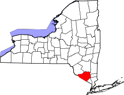
New Hampton, New York

Last updated

Central New Hampton, along routes 6 and 17M New Hampton, NY.jpg
Central New Hampton, along routes 6 and 17M

New Hampton is a small hamlet in the Town of Wawayanda in Orange County, New York, United States. It is just outside the city of Middletown, across Interstate 84 along US 6 and NY 17M. It has the ZIP Code 10958.

New Hampton spans from the northern part of Orange County's famous "Black Dirt Region" near Pine Island to route 17M adjoining Middletown, New York.

41°24′42″N74°25′12″W / 41.4118°N 74.4201°W / 41.4118; -74.4201


Related Research Articles

<span class="mw-page-title-main">Orange County, New York</span> County in New York, United States

Orange County is a county located in the U.S. state of New York. As of the 2020 census, the population was 401,310. The county seat is Goshen. This county was first created in 1683 and reorganized with its present boundaries in 1798.

<span class="mw-page-title-main">Florida, Orange County, New York</span> Village in New York, United States

Florida is a village in Orange County, New York, United States. The population was 3,049 as of the 2020 census. It is part of the Poughkeepsie-Newburgh-Middletown Metropolitan Statistical Area as well as the larger New York–Newark–Bridgeport, NY-NJ-CT-PA Combined Statistical Area. The village is located in the town of Warwick, with two small northern portions in the town of Goshen. Florida is at the convergence of Routes 17A and 94.

<span class="mw-page-title-main">Middletown, Orange County, New York</span> City in New York, United States

Middletown is the largest city in Orange County, New York, United States. It lies in New York's Hudson Valley region, near the Wallkill River and the foothills of the Shawangunk Mountains. Middletown is situated between Port Jervis and Newburgh, New York. At the 2020 United States census, the city's population was 30,345, reflecting an increase of 2,259 from the 28,086 counted in the 2010 census. The zip code is 10940. Middletown falls within the Kiryas Joel–Poughkeepsie–Newburgh Metropolitan Statistical Area, which belongs to the larger New York–Newark–Bridgeport, NY–NJ–CT–PA Combined Statistical Area.

<span class="mw-page-title-main">Pine Bush, New York</span> CDP in New York, United States

Pine Bush is a hamlet located in the town of Crawford and adjacent to Shawangunk, New York, within Orange and adjacent to Ulster counties in the U.S. It is roughly coterminous with the 12566 ZIP code and 744 telephone exchange in the 845 area code. These both extend into adjacent regions of the town of Shawangunk in Ulster County.. The population was 1,751 at the 2020 census.

<span class="mw-page-title-main">Scotchtown, New York</span> Hamlet and CDP in New York, United States

Scotchtown is a hamlet in the Town of Wallkill, in Orange County, New York, United States. The population was 10,578 at the 2020 census. It has the ZIP Code 10941. The hamlet is located east of the City of Middletown. It is part of the Poughkeepsie–Newburgh–Middletown, NY Metropolitan Statistical Area as well as the larger New York–Newark–Bridgeport, NY-NJ-CT-PA Combined Statistical Area.

<span class="mw-page-title-main">Unionville, Orange County, New York</span> Village in New York, United States

Unionville is a village in Orange County, New York, United States. The population was 592 at the 2020 census, making it by far the smallest village in Orange County and one of the smallest in New York State.

<span class="mw-page-title-main">Wawayanda, New York</span> Town in New York, United States

Wawayanda is a town in Orange County, New York, United States. The population was 7,534 as recorded by the 2020 census. The town of Wawayanda is in the western part of the county, south of Middletown.

<span class="mw-page-title-main">Monroe (village), New York</span> Village in New York, United States

Monroe is a village in Orange County, New York, United States. The population was 9,343 at the 2020 census. It is part of the Poughkeepsie–Newburgh–Middletown, NY Metropolitan Statistical Area as well as the larger New York–Newark–Bridgeport, NY-NJ-CT-PA Combined Statistical Area. The community is not named after President James Monroe, but rather after an early 19th-century New York state senator.

Little Britain is an area in the town of New Windsor, Orange County, New York, United States, south of and adjacent to Stewart International Airport. The name spread to the surrounding region, which at that time was part of Ulster County.

<span class="mw-page-title-main">Wawayanda Creek</span>

Wawayanda Creek is the name of Pochuck Creek above its confluence with the tributary Black Creek. It is 17.0 miles (27.4 km) long. Wawayanda Creek, via Pochuck Creek, is a tributary of the Wallkill River in Sussex County, New Jersey in the United States. It starts northeast of Warwick, New York, and runs southwest, mostly within Orange County, flowing into New Jersey for several miles to its confluence with Black Creek just north of Highland Lakes, forming Pochuck Creek, which flows north back into New York.

Pochuck Creek is an 8.1-mile-long (13.0 km) tributary of the Wallkill River in Orange County, New York and Sussex County, New Jersey, in the United States.

<span class="mw-page-title-main">New York State Route 17M</span> State highway in Orange County, New York, US

New York State Route 17M (NY 17M) is an east–west state highway in Orange County, New York, in the United States. It extends for 26.63 miles (42.86 km) from west of the city of Middletown to what is currently the north–south section of NY 17 just southeast of the village of Harriman. It is a busy main street in Middletown and the village of Monroe; in the former, it divides into a parkway for several blocks and forms the city's major commercial strip, located between the downtown district and an interchange with Interstate 84 (I-84). The rest of the road is a two-lane rural route. Between New Hampton and Goshen, the highway overlaps with U.S. Route 6 (US 6). The easternmost section of that overlap near Goshen is routed on the Quickway, making a three-route concurrency with NY 17.

<span class="mw-page-title-main">New York State Route 211</span> State highway in Orange County, New York, US

New York State Route 211 (NY 211) is a state highway located entirely within Orange County, New York, in the United States. The western terminus is at the intersection with US 209 located in Cuddebackville, and the eastern terminus is located at Montgomery at NY 17K, where it becomes the main thoroughfare.

<span class="mw-page-title-main">New York State Route 284</span> State highway in Orange County, New York, US

New York State Route 284 (NY 284) is a north–south state highway located entirely within Orange County, New York, in the United States. It begins just south of the village of Unionville at the New Jersey state line in the town of Minisink, where it connects to that state's Route 284. From Unionville, the route heads through rural parts of Orange County for just over 9 miles (14 km) to an intersection with U.S. Route 6 (US 6) in the hamlet of Slate Hill, located 5 miles (8.0 km) southwest of the city of Middletown in the town of Wawayanda.

Michigan Corners is a hamlet near Scotchtown east of Middletown, Orange County, New York, United States, located at the corner of New York State Route 211 and Goshen Turnpike.

Ridgebury is one of the eight hamlets in the town of Wawayanda, New York, United States. The hamlet and its township are located in Orange County, approximately 65 miles north of New York City.

<span class="mw-page-title-main">Kiryas Joel-Poughkeepsie-Newburgh metropolitan area</span> Metropolitan statistical area in New York, United States

The Kiryas Joel-Poughkeepsie-Newburgh, NY Metropolitan Statistical Area, as defined by the United States Office of Management and Budget, is an area consisting of two counties in New York's Hudson Valley, with the municipalities of Kiryas Joel, Poughkeepsie, and Newburgh as its principal cities. As of the 2020 census, the MSA had a population of 679,221. The area was centered on the urban area of Poughkeepsie-Newburgh. Prior to July 2023, it was known as the Poughkeepsie-Newburgh-Middletown, NY Metropolitan Statistical Area; whereupon it was renamed to its current name, to reflect population changes among its largest municipalities.

Mahoras Brook is an approximately 3.5 miles (5.6 km) long spring-fed tributary of Waackaack Creek that flows through Monmouth County, New Jersey. It rises in a small glen shortly west of Middletown, at 40°25′12″N74°08′13″W and makes a bend north, flowing through the northwest section of Tatum Park. The creek flows under Holland Road and runs north in a small, forested swale through a dominantly residential area, roughly paralleling Laurel Avenue, and receives a small tributary on the left bank. Then it flows under New Jersey State Route 35 and soon, its mouth is on the left bank of Waackaack Creek at 40°23′22″N74°08′13″W.

<span class="mw-page-title-main">Monroe, New York</span> Town in Orange County, New York, US

Monroe is a town in Orange County, New York, United States. The population was 21,387 at the 2020 census, compared to 39,912 at the 2010 census; the significant fall in census population was due to the secession of the town of Palm Tree in 2019. The town is named after President James Monroe.

The Hoboken International Film Festival is an annual festival that promotes domestic and international television pilots, screenplays, non-studio films. Awards, with cash prizes, are given for the best submissions. It is held at the Thomas Morahan Waterfront Park in Greenwood Lake, New York.