Middletown, New York

Last updated

Middletown, New York
Middletown, NY, skyline.jpg
Former O&W station, Middletown, NY.jpg
Gilman Center - SUNY Orange Middletown Campus.jpg
From top, left to right: Skyline of Middletown; O&W Station; Gilman Center
Seal of Middletown, Orange County, New York.png
Orange County New York incorporated and unincorporated areas Middletown highlighted.svg
Middletown, New York
Interactive map of Middletown
Coordinates: 41°27′N74°25′W / 41.450°N 74.417°W / 41.450; -74.417
Country Flag of the United States.svg  United States
State Flag of New York.svg  New York
County Orange
Incorporation as village May 15, 1848;176 years ago (1848-05-15)
Incorporation as cityOctober 9, 1888;135 years ago (1888-10-09) [1]
Government
  Type Mayor–council
   Mayor Joseph M. DeStefano (D)
  Council members
  • At-Large Member:
  • J. Miguel Rodrigues (D)
  • Ward 1:
  • Kevin Witt (D)
  • Joe Masi (D)
  • Ward 2:
  • Andrew Green (D)
  • Jerry Kleiner (D)
  • Ward 3:
  • Katie Wray (D)
  • Paul Johnson (D)
  • Ward 4:
  • Jude Jean-Francois(D)
  • Sparrow Tobin (D)
Area
[2]
  Total5.33 sq mi (13.81 km2)
  Land5.31 sq mi (13.74 km2)
  Water0.03 sq mi (0.07 km2)
Elevation
520 ft (160 m)
Highest elevation
(North boundary along Kennedy Terrace)
740 ft (230 m)
Lowest elevation
(Unnamed tributary of Monhagen Brook along south boundary)
460 ft (140 m)
Population
 (2020)
  Total30,345
  Density5,719.00/sq mi (2,208.31/km2)
Time zone UTC−5 (EST)
  Summer (DST) UTC−4 (EDT)
ZIP Code
10940
Area codes 845
FIPS code 36-47042
Wikimedia CommonsMiddletown, New York
Website www.middletown-ny.com

Middletown is the largest city in Orange County, New York, United States. It lies in New York's Hudson Valley region, near the Wallkill River and the foothills of the Shawangunk Mountains. Middletown is situated between Port Jervis and Newburgh, New York. At the 2020 United States census, the city's population was 30,345, reflecting an increase of 2,259 from the 28,086 counted in the 2010 census. The ZIP Code is 10940. Middletown falls within the Kiryas Joel–Poughkeepsie–Newburgh Metropolitan Statistical Area, which belongs to the larger New York–Newark–Bridgeport, NY–NJ–CT–PA Combined Statistical Area. [3]

Contents

Middletown was incorporated as a city in 1888. It grew in the 19th and early 20th centuries as a stop on several lower New York State railroads, attracting several small manufacturing businesses. SUNY Orange, the Times-Herald Record , U.S. Postal Service, County of Orange, Touro College of Osteopathic Medicine, Orange & Rockland Utilities, and the City of Middletown are major employers in Middletown. Many residents also work at the Galleria at Crystal Run, Walmart, Media Communications Corp, and Garnet Health in the nearby Town of Wallkill.

History

East Main Street in 1909 East Main Street, Middletown, NY.jpg
East Main Street in 1909
The Erie Railroad's Middletown Station in 1971, now Thrall Library Middletown NY Station LOC 121197pu.jpg
The Erie Railroad's Middletown Station in 1971, now Thrall Library

Early history

John Green purchased land from the DeLancey patent and probably settled the area around 1744. Due to its location between other settlements, residents adopted the name of Middletown, changing it later to South Middletown to avoid confusion with a nearby location. Eventually they dropped the word "south", using the current name when the community became a village in 1848. The village was incorporated as a city in 1888.

The First Congregational Church of Middletown, established in 1785, has the highest spire downtown. Construction of its first building was a sign of Middletown becoming established as a village. [4] Its current church building was constructed in 1872.

Growth

Middletown grew through the 19th century, stimulated by construction of the Erie Railroad and the New York, Ontario and Western Railway [5] (among others). The city was industrialized, developing factories for various industries, such as shoes, lawnmower blades, and furniture. These did well through the World War II era.

The Webb Horton mansion and adjoining 18 acres were donated to establish Orange County Community College in 1950. [6]

Due to industrial restructuring, most of the old manufacturing businesses had closed by the 1960s. In 1968, Middletown annexed the adjacent Village of Amchir. [7] In the 1970s, the economy of Middletown and surrounding communities suffered additional blows due to the closing of a large Ford Motor Company plant in Mahwah, New Jersey, and the downsizing of IBM operations in the area.

Responding to higher housing costs in New York City, from the 1970s, New York City police officers, firefighters and other workers began to move to the area, as local housing offered better value. These commuters, who drove two hours each way, helped to bolster the economy of the area. After 1986, however, New York City required its municipal employees to reside in the city, [8] and Middletown lost this source of residential development. The only railroad left in town is the Middletown and New Jersey Railway, a freight line. The population has continued to grow into the 21st century, while the economy has shifted largely to service and retail, with a regional medical center a major employer in the area.

Modern Middletown

The downtown business district of Middletown suffered from suburbanization that drew off retail businesses. The "Miracle Mile" shopping strip and Lloyd's Supermarket were developed in the late 1960s and two later shopping malls, all located in nearby Town of Wallkill along Route 211, near the intersection of Route 17 and Interstate 84. The Orange Plaza mall in the Town of Wallkill drew several of the downtown shops into it by the mid-1970s, weakening the City of Middletown's downtown. Also in the Town of Wallkill, the Galleria at Crystal Run opened in the early 1990s, and in 2001 a Wal-Mart Supercenter replaced the Orange Plaza mall. Some of the buildings downtown are abandoned or underused, but there has long been an active downtown with small business, professional offices, bars and restaurants.

The downtown area has several historic churches. The Middletown City Hall and City Court are located on James Street. [9] Prosperous neighborhoods include Presidential Heights. Highland Avenue is lined with large Victorian houses, some of the largest of which are now used as nursing homes. Other neighborhoods show the effects of loss of jobs and decline in the economy. The surrounding countryside was devoted partly to small dairy farms, but family farming has waned since the 1980s.

Middletown is the main business address for the newspaper Times Herald-Record and its owner, Local Media Group. [10] Mediacom Communications Corp, a cable and other pay TV company, is headquartered outside the city in the Town of Wallkill. It is also a manufacturing location for Bell Flavors & Fragrances. [11]

Places of interest

The First Congregational Church, built in 1872, has the tallest spire downtown First Congregationalist Church of Middletown.jpg
The First Congregational Church, built in 1872, has the tallest spire downtown

The downtown area, particularly North and Main streets, has a variety of ethnic eateries and various small boutiques and thrift shops. Several churches are located in the neighborhood. The city has the single-screen, 1,100-seat Paramount Theatre, which also offers stage shows and concerts, a local arts council, a bowling alley, WALL and WOSR radio stations, Thrall Library and the Van Duzer Historical Society museum downtown.[ citation needed ]

Civic organizations include Boy Scouts of America and Girl Scouts of the USA chapters, as well as Lions Club, Elks Club, Kiwanis and Rotary Club. The Rotary Club runs a Horse Show at Fancher Davidge Park each fall. Middletown is the site of the Orange County Fair each summer and the Orange County Fair Speedway. Highland Lakes State Park is the nearest state park. Good choices for hiking, biking and country drives are nearby.

Shopping in the area includes the Galleria at Crystal Run, a mall just east of Middletown, and a long retail strip along Route 211 on the east side of town.

Middletown's Hillside Cemetery was designed by the British architect and landscape designer Calvert Vaux, who worked with Frederick Law Olmsted to design Central Park in New York City. The J. W. Chorley Elementary School, designed by the American architect Paul Rudolph, was built in the 1960s and demolished in 2013. [12]

Health care

Health care services are provided at Garnet Health Medical Center (formerly Orange Regional Medical Center), a hospital located in the town of Walkill. [13] ORMC was completed in 2011, merging the faculties of the former Horton Medical Center and Arden Hill Hospital. It is a major employer in the region. [14]

Geography

Perspective map of Middletown from 1887 with list of landmarks by L.R. Burleigh Middletown, N.Y. 1887. LOC 75694796.jpg
Perspective map of Middletown from 1887 with list of landmarks by L.R. Burleigh

Middletown is located at 41°27′N74°25′W / 41.450°N 74.417°W / 41.450; -74.417 (41.4458, -74.4221) [15] in Orange County. The city is nearly surrounded by the town of Wallkill, except for its southernmost section, which is in the town of Wawayanda.

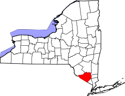
According to the United States Census Bureau, the city has a total area of 5.2 square miles (13.3 km2), of which 5.1 square miles (13.3 km2) is land and 0.19% is water. The city is drained by Monhagen Brook and the Wallkill River.

Climate

Climate data for Middletown, Orange County, New York, 1991–2020 normals, extremes 18932011
MonthJanFebMarAprMayJunJulAugSepOctNovDecYear
Record high °F (°C)66
(19)
73
(23)
85
(29)
92
(33)
95
(35)
97
(36)
102
(39)
97
(36)
100
(38)
88
(31)
78
(26)
71
(22)
102
(39)
Mean maximum °F (°C)54.5
(12.5)
56.6
(13.7)
67.6
(19.8)
81.0
(27.2)
85.6
(29.8)
89.4
(31.9)
92.2
(33.4)
90.4
(32.4)
86.1
(30.1)
77.8
(25.4)
68.8
(20.4)
56.5
(13.6)
93.7
(34.3)
Mean daily maximum °F (°C)34.1
(1.2)
37.4
(3.0)
46.8
(8.2)
59.6
(15.3)
70.2
(21.2)
78.0
(25.6)
82.4
(28.0)
80.6
(27.0)
73.4
(23.0)
62.3
(16.8)
50.0
(10.0)
38.7
(3.7)
59.5
(15.3)
Daily mean °F (°C)26.0
(−3.3)
27.7
(−2.4)
36.2
(2.3)
48.5
(9.2)
59.3
(15.2)
67.6
(19.8)
72.3
(22.4)
70.5
(21.4)
63.4
(17.4)
52.5
(11.4)
41.4
(5.2)
31.4
(−0.3)
49.7
(9.9)
Mean daily minimum °F (°C)17.8
(−7.9)
18.0
(−7.8)
25.6
(−3.6)
37.5
(3.1)
48.4
(9.1)
57.3
(14.1)
62.2
(16.8)
60.4
(15.8)
53.3
(11.8)
42.6
(5.9)
32.8
(0.4)
24.1
(−4.4)
40.0
(4.4)
Mean minimum °F (°C)−0.4
(−18.0)
2.2
(−16.6)
9.1
(−12.7)
25.3
(−3.7)
26.5
(−3.1)
45.9
(7.7)
52.5
(11.4)
50.2
(10.1)
40.3
(4.6)
29.6
(−1.3)
19.9
(−6.7)
7.7
(−13.5)
−3.0
(−19.4)
Record low °F (°C)−23
(−31)
−18
(−28)
−7
(−22)
13
(−11)
25
(−4)
38
(3)
38
(3)
41
(5)
27
(−3)
14
(−10)
10
(−12)
−21
(−29)
−23
(−31)
Average precipitation inches (mm)2.59
(66)
2.09
(53)
3.02
(77)
4.03
(102)
3.80
(97)
4.62
(117)
4.19
(106)
4.49
(114)
4.27
(108)
4.55
(116)
3.21
(82)
3.54
(90)
44.40
(1,128)
Average precipitation days (≥ 0.01 in)8.96.28.68.910.810.49.09.27.88.08.48.7104.9
Source 1: NOAA [16]
Source 2: XMACIS2 (mean maxima/minima 19812010) [17]

Transportation

Middletown station is part of Metro-North Railroad's Port Jervis Line Port Jervis Train.jpg
Middletown station is part of Metro-North Railroad's Port Jervis Line

Middletown can be reached from New York City by bus and is located near the intersection of Interstate 84 and NY 17 (the future Interstate 86). State routes 17M and 211 run right through the city, and US 6 parallels I-84 to the south.

The Middletown-Town of Wallkill station on Metro-North Railroad's Port Jervis line is located nearby, in the Town of Wallkill, and provides rail service to Port Jervis, other communities in Orange and Rockland Counties and Bergen County, New Jersey, Hoboken and New York City via a transfer at Secaucus, New Jersey.

Randall Airport is about 4 miles (6.4 km) from the center of Middletown. (ID: 06N)

Middletown has a bus service, Middletown Transit, with four routes that connect at the bus station, located on Railroad Avenue, where passengers can connect to Coach USA and Short Line bus service. [18] There is also a "Main Line" bus connecting to surrounding Orange County villages [19] and another route connecting to areas such as Newburgh and Woodbury. [20]

Demographics

Historical population
CensusPop.Note
1870 6,049
1880 8,49440.4%
1890 11,97741.0%
1900 14,52221.2%
1910 15,3135.4%
1920 18,42020.3%
1930 21,27615.5%
1940 21,9083.0%
1950 22,5863.1%
1960 23,4753.9%
1970 22,607−3.7%
1980 21,454−5.1%
1990 24,16012.6%
2000 25,3885.1%
2010 28,08610.6%
2020 30,3458.0%
U.S. Decennial Census [21]

At the 2010 census, the population of Middletown was 28,086. The ethnic make-up was 39.7% Hispanic, 36.6% white (exclusive of Hispanics), 21.0% African-American, 1.9% Asian and 0.8% Native American. [22]

1896 photo of Arthur Fanshon and E. P. Nickinson, about age 6, in a production of The Mikado in Middletown MdtnMikado.jpg
1896 photo of Arthur Fanshon and E. P. Nickinson, about age 6, in a production of The Mikado in Middletown

At the 2000 census, [23] there were 25,388 people, 9,466 households and 5,963 families residing in the city. The population density was 4,939.5 per square mile (1,907.2/km2). There were 10,124 housing units at an average density of 1,969.7 per square mile (760.5/km2). The racial make-up of the city was 68.68% White, 15.13% African American, 0.75% Native American, 1.69% Asian, 0.03% Pacific Islander, 9.33% from other races and 4.40% from two or more races. Hispanic or Latino of any race were 25.11% of the population. 34.0% of households had children under the age of 18 living with them, 40.0% were married couples living together, 16.7% had a female householder with no husband present, and 37.0% were non-families. 30.0% of all households were made up of individuals, and 12.3% had someone living alone who was 65 years of age or older. The average household size was 2.62 and the average family size was 3.27.

27.8% of the population were under the age of 18, 9.4% from 18 to 24, 31.0% from 25 to 44, 19.9% from 45 to 64 and 12.0% were 65 years of age or older. The median age was 33 years. For every 100 females, there were 93.4 males. For every 100 females age 18 and over, there were 90.1 males. The median household income was $39,570 and the median family income was $47,760. Males had a median income of $35,990 and females $28,429. The per capita income was $18,947. About 13.5% of families and 17.5% of the population were below the poverty line, including 25.4% of those under age 18 and 10.3% of those age 65 or over.

Government

Middletown is governed by a mayor and a city council known as the common council. It consists of nine members: an alderman-at-large, who acts as president of the council, and eight members elected from wards. Each of the city's four wards elects two members. [24] The mayor and the president of the common council are each elected at-large for four-year terms. The other council members have two-year terms. Terms of office begin on January 1.

A fire chief and three assistants are elected every three years by members of the city's engine companies. A corporation counsel, commissioners of public works and of assessment and taxation, a city clerk, registrar and a treasurer and any other officers required are appointed annually by the mayor and confirmed by the common council. [25]

Education

Twin Towers Middle School Twin Towers Middle School.jpg
Twin Towers Middle School
Morrison Hall (SUNY Orange, Middletown campus) WebbHortonPC.JPG
Morrison Hall (SUNY Orange, Middletown campus)

Middletown has three elementary schools covering grade levels from kindergarten to fifth grade. Both Truman Moon Elementary School and John W. Chorley Elementary School have made way for Presidential Park Elementary School, the district's newest school, built in 2014. William A. Carter Elementary and Maple Hill Elementary are the district's two other elementary schools. In 2005, the Middletown School District implemented a full day kindergarten program at the request of the Middletown voters. Two middle schools in the district, Twin Towers Middle School and Monhagen Middle School, collect the students from the elementary schools. Middletown High School is the only building for high school and includes grades nine to twelve. There is also a Catholic elementary school, Our Lady of Mt. Carmel.

SUNY Orange, previously known as Orange County Community College, is located in Middletown. Its campus includes the historic Webb Horton House (pictured), more commonly known as Morrison Hall. It also has a campus in Newburgh, and three satellite campuses, but the majority of buildings and students are in Middletown. A total of more than 6100 students attend SUNY Orange. In addition to credit classes, there are a wide variety of classes for lifelong learning. Adelphi University offers a Hudson Valley Center located on the SUNY Orange campus. [26]

Touro College of Osteopathic Medicine opened a Middletown Campus, in 2014, located in the former Horton Hospital. [27] [28]

Surrounding area

Nearby Goshen, viewed from its Historic Track, the oldest continuously operating harness racing track in the country Goshen, NY, skyline from Historic Track.jpg
Nearby Goshen, viewed from its Historic Track, the oldest continuously operating harness racing track in the country

Communities and locations adjacent to Middletown

U.S. Census Map Middletown-ny-city-map.gif
U.S. Census Map

The following communities and places are all located adjacent to, or within a few miles of Middletown: [29]

Media

The Times Herald-Record , a daily newspaper, is the result of a merger of several newspapers. Its antecedent newspapers date back to the 1850s. [30]

WALL radio (Classic hits format), 1340 AM, has been on-the-air since 1942.[ citation needed ] WOSR, 91.7 FM, is a repeater of the NPR affiliate WAMC. [31]

Notable people

Related Research Articles

<span class="mw-page-title-main">Orange County, New York</span> County in New York, United States

Orange County is a county located in the U.S. state of New York. As of the 2020 census, the population was 401,310. The county seat is Goshen. This county was first created in 1683 and reorganized with its present boundaries in 1798. The county is part of the Hudson Valley region of the state.

<span class="mw-page-title-main">Deerpark, New York</span> Town in New York, United States

Deerpark is a town in the western part of Orange County, New York, United States, and part of the New York metropolitan area. As of the 2020 Census, the population was at 7,509. The center of population of New York is located in Cuddebackville, a hamlet in Deerpark. Cuddebackville and Deerpark most prominently serve as the headquarters of both the global Falun Gong religious movement and the Shen Yun performance arts troupe, based at the Dragon Springs compound.

<span class="mw-page-title-main">Pine Bush, New York</span> CDP in New York, United States

Pine Bush is a hamlet located in the town of Crawford and adjacent to Shawangunk, New York, within Orange and adjacent to Ulster counties in the U.S. It is roughly coterminous with the 12566 ZIP code and 744 telephone exchange in the 845 area code. These both extend into adjacent regions of the town of Shawangunk in Ulster County.. The population was 1,751 at the 2020 census.

<span class="mw-page-title-main">Scotchtown, New York</span> Hamlet and CDP in New York, United States

Scotchtown is a hamlet in the Town of Wallkill, in Orange County, New York, United States. The population was 10,578 at the 2020 census. It has the ZIP Code 10941. The hamlet is located east of the City of Middletown. It is part of the Poughkeepsie–Newburgh–Middletown, NY Metropolitan Statistical Area as well as the larger New York–Newark–Bridgeport, NY-NJ-CT-PA Combined Statistical Area.

<span class="mw-page-title-main">Walden, New York</span> Village of the Town of Montgomery, in Orange County, New York

Walden is the largest of three villages of the town of Montgomery in Orange County, New York, United States. The population was 6,818 at the 2020 census. It has the ZIP Code 12586 and the 778 telephone exchange within the 845 area code. Walden is part of the Kiryas Joel−Poughkeepsie−Newburgh, NY Metropolitan Statistical Area as well as the larger New York−Newark−Bridgeport, NY-NJ-CT-PA Combined Statistical Area.

<span class="mw-page-title-main">Wallkill, Orange County, New York</span> Town in New York, United States

Wallkill is a town in Orange County, New York, United States. The population was 30,486 at the 2020 census. It is centrally located in the county. Interstate 84 crosses New York State Route 17 in the southern part of the town. U.S. Route 6 and New York State routes 17K, 211 and 302 also cross portions of the town.

<span class="mw-page-title-main">Montgomery (village), New York</span> Village in Orange County, New York, US

Montgomery is a village located in Orange County, New York, United States. Located 60 miles (97 km) northwest of New York City, and 90 miles (140 km) southwest of Albany, this quaint community is an historical and cultural hub of the Hudson Valley region and has grown in the last 30 years to become an outer-ring commuter suburb within the New York metropolitan area. The population was 3,834 at the 2020 census. It is part of the Poughkeepsie–Newburgh–Middletown, NY Metropolitan Statistical Area as well as the larger New York–Newark–Bridgeport, NY-NJ-CT-PA Combined Statistical Area. The village is named after General Richard Montgomery, an officer of the American Revolution.

<span class="mw-page-title-main">Newburgh (town), New York</span> Town in New York, United States

Newburgh is a town in Orange County, New York, United States. It forms part of the Kiryas Joel-Poughkeepsie-Newburgh metropolitan area, which is a part of the New York metropolitan area, and is a suburban satellite of the urbanized city of Newburgh. The city of Newburgh was a part of the town prior to 1865. New York Stewart International Airport is partially located within the township, and much of the land into which it could have been expanded has been turned into Stewart State Forest.

<span class="mw-page-title-main">New York State Route 300</span> State highway in New York, US

New York State Route 300 (NY 300) is a state highway located west of the city of Newburgh in the Hudson Valley of New York in the United States. The southern terminus of the route is at a five-way intersection with NY 32 and NY 94 in the hamlet of Vails Gate. From there, it runs generally northwesterly through the towns of New Windsor, Newburgh, and Shawangunk, to a junction with NY 208 near the hamlet of Wallkill. NY 300's two major changes of direction are marked by slightly unorthodox intersections with other state highways.

<span class="mw-page-title-main">New York State Route 17K</span> Highway in New York

New York State Route 17K (NY 17K) is an east–west state highway located within Orange County, New York, in the United States. It extends for 22.01 miles (35.42 km) from an intersection with NY 17 east of Bloomingburg to a junction with U.S. Route 9W (US 9W) midway across the city of Newburgh. The western terminus was where NY 17K originally connected to its parent route, NY 17; it now meets NY 17 a short distance to the east at an interchange with the Quickway. In Newburgh, NY 17K becomes Broadway and serves as the city's primary east–west street. The road can be divided into a half west of Montgomery, where it runs through relatively undeveloped land, and an eastern half where it closely parallels Interstate 84 (I-84) and serves much more populated areas.

<span class="mw-page-title-main">New York State Route 302</span> State highway in Orange County, New York, US

New York State Route 302 (NY 302) is a state highway in northern Orange County, New York, in the United States. The southern terminus of the route is at an intersection with NY 17M north of the city of Middletown in the town of Wallkill. Its northern terminus is at a junction with NY 52 in the hamlet of Pine Bush, located within the town of Crawford.

<span class="mw-page-title-main">New York State Route 17M</span> State highway in Orange County, New York, US

New York State Route 17M (NY 17M) is an east–west state highway in Orange County, New York, in the United States. It extends for 26.63 miles (42.86 km) from west of the city of Middletown to what is currently the north–south section of NY 17 just southeast of the village of Harriman. It is a busy main street in Middletown and the village of Monroe; in the former, it divides into a parkway for several blocks and forms the city's major commercial strip, located between the downtown district and an interchange with Interstate 84 (I-84). The rest of the road is a two-lane rural route. Between New Hampton and Goshen, the highway overlaps with U.S. Route 6 (US 6). The easternmost section of that overlap near Goshen is routed on the Quickway, making a three-route concurrency with NY 17.

<span class="mw-page-title-main">New York State Route 211</span> State highway in Orange County, New York, US

New York State Route 211 (NY 211) is a state highway located entirely within Orange County, New York, in the United States. The western terminus is at the intersection with US 209 located in Cuddebackville, and the eastern terminus is located at Montgomery at NY 17K, where it becomes the main thoroughfare.

<span class="mw-page-title-main">124th New York Infantry Regiment</span> Orange Blossoms

The 124th New York Infantry Regiment, commonly known as the Orange Blossoms, was a volunteer regiment from Orange County, New York, during the American Civil War. Formed in Goshen during the summer of 1862, The unit was officially mustered into United States Service on September 5, 1862, by Col. Augustus van Horne Ellis, the regiment was made up of volunteers from the surrounding towns and a core of veterans from the 71st New York State Militia.

<span class="mw-page-title-main">Middletown High School (New York)</span> High school in Middletown, Orange County, New York

Middletown High School serves 9th through 12th grade students in the Enlarged City School District of Middletown, which covers that city as well as adjacent portions of the towns of Wallkill and Wawayanda in Orange County, New York, United States. It is located on Gardner Avenue in a small outlying area of the city, near the county fairgrounds on a small rise south of NY 211.

<span class="mw-page-title-main">Interstate 84 in New York</span> Segment of the eastern U.S. freeway in the state

Interstate 84 (I-84) is a part of the Interstate Highway System that runs from Dunmore, Pennsylvania, to Sturbridge, Massachusetts, in the eastern United States. In New York, I-84 extends 71.46 miles (115.00 km) from the Pennsylvania state line at Port Jervis to the Connecticut state line east of Brewster. As it heads east–west across the mid Hudson Valley, it goes over two mountain ranges and crosses the Hudson River at the Newburgh–Beacon Bridge.

<span class="mw-page-title-main">Kiryas Joel-Poughkeepsie-Newburgh metropolitan area</span> Metropolitan statistical area in New York, United States

The Kiryas Joel-Poughkeepsie-Newburgh, NY Metropolitan Statistical Area, as defined by the United States Office of Management and Budget, is an area consisting of two counties in New York's Hudson Valley, with the municipalities of Kiryas Joel, Poughkeepsie, and Newburgh as its principal cities. As of the 2020 census, the MSA had a population of 679,221. The area was centered on the urban area of Poughkeepsie-Newburgh. Prior to July 2023, it was known as the Poughkeepsie-Newburgh-Middletown, NY Metropolitan Statistical Area; whereupon it was renamed to its current name, to reflect population changes among its largest municipalities.

<span class="mw-page-title-main">Walden–Wallkill Rail Trail</span> Rail trail in New York, US

The Walden–Wallkill Rail Trail, also known as the Jesse McHugh Rail Trail, is a 3.22-mile (5.18 km) rail trail between the village of Walden, New York and the neighboring hamlet of Wallkill. The two communities are located in Orange and Ulster counties, respectively, in upstate New York.

Garnet Health is a Middletown, New York-based three-campus health system which, together with its nine urgent-care facilities, provides care to approximately 500,000 residents in Orange and Sullivan Counties, and surrounding areas in New York State. The hospital's roots date back to 1887.

<span class="mw-page-title-main">Transit Orange</span> Bus transit services in Orange County, New York

Transit Orange is the brand name for bus transit services in Orange County, New York. Under the brand name of Transit Orange, mini-systems, mostly municipally-run, serve various towns across Orange County. In addition to these municipal and private services, Transit Orange also owns The Main Line bus, and oversees municipal dial-a-bus operations. Along with Short Line Bus and the Metro-North Port Jervis Line, Transit Orange forms the basis of public transportation in Orange County.

References

  1. Sullivan, James; Williams, Melvin E.; Conklin, Edwin P.; Fitzpatrick, Benedict, eds. (1927), "Chapter I. Orange County", History of New York State, 1523–1927 (PDF), vol. 2, New York City, Chicago: Lewis Historical Publishing Co., p. 414, hdl:2027/mdp.39015019994048, Wikidata   Q114149636
  2. "ArcGIS REST Services Directory". United States Census Bureau. Retrieved September 20, 2022.
  3. United States Office of Management and Budget (September 14, 2018). "OMB Bulletin No. 18-04" (PDF). Retrieved July 11, 2019.
  4. Photo and description of the First Congregational Church
  5. Yashinac, Rob (September 2006). "Ontario & Western Railway Station". Hudson Valley Ruins. Retrieved May 10, 2013.
  6. Kuhn, Robert (March 13, 1990). "National Register of Historic Places nomination, Webb Horton House". New York State Office of Parks, Recreation and Historic Preservation . Retrieved November 22, 2009.
  7. "Amchir Residents Blast City Hall Neglect", Times Herald-Record, August 11, 1976, p. 23
  8. "New York City residency requirements". New York City. Archived from the original on May 15, 2011. Retrieved April 28, 2011.
  9. "Middletown City Court", New York State Unified Court System. Retrieved April 5, 2012
  10. Local Media Group, accessed November 15, 2015
  11. "Worldwide Locations", Bellff, accessed August 18, 2015
  12. "Chorley School: Background & History". Middletown City Schools.
  13. "Garnet Health Medical Center", Garnet Health, accessed August 11, 2020
  14. "Orange Regional Completes Move Into New Hospital", Orange Regional Medical Center. Retrieved June 8, 2012
    - "Orange Regional Medical Center: HBE Designs and Builds First Replacement Hospital in New York in 25 Years". HBE Corporation. 2009. Archived from the original on April 11, 2013. Retrieved June 8, 2012.
  15. "US Gazetteer files: 2010, 2000, and 1990". United States Census Bureau. February 12, 2011. Retrieved April 23, 2011.
  16. "U.S. Climate Normals Quick Access – Station: Middletown 2 NW, NY". National Oceanic and Atmospheric Administration. Retrieved March 8, 2023.
  17. "xmACIS2". National Oceanic and Atmospheric Administration. Retrieved March 8, 2023.
  18. "Middletown Area", Transit Orange. Retrieved October 7, 2020.
  19. CoachUSA Mainline
  20. CoachUSA Hudson Line
  21. "Census of Population and Housing". Census.gov. Retrieved June 4, 2015.
  22. "All Zip Codes in Middletown NY".
  23. "U.S. Census website". United States Census Bureau . Retrieved January 31, 2008.
  24. "The Mayor and the Common Council". City of Middletown. Archived from the original on May 14, 2010. Retrieved April 26, 2012.
  25. Middletown City Charter, Title II, Election and Appointment of Officers, November 1, 2011. Retrieved April 26, 2012.
  26. "Hudson Valley Center". Meet Adelphi. Adelphi University. Retrieved August 19, 2023.
  27. "Our Facilities" Archived 2015-05-01 at the Wayback Machine , Touro College, accessed November 10, 2014
  28. "Touro College of Osteopathic Medicine celebrates opening of new Middletown campus", Daily Freeman , September 1, 2014; and "Better Homes and Gardens Rand Realty Announces Lease Space Available Adjacent to New Touro Medical College", Rand Realty, September 11, 2014
  29. Map of Middletown and surroundings, google.maps, accessed 29 December 2009
  30. Burkhart, Wade. "About Us". The Times Herald-Record. Archived March 7, 2012, at the Wayback Machine
  31. "WOSR", Federal Communications Commission. Retrieved October 4, 2023