Tuxedo, New York

Last updated

Tuxedo, New York
Town of Tuxedo
Tuxedo, NY, town hall.webp
Town Hall of Tuxedo
Orange County New York incorporated and unincorporated areas Tuxedo highlighted.svg
Location in Orange County and the state of New York.
USA New York location map.svg
Red pog.svg
Tuxedo, New York
Location within the state of New York
Coordinates: 41°13′19″N74°11′8″W / 41.22194°N 74.18556°W / 41.22194; -74.18556
Country United States
State New York
County Orange
Government
  SupervisorKenneth English (D)
Area
[1]
  Total49.34 sq mi (127.80 km2)
  Land47.05 sq mi (121.85 km2)
  Water2.30 sq mi (5.95 km2)
Elevation
479 ft (146 m)
Population
 (2020)
  Total3,811
  Density81.00/sq mi (31.28/km2)
Time zone UTC-5 (Eastern (EST))
  Summer (DST) UTC-4 (EDT)
ZIP code
10987
Area code 845
FIPS code 36-75781
GNIS feature ID0979566
Website www.tuxedogov.org

Tuxedo is a town located in Orange County, New York, United States, along the Ramapo River. As of the 2020 census, the town had a total population of 3,811. [2] The town is in the southeastern part of the county in the Ramapo Mountains. New York State Route 17 and the New York State Thruway (Interstate 87) pass through the town. The name is derived from a Lenape word tucseto, which has several known meanings.

Contents

History

The historic occupants of what is now the town of Tuxedo were the Lenni-Lenape, a branch of the large Algonquian language family of Native Americans, whose different branches lived along the East Coast from Canada through the Upper South. The Lenape named the largest lake in the area Tucseto, meaning either "place of the bear" or "clear flowing water."[ citation needed ] European-American colonists later adopted that name for the town they developed.

Some Lenape stayed in villages in the Ramapo Mountains, having migrated west from Connecticut. They gradually intermarried with other ethnic groups in what was long a relatively remote frontier. They maintained a culture and community of their own in this area on both sides of the later border with New Jersey. The Ramapough Mountain Indians have been recognized by New Jersey as a Native American tribe. [3]

1700s

Augusta Furnace Historic Marker AugustaFurnace 20230610 130941.jpg
Augusta Furnace Historic Marker
Southfield furnace ruin Southfield Furnace Ruin, NY - looking north.jpg
Southfield furnace ruin

In the 18th century, ethnic English and German colonists settled in the area. The men mostly worked at the nearby Sterling Iron Works in the neighboring Sterling Forest, as did some of the Ramapough Mountain Indians. Several men from the Tuxedo area served in the Revolutionary War.

In 1779 the rebel government built the Continental Road from Eagle Valley through the present-day village of Tuxedo Park to what is now Route 17 near Warwick Brook Road. The first industry in Tuxedo was the Augusta Forge at the falls on the Ramapo River, founded by Solomon Townsend in 1783, soon after the end of the war.

The town of Southfields (now part of the town of Tuxedo) was renamed Monroe in 1808. An iron forge was operated in this area, still known as Southfields; the forge ruins are still visible. The oldest documented structure in Tuxedo is the Adam Belcher house. Dating from 1790, it is located in the Southfields area.

1800s

By 1812, the Augusta Forge went out of business. Townsend sold the 7,000 acres (28 km2) Augusta Tract to Pierre Lorillard II, who was in the tobacco business. Mining continued into the 1840s, until the iron ore was largely depleted. The Lorillards later used the tract for lumbering. It helped supply fuel for the wood-fired Erie Railroad, which was built in 1841.

The southern part of Tuxedo, known as Eagle Valley, was devoted to farming, as were areas just south of Lake Mombasha: Helmsburg and Bramertown were named after early colonial settlers. In the northern part of town, in the area known as Arden, the Greenwood Furnace was established in 1810. During the American Civil War, this forge produced the iron for the famous Parrott rifles, which were built at the West Point Foundry by the Parrott Brothers, then owners of the Greenwood tract.

The Southfields Methodist Church was built in 1848. The Parrotts built St. John's Episcopal Church in Arden in 1863. The cemetery along Route 17 in Arden was associated with St. Mary's Roman Catholic Church, built in 1867 but later closed due to demographic changes in residents. It was demolished. By the 1890s, the area iron industry had declined due to the decrease in ore and the discovery of the rich surface beds of the Mesabi Range in Minnesota.

The Town of Tuxedo was established twice from the Town of Monroe. First, in 1863 it was founded as the Town of Southfields by the Orange County Board of Supervisors, the legislative body of the county. The supervisors changed their decision in 1865 and the area was returned to Monroe. On December 19, 1889, the Board of Supervisors approved separating the Town of Tuxedo from Monroe. The act was implemented on March 4, 1890.

Tuxedo Park

Pierre Lorillard IV conceived the idea of the planned community of Tuxedo Park. In 1884 he began buying up his siblings' shares in the Augusta tract, with the intention of creating a hunting-and-fishing resort surrounding the 291-acre Tuxedo Lake. The mammoth development project, laid out by the architect Bruce Price and civil engineer Ernest W. Bowditch, was constructed by some 1,800 Italian and Slovak immigrant laborers in about eighteen months.

"When the Tuxedo Club opened on June 16, 1886, close to 5,000 acres had been planned, 30 miles [48 km] of macadam roads had been built, and 40 buildings stood complete. These were soon joined by a boathouse, a school, a racetrack, a golf course (possibly the second-oldest in the country), indoor tennis courts, a game preserve and breeding ponds, a swimming pool, an electrified toboggan run, 30 miles of bridle paths, and the first water, sewer, and telephone systems outside a major metropolis." [4]

The resort attracted a number of the financial, industrial and social leaders of the day, particularly those who worked in New York City. During the first thirty years, more than 250 houses and stables were built in Tuxedo Park, as well as retail stores and service buildings in the so-called hamlet. Three churches, all still standing (one is used by the Tuxedo Historical Society today), a train station, a library, and a post office were also built, as well as a school and a hospital. Businessmen could commute by rail into New York City.

1900s

By 1915, 3,636 people lived in Tuxedo, about 20% more than were reported in the 1890 Census. A major shift in landholding in Tuxedo started after 1910, when Mrs. W. A. Harriman gave $1 million and 10,000 acres (40 km2) of her family's land to the Palisades Interstate Park Commission. The state gradually purchased additional farm and forest land from scores of owners, often by eminent domain, resulting in the present Bear Mountain-Harriman State Park, which occupies about 12,500 of Tuxedo's 30,700 acres (124 km2).

During the 1920s a new hospital and a high school were built by major donations from some residents. The Stock Market Crash of 1929 had a disproportionately negative effect on Tuxedo Park's affluence, as numerous residents lost their financial jobs. A slow but severe decline in the community's fortunes set in, resulting in a population decline and the loss of such amenities as the hospital, the Masonic Temple (now used as the Town Hall), and many retail stores.

In 1956, the Harrimans sold their Sterling Mine and Railroad Company tract to City Investing Company (now Sterling Forest LLC). It developed Maple Brook, Laurel Ridge, Clinton Woods and various offices and research centers on its 8,000 acres (32 km2) in the Town of Tuxedo.

In 1952, the area known as Tuxedo Park became an incorporated village. Today it comprises 2,050 acres (8.3 km2), of which 355 acres (1.44 km2) is three lakes, and about 340 housing units in 320 structures. Other newer housing developments include the Southfields Apartments built in 1971 on the site of a former bed factory, the Mountain View Apartments near the Sloatsburg line, and the Woodlands in Eagle Valley. Non-residential facilities include International Paper's Research Center, the Red Apple Restaurant, and the Sterling Forest Ski Area.

The evening wear known as a "tuxedo", the main component of "black tie" dress, was associated with the wealthy residents of Tuxedo Park.

The area known as Tuxedo Park separated from the Town of Tuxedo and became incorporated in 1952, adopting the village form of government. Today it comprises 2,050 acres (8.3 km2), of which 355 acres (1.44 km2) includes three lakes, and about 330 housing units in 340 structures. In recognition of its historical and architectural significance, the historic district was listed as Tuxedo Park on the National Register of Historic Places on March 13, 1980. In 1982 the designation was officially presented to Mrs. Joan Richardsson Alleman, Co-Chairman of the Tuxedo Conservation and Taxpayers Association, at the Washington's Headquarters State Historic Site in nearby Newburgh, NY. The designation was presented by Mr. Oren Lehman, Commissioner of Parks, Recreation, and Historic Preservation and is proudly displayed at the Tuxedo Park Village Office.

Geography

Tuxedo station is part of Metro-North Railroad's Port Jervis Line Tuxedo train station.jpg
Tuxedo station is part of Metro-North Railroad's Port Jervis Line

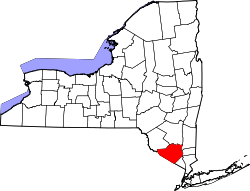
According to the United States Census Bureau, the town has a total area of 49.4 square miles (128 km2), of which 47.4 square miles (123 km2) is land and 1.9 square miles (4.9 km2) is water, for a total area of 3.89% water.

The eastern town line is the border of Rockland County. The Ramapo River flows through the town, which is situated in the Ramapo Mountains.

The New York State Thruway and NY-17 pass through the town.

Demographics

Historical population
CensusPop.Note
1890 1,678
1900 2,27735.7%
1910 2,85825.5%
1920 2,355−17.6%
1930 2,60610.7%
1940 2,314−11.2%
1950 2,281−1.4%
1960 2,227−2.4%
1970 2,96733.2%
1980 3,0693.4%
1990 3,023−1.5%
2000 3,33410.3%
2010 3,6248.7%
2020 3,8115.2%
U.S. Decennial Census [5]

As of the census [6] of 2000, there were 3,334 people, 1,337 households, and 962 families residing in the town. The population density was 70.3 inhabitants per square mile (27.1/km2). There were 1,457 housing units at an average density of 30.7 per square mile (11.9/km2). The racial makeup of the town was 92.68% White, 1.23% African American, 0.33% Native American, 3.21% Asian, 0.00% Pacific Islander, 0.84% from other races, and 1.71% from two or more races. 4.26% of the population were Hispanic or Latino of any race.

Entertainment

Tuxedo is the home of the annual New York Renaissance Faire.

Education

George F. Baker High School in Tuxedo Park George F. Baker High School in Tuxedo Park, NY.jpg
George F. Baker High School in Tuxedo Park

The Tuxedo Union Free School District exists as the principal establishment of public education in the area, consisting of the George F. Baker High School and the George Grant Mason School. Tuxedo Park School is located within the village of Tuxedo Park, serving the general area.

Communities and locations in Tuxedo

Notable person

Notes

  1. "2016 U.S. Gazetteer Files". United States Census Bureau. Retrieved July 5, 2017.
  2. "Explore Census Data". data.census.gov. Retrieved January 23, 2023.
  3. Lenik, Edward J., 2011. Ramapough Mountain Indians: People, Places and Cultural Traditions, Ringwood, NJ: North Jersey Highlands Historical Society, pp. 1-4
  4. James D. Kornwolf, "American Architecture and the Aesthetic Movement" In Pursuit of Beauty (Metropolitan Museum of Art, 1986), pp. 376-77.
  5. "Census of Population and Housing". Census.gov. Retrieved June 4, 2015.
  6. "U.S. Census website". United States Census Bureau . Retrieved January 31, 2008.

Related Research Articles

<span class="mw-page-title-main">Harriman, New York</span> Village in New York, United States

Harriman is a village in Orange County, New York, United States. It is in the southeastern section of the town of Monroe, with a small portion in the town of Woodbury. The population was 2,714 at the 2020 census. It is part of the Kiryas Joel–Poughkeepsie–Newburgh, NY Metropolitan Statistical Area as well as the larger New York–Newark–Bridgeport, NY-NJ-CT-PA Combined Statistical Area.

<span class="mw-page-title-main">Tuxedo Park, New York</span> Village in New York, United States

Tuxedo Park is a village in Orange County, New York, United States. Its population was 645 at the 2020 census. It is part of the Poughkeepsie–Newburgh–Middletown metropolitan area as well as the larger New York metropolitan area. Its name is derived from an indigenous Lenape word of the Munsee language, tucsedo or p'tuxseepu, which is said to mean 'crooked water' or 'crooked river'.

<span class="mw-page-title-main">Hillburn, New York</span> Village in New York, United States

Hillburn, originally called "Woodburn" and incorporated in 1893, is a village in the town of Ramapo, Rockland County, New York, United States. It is located north of Suffern, east of Orange County, south of Viola, and west of Montebello. It is considered to be one of the more rural communities in Rockland County. The population was 930 at the 2020 census.

<span class="mw-page-title-main">Ramapo, New York</span> Town in New York, United States

Ramapo is a town in Rockland County, New York, United States. It was originally formed as New Hampstead, in 1791, and became Ramapo in 1828. It shares its name with the Ramapo River. As of the 2020 census, Ramapo had a total population of 148,919, making it the most populous town in New York outside of Long Island. If all towns in New York were cities, Ramapo would be the 12th-largest city in the state of New York.

<span class="mw-page-title-main">Sloatsburg, New York</span> Village in Ramapo, New York, US

Sloatsburg is a village in the town of Ramapo in Rockland County, New York, United States. Located east of Orange County, it is at the southern entrance to Harriman State Park. The population was 3,036 at the 2020 census. The village is named after Stephen Sloat, an early European landowner.

<span class="mw-page-title-main">Warwick, New York</span> Town in New York, United States

Warwick is a town in the southwestern part of Orange County, New York, United States. Its population was 32,027 at the 2020 census. The town contains three villages and eight hamlets.

<span class="mw-page-title-main">Haverstraw, New York</span> Town in New York, United States

Haverstraw is a town in Rockland County, New York, United States, located north of the Town of Clarkstown and the Town of Ramapo; east of Orange County; south of the Town of Stony Point; and west of the Hudson River. The town runs from the west to the east border of the county in its northern section. The population was 39,087 at the 2020 census.

The Ramapough Mountain Indians, known also as the Ramapough Lenape Nation or Ramapough Lunaape Munsee Delaware Nation or Ramapo Mountain people, are a group of approximately 5,000 people living in and around the Ramapo Mountains of Bergen and Passaic counties in northern New Jersey and Rockland County in southern New York, about 25 miles (40 km) from New York City. They were recognized in 1980 by the state of New Jersey as the Ramapough Lenape Nation but are not recognized federally. Their tribal office is located on Stag Hill Road on Houvenkopf Mountain near Mahwah, New Jersey. Since January 2007, the chief of the Ramapough Lenape Nation has been Dwaine Perry.

<span class="mw-page-title-main">E. H. Harriman</span> American financier and railroad magnate (1848–1909)

Edward Henry Harriman was an American financier and railroad executive.

Ramapo is the name of several places and institutions in northern New Jersey and southeastern New York State. They were named after the Ramapough, a band of the Lenape Indians who migrated into the area from Connecticut by the seventeenth and early eighteenth centuries.

<span class="mw-page-title-main">Ramapo River</span>

The Ramapo River is a tributary of the Pompton River, approximately 30 mi (48 km) long, in southern New York and northern New Jersey in the United States.

<span class="mw-page-title-main">Katonah (Native American leader)</span>

Katonah was a Lenape sachem who led parts of two bands of Wappinger in what is today the far southeastern part of mainland New York State and southwestern Connecticut: the Wiechquaeskeck in the Greenwich, Stamford areas of Connecticut, and the Ramapo inhabiting that of today’s Bedford, New York.

At 47,527 acres (192.33 km2), Harriman State Park is the second largest state park in the U.S. state of New York. Located in Rockland and Orange counties 30 miles (48 km) north of New York City, it is a haven for hikers with over 200 miles (320 km) of hiking trails. The park is also known for its 31 lakes, multiple streams, public camping area, and great vistas. The park's hiking trails are currently maintained by volunteers from the New York - New Jersey Trail Conference.

<span class="mw-page-title-main">New York–New Jersey Trail Conference</span>

The New York – New Jersey Trail Conference (NYNJTC) is a volunteer-based federation of approximately 10,000 individual members and about 100 member organizations. The conference coordinates the maintenance of 2,000 miles of foot trails around the New York metropolitan area, from the Delaware Water Gap, north to beyond the Catskill Mountains, including the Appalachian Trail through New York and New Jersey. It also works to protect open space and publishes books and trail maps. The organization's headquarters are at 600 Ramapo Valley Road, Mahwah, New Jersey.

<span class="mw-page-title-main">Arden, New York</span> Hamlet in New York, United States

Arden is a hamlet around the town line of the Orange County towns of Tuxedo and Monroe in the "boot" of New York, United States, west of the Hudson River. It is roughly coterminous with the 10910 ZIP Code.

Sterling Forest State Park is a 21,938-acre (88.78 km2) state park located in the Ramapo Mountains in Orange County, New York. Established in 1998, it is among the larger additions to the New York state park system in the last 50 years.

<span class="mw-page-title-main">Clove Furnace Ruin</span> Building in Arden, NY

The Clove Furnace Ruin in Arden, New York, United States, was a longtime smelting site for iron ore mined from nearby veins in what is now Harriman State Park. It is located on Arden Station Road just east of the New York State Thruway, and can easily be seen from the highway. It was built in 1854 by Robert & Peter Parrott, who also owned and operated numerous mines in the area, known collectively as the Greenwood Iron Works. Together with the Greenwood Furnace (c.1810), located roughly one half mile east of Clove, these two furnaces produced iron which supplied the Parrott's West Point Foundry at Cold Spring, NY. The foundry produced the famous and highly effective Parrott Rifle (cannon) utilized by the Union army during the Civil War. The furnace shut down permanently, shortly after Robert Parrott's death in 1877.

<span class="mw-page-title-main">Arden (estate)</span> Historic house in New York, United States

Arden is a historic estate outside Harriman, New York, that was owned by railroad magnate Edward Henry Harriman and his wife, Mary Averell Harriman. By the early 1900s, the family owned 40,000 acres in the area, half of it comprising the Arden Estate. The main house is at the top of a mountain east of the village, reachable by Arden House Road from NY 17. Since 2011, it has been owned by the nonprofit Research Center on Natural Conservation, which operates Arden House as a conference center with 97 guest rooms.

Arden Valley Road is a scenic road located in Southfields, New York, in the United States, that travels through Harriman State Park and is owned by the Palisades Interstate Park Commission. At 5.2 miles (8.4 km) long, it begins at New York State Route 17 (NY 17) in Southfields and ends at Seven Lakes Drive in Harriman State Park. Arden Valley Road also serves a trout stocking area for the Ramapo River. The road is located entirely in Orange County and is home to the Elk's Pen Trailhead in Harriman State Park. In 1921, plans arose by the commission to construct the road, which was completed the same year and stretched along the borderline with the Harriman estate. Major William A. Welch ordered 75 elk from Yellowstone National Park to be placed in a wired cage between Arden and Southfields in 1919. The elk eventually disappeared from the pen by 1942, and the area became the current Elk's Pen trailhead for trails within Harriman State Park.

<span class="mw-page-title-main">Monroe, New York</span> Town in Orange County, New York, US

Monroe is a town in Orange County, New York, United States. The population was 21,387 at the 2020 census, compared to 39,912 at the 2010 census; the significant fall in census population was due to the secession of the town of Palm Tree in 2019. The town is named after President James Monroe.

References