Minisink, New York

Last updated

Minisink, New York
Town of Minisink
Minisink, NY, town hall.jpg
An image of the Minisink Town Hall
Orange County New York incorporated and unincorporated areas Minisink highlighted.svg
Location in Orange County and the state of New York.
USA New York location map.svg
Red pog.svg
Minisink, New York
Location within the state of New York
Coordinates: 41°20′N74°32′W / 41.333°N 74.533°W / 41.333; -74.533
CountryUnited States
State New York
County Orange
Area
[1]
  Total23.14 sq mi (59.95 km2)
  Land23.00 sq mi (59.57 km2)
  Water0.14 sq mi (0.37 km2)
Elevation
554 ft (169 m)
Population
 (2020)
  Total4,621
  Density200/sq mi (77/km2)
Time zone UTC-5 (EST)
  Summer (DST) UTC-4 (EDT)
FIPS code 36-47713
GNIS feature ID0979226

Minisink is a town located in southwestern Orange County, New York, United States, northeast of the New Jersey border between the Town of Greenville and the Town of Warwick. The population was 4,621 at the 2020 census. The town is located near Interstate 84 and New York State Route 17 and lies approximately halfway between New York City and Scranton, Pennsylvania.

Contents

History

Historically, the name Minisink, which dates to the mid 17th century, has applied to a much larger area than the current town, running as far north as Minisink Ford, twenty miles northwest of present-day Minisink, south to the Delaware Water Gap, thirty miles southwest of present-day Minisink, and from the Kittatinny Ridge to the east to the Pocono Mountains to the west (See ). The Minisink Patent, granted in 1704, was a somewhat smaller area, but still far larger than the present town, which was given its present boundaries in 1800. Adding to the confusion is the fact that the New York - New Jersey border was previously seven or eight miles north of its present location: Minisink was once in New Jersey.

First settled by Europeans around 1725, the jurisdiction was organized by Americans as a town in 1788 following the Revolutionary War. In the following decades, the Town of Minisink lost territory to newer towns: Deerpark (1798), Wawayanda (1849), and Greenville (1853). In 1871, the community of Unionville set itself off from the town by incorporating as a village.

Geography

According to the United States Census Bureau, the town has a total area of 23.2 square miles (60 km2), of which 23.1 square miles (60 km2) is land and 0.1 square miles (0.26 km2) (0.39%) is water.

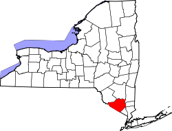
The southern town line is the border of New Jersey (Sussex County).

NY-284 is a north–south highway in Minisink.

Demographics

Historical population
CensusPop.Note
1820 5,053
1830 4,979−1.5%
1840 5,0932.3%
1850 4,972−2.4%
1860 1,266−74.5%
1870 1,44314.0%
1880 1,360−5.8%
1890 1,269−6.7%
1900 1,50518.6%
1910 1,304−13.4%
1920 1,252−4.0%
1930 1,3608.6%
1940 1,343−1.2%
1950 1,3671.8%
1960 1,4334.8%
1970 1,94235.5%
1980 2,48828.1%
1990 2,98119.8%
2000 3,58520.3%
2010 4,49025.2%
2020 4,6212.9%
U.S. Decennial Census [2]

As of the census [3] of 2000, there were 3,585 people, 1,182 households, and 945 families residing in the town. The population density was 155.2 inhabitants per square mile (59.9/km2). There were 1,245 housing units at an average density of 53.9 per square mile (20.8/km2). The racial makeup of the town was 89.00% white, 1.42% African American, 0.03% Native American, 0.59% Asian, 0.06% Pacific Islander, 1.03% from other races, and 0.92% from two or more races. Hispanic or Latino of any race were 10.60% of the population.

There were 1,182 households, out of which 44.8% had children under the age of 18 living with them, 69.3% were married couples living together, 7.6% had a female householder with no husband present, and 20.0% were non-families. 15.9% of all households were made up of individuals, and 6.2% had someone living alone who was 65 years of age or older. The average household size was 3.02 and the average family size was 3.39.

In the town, the population was spread out, with 29.8% under the age of 18, 6.3% from 18 to 24, 31.3% from 25 to 44, 24.3% from 45 to 64, and 8.3% who were 65 years of age or older. The median age was 36 years. For every 100 females, there were 97.3 males. For every 100 females age 18 and over, there were 95.2 males.

The median income for a household in the town was $55,561, and the median income for a family was $58,906. Males had a median income of $36,912 versus $28,750 for females. The per capita income for the town was $20,967. About 4.5% of families and 5.8% of the population were below the poverty line, including 6.8% of those under age 18 and 3.7% of those age 65 or over.

Government

Since January 1, 1980, the town is governed by a town board consisting of four councilmen, elected for staggered four-year terms, and a town supervisor, elected every two years. Prior to 1980, the town justices also served on the board, alongside two councilmen, and the supervisor. Minisink is governed under New York town law, by which the board holds executive and legislative powers. The day-to-day operations of the town are administered by the supervisor. The town voters also elect a town clerk, two town justices, a tax collector and a highway superintendent. Town elections are held on the Tuesday after the first Monday in November in odd-numbered calendar years. Elected officials take office the following January 1. Prior to the 1980s, Minisink also elected three assessors. Those functions are now performed by a sole assessor appointed by the town board.

Federal, state, and county representation

The town of Minisink lies in the 18th Congressional district, the 42nd State Senate district, the 98th State Assembly district, and the 3rd Orange County legislative district.

Education

Communities and locations in Minisink

Related Research Articles

<span class="mw-page-title-main">New Scotland, New York</span> Town in New York, United States

New Scotland is a town in Albany County, New York, United States. The population was 9,096 at the 2020 census.

Rodman is a town in Jefferson County, New York, United States. The population was 1,176 at the 2010 census. The name is derived from a public official, Daniel Rodman.

<span class="mw-page-title-main">Somerset, New York</span> Town in New York, United States

Somerset is a town in Niagara County, New York, United States. The population was 2,662 at the 2010 census. The town is believed to be named after Somerset, New Jersey, the source of some early settlers.

<span class="mw-page-title-main">Deerpark, New York</span> Town in New York, United States

Deerpark is a town in the western part of Orange County, New York, United States, and part of the New York metropolitan area. As of the 2020 Census, the population was at 7,509. The center of population of New York is located in Cuddebackville, a hamlet in Deerpark. Cuddebackville and Deerpark most prominently serve as the headquarters of both the global Falun Gong religious movement and the Shen Yun performance arts troupe, based at the Dragon Springs compound.

<span class="mw-page-title-main">Greenville, Orange County, New York</span> Town in New York, United States

Greenville is a town in Orange County, New York, United States, located along the southern county and state line. The population was 4,689 at the 2020 census.

<span class="mw-page-title-main">Otisville, New York</span> Village in New York, United States

Otisville is a village in Orange County, New York, United States. The population was 969 at the 2020 census. It is part of the Poughkeepsie–Newburgh–Middletown, NY Metropolitan Statistical Area as well as the larger New York–Newark–Bridgeport, NY-NJ-CT-PA Combined Statistical Area.

<span class="mw-page-title-main">Unionville, Orange County, New York</span> Village in New York, United States

Unionville is a village in Orange County, New York, United States. The population was 592 at the 2020 census, making it by far the smallest village in Orange County and one of the smallest in New York State.

<span class="mw-page-title-main">Wawayanda, New York</span> Town in New York, United States

Wawayanda is a town in Orange County, New York, United States. The population was 7,534 as recorded by the 2020 census. The town of Wawayanda is in the western part of the county, south of Middletown.

<span class="mw-page-title-main">Orangetown, New York</span> Town in New York, United States

Orangetown is a town in Rockland County, New York, United States, located in the southeastern part of the county. It is northwest of New York City, north of New Jersey, east of the town of Ramapo, south of the town of Clarkstown, and west of the Hudson River. The population was 48,655 at the 2020 census.

<span class="mw-page-title-main">Highland, Sullivan County, New York</span> Town in New York, United States

Highland is a town in Sullivan County, New York, United States. The population was 2,196 at the 2020 census. The town's name denotes its location on elevated ground north of the Delaware River. The town is in the southwestern part of the county.

<span class="mw-page-title-main">Neversink, New York</span> Town in New York, United States

Neversink is a town in Sullivan County, New York, United States. The population was 3,366 at the 2020 census.

<span class="mw-page-title-main">Tusten, New York</span> Town in New York, United States

Tusten is a town in Sullivan County in the U.S. state of New York. The population was 1,405 at the 2020 census. The name is derived from Dr. Benjamin Tusten, a distinguished military leader killed when he refused to leave his troops at the Battle of Minisink.

<span class="mw-page-title-main">Unionville, North Carolina</span> Town in North Carolina, United States

Unionville is a rural town in Union County, North Carolina, United States. The population was 6,643 at the 2020 census.

<span class="mw-page-title-main">Unionville Center, Ohio</span> Village in Ohio, United States

Unionville Center is a village in Union County, Ohio, in the United States. The population was 241 at the 2020 census.

<span class="mw-page-title-main">Birmingham Township, Chester County, Pennsylvania</span> Township in Pennsylvania, United States

Birmingham Township is a township in Chester County, Pennsylvania, United States. The population was 4,085 at the 2020 census.

<span class="mw-page-title-main">Matamoras, Pennsylvania</span> Borough in Pennsylvania, United States

Matamoras is a borough in Pike County, Pennsylvania, United States. The population was 2,362 at the 2020 census. It is the easternmost municipality of any kind in Pennsylvania. Matamoras is part of the New York–Newark–Jersey City, NY–NJ–PA Metropolitan Statistical Area, as well as the larger New York–Newark, NY–NJ–CT–PA Combined Statistical Area.

<span class="mw-page-title-main">Phelps, New York</span> Town in New York, United States

Phelps is a town in Ontario County, New York, United States. The population was 6,637 at the 2020 census. The Town of Phelps contains a village called Phelps. Both are north of Geneva.

<span class="mw-page-title-main">Goshen, New York</span> Town in New York, United States

Goshen is a town in Orange County, New York, United States. The population was 14,571 at the 2020 census. The town is named after the Biblical Land of Goshen. It contains a village also called Goshen, which is the county seat of Orange County. The town is centrally located in the county.

<span class="mw-page-title-main">Bath, New York</span> Town in New York, United States

Bath is a town in Steuben County, New York, United States, with an area of 96.3 square miles and a population of 11,426 in 2020. Its largest settlement is the Village of Bath, which has an area of 2.9 sq mi and a population of 5,641. The Village is the county seat of Steuben County. The Town is located in the central part of the county, northwest of Elmira. The town and village are either named after the city of Bath in England or after Lady Bath, daughter of a landowner.

<span class="mw-page-title-main">New York State Route 284</span> State highway in Orange County, New York, US

New York State Route 284 (NY 284) is a north–south state highway located entirely within Orange County, New York, in the United States. It begins just south of the village of Unionville at the New Jersey state line in the town of Minisink, where it connects to that state's Route 284. From Unionville, the route heads through rural parts of Orange County for just over 9 miles (14 km) to an intersection with U.S. Route 6 (US 6) in the hamlet of Slate Hill, located 5 miles (8.0 km) southwest of the city of Middletown in the town of Wawayanda.

References

  1. "2016 U.S. Gazetteer Files". United States Census Bureau. Retrieved July 5, 2017.
  2. "Census of Population and Housing". Census.gov. Retrieved June 4, 2015.
  3. "U.S. Census website". United States Census Bureau . Retrieved January 31, 2008.