Blooming Grove, New York

Last updated

Blooming Grove, New York
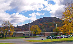
Round Hill Elementary School.jpg
Round Hill from New York State Route 208 in 2006
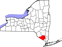
Orange County New York incorporated and unincorporated areas Blooming Grove highlighted.svg
Location in Orange County and the state of New York.
USA New York location map.svg
Red pog.svg
Blooming Grove, New York
Location within the state of New York
Coordinates: 41°26′N74°10′W / 41.433°N 74.167°W / 41.433; -74.167
Country United States
State New York
County Orange
Government
  Type Town Council
   Town Supervisor Robert C. Jeroloman
   Town Council
Members' List
Area
[1]
  Total35.35 sq mi (91.56 km2)
  Land34.74 sq mi (89.97 km2)
  Water0.62 sq mi (1.60 km2)
Elevation
374 ft (114 m)
Population
 (2020)
  Total18,811
Time zone UTC-5 (Eastern (EST))
  Summer (DST) UTC-4 (EDT)
ZIP code
10914 (Also serviced by the Monroe post office ZIP 10950)
Area code 845
FIPS code 36-07003
GNIS feature ID0978739
Website Town website

Blooming Grove is a town in Orange County, New York, United States. The population was 18,811 at the 2020 census. It is located in the central part of the county, southwest of Newburgh.

Contents

History

Vincent Mathews was likely the earliest settler who purchased the Rip Van Dam patent in 1721, built a grist mill and named his settlement "Mathewsfield." [2] He is the father of David Mathews, a Loyalist who was Mayor of New York during the American Revolutionary War, and Fletcher Mathews, also a Loyalist and alleged abettor to schemes against the newly forming republic.

The town of Blooming Grove was formed from the town of Cornwall in 1799. In 1830, the town of Hamptonburgh was established from part of Blooming Grove. Another part of Blooming Grove was taken to form the town of Chester in 1845. The village of South Blooming Grove was incorporated in July, 2006.

Andrew Jackson Davis, the "Poughkeepsie Seer", was born in Blooming Grove in 1826. [3]

The Brotherhood Winery in Washingtonville is the oldest continuously operating winery in the United States, having been established in 1839.

Geography

According to United States Census Bureau data, the town has a total area of 35.3 square miles (91 km2), of which 34.8 square miles (90 km2) is land and 0.5 square miles (1.3 km2) (1.42%) is water.

Combined New York State Route 17- U.S. Route 6 pass through the south of Blooming Grove.

Demographics

Historical population
CensusPop.Note
1800 1,611
1810 1,7599.2%
1820 2,21926.2%
1830 2,099−5.4%
1840 2,39614.1%
1850 2,184−8.8%
1860 2,2482.9%
1870 2,50211.3%
1880 2,444−2.3%
1890 2,236−8.5%
1900 2,188−2.1%
1910 2,110−3.6%
1920 1,881−10.9%
1930 1,9222.2%
1940 2,31220.3%
1950 2,4104.2%
1960 3,77756.7%
1970 8,813133.3%
1980 12,33940.0%
1990 16,67335.1%
2000 17,3514.1%
2010 18,0283.9%
2020 18,8114.3%
U.S. Decennial Census [4]

As of the census of 2010, [5] there were 18,028 people, 6,284 households, and 4,750 families residing in the town. The population density was 510.7 inhabitants per square mile (197.2/km2). There were 6,954 housing units at an average density of 197 per square mile (76/km2). The racial makeup of the town was 84.5% white, 6.2% African American, .5% Native American, 2.2% Asian, .02% Pacific Islander, 3.8% from other races, and 2.6% from two or more races. Hispanic or Latino of any race were 15% of the population.

Of the town's 6,284 households, 39.5% contained children under the age of 18, 62% were married couples living together, 9.1% had a female householder with no husband present, and 24.4% were non-families. Nearly 20% of households had only one member and 6.4% of households consisted only of someone 65 years of age or older. The average household size was 2.86 and the average family size was 3.33. The town's population has a wide age distribution, with 25.3% under the age of 18 and 11.6% who were 65 years of age or older. The median age was 40.8 years. The population was 49.3% male and 50.7% female.

According to the 2013 American Community Survey, [5] the median income for a household in the town was $89,327, and the median income for a family was $100,142. Full-time, year-round male workers had a median income of $65,685 versus $50,835 for females. The per capita income for the town was $34,472. About 3.2% of families and 6.2% of the population were below the poverty line, including 8.8% of those under age 18 and 2.8% of those age 65 or over.

For people 5 years of age and older, an estimated 83.7% spoke only English, 12.1% could speak Spanish and 21.9% spoke English less than "very well." An estimated 93.4% of people aged five years and older were born in the United States while 1.8% are not citizens. The most common ancestry groups were overwhelmingly estimated to be Irish, Italian, German and "American." [6]

Communities and locations within the town of Blooming Grove

Related Research Articles

Grove is a town in Allegany County, New York, United States. The population was 497 at the 2020 census. Grove is in the northeast part of Allegany County, northwest of Hornell.

Lenox is a town in Madison County, New York, United States. The population was 8,768 as of the 2020 census.

<span class="mw-page-title-main">Otisco, New York</span> Town in New York, United States

Otisco is a town in Onondaga County, New York, United States. As of the 2020 Census, the population was 2,368. Otisco is in the southwestern part of the county, situated at the northern edge of the Appalachian Highlands, where an escarpment declines to the Lake Ontario plain and the city of Syracuse five miles to the north.

<span class="mw-page-title-main">Spafford, New York</span> Town in New York, United States

Spafford is a town in Onondaga County, New York, United States. As of the 2020 Census, the population was 1,588. The town was named after Horatio Gates Spafford, a writer and founder of the local library. Spafford is in the southwestern corner of Onondaga County and is southwest of Syracuse.

Farmington is a town located in the northern part of Ontario County, New York, United States. The population was 14,275 at the 2020 census.

<span class="mw-page-title-main">Beaverdam Lake–Salisbury Mills, New York</span> Former census-designated place in New York, United States

Beaverdam Lake-Salisbury Mills was a census-designated place (CDP) in Orange County, New York, United States. It encompassed a region in the corner of the towns of Blooming Grove, Cornwall, and New Windsor. As of the 2000 census, its population was 2,779. After the 2000 census, the area was counted as two separate CDPs: Beaver Dam Lake in the towns of Blooming Grove and New Windsor and Salisbury Mills in the towns of Blooming Grove and Cornwall. Beaverdam Lake is also the name of a lake next to the community.

<span class="mw-page-title-main">Cornwall, New York</span> Town in New York, United States

Cornwall is a town in Orange County, New York, United States, approximately 50 miles (80 km) north of New York City on the western shore of the Hudson River. As of the 2020 census, the population was at 12,884. Cornwall has become a bedroom community for area towns and cities including New York City. Commuter rail service to North Jersey and New York City is available via the Salisbury Mills–Cornwall train station, operated by NJ Transit on behalf of Metro-North Railroad. The town is located less than an hour from the George Washington Bridge with access to major commuter routes such as the New York State Thruway and the Palisades Parkway.

<span class="mw-page-title-main">Vails Gate, New York</span> CDP in New York, United States

Vails Gate is a hamlet in Orange County, New York, United States. The population was 3,368 at the 2020 census. It is part of the Poughkeepsie–Newburgh–Middletown, NY Metropolitan Statistical Area as well as the larger New York–Newark–Bridgeport, NY-NJ-CT-PA Combined Statistical Area.

<span class="mw-page-title-main">Washingtonville, New York</span> Village in New York, United States

Washingtonville is a village in the town of Blooming Grove, Orange County, New York, United States. The population was 5,657 at the 2020 census. It is part of the Poughkeepsie–Newburgh–Middletown, NY Metropolitan Statistical Area as well as the larger New York–Newark–Bridgeport, NY-NJ-CT-PA Combined Statistical Area. The village is named in honor of George Washington.

<span class="mw-page-title-main">New Haven, New York</span> Town in New York, United States

New Haven is a town in Oswego County, New York, United States. The population was 2,856 at the 2010 census.

<span class="mw-page-title-main">Exeter, New York</span> Town in New York, United States

Exeter is a town in Otsego County, New York, United States. The town is located in the northern part of the county. The population was 987 at the 2010 census. It is named after the county town and cathedral city of Exeter in England.

<span class="mw-page-title-main">Fowler, New York</span> Town in New York, United States

Fowler is a town in St. Lawrence County, New York, United States. The population was 2,202 at the 2010 census.

Urbana is a town in Steuben County, New York, United States. The population was 2,125 at the 2020 census.

<span class="mw-page-title-main">Thompson, New York</span> Town in New York, United States

Thompson is a town in the southern part of Sullivan County, New York, United States. The population was 16,550 at the 2020 census. The town is named after William Thompson, an early settler.

<span class="mw-page-title-main">Johnsburg, New York</span> Town in New York, United States

Johnsburg is a town in the northwestern corner of Warren County, New York, United States. It is part of the Glens Falls Metropolitan Statistical Area. The town population was 2,143 at the 2020 census. The town is named after John Thurman, an early settler and founder. Johnsburg is the largest town in Warren County by area.

<span class="mw-page-title-main">Milo, New York</span> Town in New York, United States

Milo is a town in Yates County, New York, United States. The population was 7,006 at the 2010 census. The town was named after Milo of Croton, a famous athlete from Ancient Greece.

<span class="mw-page-title-main">Plattsburgh (town), New York</span> Town in New York, United States

Plattsburgh is a town in Clinton County, New York, United States. The population was 11,886 at the 2020 census. The town is named after Zephaniah Platt, an early land owner, and it surrounds the separate and more populous city of the same name. The town is in the eastern part of the county, in the North Country region of the state of New York. The region's airport, Plattsburgh International Airport, is located in the southern part of the town.

<span class="mw-page-title-main">New Windsor, New York</span> Town in New York, United States

New Windsor is a town in Orange County, New York, United States. The population was 27,805 at the 2020 census. It is located on the eastern side of the county and is adjacent to the Hudson River and the City of Newburgh.

<span class="mw-page-title-main">Dryden, New York</span> Town in New York, United States

Dryden is a town in Tompkins County, New York, United States. The population was 14,435 at the 2010 census. The town administers an area that includes two villages, one also named Dryden and one named Freeville, as well as a number of hamlets. The town is on the county's eastern border, east of Ithaca, in the Finger Lakes region.

<span class="mw-page-title-main">Beaver Dam Lake, New York</span> Census-designated place in New York, United States

Beaver Dam Lake is a census-designated place (CDP) in the towns of New Windsor, Blooming Grove, and Cornwall in Orange County, New York, United States. As of the 2020 census, it had a population of 2,609.

References

  1. "2016 U.S. Gazetteer Files". United States Census Bureau. Retrieved July 5, 2017.
  2. Headley, Russell, editor. The History of Orange County, New York, 1908
  3. Andrew Jackson Davis, "The Magic Staff", Boston: Bella Marsh (1867), p26 https://archive.org/details/cu31924028954852
  4. "Census of Population and Housing". Census.gov. Retrieved June 4, 2015.
  5. 1 2 "U.S. Census website". United States Census Bureau. Retrieved April 24, 2015.
  6. "SELECTED SOCIAL CHARACTERISTICS IN THE UNITED STATES - 2009-2013 American Community Survey 5-Year Estimates". United States Census Bureau. Retrieved April 24, 2015.

41°26′N74°10′W / 41.433°N 74.167°W / 41.433; -74.167