West Point, New York | |
---|---|
![]() Aerial view of West Point (at the center), the Hudson River, Highland Falls (on right), Cold Spring (on left) across the river in Putnam County | |
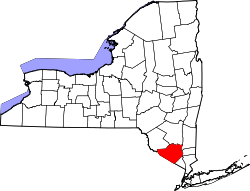
![]() Location of West Point in Orange County, New York (left) and of Orange County in New York state (right) | |
Coordinates: 41°23′29″N73°57′22″W / 41.39139°N 73.95611°W | |
Country | United States |
State | New York |
County | Orange |
Area | |
• Total | 19.34 sq mi (50.08 km2) |
• Land | 18.43 sq mi (47.75 km2) |
• Water | 0.90 sq mi (2.33 km2) |
Population (2020) | |
• Total | 7,341 |
• Density | 398.21/sq mi (153.75/km2) |
Time zone | UTC−5 (Eastern (EST)) |
• Summer (DST) | UTC−4 (EDT) |
ZIP Codes | 10996–10997 |
Area code | 845 |
FIPS code | 36-80747 [2] |
West Point is the oldest continuously occupied military post in the United States. [3] Located on the Hudson River in New York, General George Washington stationed his headquarters in West Point in the summer and fall of 1779 during the American Revolutionary War, [4] and later called it "the most important Post in America" in 1781 following war's end. [5] West Point also was the site of General Benedict Arnold's infamous and failed attempt at treason during the Revolutionary War. [6]
West Point was first occupied by the United States Armed Forces on January 27, 1778, when Brigadier General Samuel Holden Parsons and his brigade, including elements of Connecticut Colony's patriot militia, crossed an iced over Hudson River and climbed to the plain on West Point. [7] From then to the present, West Point has been occupied by the United States Army. [8] It comprises approximately 16,000 acres (6,500 ha) including the campus of the United States Military Academy, [9] which is commonly called "West Point" as well. [10]
West Point is a census-designated place (CDP) located in the town of Highlands in Orange County, [11] [12] located on the western bank of the Hudson River. The population was 7,341 at the 2020 census. [13] It is part of the New York–Newark–Jersey City, NY–NJ–PA Metropolitan Statistical Area as well as the larger New York–Newark, NY–NJ–CT–PA Combined Statistical Area.
The site for West Point was originally picked because of the abnormal S-curve in the Hudson River at that point during the American Revolutionary War, and was the subject of a committee reporting on fortifications in the Hudson River in November 1775, which first recommended occupying the land. [5] Construction of the fort was begun under Captain Louis de la Radiere [14] as chief engineer of the fort, however, New York Governor George Clinton thought that Radiere as "lacking" in the knowledge needed to hold his position. [5] Thus it was completed under Polish Colonel Tadeusz Kościuszko between 1778–1780; it was a key defensive fortification, overlooking the turn in the Hudson River and the Great Chain. [15]
General George Washington watched the construction of the fort closely and considered the fort to be General Alexander McDougall's "first priority". [5]
In 1778, Major General Israel Putnam wrote, "The place agreed upon to obstruct the navigation of Hudson river was at West Point." A fort there, Fort Clinton, named after the governor's brother, Colonel James Clinton [lower-alpha 1] (whose brigade built the main fort), was built as well. The southern and western walls were nine feet high and twenty feet thick. Three redoubts and batteries on the south were named Forts Meigs, Wyllys, and Webb. [16] : 53, 55
West Point was staffed by a small garrison of Continental Army Soldiers from early in 1776 through the end of the war. A great iron chain was laid across the Hudson at this point in 1778 in order to prevent British Navy vessels from sailing further up the Hudson River, which was never tested by the British. [17]
The site comprised multiple redoubts, as well as Fort Putnam, situated on a high hill overlooking the river. Named after its builder, Revolutionary War General and engineer Rufus Putnam, the fort is still preserved in its original design. [18] [19]
Parliament sent instructions to General Sir Henry Clinton to force George Washington out of West Point. Clinton decided to capture the strategically important posts Stony Point and Verplanck's Point, [20] which were twelve miles south of West Point. Clinton captured the forts on June 1, 1779. To block the British advance, Washington moved his troops further up the Hudson. [5]
Early on in May 1779, General Benedict Arnold had met with a Philadelphia merchant named Joseph Stansbury. Afterwards Stansbury had gone to Sir Henry Clinton, to whom he offered Arnold's "services". Clinton had been pursuing a campaign to take control of the Hudson River, so he had been interested in the plans and information of the defenses of West Point and other defenses on the Hudson River. Arnold wrote a series of letters to Clinton, one of which was written on July 12, making explicit the offer to surrender West Point to the British, later for a finalized offer of £20,000. On August 3, 1780, Arnold obtained command of West Point, which also gave him command of the American-controlled portion of the Hudson. Arnold then intentionally started weakening the fort's defenses, and through a letter sent to Clinton, proposing a meeting with British Major John André to discuss information on West Point. A meeting was set for September 11, however, Arnold and André did not meet until September 21. Carrying the plans for West Point, André was captured on September 23 by three militiamen, and the information to West Point was found. [6] After Arnold's betrayal, the fort, which was also known as Fort Arnold at the time, was renamed to Fort Clinton after General James Clinton. [21]
After the conclusion of the American Revolution, West Point was used as a storage facility for cannon and other military property used by the Continental Army [22] and until November 28, 1779 was used as the temporary headquarters to George Washington. [5] Viewing a standing army as "dangerous", Congress demobilized American forces but left fewer than a hundred men at West Point. [5] However, it was still the largest post in the army in the immediate years after the Revolutionary War. [23]
Favoring West Point due to its location and defenses, Henry Knox and Alexander Hamilton made the first official recommendation to establish a military academy at West Point in 1790. However, Congress rejected the proposal, although earlier in 1790, New York merchant and American Revolution patriot Stephen Moore sold his estate (known as "Moore's Folly") to the United States, following an Act of Congress that solidified the sale [24] which meant Congress had gained full possession of the fort. [5] The United States Military Academy was established at West Point in 1802 [25] [26] and is the nation's oldest service academy. [27] West Point has the distinction of being the longest continuously occupied United States military installation. [8]
West Point is located at 41° 23′ 42" N 73° 57' 18" W (41.395° N 73.955° W). According to the United States Census Bureau, the CDP has a total area of 25.1 sq mi (65 km2); 24.3 sq mi (63 km2) land and 0.7 sq mi (1.8 km2) water. West Point and the contiguous village of Highland Falls are on the west bank of the Hudson River. [28]
West Point has a humid continental climate (Köppen Dfa), [29] with four distinct seasons. [30] Summers are hot and humid, while winters are cold with moderate snowfall. [31] The monthly daily average temperature ranges from 27.5 °F (−2.5 °C) in January to 74.1 °F (23.4 °C) in July; on average, temperatures reaching 90 °F (32 °C) or 0 °F (−18 °C) occur on 17 and 1.4 days of the year, respectively. The average annual precipitation is approximately 50.5 in (1,280 mm), which is distributed fairly evenly throughout the year; snow averages 35 in (89 cm) per season, although this total may vary considerably from year to year. Extremes in temperature range from 106 °F (41 °C) on July 22, 1926, down to −17 °F (−27 °C) on February 9, 1934.[ citation needed ]
Climate data for West Point, New York (1991–2010 normals, extremes 1890–present) | |||||||||||||
---|---|---|---|---|---|---|---|---|---|---|---|---|---|
Month | Jan | Feb | Mar | Apr | May | Jun | Jul | Aug | Sep | Oct | Nov | Dec | Year |
Record high °F (°C) | 71 (22) | 77 (25) | 86 (30) | 96 (36) | 97 (36) | 102 (39) | 106 (41) | 105 (41) | 105 (41) | 92 (33) | 82 (28) | 72 (22) | 106 (41) |
Average high °F (°C) | 35.8 (2.1) | 38.9 (3.8) | 47.4 (8.6) | 60.4 (15.8) | 71.5 (21.9) | 79.9 (26.6) | 85.2 (29.6) | 83.3 (28.5) | 76.0 (24.4) | 63.4 (17.4) | 51.4 (10.8) | 40.7 (4.8) | 61.2 (16.2) |
Daily mean °F (°C) | 28.2 (−2.1) | 30.6 (−0.8) | 38.5 (3.6) | 50.4 (10.2) | 61.1 (16.2) | 69.8 (21.0) | 75.3 (24.1) | 73.6 (23.1) | 66.4 (19.1) | 54.5 (12.5) | 43.5 (6.4) | 33.9 (1.1) | 52.1 (11.2) |
Average low °F (°C) | 20.7 (−6.3) | 22.4 (−5.3) | 29.5 (−1.4) | 40.5 (4.7) | 50.6 (10.3) | 59.8 (15.4) | 65.4 (18.6) | 63.9 (17.7) | 56.7 (13.7) | 45.6 (7.6) | 35.5 (1.9) | 27.1 (−2.7) | 43.1 (6.2) |
Record low °F (°C) | −15 (−26) | −17 (−27) | −2 (−19) | 8 (−13) | 25 (−4) | 40 (4) | 40 (4) | 35 (2) | 28 (−2) | 20 (−7) | 5 (−15) | −16 (−27) | −17 (−27) |
Average precipitation inches (mm) | 3.82 (97) | 2.95 (75) | 4.04 (103) | 4.00 (102) | 3.84 (98) | 4.61 (117) | 4.57 (116) | 4.96 (126) | 4.57 (116) | 5.29 (134) | 4.23 (107) | 4.59 (117) | 51.47 (1,307) |
Average snowfall inches (cm) | 11.1 (28) | 7.1 (18) | 9.6 (24) | 0.4 (1.0) | 0.0 (0.0) | 0.0 (0.0) | 0.0 (0.0) | 0.0 (0.0) | 0.0 (0.0) | 0.0 (0.0) | 0.5 (1.3) | 7.0 (18) | 35.7 (91) |
Average precipitation days (≥ 0.01 in) | 9.8 | 8.3 | 9.3 | 10.5 | 11.8 | 11.4 | 9.8 | 9.6 | 8.2 | 9.6 | 9.0 | 10.4 | 117.7 |
Average snowy days (≥ 0.1 in) | 3.8 | 2.4 | 2.0 | 0.2 | 0.0 | 0.0 | 0.0 | 0.0 | 0.0 | 0.0 | 0.2 | 1.9 | 10.5 |
Source: NOAA [32] [33] |
Census | Pop. | Note | %± |
---|---|---|---|
2010 | 6,763 | — | |
2020 | 7,341 | 8.5% | |
U.S. Decennial Census [34] |
As of the census of 2020, there were 7,341 people, and 860 households residing in the CDP, with the average household size being 3.79 persons per household. The population density was 398.2 inhabitants per square mile (153.7/km2). The racial makeup of the CDP was 69.3% white, 5.4% African American, 0.2% Native American, 4.4% Asian, 0.2% Pacific Islander, and 10.3% from two or more races. Hispanic or Latino of any race were 12.0% of the population. The age distribution is 23.5% under the age of 18, and 0.4% who were 65 years of age or older. [13]
There were 860 households, out of which 79.5% were a married couple family household, 16.4% had a female householder with no spouse present, and 3.3% had a male householder with no spouse present. [35] The average household size was 3.79. The median income for a household in the CDP was $121,219. [13]
About 2.3% of the population were below the poverty line. [13]
In 1937, the West Point Bullion Depository was constructed and in 1938 opened to store silver bullion. [36] In 1988, it became the West Point Mint, as a branch of the United States Mint [37] and gained official status as a branch of the United States Mint on March 31 of that year. [38] The West Point Mint has a deep storage of 54,067,331.379 fine troy ounces of gold. [39] It sits on a 4-acre (1.6 ha) parcel of land. [40]
U.S. Route 9W, combined with NY Route 218 run north-south through West Point. New York Route 293 also runs northeast-southwest through the post. Running through the lower portion of the town is U.S. Route 6, combined with the upper extent of the Palisades Interstate Parkway.
The New York Central Railroad well into the 1950s operated several passenger trains a day on the West Shore Railroad through the academy's Gothic style station; both the limited stop trains bound for Albany and the local trains to Newburgh and Kingston made stops at the station. Service finally ended in 1958. [47] [48]
Highland Falls-Fort Montgomery Central School District is the local school district. [49] James I. O'Neill High School is its high school. [50]
The Department of Defense Education Activity (DoDEA) maintains elementary and middle schools for children of military personnel on-post at USMA, [51] but sends high school aged students who are dependents of on-base military personnel to O'Neill. [50] In March 2022 USMA's contract with O'Neill was renewed. [52]
Westchester County is located in the U.S. state of New York. It is the seventh most populous county in the State of New York and the most populous north of New York City. According to the 2020 United States Census, the county had a population of 1,004,456, its highest decennial count ever and an increase of 55,344 (5.8%) from the 949,113 counted in 2010. Located in the Hudson Valley, Westchester covers an area of 450 square miles (1,200 km2), consisting of six cities, 19 towns, and 23 villages. Established in 1683, Westchester was named after the city of Chester, England. The county seat is the city of White Plains, while the most populous municipality in the county is the city of Yonkers, with 211,569 residents per the 2020 U.S. Census.
Dutchess County is a county in the U.S. state of New York. As of the 2020 census, the population was 295,911. The county seat is the city of Poughkeepsie. The county was created in 1683, one of New York's first twelve counties, and later organized in 1713. It is located in the Mid-Hudson Region of the Hudson Valley, north of New York City.
Washington County is a county in the U.S. state of New York. As of the 2020 census, the population was 61,302. The county seat is Fort Edward. The county was named for U.S. President George Washington.
Putnam County is a county located in the U.S. state of New York. As of the 2020 census, the population was 97,668. The county seat is Carmel. Putnam County was formed in 1812 from Dutchess County and is named for Israel Putnam, a hero in the French and Indian War and a general in the American Revolutionary War.
Orange County is a county located in the U.S. state of New York. As of the 2020 census, the population was 401,310. The county seat is Goshen. This county was first created in 1683 and reorganized with its present boundaries in 1798.
Rockland County is the southernmost county on the west side of the Hudson River in the U.S. state of New York. It is part of the New York metropolitan area. As of the 2020 U.S. census, the county's population is 338,329, making it the state's third-most densely populated county outside New York City after Nassau and neighboring Westchester Counties. The county seat and largest city is New City. Rockland County is accessible via the New York State Thruway, which crosses the Hudson to Westchester at the Tappan Zee Bridge ten exits up from the NYC border, as well as the Palisades Parkway five exits up from the George Washington Bridge. The county's name derives from "rocky land", as the area has been aptly described, largely due to the Hudson River Palisades.
Ulster County is a county in the U.S. state of New York. It is situated along the Hudson River. As of the 2020 census, the population was 181,851. The county seat is Kingston. The county is named after the Irish province of Ulster.
Pasco County is located on the west central coast of the U.S. state of Florida. According to the 2020 census, the population was 561,691. Its county seat is Dade City, and its largest city is Zephyrhills. The county is named after Samuel Pasco.
Hopewell Junction is a hamlet and census-designated place (CDP) in Dutchess County, New York, United States. The population was 1330 at the 2020 census. It is part of the Poughkeepsie–Newburgh–Middletown, NY Metropolitan Statistical Area as well as the larger New York–Newark–Bridgeport, NY-NJ-CT-PA Combined Statistical Area.
Rome is a city in Oneida County, New York, United States, located in the central part of the state. The population was 32,127 at the 2020 census. Rome is one of two principal cities in the Utica–Rome Metropolitan Statistical Area, which lies in the "Leatherstocking Country" made famous by James Fenimore Cooper's Leatherstocking Tales, set in frontier days before the American Revolutionary War. Rome is in New York's 22nd congressional district.
Fort Montgomery is a hamlet in Orange County, New York, United States. The population was 1,627 at the 2020 census. It is part of the Poughkeepsie–Newburgh–Middletown, NY Metropolitan Statistical Area as well as the larger New York–Newark–Bridgeport, NY-NJ-CT-PA Combined Statistical Area.
Highlands is a town on the eastern border of Orange County, New York. The population was 12,939 at the 2020 census. West Point, including the United States Military Academy, is located alongside the Hudson River in Highlands, and the military reservation occupies a large part of the town.
Ticonderoga is a hamlet in the southeast part of the town of Ticonderoga, in Essex County, New York, United States. The name is derived from the Haudenosaunee term for "between the two waters", the two waters being Lake George and Lake Champlain. The hamlet became a census-designated place (CDP) in 2008. As of the 2010 census, the population was 3,382, out of a total 5,042 residents in the town of Ticonderoga.
Pierre Van Cortlandt Jr. was a United States representative from New York. A member of New York's Van Cortlandt family, he was the son of Pierre Van Cortlandt, an early New York political figure, and brother of Philip Van Cortlandt, who was also a U.S. Representative from New York.
Garrison Union Free School, also referred to as just Garrison School, educates students from kindergarten through eighth grade in the eponymous school district, which covers the hamlet of Garrison and nearby areas of the towns of Philipstown and Putnam Valley in Putnam County, New York, United States. It is located on NY 9D near the center of the hamlet, right across from St. Philip's Church in the Highlands, where it was originally located when established in 1793.
The Battle of Forts Clinton and Montgomery was an American Revolutionary War battle fought in the Hudson Highlands of the Hudson River valley, not far from West Point, on October 6, 1777. British forces under the command of General Sir Henry Clinton captured Fort Clinton and Fort Montgomery and then dismantled the first iteration of the Hudson River Chains. The purpose of the attack was to create a diversion to draw American troops from the army of General Horatio Gates, whose army was opposing British General John Burgoyne's attempt to gain control of the Hudson.
James I. O'Neill High School is a public high school in Highland Falls, New York and a part of the Highland Falls-Fort Montgomery Central School District.
The Kiryas Joel-Poughkeepsie-Newburgh, NY Metropolitan Statistical Area, as defined by the United States Office of Management and Budget, is an area consisting of two counties in New York's Hudson Valley, with the municipalities of Kiryas Joel, Poughkeepsie, and Newburgh as its principal cities. As of the 2020 census, the MSA had a population of 679,221. The area was centered on the urban area of Poughkeepsie-Newburgh.
Fort Covington is a census-designated place (CDP) within the town of Fort Covington, Franklin County, New York, United States. It consists of the hamlet of Fort Covington, as well as a large amount of rural land surrounding the hamlet, such that the CDP occupies about one half of the area within the town limits. The population of the CDP was 1,308 at the 2010 census, out of a total town population of 1,676.
Highland Falls-Fort Montgomery Central School District (HFFMCSD) is a school district headquartered in Highland Falls, New York.
de la radiere.