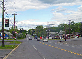
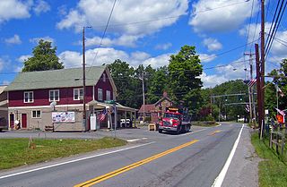
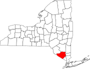
Little Britain, New York is an area in the town of New Windsor, Orange County. The name spread to the surrounding region, which at that time was part of Ulster County, New York.

Wawayanda Creek is the name of Pochuck Creek above its confluence with the tributary Black Creek.
Pochuck Creek is an 8.1-mile-long (13.0 km) tributary of the Wallkill River in Orange County, New York and Sussex County, New Jersey, in the United States.

Bullville, New York is a populated place located in the Town of Crawford in Orange County, New York, United States. It is located at the junction of routes NY-17K and NY-302. Bulville is the site of a United States Post Office and is served by the postal code 10915.

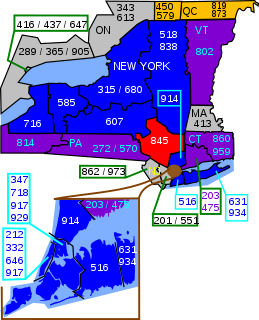
Area code 845 is a telephone area code serving the mid- and lower Hudson Valley region of the U.S. state of New York. 845 serves Rockland, Putnam, Orange, and Ulster counties, and parts of Dutchess and Sullivan, Delaware, Greene, and Columbia counties. Area code 845 was created on June 5, 2000, from most of area code 914, which was retained by Westchester County.

Slate Hill is one of the eight hamlets found in the town of Wawayanda, New York. It is home to the Minisink Valley Central School District. Slate Hill is found in Orange County, New York, one of the fastest-growing counties in the state. The area, along with its surrounding regions and the county in which it resides, has seen a recent surge in population growth that can be partially attributed to suburbanization from the New York City metropolitan area. This growth reached a peak in the post 9/11 era, but has since seen a decrease in the past 3 years.

Circleville, New York is a hamlet in the Town of Wallkill, part of Orange County, New York, United States. It is located on NY 302 around the junction with the old Goshen Turnpike, a short distance north of NY 17 and two miles (3 km) south of Bullville. It is three miles (5 km) northeast of Middletown.
Ridgebury, New York is one of the eight Hamlets in the town of Wawayanda, New York. The hamlet and its township are located in Orange County, New York, approximately 65 miles north of New York City.

Exchange is an unincorporated community in Green Township, Morgan County, in the U.S. state of Indiana.
Carpenter's Point is a historical hamlet in the town of Deer Park, Orange County, New York, first settled about 1690. It is located at the mouth of the Neversink River at its juncture with the Delaware River, near the point where the state lines of New Jersey, New York, and Pennsylvania meet at the Tri-States Monument. It is named after the Carpenter family who lived on the southeastern side of the Neversink, extending into New Jersey. Benjamin Carpenter operated a ferry across the Delaware here.

Burress is an unincorporated community in Fillmore County, Nebraska, in the United States.
New Market is an unincorporated community in Marion County, Kentucky, in the United States.
Circle Green is an unincorporated community in Jefferson County, in the U.S. state of Ohio.
Taitsville is an unincorporated community in Ray County, in the U.S. state of Missouri.
Clifton is an unincorporated community in Schuyler County, in the U.S. state of Missouri.
Little Pond is a lake in Orange County, in the U.S. state of New York. The pond has a surface area of 6 acres (2.4 ha).
Coldenham is a hamlet in Orange County, in the U.S. state of New York.
Saint Andrew is a hamlet in Orange County, in the U.S. state of New York.
Scotts Corner is a hamlet in Orange County, in the U.S. state of New York.
South Centerville is a hamlet in Orange County, in the U.S. state of New York.


