
The Delaware River is a major river in the Mid-Atlantic region of the United States. From the meeting of its branches in Hancock, New York, the river flows for 282 miles (454 km) along the borders of New York, Pennsylvania, New Jersey, and Delaware, before emptying into Delaware Bay. It is the longest free-flowing river in the Eastern United States.

Orange County is a county located in the U.S. state of New York. As of the 2020 census, the population was 401,310. The county seat is Goshen. This county was first created in 1683 and reorganized with its present boundaries in 1798.

Pike County is a county in the Commonwealth of Pennsylvania. It is part of Northeastern Pennsylvania. As of the 2020 census, the population was 58,535. Its county seat is Milford.

Sussex County is the northernmost county in the State of New Jersey. Its county seat is Newton. It is part of the New York metropolitan area and is part of New Jersey's Skylands Region. As of the 2020 U.S. census, the county's population was enumerated at 144,221, making it the 17th-most populous of the state's 21 counties, and representing a decrease of 5,044 (3.4%) from the 149,265 counted at the 2010 U.S. census, in turn an increase of 5,099 (3.5%) over the 144,166 persons at the 2000 census. Based on 2010 census data, Vernon Township was the county's largest in both population and area, with a population of 23,943 and covering an area of 70.59 square miles (182.8 km2).

Minisink is a town located in southwestern Orange County, New York, United States, northeast of the New Jersey border between the Town of Greenville and the Town of Warwick. The population was 4,621 at the 2020 census. The town is located near Interstate 84 and New York State Route 17 and lies approximately halfway between New York City and Scranton, Pennsylvania.
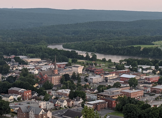
Port Jervis is a city located at the confluence of the Neversink and Delaware rivers in western Orange County, New York, United States, north of the Delaware Water Gap. Its population was 8,775 at the 2020 census. The communities of Deerpark, Huguenot, Sparrowbush, and Greenville are adjacent to Port Jervis. Matamoras, Pennsylvania, is across the river and connected by the Mid-Delaware Bridge. Montague Township, New Jersey, also borders the city. The Tri-States Monument, marking the tripoint between New York, New Jersey, and Pennsylvania, lies at the southwestern corner of town.

Unionville is a village in Orange County, New York, United States. The population was 612 at the 2010 census, making it by far the smallest village in Orange County and one of the smallest in New York State.

Goshen is a town in Orange County, New York, United States. The population was 14,571 at the 2020 census. The town is named after the Biblical Land of Goshen. It contains a village also called Goshen, which is the county seat of Orange County. The town is centrally located in the county.
Lebanon is a Middle-Eastern country on the Mediterranean Sea.
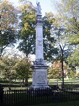
The Battle of Minisink was a battle of the American Revolutionary War fought at Minisink Ford, New York, on July 22, 1779. It was the only major skirmish of the Revolutionary War fought in the northern Delaware Valley. The battle was a decisive British victory, as the colonial militia was hastily assembled, ill-equipped, and inexperienced.
Minisink Ford is a hamlet on the Delaware River, fifteen miles northwest of Port Jervis. It is in the town of Highland, Sullivan County, New York, United States.
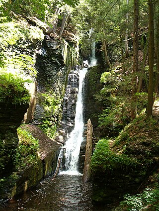
Delaware Water Gap National Recreation Area is a 70,000-acre (28,000 ha) national recreation area administered by the National Park Service in northwest New Jersey and northeast Pennsylvania. It is centered around a 40-mile (64 km) stretch of the Delaware River designated the Middle Delaware National Scenic River. At the area's southern end lays the Delaware Water Gap, a dramatic mountain pass where the river cuts between Blue Mountain and Kittatinny Mountain
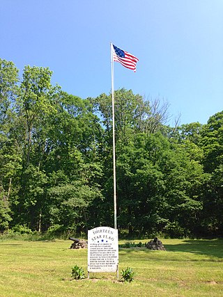
"Middlebrook encampment" may refer to one of two different seasonal stays of the Continental Army in central New Jersey near the Middlebrook in Bridgewater Township in Somerset County. They are usually differentiated by either the date of the encampment or their chronological order.

Minisink Archeological Site, also known as Minisink Historic District, is an archeological site of 1320 acres located in both Sussex County, New Jersey and Pike County, Pennsylvania. It was part of a region occupied by Munsee-speaking Lenape that extended from southern New York across northern New Jersey to northeastern Pennsylvania. The Munsee were speakers of one of the three major language dialects of the Lenape Native American tribe. This interstate territory became the most important Munsee community for the majority of the 17th and 18th centuries.

Herbert Clemens Kraft (1927–2000) was an archaeologist from New Jersey, specializing in prehistory. He wrote numerous books about archaeology in New Jersey, the Lenape and the Paleo-indians of New Jersey, as well as over 170 articles in his career.
Spencer's Additional Continental Regiment, sometimes referred to as the 5th New Jersey Regiment, was an American infantry unit that served for four years in the Continental Army during the American Revolutionary War. The Continental Congress authorized sixteen "Additional" Continental Regiments in late 1776 and Colonel Oliver Spencer accepted command of this regiment with rank from January 15, 1777.

The Minisink or Minisink Valley is a loosely defined geographic region of the Upper Delaware River valley in northwestern New Jersey, northeastern Pennsylvania and New York.
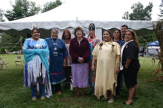
The Munsee are a subtribe and one of the three divisions of the Lenape. Historically, they lived along the upper portion of the Delaware River, the Minisink, and the adjacent country in New York, New Jersey, and Pennsylvania. They were prominent in the early history of New York and New Jersey, being among the first Indigenous peoples of that region to encounter European colonizers.

Wallpack Ridge is a mountain located in the Ridge and Valley Appalachians physiographic province in Sussex County in northwestern New Jersey. Oriented northeast to southwest, Wallpack Ridge spans 25 miles (40 km) from Montague Township south of Port Jervis, New York to the Walpack Bend in the Delaware River near Flatbrookville in Walpack Township. It is a narrow ridge ranging between 0.67 miles (1.08 km) to 1.7 miles (2.7 km) in width, and its highest elevation reaches 928 feet (283 m) above sea level. The ridge separates the Wallpack Valley from the valley of the Delaware River, and contains the watershed of the Flat Brook and its main tributaries Big Flat Brook and Little Flat Brook.

Wallpack Valley is a valley located in Sussex County in northwestern New Jersey formed by Wallpack Ridge on the west, and Kittatinny Mountain on the east. Wallpack Ridge separates the Wallpack Valley from the valley of the Delaware River, and contains the watershed of the Flat Brook and its main tributaries Big Flat Brook and Little Flat Brook. It is a narrow valley, roughly 25 miles (40 km) in length running from Montague Township south of Port Jervis, New York to the Walpack Bend in the Delaware River near Flatbrookville in Walpack Township where the Flat Brook enters the Delaware at 300 feet above sea level.


