Milford, Connecticut

Last updated

Milford, Connecticut
City of Milford
Milfordluft 2.jpg
Aerial view of Milford city center and harbor
Milford CT flag.jpg
MilfordCTseal3.jpg
Etymology: Ford by a mill
Nickname: 
Sleepy Hollow [1]
Motto: 
A Small City with a Big Heart!
New Haven County Connecticut Incorporated and Unincorporated areas Milford city Highlighted.svg
Milford, Connecticut
Coordinates: 41°13′27″N73°03′35″W / 41.22417°N 73.05972°W / 41.22417; -73.05972
CountryFlag of the United States (23px).png  United States
U.S. state Flag of Connecticut.svg  Connecticut
County New Haven
Region South Central CT
Settled1639;385 years ago (1639)
Incorporated (city)1959;65 years ago (1959)
Named for Milford, Surrey
Government
  Type Mayor–Board of Aldermen
   Mayor Tony Giannattasio (R)
Area
[2]
  Total25.13 sq mi (65.09 km2)
  Land21.91 sq mi (56.73 km2)
  Water3.23 sq mi (8.35 km2)
Population
 (2020) [3] [4]
  Total50,558
  Density2,308/sq mi (891.2/km2)
  United States Census 2010, United States Census Bureau
Time zone UTC−5 (Eastern)
  Summer (DST) UTC−4 (Eastern)
ZIP Codes
06460, 06461
Area code(s) 203/475
FIPS code 09-47515
GNIS feature ID0208882
Major highways I-95.svg Connecticut Highway 15.svg
Commuter Rail MTA NYC logo.svg
Website www.ci.milford.ct.us

Milford is a coastal city in New Haven County, Connecticut, United States, between New Haven and Bridgeport. The population was 50,558 at the 2020 United States Census. [5] The city includes the village of Devon and the borough of Woodmont. Milford is part of the South Central Connecticut Planning Region and New York metropolitan area.

Contents

History

Early history

The Eells-Stow House, c. 1700, is believed to be the oldest extant house in Milford. Eells-Stow House -- Milford, CT.jpg
The Eells-Stow House, c.1700, is believed to be the oldest extant house in Milford.

This area was occupied by indigenous peoples for thousands of years. At the time of English encounter, it was territory of the Paugusset (an Algonquian-speaking tribe). English colonists affiliated with the contemporary New Haven Colony purchased land which today comprises Milford, Orange, and West Haven on February 1, 1639, from Ansantawae, chief of the local Paugusset. They knew the area as Wepawaug, named for the small river which runs through the town. Later the settlers named streets in both Milford and Orange as Wepawaug.

The settlers built a grist mill by the Wepawaug River in 1640, to take advantage of its water power. [6]

During the Revolutionary War, the Milford section of the Boston Post Road, a vital route connecting Boston, New York and other major coastal cities, was blockaded by Continental forces, and Fort Trumbull was constructed to protect the town. The site of the blockade is commemorated by the Liberty Rock monument.

By 1822, the town had grown large enough that residents in the northern and eastern sections of Milford chartered the Town of Orange. During the next century and a half, the remaining section of Milford was known for shipbuilding, farming and oystering. Some industrial facilities were also developed in town.

Because of its location on Long Island Sound, during the later 19th century, Milford also became known as a beach resort for residents of New Haven and Bridgeport.

In 1899, the "Memorial Bridge" (a "stone bridge and tower commemorating the town's history and founders") [7] replaced the last mill over the Wepawaug, which had closed in 1894. [6] The bridge was described as "simple in design, its broad copings surmounted with rough hewn blocks of granite, bearing the names of the first settlers. There are ten blocks on the south and twenty on the north coping. At each end of the former is a stone four feet wide by five and a half high." [6] It is located where Broad Street crosses the Wepawaug River.

In 1903, the southeastern portion of the town was incorporated as the Borough of Woodmont. In 1959, the Town of Milford, including the Borough of Woodmont, was incorporated as the City of Milford.

View of Milford's greens on a 19th-century naive landscape painting Milford Connecticut old bridge.jpg
View of Milford's greens on a 19th-century naïve landscape painting

Towns created from Milford

Milford was one of the early settlements in south central Connecticut and, over time, gave rise to several new towns that broke off and incorporated separately. The following is a list of towns created from parts of Milford.

The "oatmeal lots" of Liberty Park

Starting in 1902, Quaker Oats oatmeal boxes came with a coupon redeemable for the legal deed to a tiny lot in Milford. The lots, sometimes as small as 10 feet (3 m) by 10 feet, were carved out of a 15-acre (6.1 ha) tract in a never-built subdivision called "Liberty Park". A small number of children (or their parents), often residents living near Milford, collected the deeds and started paying the extremely small property taxes on the "oatmeal lots". The developer of the prospective subdivision hoped the landowners would hire him to build homes on the lots, although several lots would need to be combined before building could start. Since the subdivision into small lots predated Milford's planning and zoning regulations, the deeds were entirely legal, although they created a large amount of paperwork for town tax collectors, who frequently couldn't find the property owners and received almost no tax revenue from the lots. [8]

Oyster Huts on Milford Point, a sketch by John Warner Barber for his Historical Collections of Connecticut (1836). Barber wrote that he found 15 or 20 of these seaweed-covered huts along the shore when he visited the town in 1836. BarberJohnWarnerOysterHutsMilfordPoint.jpg
Oyster Huts on Milford Point, a sketch by John Warner Barber for his Historical Collections of Connecticut (1836). Barber wrote that he found 15 or 20 of these seaweed-covered huts along the shore when he visited the town in 1836.

In the mid-1970s, when the town wanted to develop the area, town officials put an end to the oatmeal lots in a "general foreclosure" that avoided the enormous expense of individual foreclosures by condemning nearly all of the property in one legal filing. One of the streets in the Liberty Park subdivision plans, Shelland Street, was later built in the late 1990s as an access road to the Milford Power Company. The site is currently home to the Bic Corporation's lighter factory at 565 Bic Drive.

In a separate land giveaway in 1955 tied to the Sergeant Preston of the Yukon television show, Quaker Oats offered in its Puffed Wheat and Puffed Rice cereal boxes genuine deeds to land in the Klondike. [8]

Post-World War II development

In the post-World War II period, Milford—like many Connecticut towns—underwent significant suburbanization. Interstate 95 was routed through the city, and the Milford section was completed in 1958.

The 1960s and 1970s witnessed the construction of the Connecticut Post Mall, one of the state's largest shopping malls, and the extensive commercial development of the town's stretch of the Boston Post Road. One notable small business located on the Boston Post Road during the 1970s was SCELBI Computer Consulting, credited by many as being the world's first personal-computer manufacturer. Starting in 1975, the city began hosting the Milford Oyster Festival, which has since become firmly established as an annual Milford tradition that is held "rain or shine". [9] [10]

The city became host to several headquarters of multinational corporations, including the Schick Shaving company, [11] and Doctor's Associates, Inc., owners of the Subway chain of fast-food restaurants. The US operations of BIC were headquartered in Milford, but in March 2008 moved most of its operations to Shelton. Milford Hospital has also developed into an important health care resource for the area. It has also become home of smaller national corporations such as K-Mart and Orchid Medical.

Demographics

Historical population
CensusPop.Note
1790 2,098
1800 2,41715.2%
1810 674−72.1%
1820 2,785313.2%
1830 2,256−19.0%
1840 2,4558.8%
1850 2,4650.4%
1860 2,82814.7%
1870 3,40520.4%
1880 3,347−1.7%
1890 3,81113.9%
1900 3,783−0.7%
1910 4,36615.4%
1920 10,193133.5%
1930 12,66024.2%
1940 16,43929.8%
1950 26,87063.5%
1960 41,66255.1%
1970 50,85822.1%
1980 50,8980.1%
1990 49,938−1.9%
2000 52,2124.6%
2010 52,7591.0%
2020 50,558−4.2%
[12]

According to the 2010 US census Demographic Profile Data, there were 51,271 people living in 21,017 housing units of which 13,534 were counted as family households. [13] The population density was 2,341/sq mi (904/km2). The average density of housing units was 1,017.7 per square mile. The racial makeup of Milford was 93.55% White, 1.91% African American, 0.13% Native American, 2.36% Asian, 0.03% Pacific Islander, 0.88% from other races, and 1.14% from two or more races. Hispanic or Latino people of any race were 3.34% of the population.

Of the aforementioned households 29.3% had children under the age of 18 living with them, 54.7% were married couples living together, 9.7% had a female householder with no husband present, and 32.4% were non-families. 26.3% of all households were made up of individuals, and 10.3% had someone living alone who was 65 years of age or older. The average household size was 2.49 and the average family size was 3.04.

(In Milford the population was 22.4% under the age of 18, 5.9% from 18 to 24, 31.7% from 25 to 44, 25.0% from 45 to 64, and 14.9% who were 65 years of age or older. The median age was 39 years. For every 100 females, there were 93.6 males. For every 100 females age 18 and over, there were 90.0 males.)

As of the 2000 census, the median income for a household was $61,183. The per capita income was $28,773. About 2.4% of families and 3.8% of the population were below the poverty line, including 4.1% of those under age 18 and 5.4% of those age 65 or over.

The Census Bureau's 2010–2012 American Community Survey showed that (in 2012 inflation-adjusted dollars) median household income was $77,925 and the median family income was $93,697. Year-round male workers had a median income of $67,631 versus $59,992 for females. The per capita income for the city was $38,560. [14]

Government

Government in the city is set up with the mayor as chief executive and the Board of Aldermen as a legislative body. The mayor is permitted to propose legislation to the Board of Aldermen and introduces the city budget, but possesses no veto power over what the Aldermen chooses to pass.

Milford's city hall, the fifth building to occupy the site Milford7.jpg
Milford's city hall, the fifth building to occupy the site

Elected positions

The following is a list of city government positions elected by city residents and the terms thereof: [15]

List of mayors

After becoming incorporated as a city in 1959, the city reformed its system of government by establishing a mayor–board of aldermen format. It elected its first mayor, Charles Iovino, [16] the incumbent city manager under Milford's previous form of government, on November 3, 1959.

Since 1959, 12 people have held the office of mayor in the city. [17]

#NameIn officePolitical party
1Charles Iovino1959–1963 Independent
2Alan Jepson1963–1969 Democratic
3Edward Kozlowski1969–1971 Republican
4Clifton Moore1971–1973Republican
5Joel Baldwin1973–1977Democratic
6Henry Povinelli1977–1981Republican
7Alberta Jagoe1981–1989Democratic
8Frederick L. Lisman1989–2001Republican
9James L. Richetelli, Jr.2001–2011Republican
10Benjamin G. Blake2011–2023Democratic
11Richard Smith2023Democratic
12Tony Giannattasio2023–presentRepublican

Registered voters

Voter registration and party enrollment as of November, 01 2017 [18]
PartyActive votersInactive votersTotal votersPercentageChange since 2015 [19]
Democratic 10,31940510,72428.5%+15.6%
Republican 8,1662488,41422.4%+18.6%
Unaffiliated 17,25660617,86247.5%+6.3%
Total36,3091,27437,583100%+12.0%

Education

Milford Public Schools currently operates eight elementary schools, three middle schools, two high schools, and one alternative education high school. [20] There are also a number of private schools in the city.

Public

Milford High School operated for 141 years at the time of its closing in June, 1983. It was the first public high school to operate in Milford, beginning in 1842. [35] The former Milford High School building is now the Parson's Government building. [36]

Private schools

St. Gabriel's School opened in 1965; at the time clergy were the primary teachers. By the 2010s there were fewer clergy teachers, and lay teachers were more expensive; in addition fewer parishioners gave money to the church. By 2016 the school's budget was $111,709 in deficit. In 2008–2009 it had a peak enrollment of 219. In 2014 there was concern expressed about the school's survival expressed in the community, and in 2016 enrollment was down to 139, with 22 being in special education. The school directors chose to close the school in June 2016; the archdiocese did not order the closure. [41]

Emergency services

Fire Department

The city of Milford is protected 24/7, 365 by the 114 paid, full-time firefighters of the city of Milford Fire Department – ISO Class 1. The department currently operates out of four fire stations located throughout the city, under the command of a Battalion Chief and a Shift Commander. The Milford Fire Department is one of only two fire departments in the state of Connecticut to maintain an ISO Class 1 rating. The current[ when? ] Fire Chief is Douglas Edo. [42]

Fire station locations and apparatus

Below is a complete listing of all fire station locations and apparatus in the city of Milford. [43]

Engine companyTruck companyRescue ambulanceSpecial unitCommand unitAddress
Squad 1 (rescue pumper)Medic 1, Medic 2Squad 1aCar 4 (Shift Commander), Car 5 (Battalion Chief)72 New Haven Ave.
Quint 3, Engine 4Haz-Mat. 1, Dive Rescue Unit349 Naugatuck Ave.
Quint 5, Engine 6Rescue 234(Collapse Unit), Utility 3980 New Haven Ave.
Engine 7Medic 355 Wheelers Farms Rd.
Special Services Canteen Unit3 Charles Street

The Milford Fire Department also operates one reserve engine. Engine 8 (Reserve) is located at Semans Lane. The Canteen Unit is operated out of a garage at 3 Charles Street.

In 2021 Milford Fire department Removed Tower 1 from service and put in another full time Medic unit (Medic 3) one of the only towns to operate without a Tower Ladder

Police department

As of April 4, 2014, the Milford Police Department became one of 28 of Connecticut's 106 police departments accredited by the state of Connecticut. [44] Divisions and units include Detective Division, Special Investigations Unit, Identification Bureau and Narcotics & Vice Squad, Crime Prevention Unit, Training Unit/Recruit Academy and Marine Patrol / Dive Team. [45] The current chief of Milford Police is Keith L Mello [46]

Principal communities of Milford

Map showing Milford and neighboring towns: Stratford, Shelton, Orange, and West Haven MilfordCtAreaOutlineMap.png
Map showing Milford and neighboring towns: Stratford, Shelton, Orange, and West Haven

Other minor communities and geographic features are Anchor Beach, Bayview Heights, Burwells Beach, Cedar Beach, Downtown Historic District, Ettadore Park, Far View Beach, Forest Heights, Fort Trumbull, Great River, Gulf Beach, Heatherstone, Lexington Green, Merwin's Beach, Merwin's Point, Milford Lawns, Milford Point, Myrtle Beach, Naugatuck Gardens, Point Lookout, Silver Sands Beach, South of the Green, Wheelers Farms. Some of these communities have access to public and/or private beaches.

†: Denotes that the community is chartered by Special Act of the Connecticut General Assembly and have been granted some of the powers normally held only by a municipality including taxing authority.

‡: The Borough of Woodmont is chartered by Special Act of the Connecticut General Assembly as a municipality and has been granted all statutory powers of a municipality while simultaneously remaining part of the city of Milford. [47]

Culture and events

2006 Milford Oyster Festival banner Oyster Festival1.JPG
2006 Milford Oyster Festival banner

Every year on the third Saturday in August, Milford celebrates its annual Oyster Festival, which serves as a combination of a typical town fair with a culinary celebration of the town's location on historically shellfish-rich Long Island Sound. According to the "Encyclopedia of American Food and Drink" [48] the lobster roll originated as a hot dish at a restaurant named Perry's as early as 1929. [48] [49] This festival takes place in and around the Milford Green, near the center of town, as well as in various locations throughout the downtown area, and features a wide variety of events including canoe and kayak races, musical performances, and classic car shows.

The Milford Oyster Festival has drawn large musical acts over the years including Joan Jett, The Marshall Tucker Band, John Cafferty & The Beaver Brown Band, and Soul Asylum. [ citation needed ]

There are also other features such as carnival rides, food stands, crafts, face painting, and even opening your own oyster for a pearl.

The Milford Cultural Center, operated by the Milford Council for the Arts, offers various events throughout the year. The Firehouse Art Gallery was recently opened in Devon. The beach resort quality of the town lives on, with several rocky beaches, Silver Sands State Park, the Connecticut Audubon Society Coastal Center at Milford Point, Charles Island, two golf courses, and numerous other recreational facilities available for residents and tourists.

Since 2011, the Walnut Beach Concert Series has taken place under the pavilion at Walnut Beach. It features a different band playing every Sunday afternoon during the summer. [50]

Economy

Top employers

Top employers in Milford according to the town's 2022 Comprehensive Annual Financial Report [51]

#EmployerEmployees
1City of Milford, Board of Education1,030
2 Schick 738
3City of Milford532
4 Bridgeport Hospital (Milford Campus)517
5Inline Plastics Corps295
6 Walmart 276
7Alinibal Holdings Corp248
8Quadient Inc247
9West River Rehab Center219
10 Stop & Shop 215

Geography and environment

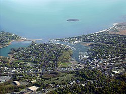
According to the United States Census Bureau, Milford, including the borough of Woodmont, has a total area of 26.1 square miles (67.7 km2), of which 22.2 square miles (57.4 km2) is land and 3.9 square miles (10.2 km2), or 15.11%, is water. [52]

Milford's Devon neighborhood [53] is located at the mouth of the Housatonic River near Stratford, and features the Connecticut Audubon Coastal Center overlooking the estuary.

Islands and coastline

Laurel Beach, 1910 PostcardLaurelBeachMilfordCT1910.jpg
Laurel Beach, 1910

Milford has over 14 miles (23 km) of shoreline facing Long Island Sound, the most of any town in Connecticut. [54] A large portion of Milford's shoreline forms the Silver Sands State Park. A newly built 3/4 mile boardwalk was opened in 2011 that connects Silver Sands to Walnut Beach in Devon. Charles Island is also a part of the park and is a protected bird nesting ground. There is a sandbar (called a tombolo since it is perpendicular, not parallel to the coast) accessible during low tide that people can walk on from Silver Sands Beach to Charles Island. However, the sandbar can be dangerous to walk on as the quick change from low tide to high tide has led to several drownings. Visitors to Charles Island include treasure hunters looking for stolen treasure believed to have been buried in 1699 by Captain William Kidd and his pirate crew. [20]

The island is a part of the Hamonasset-Ledyard Moraine and was formed as glaciers retreated at the end of the last ice age. The Wisconsin glaciation formed drumlins in Milford: Clark, Burwell, Eels, Bryan and Merwin hills. [55]

Milford owns three islands in the Housatonic River: Fowler Island, just to the south of the Igor I. Sikorsky Memorial Bridge, Duck Island, and Nells Island, both near the mouth of the river. In addition to Silver Sands State Park, Milford has five public beaches with lifeguard services for its residents—Gulf Beach, Anchor Beach, Hawley Avenue Beach, Walnut Beach, and Middle Beach—as well as seven private beaches.

Transportation

Interstate 95 and U.S. Route 1 pass through the southern part of Milford. The Wilbur Cross Parkway cuts across the northern part of the city and is connected to I-95 and Route 1 via the Milford Parkway, also known as the Daniel S. Wasson connector, named for the first police officer to die in the line of duty in the city of Milford. The Metro-North New Haven Line has a station stop in downtown Milford (Milford station) with direct service to New York City. The Milford Transit District provides in-town service to major attractions. Connections with the Greater Bridgeport Transit Authority, Norwalk Transit District, and Connecticut Transit New Haven are also available.

On the National Register of Historic Places

Notable people

Movies filmed in Milford

Movies filmed at least in part in Milford include:

See also

Related Research Articles

<span class="mw-page-title-main">Brookfield, Connecticut</span> Town in Connecticut, United States

Brookfield is a town in Fairfield County, Connecticut, United States, situated within the southern foothills of the Berkshire Mountains. The population was 17,528 at the 2020 census. The town is located 55 miles (89 km) northeast of New York City, making it part of the New York-Newark, NY-NJ-CT-PA combined statistical area. The town is part of the Western Connecticut Planning Region. In July 2013, Money magazine ranked Brookfield the 26th-best place to live in the United States, and the best place to live in Connecticut.

<span class="mw-page-title-main">Fairfield County, Connecticut</span> County in Connecticut, United States

Fairfield County is a county in the southwestern corner of the U.S. state of Connecticut. It is the most populous county in the state and was also its fastest-growing from 2010 to 2020. As of the 2020 census, the county's population was 957,419, representing 26.6% of Connecticut's overall population. The closest to the center of the New York metropolitan area, the county contains four of the state's top 7 largest cities—Bridgeport (1st), Stamford (2nd), Norwalk (6th), and Danbury (7th)—whose combined population of 433,368 is nearly half the county's total population.

<span class="mw-page-title-main">Litchfield County, Connecticut</span> County in Connecticut, United States

Litchfield County is in northwestern Connecticut, United States. As of the 2020 census, the population was 185,186. The county was named after Lichfield, in England. Litchfield County has the lowest population density of any county in Connecticut and is the state's largest county by area.

<span class="mw-page-title-main">New Haven County, Connecticut</span> County in Connecticut, United States

New Haven County is a county in the south central part of the U.S. state of Connecticut. As of the 2020 census, the population was 864,835, making it the third-most populous county in Connecticut. Two of the state's top 5 largest cities, New Haven (3rd) and Waterbury (5th), are part of New Haven County.

<span class="mw-page-title-main">Greenwich, Connecticut</span> Town in Connecticut, United States

Greenwich is a town in southwestern Fairfield County, Connecticut, United States. At the 2020 census, it had a population of 63,518. Greenwich is a principal community of the Bridgeport–Stamford–Norwalk–Danbury metropolitan statistical area, which comprises all of Fairfield County, and is part of the Western Connecticut Planning Region. The town is the southwesternmost municipality in both the State of Connecticut and the six-state region of New England. The town is named after Greenwich, a royal borough of London in the United Kingdom.

<span class="mw-page-title-main">Woodbridge, Connecticut</span> Town in Connecticut, United States

Woodbridge is a town in New Haven County, Connecticut, United States. The town is part of the South Central Connecticut Planning Region. The population was 9,087 at the 2020 census. The town center is listed on the National Register of Historic Places as Woodbridge Green Historic District. Woodbridge is part of the Amity Regional School District #5, rated the #1 school district in New Haven County and the 10th best school district in CT by Niche in 2021. As of 2019 Woodbridge has the 7th highest median household income in CT.

<span class="mw-page-title-main">Woodmont, Connecticut</span> Borough in Connecticut, United States

Woodmont is a borough of the city of Milford, in New Haven County, Connecticut. The population was 1,486 at the 2020 census. It was first created by Special Act of Connecticut General Assembly in 1893 as the Woodmont Improvement Association. In 1903 it became the Woodmont Association. It became a municipality in 1957 when the Connecticut General Assembly passed House Bill No. 2443 "An Act to change the Association status of Woodmont to Borough status".

<span class="mw-page-title-main">Darien, Connecticut</span> Town in Connecticut, United States

Darien is a coastal town in Fairfield County, Connecticut, United States. With a population of 21,499 and a land area of just under 13 square miles (34 km2), it is the smallest town on Connecticut's Gold Coast. The town is part of the Western Connecticut Planning Region. It has a high rate of marriage, and high average number of children per household.

<span class="mw-page-title-main">Stamford, Connecticut</span> City in Connecticut, United States

Stamford is a city in Fairfield County, Connecticut, 34 miles outside of New York City. It is the sixth-most populous city in New England. Stamford is also the largest city in the Western Connecticut Planning Region, and Connecticut's second-most populous city, behind Bridgeport. With a population of 135,470, Stamford passed Hartford and New Haven in population as of the 2020 census. It is in the Bridgeport-Stamford-Norwalk-Danbury metropolitan statistical area, which is part of the New York City metropolitan area.

<span class="mw-page-title-main">Orange, Connecticut</span> Town in Connecticut, United States

Orange is a town in New Haven County, Connecticut, United States. The town is part of the South Central Connecticut Planning Region. The population was 14,280 at the 2020 census. The town is governed by a Board of Selectmen.

<span class="mw-page-title-main">West Haven, Connecticut</span> City in Connecticut, United States

West Haven is a city in New Haven County, Connecticut, United States, located on the coast of Long Island Sound. The city is part of the South Central Connecticut Planning Region. At the 2020 census, the population of the city was 55,584.

<span class="mw-page-title-main">Norwalk, Connecticut</span> City in Connecticut, United States

Norwalk is a city located in Western Connecticut, United States, in southern Fairfield County, on the northern shore of the Long Island Sound. Norwalk lies within both the New York metropolitan area and the Bridgeport metropolitan area.

<span class="mw-page-title-main">Stratford, Connecticut</span> Town in Connecticut, United States

Stratford is a town in Fairfield County, Connecticut, United States. It is situated on Long Island Sound at the mouth of the Housatonic River. The town is part of the Greater Bridgeport Planning Region, and the Bridgeport–Stamford–Norwalk Metropolitan Statistical Area. It was settled by Puritans in 1639.

<span class="mw-page-title-main">Housatonic River</span> River in the northeastern U.S.

The Housatonic River is a river, approximately 149 miles (240 km) long, in western Massachusetts and western Connecticut in the United States. It flows south to southeast, and drains about 1,950 square miles (5,100 km2) of southwestern Connecticut into Long Island Sound.

<span class="mw-page-title-main">Washington Bridge (Connecticut)</span> Bridge in Stratford and Milford

The Washington Bridge, also known as the Devon Bridge, carries U.S. Route 1 (US 1) over the Housatonic River in the U.S. state of Connecticut, connecting the city of Milford to the town of Stratford. Its geographic location is N 41.20037 by W −73.11039. It is considered architecturally notable by the National Register of Historic Places for its five 100-foot-long (30 m) arches. It is designated Bridge No. 327 by the state Department of Transportation.

<span class="mw-page-title-main">Bridgeport, Connecticut</span> City in the United States

Bridgeport is the most populous city in the U.S. state of Connecticut and the fifth-most populous city in New England, with a population of 148,654 in 2020. Located in eastern Fairfield County at the mouth of the Pequonnock River on Long Island Sound, it is a port city 60 miles (97 km) from Manhattan and 40 miles (64 km) from The Bronx. It borders the towns of Trumbull to the north, Fairfield to the west, and Stratford to the east. Bridgeport and other towns in Fairfield County make up the Greater Bridgeport Planning Region, as well as the Bridgeport–Stamford–Norwalk–Danbury metropolitan statistical area, the second largest metropolitan area in Connecticut. The Bridgeport–Stamford–Norwalk–Danbury metropolis forms part of the New York metropolitan area.

<span class="mw-page-title-main">Zoar Trail</span> Blue-Blazed hiking trail "system" in Fairfield County, Connecticut

The Zoar Trail is a 6.5-mile (10.5 km) Blue-Blazed hiking trail "system" in the lower Housatonic River valley in Fairfield County, Connecticut and is entirely in the Sandy Hook section of Newtown in the lower block of Paugussett State Forest.

<span class="mw-page-title-main">Pomperaug Trail</span>

The Kettletown Trails are a 4.6-mile (7.4 km) Blue-Blazed hiking trail "system" in the lower Housatonic River valley in Fairfield County and are in the towns of Southbury and Oxford -- primarily in the Kettletown State Park and the Jackson Cove recreation area belonging to the town of Oxford.

<span class="mw-page-title-main">Charles E. Wheeler Wildlife Management Area</span>

Charles E. Wheeler Wildlife Management Area is a 625-acre (253 ha) brackish tidal marsh, nature preserve and hunting area owned by the state of Connecticut located in Devon (village), Milford, New Haven County, Connecticut.

<span class="mw-page-title-main">River Park Historic District</span> Historic district in Connecticut, United States

The River Park Historic District encompasses the residential and civic heart of the city of Milford, Connecticut. Stretching along both sides of the Wepawaug River, the area includes part of Milford's earliest colonial settlement, and a series of parks that resulted from an early 20th-century beautification project. The district was listed on the National Register of Historic Places in 1986.

References

  1. "Connecticut's Sleepy Hollow". ConnecticutHistory.org. ConnecticutHumanities. April 18, 2013. Retrieved June 14, 2017.
  2. "2019 U.S. Gazetteer Files". United States Census Bureau. Retrieved July 2, 2020.
  3. "CT - Milford city (balance)". United States Census 2010. US Census Bureau. Retrieved June 16, 2017.
  4. "QuickFacts". US Census Bureau. U.S. Department of Commerce. Retrieved June 17, 2017.
  5. "Census - Geography Profile: Milford city (balance), Connecticut" . Retrieved December 17, 2021.
  6. 1 2 3 Greene, M. Louise (March 1899). "Early Milford". The Connecticut Magazine. V (3).
  7. South Central Regional Council of Governments (1991). "#5 Milford Center Historic Walk". Milford Center Historic Walk.
  8. 1 2 Juliano, Frank (October 3, 2010). "'Oatmeal lots' gave officials indigestion". Connecticut Post . pp. A1, A12. Retrieved October 23, 2010.
  9. "Milford Oyster Festival 2010." Daily Postal. August 21, 2010
  10. Misur, Susan. "Annual Oyster Festival draws thousands in Milford Archived 2012-03-06 at the Wayback Machine ." New Haven Register. Sunday, August 22, 2010
  11. "Schick® | Shaving History". Schick.com. Archived from the original on March 25, 2013. Retrieved May 19, 2013.
  12. Enter your Company or Top-Level Office. "Office of the Secretary of the State". Sots.state.ct.us. Archived from the original on September 13, 2005. Retrieved May 19, 2013.
  13. "QuickFacts". United States Census Bureau. U.S. Department of Commerce. Retrieved June 17, 2017.
  14. SELECTED ECONOMIC CHARACTERISTICS more information 2010–2012 American Community Survey 3-Year Estimates [ dead link ], United States Census Bureau. Accessed 2013-12-01.
  15. An Act Concerning a Charter for the City of Milford, Articles II-III. City of Milford, Connecticut. Effective November 9, 1959. Revised November 8, 1983.
  16. "EX-CITY MANAGER BECOMING MAYOR; Iovino Takes Post Tomorrow in Milford, Conn., After Old Job Is Abolished". The New York Times. November 8, 1959. Retrieved May 8, 2010.
  17. John H. O'Connell (November 1, 2009). "Historic City Election Ahead". Milford Republican Town Committee. Retrieved March 2, 2010.
  18. "Registration and Party Enrollment Statistics as of November 01, 2017" (PDF). Connecticut Secretary of State. Retrieved April 20, 2017.
  19. Wayback Machine - CT Sec of State 2015 https://web.archive.org/web/20160304050323/http://www.sots.ct.gov/sots/lib/sots/electionservices/registration_and_enrollment_stats/nov15re.pdf. Archived from the original (PDF) on March 4, 2016.{{cite web}}: Missing or empty |title= (help)
  20. 1 2 Capuzzo, Jill P. (May 29, 2019). "Milford, Conn.: A Pretty New England City That's 'Just Big Enough'". The New York Times. ISSN   0362-4331 . Retrieved October 3, 2019.
  21. "Milford Public Schools: The Academy". milforded.org. Archived from the original on June 6, 2016. Retrieved June 11, 2016.
  22. "Milford Public Schools: Calf Pen Meadow". milforded.org. Archived from the original on June 25, 2016. Retrieved June 11, 2016.
  23. "Milford Public Schools: East Shore". milforded.org. Archived from the original on March 31, 2016. Retrieved June 11, 2016.
  24. "Milford Public Schools: Harborside". milforded.org. Archived from the original on May 25, 2016. Retrieved June 11, 2016.
  25. "Milford Public Schools: John F. Kennedy". milforded.org. Archived from the original on April 1, 2016. Retrieved June 11, 2016.
  26. "Milford Public Schools: Jonathan Law". milforded.org. Archived from the original on March 23, 2016. Retrieved June 11, 2016.
  27. "Milford Public Schools: Joseph A. Foran". milforded.org. Archived from the original on May 15, 2016. Retrieved June 11, 2016.
  28. "Milford Public Schools: Live Oaks". milforded.org. Archived from the original on June 25, 2016. Retrieved June 11, 2016.
  29. "Milford Public Schools: Mathewson". milforded.org. Archived from the original on April 1, 2016. Retrieved June 11, 2016.
  30. "Milford Public Schools: Meadowside". milforded.org. Archived from the original on June 25, 2016. Retrieved June 11, 2016.
  31. "Milford Public Schools: Orange Avenue". milforded.org. Archived from the original on May 12, 2016. Retrieved June 11, 2016.
  32. "Milford Public Schools: Orchard Hills". milforded.org. Archived from the original on June 7, 2016. Retrieved June 11, 2016.
  33. "Milford Public Schools: Pumpkin Delight". milforded.org. Archived from the original on June 25, 2016. Retrieved June 11, 2016.
  34. "Milford Public Schools: West Shore". milforded.org. Archived from the original on April 22, 2016. Retrieved June 11, 2016.
  35. Mirror, Milford (March 19, 2018). "Milford High Indians return for another All-Class Reunion". Milford Mirror.
  36. "Parsons Directory | Milford CT". www.ci.milford.ct.us.
  37. "Quick Facts - Lauralton Hall". lauraltonhall.org. Retrieved October 3, 2018.
  38. "Charles F. Hayden Day School". bgvillage.org. Retrieved June 11, 2016.
  39. "The Foundation School". foundationschool.org. Archived from the original on August 31, 2014. Retrieved June 11, 2016.
  40. "St. Mary School | Milford, CT | preK-8 | Catholic School". Archived from the original on May 6, 2013. Retrieved June 11, 2016.
  41. Mayko, Michael P. (January 27, 2016). "Milford's St. Gabriel's School to close in June". Houston Chronicle .
  42. City of Milford, CT (May 8, 2013). "City of Milford, CT - Milford Fire Department". Ci.milford.ct.us. Archived from the original on May 20, 2013. Retrieved May 19, 2013.
  43. City of Milford, CT (February 28, 2013). "City of Milford, CT - Fire Stations". Ci.milford.ct.us. Archived from the original on December 25, 2012. Retrieved May 19, 2013.
  44. "ACCREDITED POLICE DEPARTMENTS IN CONNECTICUT" (PDF). www.cga.ct.gov. Office of Legislative Research (CT). Retrieved June 20, 2017.
  45. "Divisions and Units". City of Milford. Virtual Towns & Schools Website. Retrieved June 20, 2017.
  46. "Chief of Police - Keith L. Mello". City of Milford, Connecticut. Virtual Towns & Schools Website. Retrieved June 20, 2017.
  47. Number 92 of the Special Acts of 1957 of the Connecticut General Assembly
  48. 1 2 "Shell game: Milford claims bragging rights as home to lobster roll - Connecticut Post". Ctpost.com. June 14, 2010. Retrieved February 20, 2017.
  49. Len (August 3, 2012). "• Milford, CT: Home of the Lobster Roll". ConnecticutSaltWaterFishing.com. Retrieved February 20, 2017.
  50. "Welcome to Walnut Beach". walnutbeachassociation.com. Archived from the original on October 17, 2014. Retrieved June 11, 2016.
  51. "City of Milford Comprehensive Annual Financial Report For the Fiscal Year July 1, 2022- June 30, 2023" (PDF). City of Milford. Retrieved February 17, 2024.
  52. "Geographic Identifiers: 2010 Demographic Profile Data (G001): Milford town, New Haven County, Connecticut". United States Census Bureau . Retrieved September 26, 2012.
  53. "Village of Devon official website". villageofdevon.com. Retrieved June 11, 2016.
  54. Charles, Eleanor "If You're Thinking of Living In/Milford, Conn.; Long Shoreline and a Wealth of Activities", The New York Times, April 7, 2002, accessed 2011-07-03.
  55. Skehan, James W., Roadside Geology of Connecticut and Rhode Island, p 218, Missoula, Montana: Mountain Press Publishing Co., 2008, ISBN   978-0-8784-2547-1
  56. "History of Milford, Connecticut, 1639-1939". The Internet Archive. Retrieved June 18, 2017.
  57. "Buckingham House". The Gombach Group. Retrieved June 18, 2017.
  58. "Milford Point Hotel". LandmarkHunter.com. James Baughn and contributors. Retrieved June 18, 2017.
  59. "River Park Historic District". The Gombach Group.
  60. Archived January 13, 2010, at the Wayback Machine
  61. "Inventor & Engineer". Simonlake.com. Retrieved May 19, 2013.
  62. "Jonathan Law". Cslib.org. Archived from the original on January 6, 2013. Retrieved May 19, 2013.
  63. "NavigatorHomeSubpage". Oceanvoyaging.com. Retrieved May 19, 2013.
  64. "Two-woman women". www.olympic.org. The International Olympic Committee. June 3, 2017. Retrieved June 20, 2017.
  65. Finley, Bill (February 12, 2006). "IN PERSON; When the Cheers Aren't Enough". The New York Times. Retrieved May 12, 2010.
  66. "Governors of Connecticut". Cslib.org. Retrieved May 19, 2013.
  67. "POND, PETER - Dictionary of Canadian Biography Online". Biographi.ca. October 18, 2007. Retrieved May 19, 2013.
  68. Mooney, Tom, "Peter Pond's War," Providence Journal, Oct 15, 1989, p. M-06.
  69. "Jonathan Quick Stats and News". nhl.com. January 21, 1986. Retrieved October 12, 2023.
  70. "Dan Rusanowsky, Radio Play-By-Play Broadcaster - San Jose Sharks - Front Office Staff". Sharks.nhl.com. Retrieved May 19, 2013.
  71. "Edwards and Dowdle, New York | Obituaries". Edwardsanddowdle.com. Archived from the original on May 18, 2013. Retrieved May 19, 2013.
  72. "The Inventors (E)". Theelevatormuseum.org. October 25, 1934. Archived from the original on May 16, 2011. Retrieved May 19, 2013.
  73. "Robert Treat". Cslib.org. Archived from the original on January 8, 2013. Retrieved May 19, 2013.