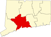
Devon (Milford)

Last updated

Coordinates: 41°12′N73°06′W / 41.20°N 73.10°W / 41.20; -73.10

Geographic coordinate system Coordinate system

A geographic coordinate system is a coordinate system that enables every location on Earth to be specified by a set of numbers, letters or symbols. The coordinates are often chosen such that one of the numbers represents a vertical position and two or three of the numbers represent a horizontal position; alternatively, a geographic position may be expressed in a combined three-dimensional Cartesian vector. A common choice of coordinates is latitude, longitude and elevation. To specify a location on a plane requires a map projection.

Contents

The village of Devon is a neighborhood of the city of Milford, Connecticut, United States. It lies on the southwest corner of the city bordering Long Island Sound and the mouth of the Housatonic River. The village generally corresponds to the Third Voting District of Milford.

Milford, Connecticut City in Connecticut, United States

Milford is a city within Coastal Connecticut and New Haven County, Connecticut, between Bridgeport, Connecticut and New Haven, Connecticut, United States. The population was estimated to be 52,536 in a July 2016 estimate. The city includes the borough of Woodmont. Milford is part of the New York-Newark Bridgeport, NY-NJ-CT-PA Combined Statistical Area.

Connecticut state of the United States of America

Connecticut is the southernmost state in the New England region of the United States. As of the 2010 Census, it has the highest per-capita income, Human Development Index (0.962), and median household income in the United States. It is bordered by Rhode Island to the east, Massachusetts to the north, New York to the west, and Long Island Sound to the south. Its capital is Hartford and its most populous city is Bridgeport. It is part of New England, although portions of it are often grouped with New York and New Jersey as the Tri-state area. The state is named for the Connecticut River which approximately bisects the state. The word "Connecticut" is derived from various anglicized spellings of an Algonquian word for "long tidal river".

United States federal republic in North America

The United States of America (USA), commonly known as the United States or America, is a country composed of 50 states, a federal district, five major self-governing territories, and various possessions. At 3.8 million square miles, the United States is the world's third or fourth largest country by total area and is slightly smaller than the entire continent of Europe's 3.9 million square miles. With a population of over 327 million people, the U.S. is the third most populous country. The capital is Washington, D.C., and the largest city by population is New York City. Forty-eight states and the capital's federal district are contiguous in North America between Canada and Mexico. The State of Alaska is in the northwest corner of North America, bordered by Canada to the east and across the Bering Strait from Russia to the west. The State of Hawaii is an archipelago in the mid-Pacific Ocean. The U.S. territories are scattered about the Pacific Ocean and the Caribbean Sea, stretching across nine official time zones. The extremely diverse geography, climate, and wildlife of the United States make it one of the world's 17 megadiverse countries.

The village features an Audubon Center overlooking the estuary.

National Audubon Society non-profit organisation in the USA

The National Audubon Society (Audubon) is a non-profit environmental organization dedicated to conservation. Located in the United States and incorporated in 1905, Audubon is one of the oldest of such organizations in the world and uses science, education and grassroots advocacy to advance its conservation mission. It is named in honor of John James Audubon, a Franco-American ornithologist and naturalist who painted, cataloged, and described the birds of North America in his famous book Birds of America published in sections between 1827 and 1838.

Estuary A partially enclosed coastal body of brackish water with one or more rivers or streams flowing into it, and with a free connection to the open sea

An estuary is a partially enclosed coastal body of brackish water with one or more rivers or streams flowing into it, and with a free connection to the open sea.

Municipal services

Since it lies within the municipality of Milford, all of its municipal services are provided by the city including police, schools, and other essential municipal services. Court services are provided by the Ansonia-Milford Judicial District.

Geography

Devon lies on the coast with a great amount of coastline, including the local, Walnut Beach, connecting to Connecticut’s Silver Sands State Park. It also has a surprisingly high amount of inland freshwater swamps. The Charles E. Wheeler Wildlife Management Area is located in Devon. Lying 59 miles (95 km) away from Central Park, Devon is the closest point to New York City within New Haven County.

Silver Sands State Park

Silver Sands State Park is a public recreation area located on Long Island Sound in the city of Milford, Connecticut. The state park consists of 297 acres (120 ha) of beach, dunes, restored salt marsh, open areas and woods as well as the 14-acre (5.7 ha) bird sanctuary of Charles Island. The park offers swimming, picnicking, trails, boardwalks, and opportunities for bird-watching. It is managed by the Connecticut Department of Energy and Environmental Protection.

Central Park Public park at the center of Manhattan in New York City, New York, United States

Central Park is an urban park in Manhattan, New York City. It is located between the Upper West Side and Upper East Side, roughly bounded by Fifth Avenue on the east, Central Park West on the west, Central Park South on the south, and Central Park North on the north. Central Park is the most visited urban park in the United States, with 40 million visitors in 2013, and one of the most filmed locations in the world. In terms of area, Central Park is the fifth largest park in New York City, covering 843 acres (341 ha).

New York City Largest city in the United States

The City of New York, usually called either New York City (NYC) or simply New York (NY), is the most populous city in the United States and thus also in the state of New York. With an estimated 2017 population of 8,622,698 distributed over a land area of about 302.6 square miles (784 km2), New York is also the most densely populated major city in the United States. Located at the southern tip of the state of New York, the city is the center of the New York metropolitan area, the largest metropolitan area in the world by urban landmass and one of the world's most populous megacities, with an estimated 20,320,876 people in its 2017 Metropolitan Statistical Area and 23,876,155 residents in its Combined Statistical Area. A global power city, New York City has been described as the cultural, financial, and media capital of the world, and exerts a significant impact upon commerce, entertainment, research, technology, education, politics, tourism, art, fashion, and sports. The city's fast pace has inspired the term New York minute. Home to the headquarters of the United Nations, New York is an important center for international diplomacy.

Flooding

Due to the low elevation of Devon, the high concentration of structures and pavement along Route 1 and Naugatuck Avenue, Devon experiences flooding during heavy rainstorms on a regular and increasing basis. The flooding also occurs as a result of or coincides with raised waters from Beaver Brook, the Housatonic River, or Long Island Sound. [1]

Housatonic River river in the United States of America

The Housatonic River is a river, approximately 149 miles (240 km) long, in western Massachusetts and western Connecticut in the United States. It flows south to southeast, and drains about 1,950 square miles (5,100 km2) of southwestern Connecticut into Long Island Sound. Its watershed is just to the west of the watershed of the lower Connecticut River. Birds and fish who live in and around the river contain significant levels of PCBs and present health risks.

Long Island Sound A tidal estuary on the east coast of the United States

Long Island Sound is a tidal estuary of the Atlantic Ocean, lying between the eastern shores of The Bronx, New York City, southern Westchester County, and Connecticut to the north, and the North Shore of Long Island, to the south. From west to east, the sound stretches 110 miles (177 km) from the East River in New York City, along the North Shore of Long Island, to Block Island Sound. A mix of freshwater from tributaries and saltwater from the ocean, Long Island Sound is 21 miles (34 km) at its widest point and varies in depth from 65 to 230 feet.

Related Research Articles

Gaylordsville, Connecticut human settlement in United States of America

Gaylordsville is a village located in the northwest corner of the Town of New Milford, Litchfield County, Connecticut. The population at the 2010 Census was 1,133.

Mount Frissell mountain in United States of America

Mount Frissell, 2,454 feet (748 m), located on the border of southwest Massachusetts and northwest Connecticut, is a prominent peak of the Taconic Range.

Still River (Housatonic River tributary) river in the United States of America

The Still River is a 25.4-mile-long (40.9 km) tributary to the Housatonic River in Western Connecticut.

The Connecticut Audubon Society Coastal Center at Milford Point is a nature center and bird sanctuary in Milford, Connecticut, established in 1995. Over 300 different species of bird have been observed at this location. The Coastal Center is located on an 8.4-acre (34,000 m2) barrier beach—the Smith-Hubbell Wildlife Refuge & Bird Sanctuary—and is situated next to the 840-acre (3.4 km2) Charles Wheeler Salt Marsh and Wildlife Management Area at the mouth of the Housatonic River. The Coastal Center provides easy access to Long Island Sound and its many habitats: tidal salt marshes, barrier beaches, tide pools and coastal dunes, and utilizes these habitats for environmental education for youth and adults. These various environments and habitats support a variety of bird, plant and animal communities for observation and study. The Coastal Center also contains educational exhibits and live animals.

The Rocky River is very short and small tributary of the Housatonic River in the U.S. state of Connecticut. It flows into the Housatonic River from the west just upstream from New Milford at 41°35′00″N73°26′23″W

Rooster River river in the United States of America

Rooster River is a river in Fairfield County, Connecticut that lies on and serves as the border between Bridgeport and Fairfield. It has flooded on numerous occasions and so has its own flood control project.

The Pomperaug River is a 13.4-mile-long (21.6 km) river in the US state of Connecticut. The two main tributaries to the Pomperaug are the Nonnewaug River and the Weekeepeemee River; their confluence forms the Pomperaug and Woodbury developed here. The river flows through Woodbury and the Town of Southbury, where it empties into the Housatonic River at Lake Zoar. The name of the river is from a local Native American language, likely Paugussset.

Pequonnock River river in the United States of America

The Pequonnock River is a 16.7-mile-long (26.9 km) waterway in eastern Fairfield County, Connecticut. Its watershed is located in five communities, with the majority of it located within Monroe, Trumbull, and Bridgeport. The river has a penchant for flooding, particularly in spring since the removal of a retention dam in Trumbull in the 1950s. There seems to be a sharp difference of opinion among historians as to just what the Indian word Pequonnock signifies. Some insist it meant cleared field or open ground; others are sure it meant broken ground; while a third group is certain it meant place of slaughter or place of destruction.

Housatonic Range Trail

The Housatonic Range Trail is a 6.2-mile (10.0 km) Blue-Blazed hiking trail in the Housatonic Valley Region of Litchfield County in the town of New Milford in the Candlewood Mountain and Gaylordsville Connecticut sections.The north-south axis of the trail parallels the Housatonic River through private land and land trust parcels.The Housatonic Range Trail is maintained largely through the efforts of the Connecticut Forest and Park Association, which provides online Blue Trail maps.

Carting Island is the largest of the four islands owned by Stratford, Connecticut in the Housatonic River between I-95 and the Merritt Parkway. The island is north of the Moses Wheeler Bridge, east of Peacock Island (Connecticut), and southwest of Long Island (Connecticut), and Pope's Flat, it is also south of Fowler Island in Milford and the Igor I. Sikorsky Memorial Bridge. The island is uninhabited except for occasional visits by anglers, bird watchers and duck hunters. All transportation to and from the island is by boat.

Pope's Flat is the second largest of the four islands owned by Stratford, Connecticut in the Housatonic River between I-95 and the Merritt Parkway. The island is north of the Moses Wheeler Bridge, northeast of Carting Island, Long Island (Connecticut) and Peacock Island (Connecticut), and south of Fowler Island in Milford and the Igor I. Sikorsky Memorial Bridge. The island is uninhabited except for occasional visits by anglers, bird watchers and duck hunters.

Peacock Island is the smallest of the four islands owned by Stratford, Connecticut in the Housatonic River between I-95 and the Merritt Parkway. The island is north of the Moses Wheeler Bridge, west of Carting Island, southwest of Long Island (Connecticut), Pope's Flat, and south of Fowler Island in Milford and the Igor I. Sikorsky Memorial Bridge. The island is uninhabited except for occasional visits by anglers, bird watchers and duck hunters.

Long Island is the second smallest of the four islands owned by Stratford, Connecticut in the Housatonic River between I-95 and the Merritt Parkway. The island is north of the Moses Wheeler Bridge, northeast of Carting Island and Peacock Island (Connecticut), west of Pope's Flat and south of Fowler Island in Milford and the Igor I. Sikorsky Memorial Bridge. The island is uninhabited except for occasional visits by anglers, bird watchers and duck hunters.

Fowler Island is the sole island owned by Milford, Connecticut north of I-95 in the Housatonic River. The island is north of the Moses Wheeler Bridge, and south of the Igor I. Sikorsky Memorial Bridge. The island is uninhabited except for occasional visits by anglers, bird watchers and duck hunters; all transportation to the island is by boat.

Duck Island is the one of two islands owned by Milford, Connecticut at the mouth of the Housatonic River. It is approximately 100 feet from the end of Milford Point Road, near the Connecticut Audubon Society Coastal Center at Milford Point. The island is uninhabited and is designated as a Department of Environmental Protection Natural Area Preserve, though people may visit the island outside of bird nesting season. The maximum elevation on the island is ~16 feet (4.9 m). It is only accessible by boat.

Nells Island is the larger of two islands owned by Milford, Connecticut at the mouth of the Housatonic River. It is directly across the river from the American Shakespeare Theatre in Stratford, Connecticut. The island is uninhabited but is designated as a "miscellaneous open space" by the City of Milford. It is about 3 feet (0.91 m) above sea level.

Shepaug River river in the United States of America

The Shepaug River is a 26.0-mile-long (41.8 km) river in Connecticut, in the United States.

The East Aspetuck River is a 9.9-mile-long (15.9 km) river in Litchfield County, Connecticut, in the United States. It begins at Lake Waramaug, in the town of Washington, and flows south through New Preston and Northville, before emptying into the Housatonic River in New Milford.

References