North Haven, Connecticut

Last updated

North Haven, Connecticut
Town of North Haven
St. Johns Episcopal Church, North Haven, CT.jpg
St. John's Episcopal Church, built in 1834
NorthHavenCtTownSeal.png
New Haven County Connecticut Incorporated and Unincorporated areas North Haven Highlighted.svg
North Haven, Connecticut
Coordinates: 41°22′54″N72°51′30″W / 41.38167°N 72.85833°W / 41.38167; -72.85833
CountryFlag of the United States.svg  United States
U.S. state Flag of Connecticut.svg  Connecticut
County New Haven
Region South Central CT
Incorporated1786
Government
  Type Selectman-town meeting
  First SelectmanMichael Freda (R)
  SelectmanWilliam J. Pieper (R)
  SelectmanSally Buemi (D)
Area
  Total21.1 sq mi (54.6 km2)
  Land20.8 sq mi (53.8 km2)
  Water0.3 sq mi (0.8 km2)
Elevation
66 ft (20 m)
Population
 (2020)
  Total24,253
  Density1,100/sq mi (440/km2)
Time zone UTC−5 (Eastern)
  Summer (DST) UTC−4 (Eastern)
ZIP Code
06473
Area code(s) 203/475
FIPS code 09-54870
GNIS feature ID0213479
Major highways US 5.svg Connecticut Highway 15.svg I-91.svg
Website www.town.north-haven.ct.us

North Haven is a town in New Haven County, Connecticut on the outskirts of New Haven, Connecticut. The town is part of the South Central Connecticut Planning Region. As of the 2020 census, it had a population of 24,253. [1]

Contents

North Haven is home of the Quinnipiac University School of Health Sciences, the School of Nursing, School of Law, School of Education, and School of Medicine on Bassett Road. [2] [3] North Haven has easy access to Interstate 91 and the Wilbur Cross Parkway (Route 15). It is near Sleeping Giant State Park and less than 10 miles (16 km) from downtown New Haven and Yale University.

History

John Warner Barber's 1835 engraving, showing St. John's Episcopal Church, the Trumbull House, and the North Haven Congregational Church in the town of Green BarberJohnWarnerNorthHaven.jpg
John Warner Barber's 1835 engraving, showing St. John's Episcopal Church, the Trumbull House, and the North Haven Congregational Church in the town of Green
Former North Haven station, December 2015. There are plans to construct a new station in North Haven, which will be served by the Hartford Line and Amtrak. North Haven station building, December 2015.JPG
Former North Haven station, December 2015. There are plans to construct a new station in North Haven, which will be served by the Hartford Line and Amtrak.
Storage barn Hamden1.jpg
Storage barn

In his will of 1714, the Reverend James Pierpont (1659–1714) of New Haven gave 8 acres (32,000 m2) to his neighbors in the Northeast Parish, as North Haven was called, "provided those neighbors will set their meeting house there and do their training and burying there."

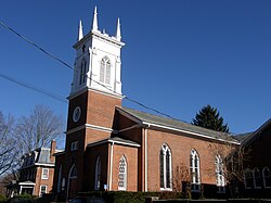
The first meeting house, completed in 1722, stood on the Green, west of what is now known as the Old Center Cemetery. About half of the original Pierpont gift remains today as the North Haven Green.

Ezra Stiles enumerated about forty families living in North Haven in the early part of the eighteenth century. All of these people were multipurpose farmers, producing what they needed for themselves and their families. In 1786, the General Assembly permitted North Haven to incorporate as a town, separate from New Haven. New roads were built to facilitate communication, namely the Hartford Turnpike in 1798 and the Middletown Turnpike in 1813.

The first United States census counted 1,236 people in the agricultural community of North Haven in 1790. However, the 1789 Grand List had found 1,620 sheep in North Haven, with the sheep outnumbering the residents.

By the middle of the nineteenth century, signs of the Industrial Revolution were apparent. In 1838, the New Haven and Hartford Railroad had laid its tracks along the level sand plains by the Quinnipiac River. In addition, small industries such as the manufacture of agricultural implements in Clintonville began in 1830. In the 1850 census, 62% of the population was listed as farmers. One-third of the residents worked in various nonagricultural occupations such as mechanics, brickmakers, and shoemakers.

After the Civil War, the expanding production of bricks, especially by the I.L. Stiles Co., brought immigrants to North Haven from Ireland, Germany, Italy, and Poland. By 1880, 11 out of 100 people had been born outside of the United States.

In the 1880s, Solomon Linsley, a North Haven architect, built the Memorial Town Hall and the new District 4 School. Linsley designed and built 32 Victorian style houses and public buildings in North Haven.

By 1900, public transportation was important to North Haven residents. Eighteen passenger trains stopped at the Broadway station every day. The Airline Railroad ran through Montowese and Clintonville to Middletown. Trolleys ran from Montowese to New Haven. After 1900, the line was extended north to Wallingford.

After World War I, the automobile changed life in this country town. The brickyards along the river were the major industry. However, residents who owned a car could live in North Haven and commute to New Haven for their jobs. Small real estate development began to grow up along the southern edge of town.

Significant population growth occurred at the end of World War II. North Haven's population increased rapidly, quadrupling between 1945 and 1970. The establishment of two factories, Pratt & Whitney and Marlin Firearms, spurred the subsequent population increase. This population shift necessitated the building of a new police station, firehouse, library, and five schools in the 1950s and 1960s to accommodate the needs of the growing community. The town continues to grow and expand until this day.

In spite of its rapid growth throughout the past few decades, however, this New England town still retains its town meeting form of government.

Those interested in an in-depth look at the history of North Haven should refer to Amidst Cultivated and Pleasant Fields: A Bicentennial History of North Haven, Connecticut by Lucy McTeer Brusic. Several copies are available to borrow at the North Haven Memorial Library.

Geography

According to the United States Census Bureau, the town has a total area of 21.1 square miles (54.6 km2), of which 20.8 square miles (53.8 km2) is land and 0.3 square miles (0.8 km2), or 1.52%, is water. North Haven is located less than 10 miles (16 km) from Long Island Sound.

North Haven is 27 miles (43 km) south of Hartford, 76 miles (122 km) northeast of New York City, 80 miles (130 km) west of Providence and 115 miles (185 km) southwest of Boston. The center of town is an area stretching along U.S. Route 5, from approximately its interchange with I-91 in the north to Bailey Road in the south.

North Haven borders the City of New Haven and the towns of East Haven, Hamden, North Branford, and Wallingford.

Principal communities

Demographics

Historical population
CensusPop.Note
1820 1,298
1850 1,325
1860 1,49913.1%
1870 1,77118.1%
1880 1,763−0.5%
1890 1,8625.6%
1900 2,16416.2%
1910 2,2544.2%
1920 1,968−12.7%
1930 3,73089.5%
1940 5,32642.8%
1950 9,44477.3%
1960 15,93568.7%
1970 22,19439.3%
1980 22,080−0.5%
1990 22,2470.8%
2000 23,0353.5%
2010 24,0934.6%
2020 24,2530.7%
U.S. Decennial Census [4]

In the 2010 decennial census, information on North Haven was organized according to the North Haven Census Designated Place (CDP), having an area of 20.8 square miles (54 km2). [5] As of the census of 2010, there were 24,093 people, [6] :Table P1 9,491 households, [6] :Table H1 and 6,632 families residing in the town. [6] :Table P35 The racial makeup of the town was 21,663 (89.9%) White, 725 (3%) Black or African American, 28 (0.1%) Native American, 1,132 (4.7%) Asian, 7 (0%) Pacific Islander, 211 (0.9%) from other races, and 327 (1.4%) from two or more races. Hispanic or Latino of any race were 1,023 (4.2%) of the population. [6] :Table P3,Table P7

Of the 9,491 households in the North Haven CDP, 2,843 (30%) had children under the age of 18 living with them, [6] :Table P205,445 (57.4%) were married couples living together, 853 (9%) had a female householder with no husband present, and 2,503 (26.4%) were non-families. [6] :Table P18 Of all households 2,133 (22.5%) were made up of individuals, [6] :Table P18 and 1,170 (12.3%) had someone living alone who was 65 years of age or older. [6] :Table P25 The average household size was 2.61, [6] :Table P17 and the average family size was 3.09. [6] :Table P37

As of the 2010 census, there were 5,004 (20.8%) people under the age of 18; 1,680 (7%) from 18 to 24; 5,187 (21.5%) from 25 to 44; 7,430 (30.8%) from 45 to 64; and 4,693 (19.5%) who were 65 years of age or older, 5 of these being more than 100 years old. [6] :Table PCT12 The median age was 45.5 years. [6] :Table P13 Among the 24,093 people in the CDP, 11,569 (48%) were male and 12,524 (52%) female. [6] :Table PCT12

The 2019 median income for a household in the town was US$96,598, and the median income for a family was US$119,371; [7] this compares to median values in 2010 of US$83,588 and US$94,916 (US$98,002 and US$111,283, respectively, in 2019 dollars). [8] The per capita income for the town was $47,106 in 2019, [9] as compared to $38,286 in 2010 ($44,888 in 2019 dollars). [10] In 2019, men had a median income of US$63,030 versus US$44,826 for women; [11] this can be compared to 2010 values of US$53,365 and US$33,075, respectively (US$114,901 and US$52,556, respectively, in 2019 dollars). [12] The percent difference between the earnings of men and women narrowed between 2010 and 2019, going from 47% to 34%. [13]

In 2010, about 2.0% of families lived below the poverty line; this had increased to about 3.5% by 2019, as compared to the state rate of about 6.8%. [14] In 2010, about 924 (3.9%) individuals living below the poverty line; this had increased to about 1,183 (5%) in 2019, as compared to the state rate of about 344,146 (9.9%). [15] For 2019, those people living below the poverty line included 281 (6.8%) people below 18 years of age and 239 (4.5%) people 65 years or older. [16]

Political registration

The table below shows both party registration and activity. The increase Increase2.svg decrease Decrease2.svg indicators refer to percentage changes in excess of 1%; where change has been <1%, the no change Steady2.svg indicator was used.

2000 [17] 2010 [18] 2020 [19]
PartyActiveInactiveTotal (%)ActiveInactiveTotal (%)ActiveInactiveTotal (%)
Republican 4,5161554,671 (30.5%)3,802853,887 (24.1%)Decrease2.svg4,6941104,804 (25.6%)Increase2.svg
Democratic 2,8321492,981 (19.5%)3,8361293,965 (24.6%)Increase2.svg4,8131995,012 (26.7%)Increase2.svg
Unaffiliated 7,3632947,657 (50%)7,9223428,264 (51.2%)Increase2.svg8,4062828,688 (46.3%)Decrease2.svg
Minor Parties 10010 (0.1%)19120 (0.1%)Steady2.svg2689277 (1.5%)Increase2.svg
Total14,72159815,319 (100%)15,57955716,136 (100%)18,18160018,781 (100%)

Minor parties represented in all three years 2000, 2010 and 2020 were the Green and Libertarian Parties. [18] [19] [20] The Reform Party was represented in 2000, [20] but was replaced by the Independent Party in 2010 and 2020. [18] [19]

Economy

North Haven has a growing commercial, retailing and manufacturing base which employs approximately 12,640 people. There are more than 75 manufacturing and commercial firms in North Haven, 40 of which are assessed at over $1,000,000. [21] North Haven has five industrial parks containing 490 acres (2.0 km2), and hosts such corporate tenants as Connecticut Container Corp. and O.F. Mossberg & Sons. In 2013, Sustainable Building Systems, an international construction and tech firm, will consolidate its headquarters in North Haven, creating over 400 jobs. North Haven is a division headquarters for surgical device-maker Medtronic. In summer 2019, Amazon began operating an 855,000 square-foot fulfillment center in North Haven, providing over 1,500 jobs. The facility is capable of shipping over 1,000,000 items per day.

The economy of North Haven is also based on education. North Haven is home to several of Quinnipiac University's graduate schools. It is also the home to a branch of Gateway Community College and The University of Connecticut New Haven County Extension Center. North Haven is near Yale University and other New-Haven based schools, making it a popular place to live for university faculty and staff.

Top employers

Top employers in North Haven according to the town's 2022 Comprehensive Annual Financial Report [22]

#Employer# of Employees
1Amazon5,500
2 Medtronic 1,834
3Town of North Haven823
4 Quinnipiac University 437
5ACES - Area Cooperative Educational Services392
6Brescome Barton350
7O.F. Mossberg & Sons Inc.207
8XPO Logistics178
9Cowles Inc175
10HB Communications Inc175

Education

There are four public elementary schools in North Haven:

There is also one public middle school and one public high school:

Gateway Community College used to have a North Haven campus located on Bassett Road. The main campus building was originally part of the North Haven public school system until its sale to the college.

Quinnipiac University operates a 104-acre (0.42 km2) graduate education campus in town. The university purchased the campus from Wellpoint, Inc. in September 2007. The university renovated an existing 180,000-square-foot (17,000 m2) building on the campus, which now serves as home to the Frank H. Netter M.D. School of Medicine at Quinnipiac University, the School of Health Sciences, the School of Nursing, the School of Law, and the School of Education.

The University of Connecticut New Haven County Extension Center is also located in North Haven.

Notable people

The 2017 Hallmark Channel Christmas movie "Romance at Reindeer Lodge" was primarily filmed on location at a North Haven home.

Notable sites

See also

Related Research Articles

<span class="mw-page-title-main">Hartford County, Connecticut</span> County in Connecticut, United States

Hartford County is a county located in the north central part of the U.S. state of Connecticut. According to the 2020 census, the population was 899,498, making it the second-most populous county in Connecticut. Hartford County contains the city of Hartford, the state capital of Connecticut and the county's most populous city, with 121,054 residents at the 2020 census. Hartford County is included in the Hartford-East Hartford-Middletown metropolitan statistical area.

<span class="mw-page-title-main">Litchfield County, Connecticut</span> County in Connecticut, United States

Litchfield County is in northwestern Connecticut, United States. As of the 2020 census, the population was 185,186. The county was named after Lichfield, in England. Litchfield County has the lowest population density of any county in Connecticut and is the state's largest county by area.

<span class="mw-page-title-main">New Haven County, Connecticut</span> County in Connecticut, United States

New Haven County is a county in the south central part of the U.S. state of Connecticut. As of the 2020 census, the population was 864,835, making it the third-most populous county in Connecticut. Two of the state's top 5 largest cities, New Haven (3rd) and Waterbury (5th), are part of New Haven County.

<span class="mw-page-title-main">Ashland, Kansas</span> City in Clark County, Kansas

Ashland is a city in and the county seat of Clark County, Kansas, United States. As of the 2020 census, the population of the city was 783.

<span class="mw-page-title-main">Basehor, Kansas</span> City in Kansas, United States

Basehor is a city in Leavenworth County, Kansas, United States which is included statistically in the Kansas City metropolitan area. As of the 2020 census, the population of the city was 6,896.

<span class="mw-page-title-main">Admire, Kansas</span> City in Lyon County, Kansas

Admire is a city in Lyon County, Kansas, United States. As of the 2020 census, the population of the city was 130.

<span class="mw-page-title-main">Haven, Kansas</span> City in Reno County, Kansas

Haven is a city in Reno County, Kansas, United States. As of the 2020 census, the population of the city was 1,170.

<span class="mw-page-title-main">Assaria, Kansas</span> City in Saline County, Kansas

Assaria is a city in Saline County, Kansas, United States. As of the 2020 census, the population of the city was 428.

<span class="mw-page-title-main">Haddam, Kansas</span> City in Washington County, Kansas

Haddam is a city in Washington County, Kansas, United States. It is named after Haddam, Connecticut. As of the 2020 census, the population of the city was 110.

<span class="mw-page-title-main">Afton, Wyoming</span> Town in Wyoming, United States

Afton is a town in Lincoln County, Wyoming, United States. The population was 2,172 at the 2020 census. Afton is home to the world's largest arch made of elk antlers. Spanning 75 feet (23 m) across the four lanes of U.S. Highway 89, the arch consists of 3,011 elk antlers and weighs 15 tons.

<span class="mw-page-title-main">Kingston, Rhode Island</span> Census-designated place in Rhode Island, United States

Kingston is a village and a census-designated place within the town of South Kingstown in Washington County, Rhode Island, United States, and the site of the main campus of the University of Rhode Island. The population was 6,974 at the 2010 census. Much of the village center is listed on the National Register of Historic Places as Kingston Village Historic District. It was originally known as Little Rest.

<span class="mw-page-title-main">Quonochontaug, Rhode Island</span> Village in Rhode Island, United States

Quonochontaug is a village in Washington County, Rhode Island, United States. It is composed of three small beach communities, and is part of Charlestown.

<span class="mw-page-title-main">Bendena, Kansas</span> Unincorporated community in Doniphan County, Kansas

Bendena is an unincorporated community in Doniphan County, Kansas, United States. As of the 2020 census, the population of the community and nearby areas was 117.

<span class="mw-page-title-main">Greene, Rhode Island</span> Census designated place in Rhode Island, United States

Greene is an unincorporated village and census-designated place in the western part of the town of Coventry, Rhode Island, United States. As of the 2010 census it had a population of 888. It is 2 miles (3 km) east of the Connecticut border and the same distance north of West Greenwich. The name derives from Nathanael Greene, a Rhode Island-born general in the American Revolution.

<span class="mw-page-title-main">Weekapaug, Rhode Island</span> Census-designated place in Rhode Island, United States

Weekapaug is a census-designated place in southern Washington County, Rhode Island, part of the town of Westerly, Rhode Island. The population was 425 at the 2010 census.

<span class="mw-page-title-main">Harmony, Rhode Island</span> Census-designated place in Rhode Island, United States

Harmony is a village and census-designated place in Providence County, Rhode Island, in the town of Glocester, located on U.S. Route 44. As of the 2010 census, it had a population of 985.

<span class="mw-page-title-main">Wyoming, Rhode Island</span> United States historic place

Wyoming is a village and census-designated place on the Wood River in southern Rhode Island, primarily in the town of Richmond, Rhode Island, but extending north across the river into the town of Hopkinton, Rhode Island. The population was 270 at the 2010 census. It is the site of the Wyoming Village Historic District and a post office assigned ZIP code 02898.

<span class="mw-page-title-main">Hallowell, Kansas</span> Unincorporated community in Cherokee County, Kansas

Hallowell is an unincorporated community in Cherokee County, Kansas, United States. As of the 2020 census, the population of the community and nearby areas was 101.

<span class="mw-page-title-main">Odin, Kansas</span> Unincorporated community in Barton County, Kansas

Odin is an unincorporated community in Barton County, Kansas, United States. As of the 2020 census, the population of the community and nearby areas was 87. It is located northwest of Claflin at the intersection of NE 140 Rd and NE 90 Ave.

Hopkinton is a census-designated place (CDP) in Washington County, Rhode Island, United States, comprising the central village in the town of Hopkinton. It was first listed as a CDP prior to the 2020 census. The village is also known as Hopkinton City, and the center of the village comprises the Hopkinton City Historic District.

References

  1. "Census - Geography Profile: North Haven, New Haven County, Connecticut". United States Census Bureau . Retrieved December 18, 2021.
  2. "North Haven Campus". Quinniapiac University. Archived from the original on November 22, 2011. Retrieved December 1, 2011.
  3. "North Haven Campus Map" (PDF) (Annotated map). Quinnipiac University. Retrieved December 12, 2020.
  4. "Census of Population and Housing". Census.gov. Retrieved June 4, 2015.
  5. "North Haven CDP, Connecticut". United States Census Bureau. Retrieved December 13, 2020.
    For boundaries of the CDP used in the 2010 census, see this map, published by the US Census Bureau.
  6. 1 2 3 4 5 6 7 8 9 10 11 12 13 "Decennial Census, DEC Summary File 1 for North Haven CDP, Connecticut" (Consists of a list of information from a variety of different tables.). United States Census Bureau. 2010. Retrieved December 12, 2020.
  7. "Income in the past 12 months (in 2019 inflation-adjusted dollars)" (American Community Survey, 5-year estimates subject tables). United States Census Bureau. 2019. p. Table S1901. Retrieved December 16, 2020.
  8. "Income in the past 12 months (in 2010 inflation-adjusted dollars)" (American Community Survey, 5-year estimates subject tables). United States Census Bureau. 2010. p. Table S1901. Retrieved December 18, 2020.
    Conversion from 2010 to 2019 dollars done using the online site https://www.in2013dollars.com/.
  9. "Per capita income in the past 12 months (in 2019 inflation-adjusted dollars)" (American Community Survey, 5-year estimates detailed tables). United States Census Bureau. 2019. p. Table B19301. Retrieved December 18, 2020.
  10. "Per capita income in the past 12 months (in 2010 inflation-adjusted dollars)" (American Community Survey, 5-year estimates detailed tables). United States Census Bureau. 2010. p. Table B19301. Retrieved December 18, 2020.
    Conversion from 2010 to 2019 dollars done using the online site https://www.in2013dollars.com/.
  11. "Earnings in the past 12 months (in 2019 inflation-adjusted dollars)" (American Community Survey, 5-year estimates subject tables). United States Census Bureau. 2019. p. Table S2001. Retrieved December 16, 2020.
  12. "Earnings in the past 12 months (in 2010 inflation-adjusted dollars)" (American Community Survey, 5-year estimates subject tables). United States Census Bureau. 2010. p. Table S2001. Retrieved December 18, 2020.
    Conversion from 2010 to 2019 dollars done using the online site https://www.in2013dollars.com/.
  13. Calculations of percent difference were done using the Percent Difference Calculator at CalculatorSoup; https://www.calculatorsoup.com/calculators/algebra/percent-difference-calculator.php
  14. "Poverty status in the past 12 months of families" (American Community Survey, 5-year estimates detailed tables). United States Census Bureau. 2010. p. Table S1702. Retrieved December 18, 2020.
    "Poverty status in the past 12 months of families" (American Community Survey, 5-year estimates detailed tables). United States Census Bureau. 2019. p. Table S1702. Retrieved December 18, 2020.
    "Poverty status in the past 12 months of families" (American Community Survey, 5-year estimates detailed tables). United States Census Bureau. 2019. p. Table S1702. Retrieved December 18, 2020.
  15. "Poverty status in the past 12 months by sex by age" (American Community Survey, 5-year estimates detailed tables). United States Census Bureau. 2010. p. Table B17001. Retrieved December 18, 2020.
    "Poverty status in the past 12 months by sex by age" (American Community Survey, 5-year estimates detailed tables). United States Census Bureau. 2019. p. Table B17001. Retrieved December 18, 2020.
    "Poverty status in the past 12 months by sex by age" (American Community Survey, 5-year estimates detailed tables). United States Census Bureau. 2019. p. Table B17001. Retrieved December 18, 2020.
  16. "Poverty status in the past 12 months" (American Community Survey, 5-year estimates subject tables). United States Census Bureau. 2019. p. Table S1701. Retrieved December 18, 2020.
  17. "Enroll by Town" (PDF). Election Information and Statistics. Connecticut Secretary of State. October 24, 2000. Retrieved December 18, 2020.
  18. 1 2 3 "2010 Registration and Enrollment Statistics" (PDF). Election Information and Statistics. Connecticut Secretary of State. October 26, 2010. Retrieved December 18, 2020.
  19. 1 2 3 "2020 Voter Registration Statistics" (PDF). Election Information and Statistics. Connecticut Secretary of State. October 27, 2020. Retrieved December 18, 2020.
  20. 1 2 "Enrollment in Minor Parties" (PDF). Election Information and Statistics. Connecticut Secretary of State. October 24, 2000. Retrieved December 18, 2020.
  21. "Economic Development North Haven Connecticut". Archived from the original on August 13, 2007.
  22. "Comprehensive Annual Financial Report of the Town of North Haven, Connecticut For the Year Ended June 30, 2022" (PDF). Town of North Haven. Retrieved September 3, 2023.