
Brookfield is a town in Fairfield County, Connecticut, United States, situated within the southern foothills of the Berkshire Mountains. The population was 17,528 at the 2020 census. The town is located 55 miles (89 km) northeast of New York City, making it part of the New York-Newark, NY-NJ-CT-PA combined statistical area. The town is part of the Western Connecticut Planning Region. In July 2013, Money magazine ranked Brookfield the 26th-best place to live in the United States, and the best place to live in Connecticut.

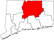
Tolland County is a county in the northeastern part of the U.S. state of Connecticut. As of the 2020 census, its population was 149,788. It is incorporated into 13 towns and was originally formed on October 13, 1785, from portions of eastern Hartford County and western Windham County.

Windham County is one of the eight historical counties in the U.S. state of Connecticut, located in its northeastern corner. As of the 2020 census, the population was 116,418, making it the least populous county in Connecticut. It forms the core of the region known as the Quiet Corner. Windham County is included in the Worcester, MA-CT Metropolitan Statistical Area, which is also included in the Boston-Worcester-Providence, MA-RI-NH-CT Combined Statistical Area. The entire county is within the Quinebaug and Shetucket Rivers Valley National Heritage Corridor, as designated by the National Park Service.
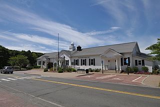
New Fairfield is a town in Fairfield County, Connecticut, United States. The population was 13,579 at the 2020 census. New Fairfield is one of five towns that surround Candlewood Lake, the largest lake in Connecticut. The town is located 55 miles (89 km) northeast of New York City, making it part of the New York metropolitan area. The town is part of the Western Connecticut Planning Region.
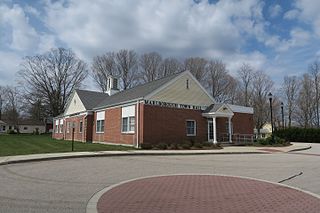
Marlborough is a town in Hartford County, Connecticut, United States. It contains the census-designated place (CDP) of Terramuggus. The town is part of the Capitol Planning Region. The town's population was 6,133 at the 2020 census. Marlborough is a suburban and rural community. The local high school is RHAM High School. In 2013, Marlborough ranked third in Connecticut Magazine's biannual ranking of Connecticut small towns. Educationally, RHAM High School, which serves Marlborough, Hebron, and Andover students, is one of the top-ranked regional high schools in the state on the SAT in 2017, and 11th highest-performing school in the state on the test. The town is home to Elmer Theines-Mary Hall elementary school which serves Pre-K through 6th grade. The school scores above state average on standardized testing and student progress.

Barkhamsted is a town in Litchfield County, Connecticut, United States. It contains seven villages: West Hill, Mallory, Barkhamsted Center, Center Hill, Washington Hill, Pleasant Valley, and Riverton. The population was 3,647 at the 2020 census, down from 3,799 at the 2010 census. The town is part of the Northwest Hills Planning Region. Barkhamsted was first incorporated in 1779, and named after Berkhamsted, Hertfordshire, England.

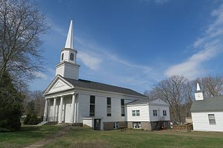
East Haddam is a town in Middlesex County, Connecticut, United States. The town is part of the Lower Connecticut River Valley Planning Region. The population was 8,875 at the time of the 2020 census.

Westbrook is a town in Middlesex County, Connecticut, United States. The town is part of the Lower Connecticut River Valley Planning Region. The population was 6,769 at the 2020 census. The town center is classified by the U.S. Census Bureau as a census-designated place (CDP).
Andover is a rural town in the Capitol Planning Region, Connecticut, United States, roughly 10 miles east of Hartford. The population was 3,151 at the 2020 census.

Bolton is a small rural town in Tolland County, Connecticut, United States. The population was 4,858 as of the 2020 census. Bolton was incorporated in October 1720 and is governed by town meeting, with a first selectman and board of selectman as well as other boards serving specific functions. Bolton was named after a town of the same name in England, also located near Manchester.
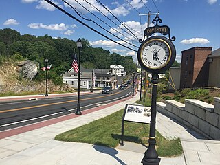
Coventry is a town in Tolland County and in the Capitol Planning Region, Connecticut, United States. The population was 12,235 at the 2020 census. The birthplace of Captain Nathan Hale, Coventry is home to the Nathan Hale Homestead, which is now a museum open to the public.

Ellington is a town in Tolland County, Connecticut, United States. Ellington was incorporated in May 1786, from East Windsor. The town is part of the Capitol Planning Region. As of the 2020 census, the town population was 16,426.

Hebron is a town in Tolland County, Connecticut, United States. The town is part of the Capitol Planning Region. The population was 9,098 at the 2020 census. Hebron was incorporated May 26, 1708. In 2010, Hebron was rated #6 in Top Towns in Connecticut with population between 6,500 and 10,000, according to Connecticut Magazine.
Mansfield is a town in Tolland County, Connecticut, United States. The town is part of the Capitol Planning Region. The population was 25,892 at the 2020 census.

Somers is a town in Tolland County, Connecticut, United States. The town is part of the Capitol Planning Region. The population was 10,255 at the 2020 census. The town center is listed by the U.S. Census Bureau as a census-designated place (CDP). In 2007, Money Magazine listed Somers 53rd on its "100 Best Places to Live", based on "economic opportunity, good schools, safe streets, things to do and a real sense of community."

Tolland is a suburban town in Tolland County, Connecticut, United States. The town is part of the Capitol Planning Region. The population was 14,563 at the 2020 census.

Union is a town located in the northeastern part of Tolland County, Connecticut, United States and is part of the Northeastern Connecticut Planning Region and Last Green Valley National Heritage Corridor. The population was 785 at the 2020 census, making it the least populous town and municipality in Connecticut. Union includes the village of Mashapaug located in the Eastern Uplands at the Massachusetts state line. Union is located 33 miles northeast of the state capital, Hartford and 67 mi (108 km) southwest of Boston, as well as 153 mi (246 km) northeast of New York City.

Willington is a town in Tolland County, Connecticut, United States. The town is part of the Capitol Planning Region. The population was 5,566 at the 2020 census.

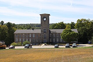
Stafford Springs is a census-designated place located in Stafford, Connecticut, United States. The population was 4,780 at the 2020 Census. The village was a borough until November 1991, when it was disincorporated.

Route 19 is a minor Connecticut state route running from Stafford to the Massachusetts state line. It is 6.99 miles (11.25 km) long and runs north–south, entirely within Stafford. The road interconnects the settlements in the eastern part of the town.


