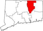
South Coventry (CDP), Connecticut

Last updated

South Coventry, Connecticut
CDP
PostcardCoventryCTKingsburyBoxAndPrintingCo1905.jpg
Kingsbury Box and Printing, 1905
Tolland County Connecticut Incorporated and Unincorporated areas South Coventry Highlighted 2010.svg
Location in Tolland County and the state of Connecticut
Coordinates: 41°46′12″N72°18′18″W / 41.77000°N 72.30500°W / 41.77000; -72.30500
Country United States
State Connecticut
County Tolland
Area
  Total3.2 sq mi (8.3 km2)
  Land3.2 sq mi (8.3 km2)
  Water0.0 sq mi (0.0 km2)
Elevation
525 ft (160 m)
Population
 (2010)
  Total1,483
  Density430.2/sq mi (166.1/km2)
Time zone UTC-5 (Eastern (EST))
  Summer (DST) UTC-4 (EDT)
FIPS code 09-69990
GNIS feature ID1867101

South Coventry is a census-designated place and part of the town of Coventry, Connecticut in Tolland County, Connecticut, United States. The population was 1,483 at the 2010 census.

Contents

Geography

According to the United States Census Bureau, the CDP has a total area of 8.3 km2 (3.2 mi2). 8.3 km2 (3.2 mi2) of it is land and 0.31% is water.

Demographics

As of the census [1] of 2000, there were 1,381 people, 555 households, and 341 families residing in the CDP. The population density was 166.1/km2 (430.2/mi2). There were 576 housing units at an average density of 69.3/km2 (179.4/mi2). The racial makeup of the CDP was 98.26% White, 0.22% African American, 0.58% Native American, 0.14% Asian, 0.36% from other races, and 0.43% from two or more races. Hispanic or Latino of any race were 1.81% of the population.

There were 555 households, out of which 33.9% had children under the age of 18 living with them, 50.3% were married couples living together, 8.1% had a female householder with no husband present, and 38.4% were non-families. 29.7% of all households were made up of individuals, and 13.0% had someone living alone who was 65 years of age or older. The average household size was 2.49 and the average family size was 3.17.

In the CDP, the population was spread out, with 26.8% under the age of 18, 6.4% from 18 to 24, 33.3% from 25 to 44, 22.2% from 45 to 64, and 11.4% who were 65 years of age or older. The median age was 37 years. For every 100 females, there were 99.9 males. For every 100 females age 18 and over, there were 95.6 males.

The median income for a household in the CDP was $44,063, and the median income for a family was $66,853. Males had a median income of $45,000 versus $34,018 for females. The per capita income for the CDP was $26,817. About 5.6% of families and 8.0% of the population were below the poverty line, including 5.5% of those under age 18 and 11.1% of those age 65 or over.

Notable people

Related Research Articles

<span class="mw-page-title-main">North Granby, Connecticut</span> Census-designated place in Connecticut, United States

North Granby is a village and census-designated place (CDP) in Hartford County, Connecticut, United States. It is part of the town of Granby. The population was 1,944 at the 2010 census.

<span class="mw-page-title-main">Oakville, Connecticut</span> Census-designated place in Connecticut, United States

Oakville is a census-designated place (CDP) and neighborhood section of Watertown, in Litchfield County, Connecticut, United States. The population was 9,047 as of the 2010 census. It is the most populous community in Watertown, with more than twice as many people as the center village of Watertown. The ZIP code for Oakville is 06779.

<span class="mw-page-title-main">Deep River, Connecticut</span> Town in Connecticut, United States

Deep River is a town in Middlesex County, Connecticut. The town is part of the Lower Connecticut River Valley Planning Region. The population was 4,415 at the 2020 census. The town center is designated by the U.S. Census Bureau as a census-designated place (CDP). Deep River is part of what the locals call the "Tri-town Area", made up of the towns of Deep River, Chester, and Essex.

<span class="mw-page-title-main">Coventry Lake, Connecticut</span> Census-designated place in Connecticut, United States

Coventry Lake is a village and census-designated place in the town of Coventry, Connecticut in Tolland County, Connecticut, United States. The population was 2,990 at the 2010 census. The CDP includes the residential areas around Wangumbaug Lake.

<span class="mw-page-title-main">Crystal Lake, Connecticut</span> Census-designated place in Connecticut, United States

Crystal Lake is a village, census-designated place, and part of the town of Ellington, in Tolland County, Connecticut, United States. The population was 1,945 at the 2010 census. The CDP includes an eponymous lake.

<span class="mw-page-title-main">Mansfield Center, Connecticut</span> CDP in Connecticut, United States

Mansfield Center is a village within the town of Mansfield in Tolland County, Connecticut, United States. The village is the basis of a census-designated place (CDP) of the same name with a population of 947 at the 2010 census. The CDP includes the original settlement of Mansfield, Mansfield Center or Mansfield Village, as well as the village of Mansfield Hollow. Mansfield Hollow State Park is also located within the boundaries of the CDP.

<span class="mw-page-title-main">Quinebaug, Connecticut</span> Census-designated place in Connecticut, United States

Quinebaug is a village and census-designated place (CDP) in Thompson, a town in Windham County, Connecticut, United States. The population was 1,133 at the 2010 census.

<span class="mw-page-title-main">South Windham, Connecticut</span> Village in Connecticut, United States

South Windham is a village and census-designated place (CDP) in Windham County, Connecticut, United States. It is located within the town of Windham, Connecticut. The population was 1,421 at the 2010 census.

<span class="mw-page-title-main">Mission Bay, Florida</span> Unincorporated place in Florida, United States

Mission Bay was a census-designated place (CDP) located in an unincorporated area west of Boca Raton in Palm Beach County, Florida, United States. The population was 3,066 at the 2000 census.
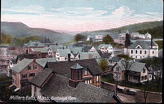
<span class="mw-page-title-main">Millers Falls, Massachusetts</span> Census-designated place in Massachusetts, United States

Millers Falls is a census-designated place (CDP) in the towns of Montague and Erving in Franklin County, Massachusetts, United States. The population was 1,139 at the 2010 census. It is part of the Springfield, Massachusetts metropolitan statistical area.
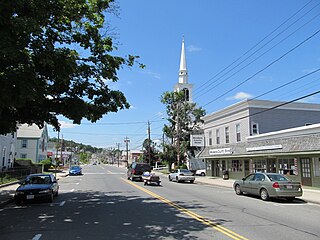
<span class="mw-page-title-main">Monson Center, Massachusetts</span> Census-designated place in Massachusetts, United States

Monson Center is a census-designated place (CDP) in the town of Monson in Hampden County, Massachusetts, United States. The population was 2,107 at the 2010 census, out of a total 8,560 people in the town. It is part of the Springfield, Massachusetts Metropolitan Statistical Area.

<span class="mw-page-title-main">Amherst Center, Massachusetts</span> Census-designated place in Massachusetts, United States

Amherst Center is a census-designated place (CDP) in the town of Amherst in Hampshire County, Massachusetts, United States. The CDP covers the primary village in town. The population was 19,065 at the 2010 census, out of a total town population of 37,819. It is part of the Springfield, Massachusetts Metropolitan Statistical Area.

<span class="mw-page-title-main">Baldwinville, Massachusetts</span> CDP in Massachusetts, United States

Baldwinville is an unincorporated village and census-designated place (CDP) in the town of Templeton in Worcester County, Massachusetts, United States. The population was 2,028 at the 2010 census. The name also refers to the local post office or railroad station.

<span class="mw-page-title-main">Adams (CDP), Massachusetts</span> Census-designated place in Massachusetts, United States

Adams is a census-designated place (CDP) located in the town of Adams in Berkshire County, Massachusetts, United States. The population was 5,515 at the 2010 census, out of 8,485 in the entire town of Adams.

<span class="mw-page-title-main">Granby (CDP), Massachusetts</span> Census-designated place in Massachusetts, United States

Granby is a census-designated place (CDP) comprising the main village in the town of Granby in Hampshire County, Massachusetts, United States. The population of the CDP was 1,368 at the 2010 census, out of a total town population of 6,240. It is part of the Springfield, Massachusetts Metropolitan Statistical Area.

<span class="mw-page-title-main">Hatfield (CDP), Massachusetts</span> Census-designated place in Massachusetts, United States

Hatfield is a census-designated place (CDP) comprising the main village in the town of Hatfield in Hampshire County, Massachusetts, United States. The population of the CDP was 1,318 at the 2010 census, out of a total town population of 3,279. It is part of the Springfield, Massachusetts Metropolitan Statistical Area.

<span class="mw-page-title-main">East Brookfield (CDP), Massachusetts</span> CDP in Massachusetts, United States

East Brookfield is a census-designated place (CDP) in the town of East Brookfield in Worcester County, Massachusetts, United States. The population was 1,323 at the 2010 census.

<span class="mw-page-title-main">Sturbridge (CDP), Massachusetts</span> CDP in Massachusetts, United States

Sturbridge is a census-designated place (CDP) in the town of Sturbridge in Worcester County, Massachusetts, United States. The population was 2,253 at the 2010 census.

<span class="mw-page-title-main">Winchendon (CDP), Massachusetts</span> Census-designated place in Massachusetts, United States

Winchendon is a census-designated place (CDP) in the town of Winchendon in Worcester County, Massachusetts, United States. The population was 4,213 at the 2010 census.

<span class="mw-page-title-main">Brattleboro (CDP), Vermont</span> CDP in Vermont, United States

Brattleboro is a census-designated place (CDP) corresponding to the densely populated core of the town of Brattleboro in Windham County, Vermont, United States. The population was 8,289 at the 2000 census.

References

  1. "U.S. Census website". United States Census Bureau . Retrieved January 31, 2008.
  2. Elisha W. Edgerton, Wisconsin Historical Society

41°46′12″N72°18′18″W / 41.77000°N 72.30500°W / 41.77000; -72.30500