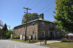
President George Washington, returning from his tour of the country in the fall of 1789, was chagrined to be involuntarily abandoned in the village on a Sunday. It was contrary to law to hire a conveyance on that day, which was observed by villagers, to Washington's great annoyance.[7]
New Ashford in Massachusetts is named after Ashford, as it was settled in 1762 by people from Ashford.
On July 17, 2018, an EF0 tornado—the first tornado to touch down in Windham County since 1992—struck Ashford Lake and the surrounding neighborhoods, downing trees, damaging homes, and killing three household rabbits.[8]
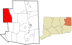
Geography
According to the United States Census Bureau, the town has a total area of 39.5 square miles (102km2), of which 38.8 square miles (100km2) is land and 0.7 square miles (1.8km2) (1.80%) is water. The Mount Hope River flows through the middle of the town, from north to south, while Bigelow Brook flows along the town's eastern border with Eastford. Ashford has several lakes and ponds, notably Ashford Lake, Lake Chaffee, Knowlton Pond, Rychlings Pond, Halls Pond, Pearson Pond[9][10] and Morey Pond. The community of Lake Chaffee surrounds the lake of the same name.
As of 2010 Ashford had a population of 4,317. The racial and ethnic composition of the population was 94.1% white, 1.0% black or African American, 0.4% Native American, 1.3% Asian, 1.1% from some other race, 2.1% from two or more races and 3.5% Hispanic or Latino of any race.[11]
As of the census[12] of 2000, there were 4,098 people, 1,578 households, and 1,084 families residing in the town. The population density was 105.6 inhabitants per square mile (40.8/km2). There were 1,699 housing units at an average density of 43.8 per square mile (16.9/km2). The racial makeup of the town was 95.71% White, 1.00% African American, 0.27% Native American, 1.02% Asian, 0.44% from other races, and 1.56% from two or more races. Hispanic or Latino of any race were 2.00% of the population.
There were 1,578 households, out of which 34.5% had children under the age of 18 living with them, 56.5% were married couples living together, 8.5% had a female householder with no husband present, and 31.3% were non-families. 20.6% of all households were made up of individuals, and 6.0% had someone living alone who was 65 years of age or older. The average household size was 2.59 and the average family size was 3.05.
In the town, the population was spread out, with 25.6% under the age of 18, 8.5% from 18 to 24, 32.0% from 25 to 44, 25.6% from 45 to 64, and 8.3% who were 65 years of age or older. The median age was 36 years. For every 100 females, there were 99.6 males. For every 100 females age 18 and over, there were 98.1 males.
The median income for a household in the town was $55,000, and the median income for a family was $61,693. Males had a median income of $42,117 versus $31,942 for females. The per capita income for the town was $26,104. About 3.4% of families and 5.9% of the population were below the poverty line, including 6.1% of those under age 18 and 8.7% of those age 65 or over.
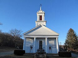
Religion
United Baptist Church in the Warrenville section of Ashford
The town of Ashford is heavily Democratic and has been since the 1930s. Ashford was one of only eight towns in Connecticut that voted for George McGovern over Richard Nixon in the 1972 election. In recent elections, Ashford has become one of the few remaining blue towns in Windham County, which has shifted rightward at the federal level.[14] In 2016, Ashford was one of only three Windham County towns, along with Windham and Pomfret, to back Hillary Clinton over Donald Trump, albeit with a plurality.[15] In 2020, Joe Biden increased the Democratic vote total in the town while the county at large stayed red.[16]
Education
Elementary and middle school-aged residents attend Ashford School, the town's only school, built in 1951 to replace the old Ashford Academy schoolhouse. This school educates students from Pre-K through grade eight. In February 1979, the town's board of education considered closing the school in response to a budget crisis.[17][18]
Paul Newman (1925–2008), award-winning actor, film director and philanthropist. A seasonal resident of Ashford from the opening of the Hole in the Wall Gang Camp in 1988
↑Staff. "Mystery Plot: Whodunit in Newark?", The New York Times, August 26, 1994. Accessed February 6, 2012. "Ms. Wilson Wesley grew up in Ashford, Conn., and now lives in Montclair, N.J., with her husband and two daughters. But she lived in nearby East Orange in the early 1970s, and Tamara's yellow-and-green Cape Cod is modeled on her old house."
This page is based on this Wikipedia article Text is available under the CC BY-SA 4.0 license; additional terms may apply. Images, videos and audio are available under their respective licenses.