Norfolk, Connecticut | |
---|---|
Town of Norfolk | |
Coordinates: 41°59′01″N73°11′47″W / 41.98361°N 73.19639°W | |
Country | United States |
U.S. state | Connecticut |
County | Litchfield |
Region | Northwest Hills |
Incorporated | 1758 |
Government | |
• Type | Selectman-town meeting |
• First selectman | Matthew T. Riiska (D) |
• Selectman | Susan M. Dyer (D) |
• Selectman | Alexandra (Sandy) Evans (R) |
Area | |
• Total | 46.4 sq mi (120.2 km2) |
• Land | 45.3 sq mi (117.4 km2) |
• Water | 1.1 sq mi (2.9 km2) |
Elevation | 1,230 ft (375 m) |
Population (2020) [1] | |
• Total | 1,588 |
• Density | 35/sq mi (13.5/km2) |
Time zone | UTC-5 (Eastern) |
• Summer (DST) | UTC-4 (Eastern) |
ZIP code | 06058 |
Area code(s) | 860/959 |
FIPS code | 09-53470 |
GNIS feature ID | 0213476 |
Website | www |
Norfolk is a town in Litchfield County, Connecticut, United States. The population was 1,588 at the 2020 census. [1] The town is part of the Northwest Hills Planning Region. The urban center of the town is the Norfolk census-designated place, with a population of 553 at the 2010 census. [2]
Norfolk is perhaps best known as the site of the Yale Summer School of Music—Norfolk Chamber Music Festival, which hosts an annual chamber music concert series in "the Music Shed", a performance hall located on the Ellen Battell Stoeckel estate to the west of the village green. Norfolk has important examples of regional architecture, notably the Village Hall (now Infinity Hall, a shingled 1880s Arts-and-Crafts confection, with an opera house upstairs and storefronts at street level); the Norfolk Library (a shingle-style structure, designed by George Keller, c. 1888/1889); and over thirty buildings, in a wide variety of styles, designed by Alfredo S. G. Taylor (of the New York firm Taylor & Levi) in the four decades before the Second World War.
Norfolk incorporated as a town in 1758. Although the town was named after Norfolk in England, the name of the town may be pronounced various ways by residents. [3] [4]
The Norfolk Historic District includes the historic center of the village of Norfolk.
According to the United States Census Bureau, the town has a total area of 46.4 square miles (120.2 km2), of which 45.3 square miles (117.4 km2) are land and 1.1 square miles (2.9 km2), or 2.38%, are water. [5] The town is located in the Litchfield Hills portion of the Appalachian mountain range. Norfolk's elevation is 1,230 feet (370 m) above sea level, and the town is sometimes called "the Icebox of Connecticut" [6] for its severe winters and particularly cool summers.
The town is bordered on the west by Canaan and North Canaan, Connecticut; on the north by New Marlborough and Sandisfield, Massachusetts; on the east by Colebrook and Winchester, Connecticut; and on the south by Goshen, Connecticut.
Norfolk is home to three state parks: Dennis Hill State Park, which includes the remnants of a lavish summer pavilion designed by Alfredo Taylor; Haystack Mountain State Park, with a stone tower at the mountain's summit; and Campbell Falls State Park Reserve, with an approximately 100-foot (30 m) natural waterfall.
According to the Köppen Climate Classification system, Norfolk has a humid continental climate, abbreviated "Dfb" on climate maps. [7] This climatic region is typified by large seasonal temperature differences, with warm to hot (and often humid) summers and cold (sometimes severely cold) winters. On February 16, 1943, the temperature fell to −37 °F (−38 °C), the lowest temperature ever recorded in Connecticut.
Climate data for Norfolk, Connecticut, 1991–2020 normals, extremes 1942–present | |||||||||||||
---|---|---|---|---|---|---|---|---|---|---|---|---|---|
Month | Jan | Feb | Mar | Apr | May | Jun | Jul | Aug | Sep | Oct | Nov | Dec | Year |
Record high °F (°C) | 62 (17) | 70 (21) | 81 (27) | 89 (32) | 89 (32) | 92 (33) | 93 (34) | 98 (37) | 93 (34) | 81 (27) | 75 (24) | 67 (19) | 98 (37) |
Mean maximum °F (°C) | 52.6 (11.4) | 52.0 (11.1) | 61.9 (16.6) | 77.7 (25.4) | 84.0 (28.9) | 86.6 (30.3) | 88.3 (31.3) | 86.6 (30.3) | 82.6 (28.1) | 72.9 (22.7) | 64.7 (18.2) | 55.2 (12.9) | 90.0 (32.2) |
Mean daily maximum °F (°C) | 29.8 (−1.2) | 32.3 (0.2) | 40.4 (4.7) | 54.0 (12.2) | 65.3 (18.5) | 73.4 (23.0) | 78.4 (25.8) | 76.4 (24.7) | 69.0 (20.6) | 56.5 (13.6) | 44.8 (7.1) | 34.6 (1.4) | 54.6 (12.5) |
Daily mean °F (°C) | 21.9 (−5.6) | 23.9 (−4.5) | 31.6 (−0.2) | 44.0 (6.7) | 55.3 (12.9) | 64.0 (17.8) | 69.0 (20.6) | 67.3 (19.6) | 60.0 (15.6) | 48.1 (8.9) | 37.5 (3.1) | 27.9 (−2.3) | 45.9 (7.7) |
Mean daily minimum °F (°C) | 14.1 (−9.9) | 15.4 (−9.2) | 22.8 (−5.1) | 34.0 (1.1) | 45.4 (7.4) | 54.5 (12.5) | 59.5 (15.3) | 58.1 (14.5) | 50.9 (10.5) | 39.7 (4.3) | 30.2 (−1.0) | 21.1 (−6.1) | 37.1 (2.9) |
Mean minimum °F (°C) | −5.7 (−20.9) | −2.0 (−18.9) | 4.7 (−15.2) | 22.0 (−5.6) | 31.6 (−0.2) | 41.5 (5.3) | 49.8 (9.9) | 47.1 (8.4) | 36.8 (2.7) | 26.6 (−3.0) | 15.1 (−9.4) | 4.5 (−15.3) | −8.0 (−22.2) |
Record low °F (°C) | −22 (−30) | −37 (−38) | −11 (−24) | 6 (−14) | 25 (−4) | 32 (0) | 41 (5) | 35 (2) | 26 (−3) | 17 (−8) | 3 (−16) | −23 (−31) | −37 (−38) |
Average precipitation inches (mm) | 3.97 (101) | 3.33 (85) | 4.21 (107) | 3.93 (100) | 4.13 (105) | 4.96 (126) | 4.77 (121) | 4.67 (119) | 4.90 (124) | 5.14 (131) | 4.07 (103) | 4.86 (123) | 52.94 (1,345) |
Average snowfall inches (cm) | 17.8 (45) | 17.5 (44) | 14.9 (38) | 3.9 (9.9) | 0.0 (0.0) | 0.0 (0.0) | 0.0 (0.0) | 0.0 (0.0) | 0.0 (0.0) | 1.4 (3.6) | 4.4 (11) | 15.0 (38) | 74.9 (189.5) |
Average precipitation days (≥ 0.01 in) | 13.1 | 11.6 | 12.4 | 12.7 | 14.1 | 13.0 | 11.8 | 11.4 | 10.4 | 12.2 | 11.4 | 13.8 | 147.9 |
Average snowy days (≥ 0.1 in) | 9.5 | 8.8 | 6.8 | 2.2 | 0.1 | 0.0 | 0.0 | 0.0 | 0.0 | 0.3 | 2.8 | 7.7 | 38.2 |
Source 1: NOAA [8] | |||||||||||||
Source 2: National Weather Service [9] |
Census | Pop. | Note | %± |
---|---|---|---|
1820 | 1,422 | — | |
1850 | 1,643 | — | |
1860 | 1,803 | 9.7% | |
1870 | 1,641 | −9.0% | |
1880 | 1,418 | −13.6% | |
1890 | 1,546 | 9.0% | |
1900 | 1,614 | 4.4% | |
1910 | 1,541 | −4.5% | |
1920 | 1,229 | −20.2% | |
1930 | 1,298 | 5.6% | |
1940 | 1,333 | 2.7% | |
1950 | 1,572 | 17.9% | |
1960 | 1,827 | 16.2% | |
1970 | 2,073 | 13.5% | |
1980 | 2,156 | 4.0% | |
1990 | 2,060 | −4.5% | |
2000 | 1,660 | −19.4% | |
2010 | 1,709 | 3.0% | |
2020 | 1,588 | −7.1% | |
U.S. Decennial Census [10] |
As of the census [11] of 2000, there were 1,660 people, 676 households, and 461 families residing in the town. The population density was 36.6 inhabitants per square mile (14.1/km2). There were 871 housing units at an average density of 19.2 per square mile (7.4/km2). The racial makeup of the town was 97.11% White, 0.48% African American, 0.24% Native American, 0.54% Asian, 0.60% from other races, and 1.02% from two or more races. Hispanic or Latino of any race were 0.96% of the population.
There were 676 households, out of which 28.0% had children under the age of 18 living with them, 58.3% were married couples living together, 6.5% had a female householder with no husband present, and 31.7% were non-families. 24.6% of all households were made up of individuals, and 10.4% had someone living alone who was 65 years of age or older. The average household size was 2.44 and the average family size was 2.92.
In the town, the population was spread out, with 23.7% under the age of 18, 4.3% from 18 to 24, 29.2% from 25 to 44, 29.0% from 45 to 64, and 13.8% who were 65 years of age or older. The median age was 41 years. For every 100 females, there were 96.4 males. For every 100 females age 18 and over, there were 97.0 males.
The median income for a household in the town was $58,906, and the median income for a family was $67,500. Males had a median income of $41,654 versus $36,442 for females. The per capita income for the town was $34,020. About 1.8% of families and 4.1% of the population were below the poverty line, including 4.3% of those under age 18 and 6.2% of those age 65 or over.
Norfolk is a member of Regional School District 7, which also includes, Barkhamsted, Colebrook, and New Hartford. Public school students attend Botelle Elementary School for grades K–6, Northwestern Middle School for grades 7–8, and Northwestern Regional High School for grades 9–12.
The main thoroughfares of the town are U.S. Route 44 (going east–west, also known as Greenwoods Road) and Connecticut Route 272 (going north–south, with 272N also known as North Street and 272S also known as Litchfield Road). US 44 leads west 7 miles (11 km) to North Canaan and southeast 10 miles (16 km) to Winsted, while CT 272 leads south 15 miles (24 km) to Torrington.
Notable residents have included:
Litchfield County is in northwestern Connecticut, United States. As of the 2020 census, the population was 185,186. The county was named after Lichfield, in England. Litchfield County has the lowest population density of any county in Connecticut and is the state's largest county by area.
Barkhamsted is a town in Litchfield County, Connecticut, United States. It contains seven villages: West Hill, Mallory, Barkhamsted Center, Center Hill, Washington Hill, Pleasant Valley, and Riverton. The population was 3,647 at the 2020 census, down from 3,799 at the 2010 census. The town is part of the Northwest Hills Planning Region. Barkhamsted was first incorporated in 1779, and named after Berkhamsted, Hertfordshire, England.
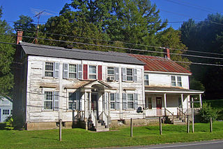
Bethlehem is a town in Litchfield County, Connecticut, United States. The population was 3,385 at the 2020 census, down from 3,607 at the 2010 census. The town is part of the Naugatuck Valley Planning Region. The town center is a historic district and a census-designated place (CDP).
Colebrook is a town in Litchfield County, Connecticut, United States. The population was 1,361 at the 2020 census. The town is part of the Northwest Hills Planning Region. Colebrook was named after Colebrooke in the English county of Devon; the reason is now unknown.
Cornwall is a town in Litchfield County, Connecticut, United States. The population was 1,567 at the 2020 census. The town is part of the Northwest Hills Planning Region.
Goshen is a town in Litchfield County, Connecticut, United States. The population was 3,150 at the 2020 census. The town is part of the Northwest Hills Planning Region.
New Hartford is a town in Litchfield County, Connecticut, United States. The population was 6,658 at the 2020 census. The town is part of the Northwest Hills Planning Region. The town center is defined by the U.S. Census Bureau as the New Hartford Center census-designated place (CDP). The town is mainly a rural community consisting of farms, homes, and parks. Brodie Park and Ski Sundown are located in New Hartford.
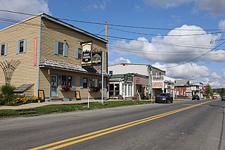
North Canaan is a town in Litchfield County, Connecticut, United States. The population was 3,211 at the 2020 census. The town is part of the Northwest Hills Planning Region. The town center is still called "Canaan", being the main town center of the old town of Canaan prior to North Canaan splitting off as its own town.
Roxbury is a town in Litchfield County, Connecticut, United States. The population was 2,260 at the 2020 census. The town is located 65 miles (105 km) northeast of New York City, and is part of the Northwest Hills Planning Region.
Sharon is a town in Litchfield County, Connecticut, United States, in the northwest corner of the state. At the time of the 2020 census, the town had a total population of 2,680. The town is part of the Northwest Hills Planning Region. The ZIP code for Sharon is 06069. The urban center of the town is the Sharon census-designated place, with a population of 729 at the 2010 census.
Woodbury is a town in Litchfield County, Connecticut, United States. The town is part of the Naugatuck Valley Planning Region. The population was 9,723 at the 2020 census. The town center, comprising the adjacent villages of Woodbury and North Woodbury, is designated by the U.S. Census Bureau as the Woodbury Center census-designated place (CDP). Woodbury was founded in 1673.
Middlebury is a town in New Haven County, Connecticut, United States. The population was 7,574 at the 2020 census. The town is part of the Naugatuck Valley Planning Region.
Canaan is a town in Columbia County, New York, United States. The population was 1,570 at the 2020 census, down from 1,710 at the 2010 census. The town is in the northeastern part of the county.
Davis is a town in Tucker County, West Virginia, United States, situated along the Blackwater River. The population was 595 at the 2020 census.
Wilmington is a town in Windham County, Vermont, United States. The population was 2,255 at the 2020 census.
The Haystack Mountain Tower is a stone observation tower at the summit of 1,680-foot (510 m) Haystack Mountain in Haystack Mountain State Park, Norfolk, Connecticut. Built in 1929, the tower and the land on which it stands were donated by Ellen Battell Stoeckel. The tower provides views of three states and Long Island Sound. It was listed on the National Register of Historic Places in 1993.
Canaan is a town in Litchfield County, Connecticut, United States. The population was 1,080 at the 2020 census, down from 1,234 at the 2010 census. The town is part of the Northwest Hills Planning Region. The town of Canaan is often referred to locally by the name of its principal settlement, Falls Village.
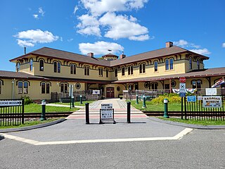
Canaan is a village and census-designated place (CDP) within the town of North Canaan in Litchfield County, Connecticut, United States. Formerly known as Canaan Depot, the village is more commonly known as Canaan Village to distinguish it from the town of Canaan located to the south of North Canaan. The Canaan Village Historic District is listed on the National Register of Historic Places. As of the 2010 census, the CDP had a population of 1,212, out of a total population of 3,315 in the town of North Canaan.
Litchfield is a borough in, and the village center of, the town of Litchfield in Litchfield County, Connecticut, United States. The population was 1,258 at the 2010 census. The entire borough was designated a Connecticut historic district in 1959 by special act of the state General Assembly and is listed on the National Register of Historic Places. Part of the borough is also a National Historic Landmark, the Litchfield Historic District.
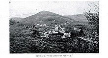
Norfolk is a census-designated place (CDP) in Litchfield County, Connecticut, United States. It is the central village within the town of Norfolk. As of the 2010 census, the population of the CDP was 553, out of 1,709 in the entire town.