Dutchess County is a county in the U.S. state of New York. As of the 2020 census, the population was 295,911. The county seat is the city of Poughkeepsie. The county was created in 1683, one of New York's first twelve counties, and later organized in 1713. The county is part of the Hudson Valley region of the state.

Putnam County is a county located in the U.S. state of New York. As of the 2020 census, the population was 97,668. The county seat is Carmel, located within one of six towns comprising the county. The county is part of the Hudson Valley region of the state.

Lewisboro is a town in Westchester County, New York, United States. The population was 12,265 at the 2020 census. The town is named after John Lewis, an early settler. Lewisboro is a suburb of New York City.

Peach Lake is a hamlet located mostly in the town of Southeast in Putnam County, New York, United States; a portion of the CDP is in the town of North Salem in Westchester County. As of the 2010 census, the population was 1,629.
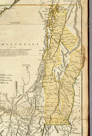
The New Hampshire Grants or Benning Wentworth Grants were land grants made between 1749 and 1764 by the colonial governor of the Province of New Hampshire, Benning Wentworth. The land grants, totaling about 135, were made on land claimed by New Hampshire west of the Connecticut River, territory that was also claimed by the Province of New York. The resulting dispute led to the eventual establishment of the Vermont Republic, which later became the U.S. state of Vermont.

Overpeck Creek is a tributary of the Hackensack River, approximately 8 miles (13 km) long, in Bergen County in northeastern New Jersey in the United States. The lower broad mouth of the creek is part of the extended tidal estuary of the lower Hackensack and of the adjacent wetland region known as the New Jersey Meadowlands.

The Wedge is a 1.068-square-mile tract of land along the borders of Delaware, Maryland and Pennsylvania. Ownership of the land was disputed until 1921; it is now recognized as part of Delaware. The tract was created primarily by the shortcomings of contemporary surveying techniques when the boundaries were defined in the 18th century. It is bounded on the north by an eastern extension of the east–west portion of the Mason–Dixon line, on the west by the north–south portion of the Mason–Dixon line, and on the southeast by the Twelve-Mile Circle around New Castle, Delaware. The crossroads community of Mechanicsville, Delaware, lies within the area today.

Mount Frissell, 2,454 feet (748 m), which straddles the border of southwest Massachusetts and northwest Connecticut, is part of the Taconic Range. Frissell's south slopes include the highest point in Connecticut, a popular destination for highpointers.

The Mianus River is a 20.3-mile-long (32.7 km) river in Westchester County, New York, and Fairfield County, Connecticut, in the United States. It begins in the town of North Castle, New York in a series of ponds at about 600 feet (180 m) altitude. Flowing northeast into the town of Bedford, it abruptly turns south and passes through the Mianus River Gorge, a nature preserve, before entering Stamford, Connecticut, where it is dammed into the Mianus Reservoir, officially known as the Samuel J. Bargh Reservoir of the Greenwich Water Company. From there, it flows south through Stamford and Greenwich into Long Island Sound, at sea level.

Haverstraw Bay, located in New York, is the widest portion of the Hudson River. The width of Haverstraw Bay is approximately 3.4 miles (5.5 km), the length approximately 5 miles (8.0 km) from river kilometer 58 at Croton Point to river kilometer 66 at Stony Point. The bay is bordered by the village of Haverstraw, in Rockland County, to the west and the village of Croton-on-Hudson, in Westchester County, to the east.
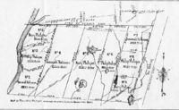
Ridgefield Township was a township that existed in Bergen County, New Jersey. The township was created in 1871, when Hackensack Township was trisected to form Palisades Township in the northernmost third, Englewood Township in the central strip and Ridgefield Township encompassing the southernmost portion, stretching from the Hudson River on the east to the Hackensack River, with Hudson County to the south. Much of the area had been during the colonial area known as the English Neighborhood. As described in the 1882 book, History of Bergen and Passaic counties, New Jersey,
Ridgefield is the first township in Bergen County which the traveler enters in passing up the Palisades. His first impressions are much like those of old Hendrick Hudson in speaking of a wider extent of country: "A very good land to fall in with, and a pleasant land to see." The valley of the Hackensack invited early settlers in the seventeenth century, and the valley of the Overpeck Creek, a navigable arm of the Hackensack, also attracted settlers quite as early in this direction. Sloops and schooners can pass up this creek nearly to the northern boundary of the township. Ridgefield is bounded on the north by Englewood, on the east by the Hudson, on the south by Hudson County, and on the west by the Hackensack River. The southern boundary is less than two miles in extent, and the northern less than four, and the length of the township from north to south does not exceed four miles. Bellman's Creek, forming part of the southern boundary, the Hackensack, the Overpeck, the Hudson, with more than a dozen other smaller streams and rivulets, bountifully supply the whole township with water. From the western border of the Palisades the land descends to the Overpeck, forming a most beautiful valley, with the land again rising to a high ridge midway between the Overpeck and the Hackensack. From this long ridge, extending far to the north beyond this township, it took its name of Ridgefield.
The New York, Susquehanna and Western, formerly the Midland Railroad, the Jersey City and Albany Railroad, and the Northern Railway of New Jersey—all running northward through the township— afford ample railroad accommodations. The Susquehanna enters the township at Bellman's Creek, and the Northern at about one hundred feet south of the creek, and at a point north and east of the Susquehanna. The Albany road in this locality is not yet constructed, diverging at present from the track of the Susquehanna between Little Ferry and Bogota stations. It has, however, an independent line projected and now under construction to New York City.
Early Settlements. Ridgefield embraces the earliest settlements in the ancient township of Hackensack, antedating even the organization of that township in 1693, and of the county of Bergen in 1675. There seems to have been no town or village compactly built, like the village of Bergen, but there were settlements both of Dutch and English in and about what was subsequently known as English Neighborhood prior to 1675. The Westervelts, the Zimcrmans, the Bantas, and the Blauvelts, all coming from Holland, settled in the middle of the seventeenth century in that locality. The ancestors of Jacob P. Westervelt, now of Hackensack Village, with himself, were born in English Neighborhood. His father was born there in 1776, and was the son of Christopher Westervelt, who was born there certainly as early as 1690, and he was the son of the original ancestor of this family, who came from Holland and settled on Overpeck Creek, within the present limits of Ridgefield township, probably about 1670.
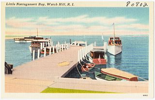
Little Narragansett Bay is an inlet of the Atlantic Ocean and an estuary of the Pawcatuck River on the Rhode Island–Connecticut state line. It is sheltered by the curving peninsula of Napatree Point.

The northern boundary of the U.S. state of Massachusetts adjoins two other states: Vermont and New Hampshire. The majority of the boundary is roughly a straight line from the northwest corner of the state east to a point in Dracut, just north of Lowell. East of that point, the border is a series of line segments about 3 miles (5 km) north of the curving Merrimack River, ending in the Atlantic Ocean.
Border irregularities of the United States, particularly panhandles and highway incursions into other jurisdictions, are shown here. Often they are a result of borders which do not conform to geological features such as changes in the course of a river that previously marked a border.

The Ten Mile River is a 15.4-mile-long (24.8 km) river that flows through Dutchess County, New York, into westernmost Connecticut. The river is formed in the town of Amenia, New York, at the confluence of Webatuck Creek and Wassaic Creek. The Ten Mile River runs south through the town of Dover, New York before turning east and crossing into Connecticut, where it forms the boundary between the towns of Kent and Sherman for one-half mile before flowing into the Housatonic River. This is a popular whitewater paddling destination with mostly quickwater and a few whitewater areas reaching up to Class III.
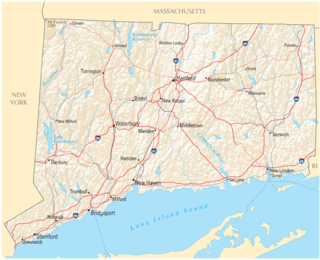
The U.S. state of Connecticut is bordered on the south by Long Island Sound, on the west by New York, on the north by Massachusetts, and on the east by Rhode Island. The state capital and fourth largest city is Hartford, and other major cities and towns include Bridgeport, New Haven, Stamford, Waterbury, Norwalk, Danbury, New Britain, Greenwich, and Bristol. There are 169 incorporated towns in Connecticut, with cities and villages included within some towns.

Wilton Center is a neighborhood/section and census-designated place (CDP) in the town of Wilton in Fairfield County, Connecticut, United States. As of the 2010 census it had a population of 732. The CDP partially overlaps the Wilton Center Historic District.

The Pequonnock River is a 16.7-mile-long (26.9 km) waterway in eastern Fairfield County, Connecticut. Its watershed is located in five communities, with the majority of it located within Monroe, Trumbull, and Bridgeport. The river has a penchant for flooding, particularly in spring since the removal of a retention dam in Trumbull in the 1950s. There seems to be a sharp difference of opinion among historians as to just what the Indian word Pequonnock signifies. Some insist it meant cleared field or open ground; others are sure it meant broken ground; while a third group is certain it meant place of slaughter or place of destruction.
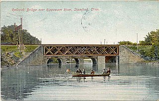
The Rippowam River is a river in Fairfield County, Connecticut and Westchester County, New York. It drains a catchment area of 37.5 square miles (97 km2) and flows for 17 miles (27 km) from Ridgefield to Long Island Sound, which it enters in Stamford's harbor.

During the American colonial era, the colonies of New York and Connecticut often disputed the precise location of their shared border, leading to a border dispute that eventually gave the colonies their modern shapes. Though the dispute was officially resolved in 1731, effects of the boundary conflict persisted until well after both colonies gained statehood as part of the United States following the American Revolution.