Simsbury, Connecticut

Last updated

Simsbury
Town of Simsbury
Farmington Canal Heritage Trail, Simsbury CT.jpg
SimsburyCTseal.gif
Simsbury CT lg.PNG
Capitol Region incorporated and unincorporated areas Simsbury highlighted.svg
Simsbury, Connecticut
Coordinates: 41°52′14″N72°49′31″W / 41.87056°N 72.82528°W / 41.87056; -72.82528
CountryFlag of the United States.svg  United States
U.S. state Connecticut
County Hartford
Region Capitol Region
Settled1642
Named1670
Government
  TypeTown Manager/Board of Selectmen
  Town ManagerMaria Capriola
  SelectmenWendy G. Mackstutis (D), First Selectman
Amber Abbuhl (D), Deputy First Selectman
Sean P. Askham (R)
Eric Wellman (D)
Heather Goetz (R)
Chris Peterson (D)
Area
  Total34.3 sq mi (88.8 km2)
  Land33.9 sq mi (87.9 km2)
  Water0.4 sq mi (1.0 km2)
Elevation
233 ft (71 m)
Population
 (2020)
  Total24,517
  Density720/sq mi (280/km2)
Time zone UTC−5 (Eastern)
  Summer (DST) UTC−4 (Eastern)
ZIP Codes
06070, 06081, 06089, 06092
Area code(s) 860/959
FIPS code 09-68940
GNIS feature ID0213506
Website www.simsbury-ct.gov

Simsbury is a town in Hartford County, Connecticut, United States, incorporated as Connecticut's 21st town in May 1670. [1] The town is part of the Capitol Planning Region. The population was 24,517 in the 2020 census. [2]

Contents

History

Early history

At the beginning of the 17th century, the area that would become known as Simsbury as of 1670 was inhabited by indigenous peoples. The Wappinger were one of these groups, composed of eighteen bands that were organized not formally as a tribe, but more akin to an association, like the Delaware. These bands lived between the Hudson and Connecticut rivers. The Wappingers were one of the Algonquian peoples, a linguistic grouping which includes hundreds of tribes. [3] One of the Wappinger bands, the Massaco, lived near, but mostly west of, what became known as the Farmington River, in the area that would become known as Simsbury and Canton, [4] the latter as of 1806. [5] The river was called the Massaco by the native inhabitants. The term Massaco (pronounced Mas-saco) may refer to the indigenous peoples, the river itself, the village occupied by the indigenous peoples, and the land adjacent to the river. [6]

In 1633, Windsor was the second town in Connecticut settled by Europeans and the first English settlement (the first European settlement being Huys de Goede Hoop, established by the Dutch in the Hartford area as a frontier settlement for the New Netherland Colony ten years earlier). For some time, the area of Massaco was considered "an appendix to the towne of Windsor." [7] Settlers in Windsor forested and farmed in the area, but did not settle in Massaco permanently for a number of years. In 1642, the General Court of the colony of Connecticut ordered that: [8]

the Governor and Mr. Heynes shall have liberty to dispose of the ground uppon that parte of Tunxis River cauled Mossocowe, to such inhabitants of Wyndsor as they shall see cause.

Despite this order, there is no record that any settlements immediately ensued. Five years later the General Court issued another order: [9]

The Court thinks fitt that Massacoe be purchased by the Country, and that ther be a Committee chosen to dispose of yt to such inhabitants of Wyndsor as by the shalbe judged meet to make improuement therof...

but there is no record of land grants arising from this order. [10]

In 1643, John Griffin and Michael Humphrey started a tar and turpentine business in Windsor. A few years later, a Massaco Indian named Manahanoose started a fire which destroyed tar belonging to Griffin. The Court ordered the payment of "five hundred fathom of wampum" as compensation. As he was unable to pay this amount, Manahanoose was instead ordered by the Court to either serve Griffin or be exchanged for Black slaves. To avoid this, he instead delivered a deed to the land at Massacoe. The deed was agreed to by Manahanoose as well as other Indians, identified as "the proprietors of Massaco". [11] In 1653, the General Court granted 50 acres (200,000 m2) of meadowland to Lieutenant Aaron Cook, 60 acres (240,000 m2) to John Bissell and 50 acres (200,000 m2) to Thomas Ford, all in Massacoe. [12]

Settlers did not build permanent settlements until the following decade. Aaron Cook built one of the early homes in the area established c.1660 as Terry's Plain, and John Griffin also built a home, possibly in 1664—the date associated with a deed to land in Massacoe. [13] The settlement of Massacoe continued in the late 1660s. The General Court awarded a land grant of two hundred acres to John Griffin in 1663. A deed description from 1664 indicates he had become a permanent inhabitant. In 1669, a survey found that there were thirteen permanent residents of Massacoe. One of those residents, John Case, was appointed to the position of constable. [14] This is the first recorded civil office held by residents of the area. [11]

Incorporation

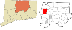
In 1670, John Case, along with Joshua Holcomb & Thomas Barber, presented a petition to the General Court, requesting that Massacoe become a town of the colony of Connecticut. [15] On May 12, 1670, the General Court granted the petition, and ordered that the plantation should be called "Simmsbury". The boundaries at that time were Farmington on the south and Windsor on the east, with the extent of Simsbury running 10 miles (16 km) north of Farmington and 10 miles (16 km) west of Windsor. The northern border, subject to dispute with Massachusetts, was left to be resolved later. [16] This area includes the township Simsbury as well as Granby and Canton, which would later separate from Simsbury in 1786 [17] and 1806, [5] respectively.

The precise origin of the name of the town is not known for certain. The town records covering the first ten years after incorporation were accidentally burned in 1680 and 1681. One possibility is that the name of Simsbury comes from the English town of Symondsbury. [18] Holcomb, one of the petitioners, originally came from Symondsbury. Another possibility is that the name was derived from Simon Wolcott's name. He was known familiarly as "Sim", and he was considered one of the prominent men of the town. [15]

King Philip's War

In 1675, rumors of unrest among the indigenous peoples began to surface. The rumors proved accurate, and King Philip's War, a war between a number of tribes and the New England settlers, began in the summer. The war extended through parts of four colonies, with Simsbury on the western edge of the conflict. At the time, it was seen as a frontier settlement. [19] The conflict was largely over by August 1676, although it did not formally end until a treaty was signed in 1678.

The colony of Connecticut formed a Council of War. In the days leading up to the war, they ordered settlers to keep night watches and to work in the fields in armed groups of at least six. [20] By the time of the colony's General Court meeting of October 14, 1675, the situation was considered serious enough that the court ordered the residents of Simsbury to move to safety in Windsor. The order read:

This Court orders, that the people of Simsbury shall have a week's time to secure themselves and their corn there, and at the end of the week from this date, the souldiers, now in garrison at Simsbury, shall be released their attendance there.

Colony of Connecticut General Court [21]

In March 1676, the town of Simsbury was first pillaged, then burned to the ground. This destruction has been described as the most extensive of any event of any Indian War in New England. [22] The settlers remained in Windsor until the spring of 1677, during which most moved back to Simsbury, though some never returned. [23]

Daniel Hayes

In 1707, Daniel Hayes, then aged twenty-two, was captured by indigenous people and carried to Canada. The capture was witnessed and a rescue party was raised, but the group did not catch up with the captors. Hayes was tied up each night and bound to saplings. It took thirty days to reach Canada, where Hayes was forced to run the gauntlet. Near the end of the gauntlet, he hid in a wigwam to avoid an attempted blow by a club. The woman in the wigwam declared that the house was sacred and, having lost a husband and son to a war, adopted Hayes as her son. He remained for several years, attending to the woman. Eventually, he was sold to a Frenchman, who learned that Hayes had skill as a weaver and put him to work in that business. Hayes managed to earn enough to buy his freedom after two years. He then returned to Simsbury, settled down on a farm and married. He became a prominent figure in civil affairs, as well as the church at Salmon Brook (now Granby). [24]

Patent Safety Fuse factory explosion

Main Street in 1921 PostcardMainStSimsburyCT1921.jpg
Main Street in 1921

On Tuesday, December 20, 1859, the two-story Patent Safety Fuse factory located near the center of town exploded, killing seven women and one man. The blast also injured several other people, including the factory owner. The factory made cord fast-burning fuses used for blasting, which resulted in the explosion. Two days later, on Thursday, December 22, 1859, the New York Times ran a story about the explosion. [25]

Geography

Talcott Mountain ridgeline Penwood State park.jpg
Talcott Mountain ridgeline
The Farmington River in Simsbury TariffvilleGorge2.jpg
The Farmington River in Simsbury

According to the United States Census Bureau, the town has a total area of 34.3 square miles (88.8 km2), of which 33.9 square miles (87.9 km2) is land and 0.39 square miles (1.0 km2), or 1.09%, is water. [26]

Simsbury lies in the northern end of the Farmington Valley. The east side of Simsbury is flanked by Talcott Mountain, which is part of the Metacomet Ridge, a mountainous trap rock ridgeline that stretches from Long Island Sound to near the Vermont border. Notable features of the Metacomet Ridge in Simsbury include Heublein Tower, Talcott Mountain State Park, Penwood State Park, and the Tariffville Gorge of the Farmington River. The 51-mile-long (82 km) Metacomet Trail traverses the ridge. At the western foot of the mountain, the Pinchot Sycamore, the largest tree in Connecticut, grows near the Farmington River. Simsbury also has some patches of old-growth forest; Belden Forest, a 40-acre site with public hiking trails near the center of town was inducted into the Old-Growth Forest Network in October 2019. [27]

The town is often considered a bedroom community for the nearby city of Hartford, Connecticut, which is a 20 to 25 minute drive from Simsbury Center; however, many residents also commute to other towns and cities within the west-central Connecticut region.[ citation needed ]

Principal communities

After the complete destruction of the town in 1676 during King Philip's War, there were three late 17th to early 18th century nucleated resettlement communities: East Weatogue (also called East Simsbury), Simsbury Center, and Terry's Plain.

There are four census-designated places in Simsbury: Simsbury Center, Tariffville, Weatogue, and West Simsbury.

Climate

Climate data for Simsbury, Connecticut
MonthJanFebMarAprMayJunJulAugSepOctNovDecYear
Record high °F (°C)72
(22)
73
(23)
89
(32)
96
(36)
99
(37)
101
(38)
102
(39)
102
(39)
101
(38)
91
(33)
83
(28)
76
(24)
102
(39)
Average high °F (°C)34
(1)
39
(4)
48
(9)
61
(16)
71
(22)
80
(27)
85
(29)
83
(28)
75
(24)
63
(17)
52
(11)
40
(4)
61
(16)
Average low °F (°C)18
(−8)
21
(−6)
28
(−2)
38
(3)
48
(9)
57
(14)
63
(17)
61
(16)
53
(12)
41
(5)
33
(1)
23
(−5)
40
(5)
Record low °F (°C)−26
(−32)
−24
(−31)
−8
(−22)
9
(−13)
28
(−2)
37
(3)
44
(7)
36
(2)
27
(−3)
17
(−8)
1
(−17)
−18
(−28)
−26
(−32)
Average precipitation inches (mm)3.23
(82)
3.00
(76)
3.62
(92)
3.72
(94)
4.35
(110)
4.35
(110)
4.18
(106)
3.93
(100)
3.88
(99)
4.37
(111)
3.89
(99)
3.44
(87)
45.96
(1,166)
Source: [28]

Demographics

Historical population
CensusPop.Note
1820 1,875
1850 2,737
1860 2,410−11.9%
1870 2,051−14.9%
1880 1,830−10.8%
1890 1,8742.4%
1900 2,09411.7%
1910 2,53721.2%
1920 2,95816.6%
1930 3,62522.5%
1940 3,9418.7%
1950 4,82222.4%
1960 10,138110.2%
1970 17,47572.4%
1980 21,16121.1%
1990 22,0234.1%
2000 23,2345.5%
2010 23,5111.2%
2020 24,5174.3%
U.S. Decennial Census [29]
A. E. Lathrop's Drug Store, c. 1905 PostcardSimsburyCTAELathropsDrugStoreCirca1905.jpg
A. E. Lathrop's Drug Store, c.1905

As of the census [30] of 2000, there were 23,234 people, 8,527 households, and 6,591 families residing in the town. The population density was 685.7 inhabitants per square mile (264.8/km2). There were 8,739 housing units at an average density of 257.9 per square mile (99.6/km2). The racial makeup of the town was 95.3% White, 1.17% African American, 0.09% Native American, 2.12% Asian, 0.03% Pacific Islander, 0.26% from other races, and 1.03% from two or more races. Hispanic or Latino people of any race were 1.54% of the population. The five largest percentages of reported ethnicity, expressed as percentage out of total residents, were Irish (23.0%), English (17.4%), German (15.6%), Italian (13.7%), and Polish (7.6%). [31]

There were 8,527 households, out of which 41.1% had children under the age of 18 living with them, 69.1% were married couples living together, 6.4% had a female householder with no husband present, and 22.7% were non-families. 19.4% of all households had someone living alone, and 7.8% had someone living alone who was 65 years of age or older. The average household size was 2.70 and the average family size was 3.12.

29.5% of the population was under the age of 18, 3.6% were from 18 to 24, 27.7% were from 25 to 44, 26.6% were from 45 to 64, and 12.5% were 65 years of age or older. The median age was 40 years old. For every 100 females, there were 94.6 males. For every 100 females age 18 and over, there were 89.3 males.

In 2018, the median household income was $119,588 and the per capita income for the town was $60,453. [32] About 1.0% of families and 2.2% of the population were below the poverty line, including 1.6% of those under age 18 and 4.3% of those age 65 or over.

Economy

Top employers

According to Simsbury's 2022 Comprehensive Annual Financial Report, [33] the top employers in the city are:

#Employer# of employees
1Simsbury Board of Education651
2Wings Media Group500-999
3Everest Global Svc500-999
4 Chubb 250-499
5Keller Williams Realty250-499
6Hoffman Auto Group250-499
7McLean Home Care250-499
8 The Hartford
9 Ensign-Bickford Company
10 Stop & Shop

Landmarks

On the National Register of Historic Places

Drake Hill Road Bridge (1892) Drake Hill Road Bridge.JPG
Drake Hill Road Bridge (1892)
Eno Memorial Hall Eno Memorial Hall.JPG
Eno Memorial Hall
John Humphrey House John Humphrey House.JPG
John Humphrey House

Schools

Public high schools

Private high schools

Public primary/middle schools

Private primary/middle schools

Notable people

Athletes

Sasha Cohen Sasha Cohen 2009 SOI Halifax Spiral.jpg
Sasha Cohen

Media

Politicians

Others

Sister cities

See also

Notes

  1. "Connecticut Towns in Order of Their Establishment". Connecticut Secretary of State. Retrieved February 7, 2023.
  2. "Census - Geography Profile: Simsbury town, Hartford County, Connecticut". United States Census Bureau . Retrieved December 21, 2021.
  3. Trelease 1997, p. 4–9.
  4. "New York Indian Tribes". Access Genealogy.com. Archived from the original on December 3, 2010. Retrieved September 29, 2010.
  5. 1 2 Canton Sesquicentennial, 1806-1956; A Short Illustrated History of Canton. Canton Sesquicentennial Committee. 1956.
  6. "Phelps Family History in America". Phelps Family History. Archived from the original on August 8, 2020. Retrieved January 28, 2023.
  7. Connecticut 1852, p. 97.
  8. Connecticut 1850, p. 71.
  9. Connecticut 1850, p. 161.
  10. Phelps 1845, p. 10.
  11. 1 2 Trumbull 2009, p. 342.
  12. Connecticut 1850, p. 247.
  13. Phelps 1845, p. 12.
  14. Connecticut 1852, p. 118.
  15. 1 2 Trumbull 2009, p. 343.
  16. Connecticut 1852, p. 127.
  17. "Town of Southwick, Massachusetts". Archived from the original on August 5, 2007. Retrieved October 14, 2007.
  18. Fry, CR. "Simsbury, USA, and Symondsbury, Dorset: Holcomb and Wolcott Connections? The Greenwood Tree. Vol.32, No.3, 2007
  19. Phelps 1845, p. 21.
  20. Phelps 1845, p. 20.
  21. Connecticut 1852, p. 269.
  22. Phelps 1845, p. 24.
  23. Phelps 1845, p. 25.
  24. Phelps 1845, p. 37–44.
  25. "The Explosion at Simsbury, Conn.; A SAFETY-FUSE FACTORY BLOWN UP--SEVEN LIVES LOST" . The New York Times. Simsbury. December 22, 1859. Retrieved January 27, 2023.
  26. "Geographic Identifiers: 2010 Demographic Profile Data (G001): Simsbury town, Hartford County, Connecticut". U.S. Census Bureau, American Factfinder. Archived from the original on February 12, 2020. Retrieved November 28, 2012.
  27. "Forest Dedication: Belden Forest - Our First Connecticut Forest!". Old-Growth Forest Network. Retrieved January 17, 2021.
  28. "Monthly Averages for Simsbury, CT (06070)". Weather.com. Retrieved November 22, 2011.
  29. "Census of Population and Housing". Census.gov. Retrieved June 4, 2015.
  30. "U.S. Census website". United States Census Bureau . Retrieved January 31, 2008.
  31. "Simsbury, Connecticut". City-Data. Retrieved May 21, 2013.
  32. "U.S. Census Bureau QuickFacts: Simsbury town, Hartford County, Connecticut". www.census.gov. Retrieved July 8, 2020.
  33. "Town of Simsbury Comprehensive Annual Financial Report For the Fiscal Year Ended June 30, 2022" (PDF). Town of Simsbury. Retrieved August 13, 2023.
  34. "Drake Hill Road Bridge". National Register of Historic Places. Retrieved September 20, 2010.
  35. "John Humphrey House". National Register of Historic Places. Retrieved September 20, 2010.
  36. "Simsbury Townhouse". National Register of Historic Places. Retrieved September 20, 2010.
  37. 1 2 3 Rabinovitz, Jonathan (February 2, 1997). "When Olympic Champions Moved In, They Put Simsbury on the World Map". The New York Times. Simsbury, Connecticut. Retrieved January 4, 2011.
  38. "BARBER, Levi (1777 - 1833)". Biographical Directory of the United States Congress. Retrieved December 21, 2012.
  39. "McLEAN, George Payne (1857 - 1932)". Biographical Directory of the United States Congress. Retrieved December 21, 2012.
  40. Mullgardt, Brian (1999). What's in a Name? Residence Halls at UConn. Storrs, CT: University of Connecticut. p. 37. hdl:11134/20004:20091712.
  41. "PHELPS, Elisha (1779 - 1847)". Biographical Directory of the United States Congress. Retrieved December 21, 2012.
  42. "* Pennsylvania Governor Gifford Pinchot". National Governors Association. Retrieved January 24, 2013.
  43. James, Edward T., et al. Notable American Women, 1607–1950: A Biographical Dictionary, vol. 2, p. 86.
  44. King, Martin Luther Jr. (1998). "Chapter 1: Early Years". In Carson, Clayborne (ed.). The Autobiography of Martin Luther King Jr. New York City: Warner Books. p. 11. ISBN   9780446524124 . Retrieved September 19, 2020 via Stanford University | Martin Luther King, Jr. Research and Education Institute.

Related Research Articles

<span class="mw-page-title-main">Hartford County, Connecticut</span> County in Connecticut, United States

Hartford County is a county located in the north central part of the U.S. state of Connecticut. According to the 2020 census, the population was 899,498, making it the second-most populous county in Connecticut. Hartford County contains the city of Hartford, the state capital of Connecticut and the county's most populous city, with 121,054 residents at the 2020 census. Hartford County is included in the Hartford-East Hartford-Middletown metropolitan statistical area.

<span class="mw-page-title-main">Avon, Connecticut</span> Town in Connecticut, United States

Avon is a town in the Farmington Valley region of the Capitol Planning Region, Connecticut, United States. As of the 2020 census, the town had a population of 18,932.

<span class="mw-page-title-main">Bloomfield, Connecticut</span> Town in Connecticut, United States

Bloomfield is a suburb of Hartford in the Capitol Planning Region, Connecticut, United States. The town's population was 21,535 at the 2020 census. Bloomfield is best known as the headquarters of healthcare services company Cigna.

<span class="mw-page-title-main">Canton, Connecticut</span> Town in Connecticut, United States

Canton is a town, incorporated in 1806, located in the Farmington Valley section of the Capitol Planning Region, Connecticut, United States. The population was 10,124 as of the 2020 census. It is bordered by Granby on the north, Simsbury on the east, Avon and Burlington on the south, New Hartford on the west, and Barkhamsted on the northwest. Running through it is the Farmington River. The town includes the villages of North Canton, Canton Center, Canton, and Collinsville. In September 2007, Collinsville was ranked in Budget Travel magazine as one of the "Ten Coolest Small Towns In America".

<span class="mw-page-title-main">East Granby, Connecticut</span> Town in Connecticut, United States

East Granby is a town in the Capitol Planning Region, Connecticut, United States. The population was 5,214 at the 2020 census.

<span class="mw-page-title-main">Farmington, Connecticut</span> Town in Connecticut, United States

Farmington is a town in Hartford County in the Farmington Valley area of central Connecticut in the United States. The town is part of the Capitol Planning Region. The population was 26,712 at the 2020 census. It sits 10 miles west of Hartford at the hub of major I-84 interchanges, 20 miles south of Bradley International Airport and two hours by car from New York City and Boston. It is home to the world headquarters of several large corporations including Otis Elevator Company, United Technologies, and Carvel. The northwestern section of Farmington is a suburban neighborhood called Unionville.

<span class="mw-page-title-main">Granby, Connecticut</span> Town in Connecticut, United States

Granby is a town in far northern Hartford County, Connecticut, United States. The town is part of the Capitol Planning Region. The population was 10,903 at the 2020 census. The town center is defined as a census-designated place known as Salmon Brook. Other areas in town include North Granby and West Granby. Granby is a rural town, located in the foothills of the Litchfield Hills of the Berkshires, besides the suburban natured center, the outskirts of town are filled with dense woods and rolling hills and mountains. From the 1890s to the 1920s many immigrants from Sweden came to reside in the town.

<span class="mw-page-title-main">Tariffville, Connecticut</span> Census-designated place in Connecticut, United States

Tariffville is a neighborhood and census-designated place (CDP) in the town of Simsbury in Hartford County, Connecticut, United States. The population was 1,324 at the 2010 census. It is a popular location for whitewater paddlers who use the Farmington River.

<span class="mw-page-title-main">Windsor, Connecticut</span> Town in Connecticut, United States

Windsor is a town in Hartford County, Connecticut, United States, and was the first English settlement in the state. It lies on the northern border of Connecticut's capital, Hartford. The town is part of the Capitol Planning Region. The population of Windsor was 29,492 at the 2020 census.

<span class="mw-page-title-main">Eastford, Connecticut</span> Town in Connecticut, United States

Eastford is a town in Windham County, Connecticut, United States. The town is part of the Northeastern Connecticut Planning Region. The population was 1,649 at the 2020 census.

<span class="mw-page-title-main">Farmington River</span> River in the United States of America

The Farmington River is a river, 46.7 miles (75.2 km) in length along its main stem, located in northwest Connecticut with major tributaries extending into southwest Massachusetts. The longest route of the river, from the origin of its West Branch, is 80.4 miles (129.4 km) long, making it the Connecticut River's longest tributary by 2.3 miles (3.7 km) over the major river directly to its north, the Westfield River. The Farmington River's watershed covers 609 square miles (1,580 km2). Historically, the river played an important role in small-scale manufacturing in towns along its course, but it is now mainly used for recreation and drinking water.

<span class="mw-page-title-main">Greater Hartford</span> Metropolitan region in the United States

Greater Hartford is a region located in the U.S. state of Connecticut, centered on the state's capital of Hartford. It represents the only combined statistical area in Connecticut defined by a city within the state, being bordered by the Greater Boston region to the northeast and New York metropolitan area to the south and west. Sitting at the southern end of the Metacomet Ridge, its geology is characterized by land of a level grade along the shores of Connecticut River Valley, with loamy, finer-grained soil than other regions in the state. Greater Hartford, had a total population of 1,213,531 at the 2020 United States census.

The Farmington Valley is located along the western boundary of Hartford County in Connecticut, bordering Litchfield County immediately to the west. It is defined by the Farmington River, which runs through it. Physiographically, the valley is lowlands and floodplain flanked by the Litchfield Hills on the west and Talcott Mountain on the east.

<span class="mw-page-title-main">Connecticut Route 185</span> State highway in Hartford County, Connecticut, US

Route 185 is a Connecticut state highway in the western Hartford suburbs, running from Simsbury to West Hartford.

<span class="mw-page-title-main">Route 189 (Connecticut–Massachusetts)</span> Highway in Connecticut and Massachusetts

Route 189 is a 22.43-mile-long (36.10 km) state route in the U.S. states of Connecticut and Massachusetts. The route begins in the northwestern portion of the Connecticut state capital of Hartford and ends in the rural town of Granville. In Massachusetts, the route is not a state highway and is maintained by the town of Granville.

<span class="mw-page-title-main">Simsbury Center Historic District</span> Historic district in Connecticut, United States

The Simsbury Center Historic District is a 75-acre (30 ha) historic district located in the town center area of Simsbury, Connecticut. It encompasses seven blocks of Hopmeadow Street, as well as the cluster of commercial, civic, and residential buildings along Railroad, Station, and Wilcox Streets, and Phelps Lane. Although its oldest element is the cemetery, most of its buildings were built in the late 19th and early 20th century. It was listed on the National Register of Historic Places in 1996.

<span class="mw-page-title-main">Tunxis Trail</span>

The Tunxis Trail is a 79-mile (127 km) Blue-Blazed hiking trail "system" that traverses the western ridge of the central Connecticut Valley. The mainline trail is not completely contiguous, notably there are two gaps of several miles.

<span class="mw-page-title-main">Massaco</span>

Massaco was a native settlement near the present-day towns of Simsbury and Canton along the banks of the Farmington River. The small, local Algonquian-speaking Indians who lived there in the 17th and early 18th centuries belonged to the Tunxis, a Wappinger people.

<span class="mw-page-title-main">Terry's Plain Historic District</span> Historic district in Connecticut, United States

The Terry's Plain Historic District is a 325-acre (132 ha) historic district in the town of Simsbury, Connecticut that was listed on the National Register of Historic Places in 1993. The district is significant as a preserved rural landscape. It included 27 contributing buildings of various architectural styles, including Greek Revival, Federal and Late Victorian architecture, and 17 non-contributing buildings.

References