Salmon Brook, Connecticut

Last updated

Salmon Brook, Connecticut
Salmon Brook Historical Society, Granby CT.jpg
Salmon Brook Historical Society
USA Connecticut location map.svg
Red pog.svg
Salmon Brook
Usa edcp location map.svg
Red pog.svg
Salmon Brook
Coordinates: 41°57′13″N72°47′21″W / 41.95361°N 72.78917°W / 41.95361; -72.78917
CountryUnited States
State Connecticut
County Hartford
Town Granby
Area
  Total3.0 sq mi (7.8 km2)
  Land3.0 sq mi (7.8 km2)
  Water0 sq mi (0 km2)
Elevation
215 ft (66 m)
Population
 (2010)
  Total2,324
  Density770/sq mi (300/km2)
Time zone UTC-5 (Eastern)
  Summer (DST) UTC-4 (Eastern)
ZIP code
06035
Area code 860
FIPS code 09-66455
GNIS feature ID2377858

Salmon Brook is the name of a census-designated place (CDP) corresponding to the village of Granby, [1] the primary settlement of the town of Granby, Connecticut, in Hartford County. The population of the CDP was 2,324 as of the 2010 census. [2]

Contents

Geography

Salmon Brook is a stream that flows to the east of Granby village, leading south to the Farmington River. The West Branch of Salmon Brook flows to the south of the village, which is located primarily on a flat terrace 50 feet (15 m) above the level of the brook valleys. According to the United States Census Bureau, the CDP has a total area of 3.0 square miles (7.8 km2), all of which is land. [2]

The village is located at the intersection of several major roads. U.S. Route 202 and Connecticut Route 10 pass north–south through the village, leading north to Westfield, Massachusetts, and south to Simsbury. Connecticut Route 20 passes east–west through the village, leading east to Bradley International Airport and Windsor Locks and west towards Winsted. Connecticut Route 189 leads northwest from Granby/Salmon Brook to Granville, Massachusetts, and southeast via Tariffville and Bloomfield to Hartford. All of the highways converge at the Granby Green in the center of the village.

Demographics

As of the census [3] of 2000, there were 2,453 people, 988 households, and 672 families residing in the CDP. The population density was 826.8 inhabitants per square mile (319.2/km2). There were 1,018 housing units at an average density of 343.1 per square mile (132.5/km2). The racial makeup of the CDP was 98.08% White, 0.24% African American, 0.16% Native American, 0.49% Asian, 0.04% Pacific Islander, 0.33% from other races, and 0.65% from two or more races. Hispanic or Latino of any race were 1.14% of the population.

There were 988 households, out of which 32.2% had children under the age of 18 living with them, 58.2% were married couples living together, 7.7% had a female householder with no husband present, and 31.9% were non-families. 26.9% of all households were made up of individuals, and 13.3% had someone living alone who was 65 years of age or older. The average household size was 2.39 and the average family size was 2.92.

In the CDP, the population was spread out, with 23.7% under the age of 18, 3.3% from 18 to 24, 29.9% from 25 to 44, 24.3% from 45 to 64, and 18.8% who were 65 years of age or older. The median age was 41 years. For every 100 females, there were 87.8 males. For every 100 females age 18 and over, there were 83.5 males.

The median income for a household in the CDP was $67,500, and the median income for a family was $80,945. Males had a median income of $57,424 versus $40,307 for females. The per capita income for the CDP was $32,311. About 3.1% of families and 6.0% of the population were below the poverty line, including 10.0% of those under age 18 and 7.3% of those age 65 or over.

Related Research Articles

<span class="mw-page-title-main">Blue Hills, Connecticut</span> Place in Connecticut, United States

Blue Hills is a community in Hartford County, Connecticut, encompassing the northwest corner of the city of Hartford and the southeast corner of the town of Bloomfield. The Bloomfield portion is listed by the U.S. Census Bureau as a census-designated place (CDP), with a population of 2,762 at the 2020 census.

<span class="mw-page-title-main">Broad Brook, Connecticut</span> Census-designated place in Connecticut, United States

Broad Brook is a neighborhood and census-designated place (CDP) in the town of East Windsor, Hartford County, Connecticut, United States. As of the 2010 census, the CDP population was 4,069.

<span class="mw-page-title-main">Granby, Connecticut</span> Town in Connecticut, United States

Granby is a town in northern Hartford County, Connecticut, United States. The town is part of the Capitol Planning Region. The population was 10,903 at the 2020 census. The town center is defined as a census-designated place known as Salmon Brook. Other areas in town include North Granby and West Granby. Granby is a rural town, located in the foothills of the Litchfield Hills of the Berkshires, besides the suburban natured center, the outskirts of town are filled with dense woods and rolling hills and mountains. From the 1890s to the 1920s many immigrants from Sweden came to reside in the town.

<span class="mw-page-title-main">Kensington, Connecticut</span> Census-designated place in Connecticut, United States

Kensington is a census-designated place (CDP) and section of the town of Berlin in Hartford County, Connecticut, United States. The Berlin town offices are located in Kensington. The population was 8,459 at the 2010 census.

<span class="mw-page-title-main">North Granby, Connecticut</span> Census-designated place in Connecticut, United States

North Granby is a village and census-designated place (CDP) in Hartford County, Connecticut, United States. It is part of the town of Granby. The population was 1,944 at the 2010 census.

<span class="mw-page-title-main">Sherwood Manor, Connecticut</span> Census-designated place in Connecticut, United States

Sherwood Manor is a census-designated place (CDP) within the town of Enfield in Hartford County, Connecticut, United States. The population was 5,410 at the 2010 census.

<span class="mw-page-title-main">Tariffville, Connecticut</span> Census-designated place in Connecticut, United States

Tariffville is a neighborhood and census-designated place (CDP) in the town of Simsbury in Hartford County, Connecticut, United States. The population was 1,324 at the 2010 census. It is a popular location for whitewater paddlers who use the Farmington River.

<span class="mw-page-title-main">Terramuggus, Connecticut</span> Census-designated place in Connecticut, United States

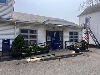
Terramuggus is a census-designated place (CDP) in the town of Marlborough, Hartford County, Connecticut, United States. It contains the town center village and surrounding areas. The population was 1,025 at the 2010 census.

<span class="mw-page-title-main">Thompsonville, Connecticut</span> Census-designated place in Connecticut, United States

Thompsonville is a census-designated place (CDP) in the town of Enfield in Hartford County, Connecticut, United States. The population of the CDP was 8,577 at the 2010 census.

<span class="mw-page-title-main">Weatogue, Connecticut</span> Census-designated place in Connecticut, United States

Weatogue is a village and census-designated place in Simsbury, Hartford County, Connecticut. The population was 2,776 at the 2010 census.

<span class="mw-page-title-main">Northwest Harwinton, Connecticut</span> Census-designated place in Connecticut, United States

Northwest Harwinton is a census-designated place (CDP) in the town of Harwinton in Litchfield County, Connecticut, United States. The population was 3,158 at the 2020 census, out of 5,484 in the entire town. The CDP contains the town center.

<span class="mw-page-title-main">Oakville, Connecticut</span> Census-designated place in Connecticut, United States

Oakville is a census-designated place (CDP) and neighborhood section of Watertown, in Litchfield County, Connecticut, United States. The population was 9,047 as of the 2010 census. It is the most populous community in Watertown, with more than twice as many people as the center village of Watertown. The ZIP code for Oakville is 06779.

<span class="mw-page-title-main">Simsbury Center, Connecticut</span> Census-designated place in Connecticut, United States

Simsbury Center is a census-designated place (CDP) that consists of the central settlement, and the neighborhoods immediately surrounding it, in the town of Simsbury, Connecticut, in the United States. As of the 2010 census, the CDP had a population of 5,836. The core area of the CDP is listed as the Simsbury Center Historic District on the National Register of Historic Places.

<span class="mw-page-title-main">Wilder, Vermont</span> Census-designated place in Vermont, United States

Wilder is an unincorporated village and census-designated place (CDP) within the town of Hartford in Windsor County, Vermont, United States. It is the location of the Wilder Dam on the Connecticut River. The population of the CDP was 1,690 at the 2010 census. The village center is an early example of a planned mill community, and was listed on the National Register of Historic Places as the Wilder Village Historic District in 1999.

<span class="mw-page-title-main">Granby (CDP), Massachusetts</span> Census-designated place in Massachusetts, United States

Granby is a census-designated place (CDP) comprising the main village in the town of Granby in Hampshire County, Massachusetts, United States. The population of the CDP was 1,368 at the 2010 census, out of a total town population of 6,240. It is part of the Springfield, Massachusetts Metropolitan Statistical Area.

<span class="mw-page-title-main">Bethlehem Village, Connecticut</span> Census-designated place in Connecticut, United States

Bethlehem Village is a census-designated place (CDP) within the town of Bethlehem in Litchfield County, Connecticut, United States. The CDP includes the Bethlehem Green Historic District at the town center, as well as surrounding residential and rural land. As of the 2010 census, the CDP had a population of 2,021, out of a population of 3,607 for the entire town of Bethlehem.

<span class="mw-page-title-main">Suffield Depot, Connecticut</span> Census-designated place in Connecticut, United States

Suffield Depot is the name of a census-designated place (CDP) corresponding to the village of Suffield, the primary settlement of the town of Suffield, Connecticut, in Hartford County. The population of the CDP was 1,325 as of the 2010 census.

<span class="mw-page-title-main">Canton Valley, Connecticut</span> Census-designated place in Connecticut, United States

Canton Valley is a village and census-designated place (CDP) in the town of Canton in Hartford County, Connecticut, United States. The population was 1,580 at the 2010 census. As of the 2017 census the population was 1,489.

<span class="mw-page-title-main">Glastonbury Center, Connecticut</span> Census-designated place in Connecticut, United States

Glastonbury Center is a census-designated place (CDP) that constitutes the densely populated center of the town of Glastonbury in Hartford County, Connecticut, United States. The population was 7,387 at the 2010 census, out of a total town population of 34,427.

<span class="mw-page-title-main">New Hartford Center, Connecticut</span> Census-designated place in Connecticut, United States

New Hartford Center is a census-designated place (CDP) in Litchfield County, Connecticut, United States. It comprises the village of New Hartford, the adjacent Pine Meadow Historic District, and some surrounding forest land, all within the town of New Hartford. As of the 2010 census, the population of New Hartford Center was 1,385, out of 6,970 in the entire town of New Hartford.

References

  1. U.S. Geological Survey Geographic Names Information System: Granby, Connecticut
  2. 1 2 "Geographic Identifiers: 2010 Demographic Profile Data (G001): Salmon Brook CDP, Connecticut". U.S. Census Bureau, American Factfinder. Archived from the original on February 12, 2020. Retrieved November 29, 2012.
  3. "U.S. Census website". United States Census Bureau . Retrieved January 31, 2008.