
Bolton Field is a public airport in Columbus, Franklin County, Ohio, United States. It is a towered airport operated under the Columbus Regional Airport Authority. It is one of 12 general aviation reliever airports in Ohio recognized in the National Plan of Integrated Airport Systems (NPIAS) and is a reliever airport for John Glenn Columbus International Airport.

Dayton–Wright Brothers Airport is a public airport located 10 miles (16 km) south of the central business district of Dayton, Ohio, located mainly in Miami Township, Montgomery County and partly in Clearcreek Township, Warren County, near the suburb of Springboro. It is owned and operated by the City of Dayton and serves as the reliever airport for Dayton International Airport. It mainly serves corporate and personal aircraft users. The airport's identifying code, MGY, is a reference to its former name of Montgomery County Airport.

Cuyahoga County Airport, also known as Robert D. Shea Field, is a public use airport in northeastern Cuyahoga County, Ohio, United States. Owned and operated by Cuyahoga County since 1946, it also serves Lake County and Geauga County. The airport is located 10 nautical miles east of downtown Cleveland and sits on the border of three cities: Highland Heights, Richmond Heights and Willoughby Hills. It is included in the National Plan of Integrated Airport Systems for 2011–2015, which categorized it as a general aviation reliever airport for Cleveland Hopkins International Airport.

Camarillo Airport is a public airport located three miles (5 km) west of the central business district of Camarillo, a city in Ventura County, California, United States. The airport has one runway and serves privately operated general aviation and executive aircraft with no scheduled commercial service. A separate, uncontrolled runway in the southwest quadrant of the airport is for exclusive use of light-sport aircraft and ultralights, and is not connected to the larger airport. The airport is the site for an annual air show "Wings Over Camarillo", organized by the Southern California Wing of the Commemorative Air Force.

Jackson County Airport, also known as Reynolds Field, is a county-owned, public-use airport located two nautical miles (3.7 km) west of the central business district of Jackson, in Jackson County, Michigan, United States. It is a class D airport with operating control tower. It is included in the Federal Aviation Administration (FAA) National Plan of Integrated Airport Systems for 2017–2021, in which it is categorized as a regional general aviation facility.
Gladwin Zettel Memorial Airport is a public use airport located one nautical mile (2 km) southeast of the central business district of Gladwin, a city in Gladwin County, Michigan, United States. The airport is owned by the city and county. It is included in the Federal Aviation Administration (FAA) National Plan of Integrated Airport Systems for 2017–2021, in which it is categorized as a local general aviation facility.
Portage County Airport, also known as Portage County Regional Airport, is a public use airport in Portage County, Ohio, United States. It is owned by the Portage County Board of Commissioners and located three nautical miles (6 km) north of Ravenna, in Shalersville Township. This airport is included in the National Plan of Integrated Airport Systems for 2011–2015, which categorized it as a general aviation facility.
Eagles Nest Airport is a privately owned public-use airport serving general aviation aircraft. It was upgraded in April 1989, but had been in operation since the 1960s. It is located two nautical miles north of the community of West Creek, in Eagleswood Township, New Jersey.
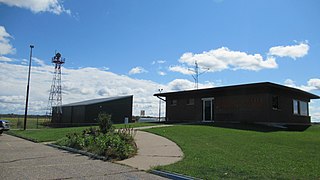
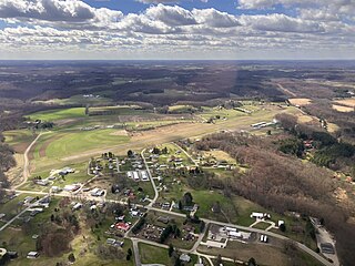
Newark–Heath Airport is a public airport located in Heath, Ohio. It is three miles (4.8 km) southwest of the central business district of Newark, a city in Licking County, Ohio, United States. The airport was opened in 1930 by the city of Newark, and was transferred to the Licking County Regional Airport Authority in 1967. The airport currently has a McDonnell Douglas F-4C Phantom II S.N. 64–0683 on static display.

Union County Airport is a public use airport in Union County, Ohio, United States. It is owned by the Union County Airport Authority and located one nautical mile (2 km) southeast of the central business district of Marysville, Ohio. This airport is included in the National Plan of Integrated Airport Systems for 2011–2015, which categorized it as a general aviation facility.
Dowagiac Municipal Airport is a public airport owned and operated by the City of Dowagiac located 1m (1.6 km) northwest of Dowagiac, Michigan, United States. The uncontrolled airport is used for general aviation purposes. It is included in the Federal Aviation Administration (FAA) National Plan of Integrated Airport Systems for 2017–2021, in which it is categorized as a local general aviation facility.
Fostoria Metropolitan Airport is a city-owned public airport two miles northeast of Fostoria, Ohio, United States. The FAA's National Plan of Integrated Airport Systems for 2009-2013 classified it as a general aviation airport.

Joliet Regional Airport is a public use airport located four nautical miles (7 km) west of the central business district of Joliet, a city in Will County, Illinois, United States. It is owned by the Joliet Park District.

Wood County Airport is a county-owned, public-use airport located one nautical mile (1.85 km) northeast of the central business district of Bowling Green, in Wood County, Ohio, United States on the campus of Bowling Green State University. It is owned by the Wood County Airport Authority and is also known as Wood County Regional Airport (WCRA). As per the FAA's National Plan of Integrated Airport Systems for 2009–2013, it is classified as a general aviation airport.
Carroll County–Tolson Airport is a county–owned, public-use airport located one nautical mile (1.85 km) southeast of the central business district of Carrollton, a village in Carroll County, Ohio, United States. It is owned by the Carroll County Airport Authority. According to the FAA's National Plan of Integrated Airport Systems for 2009–2013, it is categorized as a general aviation airport.
Hastings Airport is a public use airport located three nautical miles (6 km) west of the central business district of Hastings, a city in Barry County, Michigan, United States. It is owned by the city and county and is also known as Hastings City/Barry County Airport.
Dalton Airport is a privately owned, public use airport located two nautical miles (4 km) east of the central business district of Flushing, in Genesee County, Michigan, United States. It is named after its founder, Edwin P. Dalton, who opened it in 1946 on the former site of the Marsa farm.

On October 2, 2019, a Boeing B-17 Flying Fortress privately owned by the Collings Foundation crashed at Bradley International Airport, Windsor Locks, Connecticut, United States. Seven of the thirteen people on board were killed, and the other six, as well as one person on the ground, were injured. The aircraft was destroyed by fire, with only a portion of one wing and the tail remaining.
The Whiteside County Airport, also known as Joseph H. Bittorf Field, is a public-use airport serving Rock Falls, Illinois, United States, as well as the Sauk Valley and Dixon area.
Cottonwood Airport is a public use airport located two-mile (3.2 km) northwest of Rockford, Illinois. The airport is privately owned. The airport is one of multiple airports in Rockford; the city's main airport, located six miles (9.7 km) south of Cottonwood, is the Chicago/Rockford International Airport.

