
Nome Airport is a state-owned public-use airport located two nautical miles (4 km) west of the central business district of Nome, a city in the Nome Census Area of the U.S. state of Alaska.

Merrill Field is a public-use general aviation airport located one mile (1.6 km) east of downtown Anchorage in the U.S. state of Alaska. The airport is owned by Municipality of Anchorage. It opened in 1930 as Anchorage Aviation Field and was renamed in honor of Alaska aviation pioneer Russel Merrill.

Grayling Army Airfield is a public/military use airport located one nautical mile (1.85 km) northwest of the central business district of Grayling, in Crawford County, Michigan, United States. It is owned by United States Army. The airfield is located 7 miles (11 km) northeast of the main cantonment area of Camp Grayling. It is included in the Federal Aviation Administration (FAA) National Plan of Integrated Airport Systems for 2017–2021, in which it is categorized as a general aviation facility.

Meriden Markham Municipal Airport is a public-use airport located three miles (5 km) southwest of the central business district of Meriden, a city in New Haven County, Connecticut, United States. This general aviation airport is owned by City of Meriden. It is included in the Federal Aviation Administration (FAA) National Plan of Integrated Airport Systems for 2017–2021, in which it is categorized as a local general aviation facility.

Allen Army Airfield is a public and military use airport serving Fort Greely and located three miles (5 km) south of the central business district of Delta Junction, a city in the Southeast Fairbanks Census Area of the U.S. state of Alaska. It is owned by the United States Army, which has an agreement with the City of Delta Junction for joint use of the airfield by both military and civilian aircraft.

Roanoke Municipal Airport is two miles south of Roanoke, in Randolph County, Alabama. The FAA's National Plan of Integrated Airport Systems for 2009–2013 categorized it as a general aviation facility.
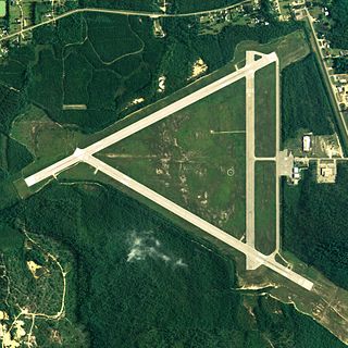
Brewton Municipal Airport is a city-owned public-use airport located 3 nautical miles (6 km) south of the central business district of Brewton, a city in Escambia County, Alabama, United States. Originally constructed by the U.S. Navy during World War II as an auxiliary field to the Naval Air Station Pensacola complex, it was later redesignated as Navy Outlying Landing Field (NOLF) Brewton before being conveyed to the city of Brewton as a public use facility. Although under civilian ownership, the airfield still functions concurrently as NOLF Brewton and is used by Navy training aircraft located at Naval Air Station Whiting Field, Florida.

Lanett Municipal Airport is a city-owned public-use airport located three nautical miles southwest of the central business district of Lanett, a city in Chambers County, Alabama, United States. According to the FAA's National Plan of Integrated Airport Systems for 2009–2013, it is categorized as a general aviation facility.
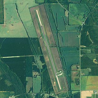
Vaiden Field Airport is a public-use airport located eight nautical miles southwest of the central business district of Marion, in the community of Vaiden, Perry County, Alabama, United States. It is owned by the Perry County Airport and Industrial Authority.
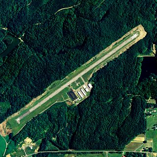
Robbins Field is a public use airport located five nautical miles northeast of the central business district of Oneonta, a city in Blount County, Alabama, United States. It is owned by the City of Oneonta and Blount County. According to the FAA's National Plan of Integrated Airport Systems for 2009–2013, it is categorized as a general aviation facility.

Cordova Municipal Airport is a state-owned public-use airport located one nautical mile (1.8 km) east of the central business district of Cordova, a city in the Valdez-Cordova Census Area of the U.S. state of Alaska. It is located on Eyak Lake on which it also has a landing area for seaplanes.
Boswell Bay Airport is owned by the U.S. Forest Service and is located near Boswell Bay, in the Valdez–Cordova Census Area, Alaska of the U.S. state of Alaska. The airfield was constructed in 1968 to serve the nearby White Alice radar site, now abandoned.
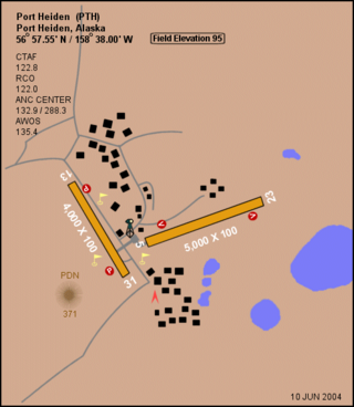
Port Heiden Airport is a state-owned public airport located six nautical miles northeast of the central business district of Port Heiden, in the Lake and Peninsula Borough of the U.S. state of Alaska. The scheduled airline services to King Salmon Airport are provided by Peninsula Airways (PenAir).
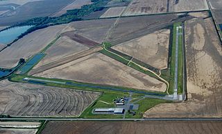
Almyra Municipal Airport is a city-owned, public-use airport located three nautical miles west of the central business district of Almyra, a city in Arkansas County, Arkansas, United States. This airport is included in the FAA's National Plan of Integrated Airport Systems for 2009–2013, which categorizes it as a general aviation facility.
McMinn Airport is a privately owned public-use airport located one nautical mile southwest of the central business district of Weaver, a city in Calhoun County, Alabama, United States.

Candlelight Farms Airport is a privately-owned, public use airfield located in New Milford, Connecticut, United States.
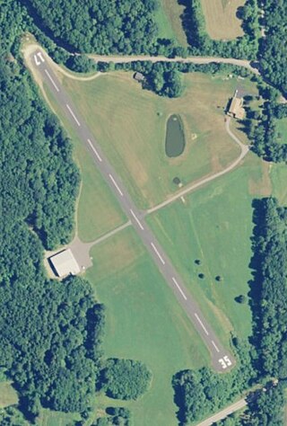
Toutant Airport, is located in Woodstock, Connecticut, United States.

Skylark Airport is located in Warehouse Point, Connecticut, United States.

Waterbury Airport, is located in Plymouth, Connecticut, United States.

Carlisle Municipal Airport is a city-owned, public-use airport located two nautical miles (4 km) northeast of the central business district of Carlisle, a city in Lonoke County, Arkansas, United States. It is included in the National Plan of Integrated Airport Systems for 2011–2015, which categorized it as a general aviation facility.


