Orthophoto

Last updated
Orthographic views project at a right angle to the datum plane. Perspective views project from the surface onto the datum plane from a fixed location. OrthoPerspective.svg
Orthographic views project at a right angle to the datum plane. Perspective views project from the surface onto the datum plane from a fixed location.
Aerophotogrammetry, orthophoto from drone, Citta Alta, Bergamo, Italy. Ortofoto Citta Alta, Rocca.jpg
Aerophotogrammetry, orthophoto from drone, Città Alta, Bergamo, Italy.
This photo is properly projected on elevation model, yet on a single building scale, a small tilt is noticeable. This is an orthophoto, but not a true orthophoto (not all vertical features are reprojected). Aerial Orthophoto.png
This photo is properly projected on elevation model, yet on a single building scale, a small tilt is noticeable. This is an orthophoto, but not a true orthophoto (not all vertical features are reprojected).
This photo is assembled from several overlapping photos from UAV, completely removing any residual tilt of the buildings. This is a true orthophoto. Aerial True Orthophoto.png
This photo is assembled from several overlapping photos from UAV, completely removing any residual tilt of the buildings. This is a true orthophoto.

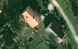
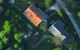
An orthophoto, orthophotograph, orthoimage or orthoimagery is an aerial photograph or satellite imagery geometrically corrected ("orthorectified") such that the scale is uniform: the photo or image follows a given map projection. Unlike an uncorrected aerial photograph, an orthophoto can be used to measure true distances, because it is an accurate representation of the Earth's surface, having been adjusted for topographic relief, [1] lens distortion, and camera tilt.

Contents

Orthophotographs are commonly used in geographic information systems (GIS) as a "map accurate" background image. An orthorectified image differs from "rubber sheeted" rectifications as the latter may accurately locate a number of points on each image but "stretch" the area between so scale may not be uniform across the image. A digital elevation model (DEM) is required to create an accurate orthophoto as distortions in the image due to the varying distance between the camera/sensor and different points on the ground need to be corrected. An orthoimage and a "rubber sheeted" image can both be said to have been "georeferenced"; however, the overall accuracy of the rectification varies. Software can display the orthophoto and allow an operator to digitize or place linework, text annotations or geographic symbols (such as hospitals, schools, and fire stations). Some software can process the orthophoto and produce the linework automatically.

Production of orthophotos was historically achieved using mechanical devices. [2]

The orthorectification is not always perfect and has side effect especially for the geometry of high-rise constructions.

Orthophotomosaic and orthophotomap

Orthophotomap of Rockport, Texas. The orthophotomap contains additional roads, terrain elevation and bathymetry layers. 7.5 minute series orthophotomap (topographic).jpg
Orthophotomap of Rockport, Texas. The orthophotomap contains additional roads, terrain elevation and bathymetry layers.
Orthophotomap of Oviedo city center, Spain. Ortofotomapa Asturias 2010-OVIEDO CENTRO.jpg
Orthophotomap of Oviedo city center, Spain.

An orthophotomosaic is a raster image mosaic made by merging or stitching orthophotos. The aerial or satellite photographs have been transformed to correct for perspective so that they appear to have been taken from vertically above at an infinite distance. [3] Google Earth images are of this type.

The document (digital or paper) representing an orthophotomosaic with additional marginal information like a title, north arrow, scale bar and cartographical information is called an orthophotomap or image map. Often these maps show additional point, line or polygon layers (like a traditional map) on top of the orthophotomosaic. A similar document, mostly used for disaster relief, is called a spatiomap.

Aerial orthorectified image of a mine for volumetric measurements in stock pile reporting. Stock Pile Reporting.jpg
Aerial orthorectified image of a mine for volumetric measurements in stock pile reporting.

See also

Related Research Articles

<span class="mw-page-title-main">Geographic information system</span> System to capture, manage and present geographic data

A geographic information system (GIS) consists of integrated computer hardware and software that store, manage, analyze, edit, output, and visualize geographic data. Much of this often happens within a spatial database, however, this is not essential to meet the definition of a GIS. In a broader sense, one may consider such a system also to include human users and support staff, procedures and workflows, the body of knowledge of relevant concepts and methods, and institutional organizations.

<span class="mw-page-title-main">Aerial photography</span> Taking images of the ground from the air

Aerial photography is the taking of photographs from an aircraft or other airborne platforms. When taking motion pictures, it is also known as aerial videography.

<span class="mw-page-title-main">Photogrammetry</span> Taking measurements using photography

Photogrammetry is the science and technology of obtaining reliable information about physical objects and the environment through the process of recording, measuring and interpreting photographic images and patterns of electromagnetic radiant imagery and other phenomena.

Planimetrics is the study of plane measurements, including angles, distances, and areas.

<i>The National Map</i> USGS topographical information

The National Map is a collaborative effort of the United States Geological Survey (USGS) and other federal, state, and local agencies to improve and deliver topographic information for the United States. The purpose of the effort is to provide "...a seamless, continuously maintained set of public domain geographic base information that will serve as a foundation for integrating, sharing, and using other data easily and consistently".

Georeferencing or georegistration is a type of coordinate transformation that binds a digital raster image or vector database that represents a geographic space to a spatial reference system, thus locating the digital data in the real world. It is thus the geographic form of image registration. The term can refer to the mathematical formulas used to perform the transformation, the metadata stored alongside or within the image file to specify the transformation, or the process of manually or automatically aligning the image to the real world to create such metadata. The most common result is that the image can be visually and analytically integrated with other geographic data in geographic information systems and remote sensing software.

In cartography and geographic information systems, rubbersheeting is a form of coordinate transformation that warps a vector dataset to match a known geographic space. This is most commonly needed when a dataset has systematic positional error, such as one digitized from a historical map of low accuracy. The mathematics and procedure are very similar to the georeferencing of raster images, and this term is occasionally used for that process as well, but image georegistration is an unambiguous term for the raster process.

<span class="mw-page-title-main">Digital orthophoto quadrangle</span>

A digital orthophoto quadrangle (DOQ) is aerial photography or satellite imagery that has been corrected so that its pixels are aligned with longitude and latitude lines, and have a narrowly defined region of coverage. This is a widely used format introduced by United States Geological Survey (USGS). The correction technique is called image rectification and is a large part of photogrammetry.

SOCET SET is a software application that performs functions related to photogrammetry. It is developed and published by BAE Systems. SOCET SET was among the first commercial digital photogrammetry software programs. Prior to the development of digital solutions, photogrammetry programs were primarily analog or custom systems built for government agencies.

<span class="mw-page-title-main">Terrain cartography</span> Representation of surface shape on maps

Terrain cartography or relief mapping is the depiction of the shape of the surface of the Earth on a map, using one or more of several techniques that have been developed. Terrain or relief is an essential aspect of physical geography, and as such its portrayal presents a central problem in cartographic design, and more recently geographic information systems and geovisualization.

<span class="mw-page-title-main">Stereoplotter</span>

A stereoplotter uses stereo photographs to determine elevations. It has been the primary method to plot contour lines on topographic maps since the 1930s. Although the specific devices have advanced technologically, they are all based on the apparent change in position of a feature in the two stereo photographs.

<span class="mw-page-title-main">Computer cartography</span> Compiling data to create a visual image

Computer cartography is the art, science, and technology of making and using maps with a computer. This technology represents a paradigm shift in how maps are produced, but is still fundamentally a subset of traditional cartography. The primary function of this technology is to produce maps, including creation of accurate representations of a particular area such as, detailing major road arteries and other points of interest for navigation, and in the creation of thematic maps. Computer cartography is one of the main functions of geographic information systems (GIS), however, GIS is not necessary to facilitate computer cartography and has functions beyond just making maps. The first peer-reviewed publications on using computers to help in the cartographic process predate the introduction of full GIS by several years.

IMAGINE Photogrammetry is a software application for performing photogrammetric operations on imagery and extracting information from imagery. IMAGINE Photogrammetry is significant because it is a leading commercial photogrammetry application that is used by numerous national mapping agencies, regional mapping authorities, various DOTs, as well as commercial mapping firms. Aside from commercial and government applications, IMAGINE Photogrammetry is widely used in academic research. Research areas include landslide monitoring, cultural heritage studies, and more.

TopoFlight is a three-dimensional flight planning software for photogrammetric flights.

<span class="mw-page-title-main">Nearmap</span> Australian technology company

Nearmap is an aerial technology company headquartered in Australia that provides frequently-updated, high-resolution aerial imagery and location intelligence on up to 95% of Australia's population, 80% of the United States population, 75% of the New Zealand population, and 66% of Canada's population. It was a publicly traded company on the Australian Securities Exchange until being taken private by Thoma Bravo in 2022.

Created in 1986, IGN FI is the private subsidiary of the French Institut Géographique National (IGN) and works essentially abroad. Its goal is to promote the savoir-faire of the French IGN around the world.

<span class="mw-page-title-main">CATUAV</span> Spanish UAV manufacturer

CATUAV S.L. is a technology-based private company that offers aerial services using unmanned aerial vehicles (UAV). Its headquarters are located in the Moià airfield in the BCN Drone Center, 40 km north of Barcelona, Spain.

DAT/EM Systems International is an Alaska-based company that develops digital photogrammetric mapping applications to extract and edit 3D vector terrain and object features from stereo imagery and point clouds. DAT/EM Systems International develops solutions for the photogrammetry, engineering & GIS industries.

Digital archaeology is the application of information technology and digital media to archaeology. It includes the use of digital photography, 3D reconstruction, virtual reality, and geographical information systems, among other techniques. Computational archaeology, which covers computer-based analytical methods, can be considered a subfield of digital archaeology, as can virtual archaeology.

<span class="mw-page-title-main">National Geographical Organization of Iran</span> Geography center of Iran

The National Geographical Organization of Iran or National Geographical Organization of the Armed Forces of Iran is an Iranian government agency affiliated to the Ministry of Defence and Armed Forces Logistics of Iran, which has been established to prepare quick and accurate access spatial information of the country and other areas required by the Armed Forces of Iran.

References

  1. Smith, Gary S. "Digital orthophotography and GIS." ESRI Conference. http://proceedings.esri.com/library/userconf/proc95/to150/p124.html
  2. BBC Tomorrow's World: How maps are corrected and updated using aerial photography and optical machinery. 18 December 1970.
  3. American Congress on Surveying and Mapping, American Society for Photogrammetry and Remote Sensing (1994), Glossary of the Mapping Sciences, American Society of Civil Engineers, p. 370, ISBN   9780784475706