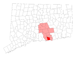
Westbrook, Connecticut

Last updated

Westbrook, Connecticut
Town of Westbrook
Trolley Road, Westbrook, CT.JPG
Looking east on Trolley Road
WestbrookCTseal.jpg
Westbrook, Connecticut
Coordinates: 41°18′N72°28′W / 41.300°N 72.467°W / 41.300; -72.467
CountryFlag of the United States.svg  United States
U.S. state Flag of Connecticut.svg  Connecticut
County Middlesex
Region Lower CT River Valley
Incorporated1840
Government
  Type Selectman-town meeting
  First selectmanJohn Hall, III (R)
  SelectmanJoseph Campbell (R)
  SelectmanChester Bialicki (D)
Area
  Total21.4 sq mi (55.4 km2)
  Land15.7 sq mi (40.7 km2)
  Water5.7 sq mi (14.7 km2)
Elevation
[1]
52 ft (16 m)
Population
 (2020)
  Total6,769
  Density431/sq mi (166.3/km2)
Time zone UTC−5 (Eastern)
  Summer (DST) UTC−4 (Eastern)
ZIP code
06498
Area code(s) 860/959
FIPS code 09-81680
GNIS feature ID0213528 [1]
Website http://www.westbrookct.us/

Westbrook is a town in Middlesex County, Connecticut, United States. The town is part of the Lower Connecticut River Valley Planning Region. The population was 6,769 at the 2020 census. [2] The town center is classified by the U.S. Census Bureau as a census-designated place (CDP).

Contents

Geography

Westbrook lies in the shoreline area of the state. The town is bordered by the towns of Essex, Clinton, Deep River, and Old Saybrook, where the Connecticut River empties into Long Island Sound. The Salt Meadow Unit of the Stewart B. McKinney National Wildlife Refuge is located in town.

According to the United States Census Bureau, the town has a total area of 21.4 square miles (55 km2), of which, 15.7 square miles (41 km2) is land and 5.7 square miles (15 km2) (26.47%) is water. The Westbrook Center CDP has a total area of 2.2 square miles (5.7 km2) of which 22.33% is water.

Westbrook encompasses three islands in Long Island Sound, all of which are uninhabited. Salt Island is the easternmost and smallest, at approximately 0.9 acres. Menunketesuck Island, which is the largest of Westbrook's islands at approximately 4.6 acres, extends into the Sound from the outlet of the Menunketesuck and Patchogue Rivers and is part of the Stewart B. McKinney National Wildlife Refuge. Further west is Duck Island, measuring approximately 3.6 acres. [3]

Private beach Associations in the town are: Chapman Beach, Coral Sands, Grove Beach Point, Grove Beach Terrace, Horse Hill, Island View, Kelsey Point, Little Stannard, Middle Beach, Pilot's Point, Pointina, Quotonset Beach, Sagamore Terrace, Salt Works, Stannard Beach, West Beach.

History

Town library, c. 1906 PostcardPublicLibraryWestbrookCT1906.jpg
Town library, c.1906

Westbrook was incorporated in 1840. [4]

Demographics

Historical population
CensusPop.Note
1840 1,182
1850 1,2021.7%
1860 1,056−12.1%
1870 987−6.5%
1880 878−11.0%
1890 874−0.5%
1900 8841.1%
1910 9517.6%
1920 849−10.7%
1930 1,03722.1%
1940 1,15911.8%
1950 1,54933.6%
1960 2,39954.9%
1970 3,82059.2%
1980 5,21636.5%
1990 5,4143.8%
2000 6,29216.2%
2010 6,93810.3%
2020 6,769−2.4%
U.S. Decennial Census [5]

At the 2000 census there were 6,292 people, 2,605 households, and 1,693 families living in the town. The population density was 400.3 inhabitants per square mile (154.6/km2). There were 3,460 housing units at an average density of 220.1 per square mile (85.0/km2). The racial makeup of the town was 95.76% White, 0.70% African American, 0.13% Native American, 1.56% Asian, 0.11% Pacific Islander, 0.72% from other races, and 1.03% from two or more races. Hispanic or Latino of any race were 2.51%. [6]

Of the 2,605 households 26.5% had children under the age of 18 living with them, 54.1% were married couples living together, 7.8% had a female householder with no husband present, and 35.0% were non-families. 28.0% of households were one person and 12.7% were one person aged 65 or older. The average household size was 2.39 and the average family size was 2.93.

The age distribution was 21.8% under the age of 18, 5.2% from 18 to 24, 29.2% from 25 to 44, 26.7% from 45 to 64, and 17.1% 65 or older. The median age was 42 years. For every 100 females, there were 95.8 males. For every 100 females age 18 and over, there were 92.7 males.

The median household income was $57,531 and the median family income was $71,344. Males had a median income of $46,889 versus $32,227 for females. The per capita income for the town was $28,680. About 2.7% of families and 5.2% of the population were below the poverty line, including 3.7% of those under age 18 and 8.1% of those age 65 or over.

CDP

At the 2000 census, there were 2,238 people, 1,052 households, and 551 families living in the Westbrook Center CDP. The population density was 1,336.0 inhabitants per square mile (515.8/km2). There were 1,662 housing units at an average density of 992.2 per square mile (383.1/km2). The racial makeup of the CDP was 94.50% White, 1.39% African American, 0.09% Native American, 2.19% Asian, 0.63% from other races, and 1.21% from two or more races. Hispanic or Latino of any race were 2.19% of the population.

Of the 1,052 households 18.5% had children under the age of 18 living with them, 40.9% were married couples living together, 8.7% had a female householder with no husband present, and 47.6% were non-families. 37.9% of households were one person and 16.8% were one person aged 65 or older. The average household size was 2.09 and the average family size was 2.71.

The age distribution was 16.1% under the age of 18, 6.9% from 18 to 24, 28.9% from 25 to 44, 25.7% from 45 to 64, and 22.4% 65 or older. The median age was 44 years. For every 100 females, there were 92.6 males. For every 100 females age 18 and over, there were 90.1 males.

The median household income was $45,385 and the median family income was $59,375. Males had a median income of $40,707 versus $31,250 for females. The per capita income for the CDP was $29,866. About 3.7% of families and 6.6% of the population were below the poverty line, including 6.7% of those under age 18 and 7.2% of those age 65 or over.

Voter Registration and Party Enrollment as of October 31, 2023 [7]
PartyTotal votersPercentage
Unaffiliated 2,30243.75%
Democratic 1,39526.5%
Republican 1,46927.9%
Minor parties 961.8%
Total5,262100%
Presidential Election Results [8] [9]
Year Democratic Republican Third Parties
2020 53.0%2,28845.4% 1,9581.5% 65
2016 44.8%1,69951.0%1,9364.0% 155
2012 53.6%1,90345.2% 1,6051.3% 45
2008 54.9%2,10443.8% 1,6801.3% 51
2004 51.0%1,90847.7% 1,7871.3% 49
2000 51.8%1,72042.0% 1,3976.1% 203

Education

The town's public education needs are overseen by its local school district, Westbrook Public Schools. Westbrook's public elementary school, the Daisy Ingraham Elementary School, was the recipient of a Blue Ribbon honor for excellence for 1998–1999. A new middle school, connected to the high school, Westbrook High School, opened in 2005.

Oxford Academy, an all-boys boarding school, has been located in Westbrook since 1973.

Infrastructure

Emergency services

The town of Westbrook is the home of Connecticut State Police Troop F, located on Interstate 95 and Spencer Plains Road. Police services in Westbrook are coordinated by a Resident State Trooper and several Police Constables. Constables patrol during the day and evening hours while overnight patrol is provided by the State Police.

Fire protection is provided by the Westbrook Fire Department (a.k.a. Westbrook Chemical Engine Company), located on South Main Street. This all-volunteer department is responsible for response to alarms of fire, rescue emergencies and medical emergencies. Emergency Medical Services are provided by the Westbrook Ambulance Association, a paid-on-call basic life support service. Paramedic services are provided by Middlesex Hospital from their satellite facility in Essex, CT.

Transportation

Eastbound platform at Westbrook station Eastbound platform at Westbrook station, December 2017.JPG
Eastbound platform at Westbrook station

Westbrook station is a station along the Shore Line East commuter line.

The Estuary Transit District provides public bus transportation throughout Westbrook and the surrounding towns through its 9 Town Transit Service. Services include connections to the Old Saybrook Train Station which is served by Amtrak in addition to the Shore Line East railroad.

Notable people

Related Research Articles

<span class="mw-page-title-main">Georgetown, Connecticut</span> Census-designated place in Connecticut, United States

Georgetown is a census-designated place in Fairfield County, Connecticut, United States. It is located in the area where the towns of Wilton, Redding, Weston, and Ridgefield meet.

<span class="mw-page-title-main">Broad Brook, Connecticut</span> Census-designated place in Connecticut, United States

Broad Brook is a neighborhood and census-designated place (CDP) in the town of East Windsor, Hartford County, Connecticut, United States. As of the 2010 census, the CDP population was 4,069.

<span class="mw-page-title-main">Kensington, Connecticut</span> Census-designated place in Connecticut, United States

Kensington is a census-designated place (CDP) and section of the town of Berlin in Hartford County, Connecticut, United States. The Berlin town offices are located in Kensington. The population was 8,459 at the 2010 census.

<span class="mw-page-title-main">North Granby, Connecticut</span> Census-designated place in Connecticut, United States

North Granby is a village and census-designated place (CDP) in Hartford County, Connecticut, United States. It is part of the town of Granby. The population was 1,944 at the 2010 census.

<span class="mw-page-title-main">Sherwood Manor, Connecticut</span> Census-designated place in Connecticut, United States

Sherwood Manor is a census-designated place (CDP) within the town of Enfield in Hartford County, Connecticut, United States. The population was 5,410 at the 2010 census.

<span class="mw-page-title-main">Terramuggus, Connecticut</span> Census-designated place in Connecticut, United States

Terramuggus is a census-designated place (CDP) in the town of Marlborough, Hartford County, Connecticut, United States. It contains the town center village and surrounding areas. The population was 1,025 at the 2010 census.

<span class="mw-page-title-main">Chester, Connecticut</span> Town in Connecticut, United States

Chester is a town in Middlesex County, Connecticut, United States. The town is part of the Lower Connecticut River Valley Planning Region. The population was 3,749 at the 2020 census. The town center is defined by the U.S. Census Bureau as a census-designated place (CDP). The name is a transfer from Chester, in England.

<span class="mw-page-title-main">Deep River, Connecticut</span> Town in Connecticut, United States

Deep River is a town in Middlesex County, Connecticut. The town is part of the Lower Connecticut River Valley Planning Region. The population was 4,415 at the 2020 census. The town center is designated by the U.S. Census Bureau as a census-designated place (CDP). Deep River is part of what the locals call the "Tri-town Area", made up of the towns of Deep River, Chester, and Essex.

Saybrook Manor is a community and census-designated place (CDP) in Old Saybrook, a town in Middlesex County, Connecticut, United States. The population was 1,127 at the 2020 census. The Saybrook Manor section is generally the area south of U.S. Route 1 between the Westbrook town line and the Oyster River.

<span class="mw-page-title-main">Niantic, Connecticut</span> Census-designated place in Connecticut, United States

Niantic is a census-designated place (CDP) and village in the town of East Lyme, Connecticut in the United States. The population was 3,114 at the 2010 census. It is located on Long Island Sound, the Millstone Nuclear Power Plant in nearby Waterford is visible on the bay's eastern horizon line, Rocky Neck State Park is also located in the area. Niantic was once famous for its Niantic River scallops, but the scallop population has been in decline for a number of years.

<span class="mw-page-title-main">Somers, Connecticut</span> Town in Connecticut, United States

Somers is a town in Tolland County, Connecticut. The town is part of the Capitol Planning Region. The population was 10,255 at the 2020 census. The town center is listed by the U.S. Census Bureau as a census-designated place (CDP). In 2007, Money Magazine listed Somers 53rd on its "100 Best Places to Live", based on "economic opportunity, good schools, safe streets, things to do and a real sense of community."

<span class="mw-page-title-main">Moosup, Connecticut</span> Village in Connecticut, United States

Moosup is a village and census-designated place (CDP) in the town of Plainfield, Connecticut in the United States. The population was 3,231 at the 2010 census.

<span class="mw-page-title-main">Plainfield Village, Connecticut</span> Village in Connecticut, United States

Plainfield Village is a village and census-designated place (CDP) in the town of Plainfield, Connecticut in the United States. The population was 2,557 at the 2010 census. It is located in the southwest part of town, in the area west of I-395 and south of Route 14. The village is also the core of the Plainfield, CT urban cluster.

<span class="mw-page-title-main">Simsbury Center, Connecticut</span> Census-designated place in Connecticut, United States

Simsbury Center is a census-designated place (CDP) that consists of the central settlement, and the neighborhoods immediately surrounding it, in the town of Simsbury, Connecticut, in the United States. As of the 2010 census, the CDP had a population of 5,836. The core area of the CDP is listed as the Simsbury Center Historic District on the National Register of Historic Places.

<span class="mw-page-title-main">East Atlantic Beach, New York</span> Hamlet and census-designated place in New York, United States

East Atlantic Beach is a hamlet and census-designated place (CDP) in Nassau County, New York, United States. The population was 2,049 at the 2010 census. The unincorporated hamlet is governed by the Town of Hempstead, one of three towns in Nassau County.

<span class="mw-page-title-main">Ridgefield (CDP), Connecticut</span> Census-designated place in Connecticut, United States

Ridgefield is a census-designated place (CDP) in Fairfield County, Connecticut, United States. It consists of the primary central village in the town of Ridgefield and surrounding residential areas. As of the 2020 census, the population of the CDP was 7,596, out of 25,053 in the entire town.

<span class="mw-page-title-main">Durham, Connecticut</span> Town in Connecticut, United States

Durham is a town in Middlesex County, Connecticut, United States. Durham is a former farming village on the Coginchaug River in central Connecticut. The town is part of the Lower Connecticut River Valley Planning Region. The population was 7,152 at the 2020 census. Every autumn, the town hosts the Durham Fair, the largest volunteer agricultural fair in New England.

<span class="mw-page-title-main">Glastonbury Center, Connecticut</span> Census-designated place in Connecticut, United States

Glastonbury Center is a census-designated place (CDP) that constitutes the densely populated center of the town of Glastonbury in Hartford County, Connecticut, United States. The population was 7,387 at the 2010 census, out of a total town population of 34,427.

<span class="mw-page-title-main">Clinton, Connecticut</span> Town in Connecticut, United States

Clinton is a town in Middlesex County, Connecticut, United States. The town is part of the Lower Connecticut River Valley Planning Region. The population of the town was 13,185 at the 2020 census. The town center along the shore line was listed as a census-designated place (CDP) by the U.S. Census Bureau in the 2020 census.

<span class="mw-page-title-main">East Hampton, Connecticut</span> Town in Connecticut, United States

East Hampton is a town in Middlesex County, Connecticut, United States. The town is part of the Lower Connecticut River Valley Planning Region. The population was 12,717 at the 2020 census. The town center village is listed as a census-designated place (CDP). East Hampton includes the communities of Cobalt, Middle Haddam, and Lake Pocotopaug.

References

  1. 1 2 U.S. Geological Survey Geographic Names Information System: Westbrook, Connecticut
  2. "Census - Geography Profile: Westbrook town, Middlesex County, Connecticut" . Retrieved December 23, 2021.
  3. Official Westbrook, CT GIS Map and Parcel Database
  4. The Connecticut Magazine: An Illustrated Monthly. Connecticut Magazine Company. 1903. p. 335.
  5. "Census of Population and Housing". Census.gov. Retrieved June 4, 2015.
  6. "U.S. Census website". United States Census Bureau . Retrieved January 31, 2008.
  7. "Registration and Party Enrollment Statistics as of October 31, 2023" (PDF). Connecticut Secretary of State. Retrieved November 14, 2023.
  8. "General Election Statements of Vote, 1922 – Current". CT Secretary of State. Retrieved December 21, 2020.
  9. "Election Night Reporting". CT Secretary of State. Retrieved December 21, 2020.