Wilton, Connecticut

Last updated

Wilton, Connecticut
Town of Wilton
WiltonCTTownHallFront11112007.JPG
WiltonCTseal.jpg
Fairfield County Connecticut incorporated and unincorporated areas Wilton highlighted.svg
Wilton, Connecticut
Wilton, Connecticut
Wilton, Connecticut
Coordinates: 41°12′N73°26′W / 41.200°N 73.433°W / 41.200; -73.433
CountryFlag of the United States.svg  United States
U.S. state Flag of Connecticut.svg  Connecticut
County Fairfield
Region Western CT
Incorporated1802
Government
  Type Selectman-town meeting
  First selectmanLynne Vanderslice (R)
  SelectmenJosh Cole (R)
Kim Healy (R)
Ross Tartell (D)
Bashar Nabulsi (D)
Area
  Total27.3 sq mi (71.0 km2)
  Land26.9 sq mi (69.8 km2)
  Water0.4 sq mi (1.1 km2)
Elevation
335 ft (102 m)
Population
 (2020) [1]
  Total18,503
  Density680/sq mi (260/km2)
Time zone UTC−5 (Eastern)
  Summer (DST) UTC−4 (Eastern)
ZIP Code
06897
Area code(s) 203/475
FIPS code 09-86370
GNIS feature ID0213535
Website www.wiltonct.org

Wilton is a town in Fairfield County, Connecticut, United States. [2] As of the 2020 census, the town population was 18,503. [3] The town is part of the Western Connecticut Planning Region.

Contents

Officially recognized as a parish in 1726, Wilton today is a residential community with open lands, historic architecture such as the Round House, and many colonial homes. [4] [5] Many residents commute to nearby cities such as Stamford or New York City.

Wilton is home to many global corporations such as ASML, Breitling SA, Cannondale Bicycle Corporation, Melissa & Doug, and formerly Deloitte. It is also home to AIG Financial Products, whose collapse played a pivotal role in the financial crisis of 2007–2008. [6] [7] [8]

The transformation from a small farming town to a suburban residential community has been carefully controlled by zoning, efforts to preserve the town's colonial landmarks, and the reservation of almost 1,000 acres (4 km2) of open space for active and passive recreational use. The Cannondale Historic District, in north-central Wilton, retains its historic character and was listed on the National Register of Historic Places in 1992.

History

Colonial days

The first written records of the areas that are now Wilton date back to 1640, when Roger Ludlow and his friends purchased land from the Indians between the Norwalk and Saugatuck Rivers and "a day's walk into the country." This land was called Norwalk.

The first settlers, called the Proprietors, arrived in Norwalk in 1651 and owned 50,000 acres (200 km2) in common. On the outskirts of Norwalk's settled area, the Proprietors were allowed private ownership of land in a common planting field, but cattle, sheep, and hogs were grazed in a communal pasture area. The outer limit of this pasture approximates Wilton's present southern boundary.

By the end of the 17th century, the Norwalk Proprietors began to sell off the northern lands for settlement. The first non-Indian settlements in what is now Wilton were in the fertile lands of the Norwalk River valley, and on the ridges of Belden Hill, Chestnut Hill, and Ridgefield Road. In order to till the lands, the settlers had to clear the forests and remove hundreds of glacial rocks, which became the stone boundary walls that are treasured today.

The families who bought land in Wilton did not have their own church and were required to attend service in Norwalk each Sunday. When demand for Wilton lands increased in the early 18th century, the Proprietors realized that the land would be worth more if Wilton settlers did not have to make such a long trek each week.

By 1725 there were forty families living in Wilton who wanted their own Congregational church and were allowed by Norwalk to hire a minister (Robert Sturgeon, who also became the town's first schoolmaster), open schools and build roads. [9] Therefore, in 1726, with the approval of both the Proprietors and the Wilton settlers, a petition to the General Court in Hartford created Wilton Parish, "a village enjoying parish privileges" but still part of the town of Norwalk. A copy of the petition is framed and on display in the Town Hall. (See also: Benjamin Hickox)

The Wilton Parish, organized as an ecclesiastical society, dealt with many problems of a secular nature as well. It dealt with such things as communal flocks, pounds for animals, and the regulation of the trades and taverns. The state of the roads was a constant source of comment in the society meeting, as was the inevitable subject of taxation. Although the village parish did not have the right to send a representative to the state legislature, it did have complete charge of both local education and military training. The first minister, Mr. Robert Sturgeon, was also Wilton's first schoolmaster.

As soon as the first meetinghouse was built in 1726, Wilton had a "center" of town, although other areas such as Belden Hill, Drum Hill, Pimpewaug and Chestnut Hill had already been settled by self-sufficient farmers. By 1738 the first meetinghouse had become too small, and a second was built on the corner of Sharp Hill Road. Less than sixty years later, this second meeting house had fallen into such disrepair that a third church was built in 1790 on Ridgefield Road where it still stands as the oldest church building in Fairfield County, Connecticut.

Revolutionary War

During the Revolutionary War, more than 300 men from Wilton served in some military unit. Among them was an African American named Cato Treadwell (1762–1849), who served three years in the 2nd Brigade of the Connecticut Line. [10] In 1777, British forces passed through Wilton after raiding nearby Danbury. [11] Several homes were burned along Ridgefield, Belden, Danbury, and Dudley roads, but the town remained intact. [12] About 52 Revolutionary veteran graves are still identifiable in Wilton cemeteries.

19th century

South Wilton Railroad Station, from a postcard sent in 1906 PostcardWiltonCTSouthWiltonStation1906.jpg
South Wilton Railroad Station, from a postcard sent in 1906

In 1802, despite Norwalk's objections, the people of Wilton sought and were granted separate Town government status by an act of the Connecticut General Assembly and became a political entity independent from Norwalk. [13] The town chose the traditional New England Town Meeting-Selectmen form of government, which has been retained to this day.

In the 19th century, education became the responsibility of the school societies of nine separate school districts in Wilton. In addition, many Wilton children and those of well-to-do families of Norwalk and Stamford attended five private schools and academies in Wilton.

Wilton's population grew slowly from 1,728 in 1810 to 2,208 in 1860. Most of the land was farmland used for dairy herds, horses, or marketable crops. Farmers found their yield from the rocky soil to be very low at the same time that midwestern produce, made readily available by the railroads, began to compete with homegrown products, home industry expanded.

Industries such as shoemaking, shirt making, carriage building, and distilleries were common. Mills of various types were built along the streams and the Gilbert and Bennett Manufacturing Co. began producing wire sieves in 1834.

Civil War

Before the Civil War, the anti-slavery movement was strong in town. Wilton served as one of the stops on the Underground Railroad, a loosely organized escape route to Canada for runaway slaves, primarily at the house of William Wakeman, "an earnest abolitionist and undergrounder for many years." [14] The Civil War itself had little impact on Wilton, although local businesses profited from wartime spending.

Industrial age

Cannondale School building (1872), now a restaurant WiltonCTCannonXingSchoolhouse09162007.JPG
Cannondale School building (1872), now a restaurant

The coming of the railroad in 1852 brought few advantages to a community of home industry and farming, but offered easy access to bountiful western lands.

After the Civil War, Wilton's population declined as cities grew, industrialization increased, the market for home products dropped, and farms were abandoned. Its population declined by some 30% between 1860 and 1900. By 1900, the census showed only 1,598 people living in Wilton.

This depopulation enabled many 18th- and 19th-century homes to escape demolition and suburban development. Beginning in the 1910s, abandoned farms were discovered by New Yorkers for summer homes and in the 1930s, there were noticeable stresses at Town Meetings between the "old-timers" and the "new people." The community was changing from agricultural to one of commuters. By 1935, the last two of Wilton's nine schoolhouses—Belden Hill and Hurlbutt Street—had closed. The original nine school districts are consolidated into the Center school in Wilton Center.

Originating in its colonial origins, Wilton had developed in a rather haphazard, individualistic way: a house here and a store there. Shortly after World War II, a new phenomenon brought a new look to Wilton's landscape: the builder subdivision.

Light industry began moving into town. To plan for orderly growth, town zoning was adopted. With the growth in population and businesses came the corresponding need for new schools, new roads, executive offices, and more support services. The period of greatest growth was from 1950 to 1970, when the population grew from 4,558 to 13,572.

Dry to damp

Wilton was classified as a "dry" town until 1993, when the local ordinance was altered to permit the sale of alcoholic beverages in restaurants. The town was then referred to as "damp." On November 5, 2009, a referendum proposal was passed to allow liquor stores. [15] The town Board enacted an ordinance to allow liquor stores to sell alcoholic beverages in 2010 and since then, several stores have since opened, including Ancona's.

Wilton deaths on September 11, 2001

On September 11, 2001, four town residents died in the terrorist attack on the World Trade Center: Edward T. Fergus Jr., 40; Peter Christian Fry, 36; John Iskyan, 41; and Edward P. York, 45. [16] Wilton High School graduate John Henwood, 35, also died in the attack.

Geography

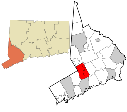
According to the United States Census Bureau, the town has a total area of 27.4 square miles (71 km2), of which 27.0 square miles (70 km2) is land and 0.4 square miles (1.0 km2), or 1.50%, is water, including the South Norwalk Reservoir. Wilton is bordered by Ridgefield to the northwest, Norwalk to the south, New Canaan to the southwest, Westport to the southeast, and Weston and Redding to the northeast. It is also bordered on the west by the hamlet of Vista in Lewisboro, Westchester County, New York.

Housing and land use

Police station behind the Town Hall WiltonCTPoliceStation11112007.JPG
Police station behind the Town Hall

Wilton has about 500 surviving 18th- and 19th-century homes. In 2005, Marilyn Gould, the director of the Wilton Historical Society said:

People aren't taking down historic houses but the more modest homes that were built in the '50s and '60s.... What that's doing is changing the affordability of the town and the demographic of the town. Wilton used to have a wide demographic of people who worked with their handsartisans, builders, mechanics. Now it's management and upper management. [17]

Between 1999 and 2005, the town's voters endorsed spending $23 million through municipal bonds to preserve land. [17]

South Norwalk Electric and Water (SNEW) has a reservoir on the western side of town with about 350 acres (1.4 km2) of land, along with another 25 acres (100,000 m2) adjacent in New Canaan. In the fall, hunters with bows and arrows—no more than 10 at a time—are allowed to hunt deer on the Wilton property, in order to keep down the number of deer in the area. [18]

Wilton town center contains several local restaurants, boutiques, retail stores .These stores were added around 2000 next to the old Wilton Center, which consists of the Wilton Library, [19] the Wilton Post Office, the Old Post Office Square, and the Village Market. [20] In the southern part of town, US 7 contains a business district.

Recent nature access developments in town include the expansion of the Norwalk River Valley Trail, a multi-use trail designed to run between Norwalk and Danbury.

Neighborhoods

The southwest corner of town includes part of the Silvermine neighborhood (which also extends into New Canaan and Norwalk). Georgetown, which is primarily within the town but also extends into Redding and partly into Weston, is in the northeast corner of town. Other neighborhoods in town are South Wilton, Wilton Center, Gilbert Corners, Cannondale, and North Wilton.

Demographics

Historical population
CensusPop.Note
1820 1,818
1850 2,066
1860 2,2086.9%
1870 1,994−9.7%
1880 1,864−6.5%
1890 1,722−7.6%
1900 1,598−7.2%
1910 1,7066.8%
1920 1,284−24.7%
1930 2,13366.1%
1940 2,82932.6%
1950 4,55861.1%
1960 8,02676.1%
1970 13,57269.1%
1980 15,35113.1%
1990 15,9894.2%
2000 17,63310.3%
2010 18,0622.4%
2020 18,5032.4%
U.S. Decennial Census [21] [22]

As of the census [23] of 2000, there were 17,633 people, 5,923 households, and 4,874 families residing in Wilton. The population density was 654.3 inhabitants per square mile (252.6/km2). There were 6,113 housing units at an average density of 226.8 per square mile (87.6/km2). The racial makeup of the town was 95.55% White, 0.60% African American, 0.09% Native American, 2.69% Asian, 0.01% Pacific Islander, 0.27% from other races, and 0.79% from two or more races. Hispanic or Latino of any race were 1.53% of the population.

There were 5,923 households, out of which 46.6% had children under the age of 18 living with them, 75.4% were married couples living together, 5.4% had a female householder with no husband present, and 17.7% were non-families. Of all households 15.3% were made up of individuals, and 6.6% had someone living alone who was 65 years of age or older. The average household size was 2.91 and the average family size was 3.25.

The age distribution is 31.5% under the age of 18, 2.8% from 18 to 24, 25.6% from 25 to 44, 27.9% from 45 to 64, and 12.2% who were 65 years of age or older. The median age was 40 years. For every 100 females, there were 93.9 males. For every 100 females age 18 and over, there were 86.2 males.

The median income for a household in the town was $197,428, and the median income for a family was $217,415. Males had a median income of $190,000 versus $71,611 for females. The per capita income for the town was $65,806. About 1.3% of families and 2.9% of the population were below the poverty line, including 1.7% of those under age 18 and 6.6% of those age 65 or over.

Arts and culture

Events

Listings on the National Register of Historic Places

Weir Farm National Historic Site in Wilton Weirfarm.jpg
Weir Farm National Historic Site in Wilton

Parks and recreation

The Wilton Parks and Recreation Department offers a number of programs for all ages including pre-school programs, senior programs youth soccer and basketball. [29] There are also many walking paths including part of the Norwalk River Valley Trail. [30] Merwin Meadows is a picnic area for families with a pond, playground and athletic field. [31]

Government and politics

Wilton town vote
by party in presidential elections [32]
Year Democratic Republican Third Parties
2020 65.59%7,67632.63% 3,8191.86% 218
2016 58.27%6,05536.44% 3,7865.29% 550
2012 45.37% 4,58953.62%5,4241.01% 102
2008 53.41%5,56946.04% 4,8010.55% 57
2004 46.57% 4,82352.35%5,4221.08% 112
2000 41.90% 4,08654.52%5,3163.58% 349
1996 38.75% 3,45154.55%4,8596.70% 597
1992 33.95% 3,40251.32%5,14314.74% 1,477
1988 31.85% 2,96467.51%6,2830.64% 60
1984 27.23% 2,46272.46%6,5530.31% 28
1980 23.73% 1,11759.91%2,82016.36% 770
1976 31.63% 2,56667.95%5,5130.42% 34
1972 31.38% 2,37867.63%5,1240.99% 75
1968 32.69% 1,99564.85%3,9572.46% 150
1964 52.58%2,55347.42% 2,3020.00% 0
1960 26.10% 1,12173.90%3,1740.00% 0
1956 18.19% 61281.81%2,7530.00% 0

Once a Republican bastion, Wilton has become increasingly Democratic in recent years. In 2008, Wilton voted for Barack Obama, who became the first Democratic candidate for U.S. President to carry the town since Lyndon B. Johnson in 1964. The town flipped back in 2012, voting for Mitt Romney, a former governor of neighboring Massachusetts. In 2016, voters in Wilton delivered a 22-point margin of victory to Hillary Clinton, the best performance for a Democratic presidential nominee in the town since Johnson in 1964. In 2019 and 2021, Republicans won the majority of local offices. In 2020, the town gave a 33-point margin to Joe Biden.

Wilton is a part of the 26th District of the Connecticut Senate. Represented by Ceci Maher. Parts of Wilton are encompassed by the 125th District of the Connecticut House of Representatives. Represented by Tom O'Dea. Wilton is also a part of the 143rd District. Currently represented by Keith B. Denning.

Since 2015, Wilton has been led by First Selectwoman Lynne Vanderslice, a Republican serving her second four-year term. Her term expires on November 30, 2023. [33]

Voter registration and party enrollment as of October 26, 2021 [34]
PartyActive votersInactive votersTotal votersPercentage
Democratic 4,1524484,60032.68%
Republican 3,3514083,75926.70%
Unaffiliated 4,8886485,53639.32%
Minor parties168151831.30%
Total12,5591,51914,078100%

Education

Public schools

A total of about 3,750 students attend the town's four public schools: two elementary schools, Miller-Driscoll School (Grades Pre-K–2) and Cider Mill School (3–5); one middle school, Middlebrook School (6–8); and one high school, Wilton High School, which has accelerated classes for gifted students, music and visual arts courses, and a resource center. The language laboratory teaches six languages: French, German, Spanish, Latin, classical Greek, and American Sign Language.

The elementary schools have class sizes typically ranging from 18 to 22 and a 19-to-1 student/teacher ratio.

Middlebrook has interdisciplinary instruction teams in languages and science, mathematics, social studies, computers, art, and gifted student instruction. Class sizes range from 20 to 25 with a student/teacher ratio of 13-to-1. [35]

Private schools

There are five private schools in the town:

Media

The Wilton Bulletin [38] is a weekly newspaper published by Hearst Connecticut Media and formerly published by Hersam Acorn Newspapers. GOOD Morning Wilton [39] is an online daily news website. Virgin Mobile Live, a 24-hour online radio service licensed by Virgin Radio, is based in Wilton.[ citation needed ] There is also the weekly Wilton Villager newspaper.[ citation needed ]

Infrastructure

Transportation

Highways

The town's main north-south roadways are U.S. Route 7 and Route 33. State highways Route 53 and Route 106 also run through the town. The nearby Merritt Parkway (Route 15) serves the town via the Route 33 exit (Exit 41, signed for Wilton/Westport) and the Route 7 exits (Exits 39B & 40B, signed for Danbury).

Railroad

The town has two railroad stations: Wilton near the town center and Cannondale. Both are served by Metro-North Railroad's Danbury Branch, which provides direct commuter train service south to Norwalk (15 minutes), Stamford (25 minutes), and New York City's Grand Central Terminal (90 minutes); and north to Danbury (33 minutes), New Haven, and Boston.

Wilton was previously served by a station called South Wilton (1852–1971) and Kent Road (1976–1994) and by the Georgetown station from 1852–1970.

Buses

The town is served by the 7 Link bus route of the Norwalk Transit District that runs between Norwalk and Danbury along the Route 7 corridor. A commuter shuttle bus during rush hours is also available between South Wilton and the South Norwalk railroad station on the New Haven Line.

Notable people

Related Research Articles

<span class="mw-page-title-main">Fairfield County, Connecticut</span> County in Connecticut, United States

Fairfield County is a county in the southwestern corner of the U.S. state of Connecticut. It is the most populous county in the state and was also its fastest-growing from 2010 to 2020. As of the 2020 census, the county's population was 957,419, representing 26.6% of Connecticut's overall population. The closest to the center of the New York metropolitan area, the county contains four of the state's top 7 largest cities—Bridgeport (1st), Stamford (2nd), Norwalk (6th), and Danbury (7th)—whose combined population of 433,368 is nearly half the county's total population.

<span class="mw-page-title-main">New Canaan, Connecticut</span> Town in Connecticut, United States

New Canaan is a town in Fairfield County, Connecticut, United States. The population was 20,622 according to the 2020 census. The town is part of the Western Connecticut Planning Region.

<span class="mw-page-title-main">Redding, Connecticut</span> Town in Connecticut, United States

Redding is a town in Fairfield County, Connecticut, United States. The population was 8,765 at the 2020 census. The town is part of the Western Connecticut Planning Region.

<span class="mw-page-title-main">Lewisboro, New York</span> Town in New York, United States

Lewisboro is a town in Westchester County, New York, United States. The population was 12,411 at the 2010 census. The town is named after John Lewis, an early settler. Lewisboro is a suburb of New York City.

<span class="mw-page-title-main">Danbury, Connecticut</span> City in Connecticut, United States

Danbury is a city in Fairfield County, Connecticut, located approximately 50 miles (80 km) northeast of New York City. Danbury's population as of 2020 was 86,518. It is the third-largest city in Western Connecticut, and the seventh-largest city in Connecticut.

<span class="mw-page-title-main">Ridgefield (CDP), Connecticut</span> Census-designated place in Connecticut, United States

Ridgefield is a census-designated place (CDP) in Fairfield County, Connecticut, United States. It consists of the primary central village in the town of Ridgefield and surrounding residential areas. As of the 2020 census, the population of the CDP was 7,596, out of 25,053 in the entire town.

<span class="mw-page-title-main">Norwalk, Connecticut</span> City in Connecticut, United States

Norwalk is a city located in Western Connecticut, United States, in southern Fairfield County, on the northern shore of the Long Island Sound. Norwalk lies within both the New York metropolitan area and the Bridgeport metropolitan area.

<span class="mw-page-title-main">Ridgefield, Connecticut</span> Town in Connecticut, United States

Ridgefield is a town in Fairfield County, Connecticut, United States. Situated in the foothills of the Berkshire Mountains, Ridgefield has a population of 25,033 as of the 2020 census. The town is part of the Western Connecticut Planning Region. The town center, which was formerly a borough, is defined by the U.S. Census Bureau as a census-designated place. The town was settled then quickly incorporated by 1709.

<span class="mw-page-title-main">U.S. Route 7</span> Highway in the United States

U.S. Route 7 (US 7) is a north–south United States Numbered Highway in western New England that runs for 308 miles (496 km) through the states of Connecticut, Massachusetts, and Vermont. The highway's southern terminus is at Interstate 95 (I-95) exit 15 in Norwalk, Connecticut. Its northern terminus is at I-89 exit 22 near the village of Highgate Springs, Vermont, immediately south of the Canada–United States border.

<span class="mw-page-title-main">Danbury Branch</span> Metro-North Railroad branch in Connecticut

The Danbury Branch is a diesel branch of the Metro-North Railroad's New Haven Line in the U.S. state of Connecticut, running from downtown Norwalk north to Danbury. It opened in 1852 as the Danbury and Norwalk Railroad. Until the early 1970s, passenger service continued north from Danbury to Canaan, Connecticut, and Pittsfield, Massachusetts. Metro-North took over operation of the line from Conrail in 1983, and the modern-day branch is mostly single-tracked.

<span class="mw-page-title-main">Danbury and Norwalk Railroad</span> American railroad

The Danbury and Norwalk Railroad, chartered in 1835 as the Fairfield County Railroad, was an independent American railroad that operated between the cities of Danbury and Norwalk, Connecticut from 1852 until its absorption by the Housatonic Railroad in 1886. The right of way established by the D&N continues in operation and is now the Danbury Branch of the New Haven Line of the Metro-North Railroad.

<span class="mw-page-title-main">Cannondale station</span> Metro-North Railroad station in Connecticut

Cannondale station is a commuter rail station on the Danbury Branch of the Metro-North Railroad's New Haven Line, located in the Cannondale neighborhood of Wilton, Connecticut. The station building was added to the National Register of Historic Places in 1992 as part of the Cannondale Historic District.

<span class="mw-page-title-main">Wilton station (Metro-North)</span> Metro-North Railroad station in Connecticut

Wilton station is a commuter rail station on the Danbury Branch of the Metro-North Railroad's New Haven Line, located in Wilton, Connecticut. The station first opened in 1852 and is the most used station on the Danbury Branch by weekday passengers.

<span class="mw-page-title-main">Housatonic Area Regional Transit</span> Transportation provider in Danbury, Connecticut

Housatonic Area Regional Transit, known popularly as HARTransit, is the provider of public transportation for Danbury, Connecticut and surrounding communities. HARTransit was founded in 1972 as the Danbury-Bethel Transit District by the two municipalities. The name was changed to Housatonic Area Regional Transit in 1979 after the addition of other municipal members. The agency receives funding from municipal contracts, the Connecticut Department of Transportation, Federal Transit Administration and the New York State Department of Transportation. Prior to HARTransit's establishment, Danbury had gone without transit service since 1967 when the privately owned ABC Bus Company which had replaced the Candlewood Bus Company a few months before, ceased operations. The first local bus transit operator in the area, Danbury Power & Transportation Company, operated bus services in Danbury and Bethel from 1926 to 1965. HARTransit provides service to a greater number of towns than its predecessors.

<span class="mw-page-title-main">Greater Bridgeport</span> Metropolitan statistical area in Connecticut, United States

Stamford-Bridgeport-Norwalk is a metropolitan area in the U.S. state of Connecticut. The area is located in Southwestern Connecticut. In its most conservative form the area consists of the city of Bridgeport and five surrounding towns—Easton, Fairfield, Monroe, Stratford, and Trumbull. This definition of the Stamford area has a population of more than 305,000 and is within the Stamford -Bridgeport-Norwalk-Danbury metropolitan statistical area, which consists of all of Fairfield County, Connecticut. The estimated 2015 county population was 948,053. The area is numbered as part of the New York-Newark Combined Statistical Area NY-NJ-CT-PA by the United States Census Bureau.

<span class="mw-page-title-main">Wilton High School</span> Public high school in Wilton, Connecticut, United States

Wilton High School is a public high school in Wilton, Connecticut, U.S., considered "one of Connecticut's top performers" in various measures of school success in 2007, including scores on standardized mathematics and reading tests. In 2016, U.S. News & World Report ranked Wilton as the 7th best public high school in Connecticut and 386th in the United States.

<span class="mw-page-title-main">Branchville, Connecticut</span> Census-designated place in Connecticut, United States

Branchville is a neighborhood of the town of Ridgefield in Fairfield County, Connecticut, United States, and is also the name of a Metro North railroad station. Branchville was listed as a census-designated place (CDP) prior to the 2020 census.

<span class="mw-page-title-main">Cannondale, Connecticut</span> Census-designated place in Connecticut, United States

Cannondale is a census-designated place (CDP) within the town of Wilton in Fairfield County, Connecticut. It had a population of 141 at the 2010 census. The neighborhood consists of many old homes on large, almost rural lots now largely wooded. The English first settled the land in the 17th century. At the center of Cannondale is Cannon Crossing, a small shopping village of boutiques and restaurants made up of 19th-century buildings restored by actress June Havoc in the late 1970s on the east side of Cannondale Railroad Station. Both are part of Cannondale Historic District, which encompasses the central part of Cannondale and most of its significant historical buildings.

<span class="mw-page-title-main">U.S. Route 7 in Connecticut</span> Highway in Connecticut

U.S. Route 7 (US 7) is a north–south United States Numbered Highway which runs 78 miles (126 km) in the state of Connecticut. The route begins at Interstate 95 (I-95) in Norwalk starting out as a freeway until the Wilton town line. The route then proceeds north as a two-lane surface road through Redding and Ridgefield, where it becomes a four-lane surface road until it reaches Danbury. The route becomes an freeway again, eventually merging with I-84 for a brief period before it turns and proceeds north with US 202 in Brookfield. The freeway section terminates at an intersection with US 202 at the Fairfield–Litchfield county line next to Candlewood lake. The route then continues north as a four-lane arterial road to New Milford, where it becomes a two-lane surface road, running north to the Massachusetts border in North Canaan. US 7 was aligned to its current route around 1930, and, since then, three sections totaling around 12 miles (19 km) have been upgraded to freeway standards.

<span class="mw-page-title-main">Wilton Center, Connecticut</span> Census-designated place in Connecticut, United States

Wilton Center is a neighborhood/section and census-designated place (CDP) in the town of Wilton in Fairfield County, Connecticut, United States. As of the 2010 census it had a population of 732. The CDP partially overlaps the Wilton Center Historic District.

References

  1. "SUB-EST2005_9.csv". census.gov. October 15, 2006. Archived from the original on October 15, 2006.
  2. "The Town of Wilton, Connecticut – Official Website". www.wiltonct.org. Archived from the original on December 8, 2014. Retrieved August 6, 2010.
  3. "Census - Geography Profile: Wilton town, Fairfield County, Connecticut". United States Census Bureau . Retrieved December 23, 2021.
  4. "The Round House | Wilton Connecticut".
  5. "Gregory family donates 19th century road cart | Wilton Bulletin". Wilton Bulletin. September 6, 2017. Retrieved August 10, 2018.
  6. Behind Insurer’s Crisis, Blind Eye to a Web of Risk, New York Times , September 27, 2008.
  7. Hampson, Rick (March 21, 2009). "AIG office flies under radar of Conn. town". USA Today. Retrieved February 23, 2016.
  8. De La Merced, Michael J. (August 5, 2011). "A.I.G. Unit at Center of Financial Crisis Is Wound Down". New York Times. Retrieved February 23, 2016.
  9. "The Town of Wilton, Connecticut – Official Website". www.wiltonct.org. Retrieved August 10, 2018.
  10. David H. Van Hoosear, "Annals of Wilton," Wilton Bulletin, March 23, 1939, p. 6; and Revolutionary War Pension Records, Cato Tredwell [sic], File S 35358.
  11. Barone, Meg (October 10, 2018). "On the Market / 'The red house with the big window' hits the market". The Hour. Retrieved March 10, 2019.
  12. Francis Carr Jr (July 9, 2015). "Historians address inaccuracies about the Battle of Norwalk on its (supposed) anniversary". The Hour. Retrieved March 10, 2019.
  13. The Connecticut Magazine: An Illustrated Monthly. Connecticut Magazine Company. 1903. p. 335.
  14. Strother, Horatio T. (1962). The Underground railroad in Connecticut. Middletown, Conn.: Wesleyan University Press. p. 121.
  15. "Did You Know? Three Facts About Every Connecticut Town". Hartford Courant. August 27, 2014.
  16. Associated Press listing, as it appeared in The Advocate of Stamford ("State residents killed on Sept. 11, 2001"), September 12, 2006, page A4
  17. 1 2 West, Debra (December 4, 2005). "A Playground for Preservationists". New York Times. Archived from the original on January 30, 2013.
  18. "New Canaan News Review - Deer Hunt Plan Aims for Watershed by Fall". Archived from the original on September 29, 2007. Retrieved April 14, 2007. Glavin, Kristiana, "Deer Hunt Plan Aims for Watershed by Fall", a news article in The New Canaan News Review, April 6, 2007
  19. "Welcome to Wilton Library - Wilton Library". www.wiltonlibrary.org.
  20. "Village Market". www.villagemarketwilton.com.
  21. "Census of Population and Housing". Census.gov. Retrieved June 4, 2015.
  22. "Section VII-Local Government". www.sots.ct.gov. Archived from the original on February 16, 2008. Retrieved January 17, 2022.
  23. "U.S. Census website". United States Census Bureau . Retrieved January 31, 2008.
  24. Wilton, Mailing Address: 735 Nod Hill Road; Us, CT 06897 Phone:834-1896 x0 Contact. "19th Annual Jazz in the Garden Concert - Weir Farm National Historic Site (U.S. National Park Service)". www.nps.gov. Retrieved February 17, 2020.{{cite web}}: CS1 maint: numeric names: authors list (link)
  25. "Wilton Rocks for Food Fundraiser". wilton-rocks. Retrieved February 17, 2020.
  26. "Wilton Historical Society - Wilton CT". Wilton Historical Society. Retrieved February 17, 2020.
  27. "Wilton Farmers' Market". Wilton Chamber of Commerce. Retrieved February 17, 2020.
  28. "Wilton Street Fair and Sidewalk Sale". Wilton Chamber of Commerce. Retrieved February 17, 2020.
  29. "Town of Wilton, CT, Parks & Recreation". wiltonparksandrec.org.
  30. "Norwalk River Valley Trail – Five Towns…One Vision".
  31. "Untitled Document". www.wiltonct.org.
  32. "General Elections Statement of Vote 1922". CT.gov - Connecticut's Official State Website.
  33. Town of Wilton. "First Selectwomans office". Wiltonct.org. Town of Wilton. Retrieved November 21, 2020.
  34. "Registration and Party Enrollment Statistics as of October 26, 2021" (PDF). Connecticut Secretary of State. Retrieved November 3, 2021.
  35. "Portal Berita Bola Paling Akurat – Website berita bola berdasarkan fakta, bukan gosip". Archived from the original on February 2, 2019. Retrieved February 2, 2019.
  36. "Our Lady Of Fatima School". www.fatimaschoolwilton.org. Archived from the original on February 2, 2019. Retrieved February 2, 2019.
  37. "The Montessori School - Private Montessori School in Wilton, CT". www.sevenacresmontessori.org/.
  38. Wilton Bulletin
  39. "Good Morning Wilton". Good Morning Wilton.
  40. MacKenzie, Chris (March 13, 1978). "A Clone No More, Jeremy Black Is Back". The Hour . Retrieved September 28, 2015.
  41. Meyers, Joe (May 19, 2002). "Heavenly Role for Black: Wilton Native plays Jesus in New York Production" (PDF). Connecticut Post . Archived from the original (PDF) on September 29, 2015. Retrieved September 28, 2015.
  42. "Linda Blair faces drug charge", article in The Victoria Advocate , March 12, 1979
  43. Seremet, Pat, "JAVA", article in The Hartford Courant , August 26, 2000 ("jazz great Dave Brubeck, who lives in Wilton")
  44. Stowe, Stacey (May 13, 2001). "Bringing Home a Daytime Emmy". The New York Times.
  45. Cassidy, John (July 18, 2011). "Mastering the Machine". The New Yorker.
  46. "Wilton, Conn. – Economist Dalio Foresees Greatest Crisis Since '29". Wilton Bulletin. September 22, 1982.
  47. "Home". TownVibe.
  48. Kaplan, Don (November 13, 2008). "Two New At 'SNL'". New York Post.
  49. Cox, Jeff (2007). "25 Top-Earning Towns." CNNMoney.com.
  50. Orshoski, Wes (September 3, 2003). "When Ace Frehley Said Farewell During Last Kiss Tour, He Meant It." Chicago Sun-Times.
  51. "Children's authors to sign at Just Books, Too", short notice in The Greenwich Post, Greenwich, Connecticut, October 16, 2003 ("Ms. Grodin, who lives in Wilton, with her actor husband Charles Grodin")
  52. Brown, Joe, "A trouper who cries not havoc", article in The Washington Post , May 22, 1987 ("She lives in Wilton, Connecticut at Cannon Crossings"); "Wilton Online: Wilton Collects...Skip Heydt Delights in His Microcosmic World". Archived from the original on May 21, 2006. Retrieved July 4, 2006. "Wilton Collects...Skip Heydt Delights in His Microcosmic World," by Nancy Maar, article in Wilton Magazine, Winter/Spring 2004; accessed on July 3, 2006
  53. "Henry Hazlitt, 98, a Journalist Who Concentrated on Economics", obituary in The New York Times, July 10, 1993, accessed March 14, 2024.
  54. "Hearst To Do 'Monologues'", news brief, Mercury-News wire services, San Jose Mercury News, September 6, 2001, page 2A ("Patty Hearst will star in The Vagina Monologues when it plays Sept. 18 to 23 at the Shubert Theater in New Haven, Conn. She lives in Wilton, Conn., with her husband and two daughters.")
  55. "Political Theater: A Banned Play on the War (5 Letters)", first letter by Ira Levin, accessed on March 27, 2007
  56. "Kristine Lilly" at USSoccer.com, "The official site of U.S. Soccer" Archived 2008-08-28 at the Wayback Machine ("Hometown: Wilton, Connecticut"), accessed November 11, 2007
  57. Stockel, Allison, "Pantoliano will lead screening of his new film, 'The Moguls'", article in The Wilton Bulletin, Wilton, Connecticut, December 15, 2005 ("Actor Joe Pantoliano, who lives in Wilton")
  58. Alyson Kreuger (July 31, 2013). "Reluctantly Returning to the Stage". New York Times . Retrieved November 12, 2013.
  59. Associated Press story, "Divot yields Super find for former Jets player" as appeared in The New Haven Register , October 17, 1999 ("[...] put him in touch with Rasmussen at Rand Insurance in Greenwich where the Wilton resident is director of financial services.")
  60. Holden, Stephen (May 2, 2000). "Vicki Sue Robinson, 46, Singer of Disco Anthem". The New York Times. Retrieved July 2, 2021.
  61. "Former New Canaan Students Play Letterman's Late Show". New Canaan Daily Voice. December 14, 2012.
  62. Lewis, Christian, "A Stepford wife walks with stars", article in The Ridgefield Press, October 30, 2003 ("Christopher Walken, who lives in Wilton")
  63. Comiskey, Devin. "From TV to church work – Soap star begins new role as children's ministry director." The Wilton Bulletin, (CT) 5 Aug. 2004, News: A001. NewsBank. Web. 11 Aug. 2013.