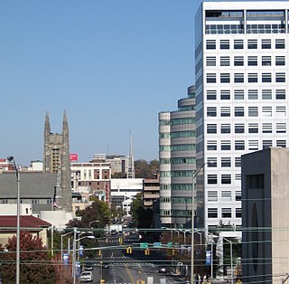
Fairfield County is a county in the southwestern corner of the U.S. state of Connecticut. It is the most populous county in the state and was also its fastest-growing from 2010 to 2020. As of the 2020 census, the county's population was 957,419, representing 26.6% of Connecticut's overall population. The closest to the center of the New York metropolitan area, the county contains four of the state's top 7 largest cities—Bridgeport (1st), Stamford (2nd), Norwalk (6th), and Danbury (7th)—whose combined population of 433,368 is nearly half the county's total population.

Bethel is a town in Fairfield County, Connecticut, United States. As of the 2020 census, the population of the town was 20,358. The town is part of the Western Connecticut Planning Region. The town includes the Bethel Census Designated Place.

Bethel is a census-designated place (CDP) in Fairfield County, Connecticut, United States. It comprises the primary village and surrounding residential land within the town of Bethel. As of the 2010 census, the population of the CDP was 9,549, out of 18,584 in the entire town.

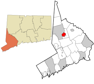
Ridgefield is a census-designated place (CDP) in Fairfield County, Connecticut, United States. It consists of the primary central village in the town of Ridgefield and surrounding residential areas. As of the 2020 census, the population of the CDP was 7,596, out of 25,053 in the entire town.

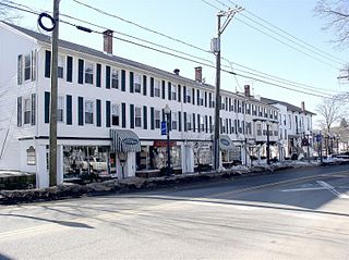
Ridgefield is a town in Fairfield County, Connecticut, United States. Situated in the foothills of the Berkshire Mountains, Ridgefield has a population of 25,033 as of the 2020 census. The town is part of the Western Connecticut Planning Region. The town center, which was formerly a borough, is defined by the U.S. Census Bureau as a census-designated place. The town was settled then quickly incorporated by 1709.

Wingdale is a hamlet and census-designated place (CDP) in the town of Dover in Dutchess County, New York, United States. It was first listed as a CDP prior to the 2020 census.

Branchville is a neighborhood of the town of Ridgefield in Fairfield County, Connecticut, United States, and is also the name of a Metro North railroad station. Branchville was listed as a census-designated place (CDP) prior to the 2020 census.

Route 116 is a 4.24-mile-long (6.82 km) state highway entirely within Ridgefield, Connecticut that runs from the Ridgefield town center at Route 35 to the New York state line, where New York State Route 116 continues towards the hamlet of North Salem.
Topstone is a census-designated place (CDP) in the town of Redding, Fairfield County, Connecticut, United States. It is on the west side of the town and is bordered to the west by the town of Ridgefield.
Compo is a census-designated place (CDP) in the town of Westport, Fairfield County, Connecticut, United States. It is in the south-central part of the town, lying between the Saugatuck River and the neighborhood of Saugatuck to the west, and Compo Cove, Sherwood Millpond, and the neighborhood of Greens Farms to the east. The CDP extends south to Compo Beach on Long Island Sound and north to U.S. Route 1. Interstate 95 crosses the middle of the CDP from east to west, with access from either Saugatuck or Greens Farms.

Wilton Center is a neighborhood/section and census-designated place (CDP) in the town of Wilton in Fairfield County, Connecticut, United States. As of the 2010 census it had a population of 732. The CDP partially overlaps the Wilton Center Historic District.
Indian Field is a census-designated place (CDP) in the town of Greenwich, Fairfield County, Connecticut, United States. It is in the southern part of the town, on a peninsula between Indian Harbor to the west and Cos Cob Harbor to the east. It extends south into Captain Harbor, an inlet of Long Island Sound, and it extends north as far as U.S. Route 1. Interstate 95 crosses the CDP, with access from Exit 4.
Weston is a census-designated place (CDP) in the town of Weston, Fairfield County, Connecticut, United States. It comprises the center of town government and surrounding residential areas. The area was known as "Norfield" from 1795 to 1920, and the Norfield Historic District, which occupies the center of the CDP, around the intersection of Norfield Road and Weston Road, preserves the older name.
West Mountain is a census-designated place (CDP) in the town of Ridgefield, Fairfield County, Connecticut, United States. It is on the west side of Ridgefield and is bordered to the west by the towns of North Salem and Lewisboro in Westchester County, New York. The West Mountain Historic District occupies 425 acres (172 ha) at the center of the CDP, and newer residences occupy portions of the remainder of the CDP.
Route 7 Gateway is a census-designated place (CDP) in the town of Ridgefield, Fairfield County, Connecticut, United States. It is on the east side of Ridgefield, bordered to the east by the town of Redding and to the northeast by the city of Danbury. U.S. Route 7 runs through the center of the CDP, leading north into Danbury and south to Norwalk. Connecticut Route 35 splits off Route 7 to the southwest in the center of the CDP, leading to the center of Ridgefield.
Mamanasco Lake is a census-designated place (CDP) in the town of Ridgefield, Fairfield County, Connecticut, United States. It is northwest of the center of Ridgefield and surrounds a lake of the same name.
Lakes East is a census-designated place (CDP) in the town of Ridgefield, Fairfield County, Connecticut, United States. It is in the northeast part of the town and consists of neighborhoods sited around several small lakes, notably Wataba Lake in the north and Fox Hill Lake in the south.
Lakes West is a census-designated place (CDP) in the town of Ridgefield, Fairfield County, Connecticut, United States. It is in the northern part of the town on the north side of Ridgebury Mountain and extending north into a valley occupied by Lake Windwing. It is bordered to the east by the Lakes East CDP and to the northwest by Ridgebury.

Taylor Corners is a census-designated place (CDP) in the town of New Fairfield, Fairfield County, Connecticut, United States. It is in the southwest corner of the town, bordered to the south by the city of Danbury, to the north by Ball Pond, and to the west by the town of Southeast in Putnam County, New York.

Kellogg Point is a census-designated place (CDP) in the town of New Fairfield, Fairfield County, Connecticut, United States. It is in the southeast part of the town, on the western shore of Candlewood Lake. It is 6 miles (10 km) north of the center of Danbury, Connecticut.


