Middlefield, Connecticut

Last updated
Middlefield, Connecticut
Town of Middlefield
Higbymountain.jpg
The view from Higby Mountain
MiddlefieldCTseal.jpg
Middlefield, Connecticut
Coordinates: 41°31′03″N72°42′44″W / 41.51750°N 72.71222°W / 41.51750; -72.71222
CountryFlag of the United States.svg  United States
U.S. state Flag of Connecticut.svg  Connecticut
County Middlesex
Region Lower CT River Valley
IncorporatedMay 9, 1866
Government
  Type Selectman-town meeting
   First Selectman Robert Yamartino
  SelectmanCarol Bufithis
  SelectmanJames Irish
Area
  Total13.3 sq mi (34.4 km2)
  Land12.7 sq mi (32.9 km2)
  Water0.6 sq mi (1.6 km2)
Elevation
[1]
210 ft (60 m)
Population
 (2020) [2]
  Total4,217
  Density332.0/sq mi (128.2/km2)
Time zone UTC−5 (Eastern)
  Summer (DST) UTC−4 (Eastern)
ZIP code
06455, 06481
Area code(s) 860/959
FIPS code 09-47080
GNIS feature ID0213460 [1]
Website www.middlefieldct.org

Middlefield is a town in Middlesex County, Connecticut, United States. The town is part of the Lower Connecticut River Valley Planning Region. The population was 4,217 at the 2020 census. [3] The town includes the village of Rockfall in the northeast section.

Contents

History

Middlefield, in Middlesex County, is so named because it is halfway between Middletown and Durham, and Middletown and Meriden. For such a small community, Middlefield has an abundance of wonderful history that goes back to the late 17th century and many first settlers of Connecticut. The Old North Burying Ground was established for those living west of Middletown and the first burial was in 1738.

Middlefield became a town in 1866 by an act of the Connecticut Legislature. The town was previously part of the City of Middletown.
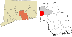
Geography

According to the United States Census Bureau, the town has a total area of 13.3 square miles (34 km2), of which, 12.7 square miles (33 km2) of it is land and 0.6 square miles (1.6 km2) of it (4.65%) is water.

The west side of Middlefield is flanked by the Metacomet Ridge, a mountainous trap rock ridgeline that stretches from Long Island Sound to nearly the Vermont border. Notable mountains of the Metacomet Ridge in Middlefield include Higby Mountain and Besek Mountain. The 50 mile Mattabesett Trail traverses the ridge. The Nature Conservancy manages the summit and ledges of Higby Mountain.

Attractions

Middlefield offers many seasonal activities. Residents can also go ice-skating on one of the many ponds located at the edge of Peckham Park. In the summer Peckham Park has little league baseball games going on almost every day of the week. The smaller kids can play on the jungle gym or play basketball and soccer. Some other summer activities could be golfing on one of the two local golf courses or go to the beach located on Lake Beseck just off of Route 147. Residents can also enjoy picking fruit, playing golf, shopping, and eating at Lyman Orchards. Middlefield is also home to the Powder Ridge Ski Area.

Wadsworth Falls State Park, or simply Wadsworth Falls, is a public recreation and preserved natural area located on the Coginchaug River in the towns of Middletown and Middlefield, Connecticut. The state park's 285 acres (115 ha) offer trails, fishing, swimming, and picnicking. It is managed by the Connecticut Department of Energy and Environmental Protection. [4]

Powder Ridge Ski Area (category Tourist attractions in Middlesex County, Connecticut)

small ski area located inMiddlefield, Connecticut. It began operations on January 22, 1961, the day JFK was inaugurated. It closed in 2007, and has reopened

Registered historic places in town

Education

Middlefield, along with Durham, forms Regional School District 13. [5] It offers a traditional as well as an "Integrated Day" program of education for students in the two communities. The schools in Regional School District 13 are: Brewster Elementary School (K–2), John Lyman Elementary School (grades K–4), Korn Elementary School (grades 3–4), Memorial Middle School (grades 5–6), Strong Middle School (grades 7–8) and Coginchaug Regional High School (grades 9–12). The town is also home to the private pre-school–8 school The Independent Day School. [6]

Town seal

The town seal is a view of Middlefield as seen through a gun sight. The crosshairs represent the gun sight manufacturing that has taken place in Middlefield for many years. The four quadrants of the gun sight are broken into different aspects of the town of Middlefield. The upper left-hand quadrant is a picture of the 1700s saltbox homes that still stand in Middlefield. The upper right-hand quadrant represents the orchards and farmland that make up much of the open space of Middlefield. The lower left-hand quadrant represents many of the outdoor activities that go on in Middlefield such as fishing, hunting, boating, skiing, golfing, and many other activities. The lower right-hand quadrant is the old pistol shop that used to be a major part of Middlefield's makeup. The seal was designed by Donald Ginter.

Brook Falls Brook falls.jpg
Brook Falls

Demographics

Historical population
CensusPop.Note
1870 1,053
1880 928−11.9%
1890 1,0028.0%
1900 845−15.7%
1910 1,03622.6%
1920 1,0471.1%
1930 1,20415.0%
1940 1,2302.2%
1950 1,98361.2%
1960 3,25564.1%
1970 4,13226.9%
1980 3,796−8.1%
1990 3,9253.4%
2000 4,2037.1%
2010 4,4255.3%
2020 4,217−4.7%
U.S. Decennial Census [7]

As of the census [8] of 2000, there were 4,203 people, 1,645 households, and 1,199 families residing in the town. The population density was 330.9 inhabitants per square mile (127.8/km2). There were 1,740 housing units at an average density of 137.0 per square mile (52.9/km2). The racial makeup of the town was 97.76% White, 0.74% African American, 0.02% Native American, 0.36% Asian, 0.02% Pacific Islander, 0.43% from other races, and 0.67% from two or more races. Hispanic or Latino of any race were 1.33% of the population.

There were 1,645 households, out of which 34.0% had children under the age of 18 living with them, 62.4% were married couples living together, 7.3% had a female householder with no husband present, and 27.1% were non-families. 22.3% of all households were made up of individuals, and 11.0% had someone living alone who was 65 years of age or older. The average household size was 2.56 and the average family size was 3.03.

In the town, the population was spread out, with 24.7% under the age of 18, 4.6% from 18 to 24, 30.2% from 25 to 44, 24.8% from 45 to 64, and 15.6% who were 65 years of age or older. The median age was 40 years. For every 100 females, there were 101.1 males. For every 100 females age 18 and over, there were 97.5 males.

The median income for a household in the town was $59,448, and the median income for a family was $69,267. Males had a median income of $43,953 versus $31,487 for females. The per capita income for the town was $25,711. About 0.6% of families and 1.5% of the population were below the poverty line, including 0.8% of those under age 18 and 3.4% of those age 65 or over.

Politics

Middlefield has a selectman-town meeting form of government. The current acting first selectman is Robert Yamartino, whom assumed the office of First Selectman on December 8, 2021, due to the death of incumbent first selectman Ed Bailey. [9] The other current selectman is Carol Bufithis.

Voter registration and party enrollment as of October 25, 2005 [10]
PartyActive votersInactive votersTotal votersPercentage
Democratic 9202094029.63%
Republican 5902361319.32%
Unaffiliated 1,571421,61350.84%
Minor Parties7070.22%
Total3,088853,173100%

State politics

Middlefield is in the 13th state senate district, being represented by Democrat Mary Daugherty Abrams, and in the 82nd district in the state house by Democrat Michael Quinn.

Middlefield has swung for Republican candidates in gubernatorial elections, including in 2018, where Republican Bob Stefanowski won 53% of the vote.

Federal politics

Middlefield is part of Connecticut's 3rd congressional district, and is represented by Rosa DeLauro. It has swung in presidential elections, voting for Joe Biden in 2020 and Barack Obama in 2012 but supporting Donald Trump in 2016.

Related Research Articles

<span class="mw-page-title-main">Middlesex County, Connecticut</span> County in Connecticut, United States

Middlesex County is a county in the south central part of the U.S. state of Connecticut. As of the 2020 census, the population was 164,245. The county was created in May 1785 from portions of Hartford County and New London County.

<span class="mw-page-title-main">Berlin, Connecticut</span> Town in Connecticut, United States

Berlin is a town in the Capitol Planning Region, Connecticut, United States. The population was 20,175 at the 2020 census. It was incorporated in 1785. The geographic center of Connecticut is located in the town. Berlin is residential and industrial, and is served by the Amtrak station of the same name. Berlin also has two hamlets: Kensington and East Berlin.

<span class="mw-page-title-main">Bloomfield, Connecticut</span> Town in Connecticut, United States

Bloomfield is a suburb of Hartford in the Capitol Planning Region, Connecticut, United States. The town's population was 21,535 at the 2020 census. Bloomfield is best known as the headquarters of healthcare services company Cigna.

<span class="mw-page-title-main">East Granby, Connecticut</span> Town in Connecticut, United States

East Granby is a town in the Capitol Planning Region, Connecticut, United States. The population was 5,214 at the 2020 census.

<span class="mw-page-title-main">Plainville, Connecticut</span> Town in Connecticut, United States

Plainville is a town in Hartford County, Connecticut, United States. The town is part of the Capitol Planning Region. The population was 17,525 at the 2020 census.

<span class="mw-page-title-main">Cromwell, Connecticut</span> Town in Connecticut, United States

Cromwell is a town in Middlesex County, Connecticut, United States located in the middle of the state. The town is part of the Lower Connecticut River Valley Planning Region. The population was 14,225 at the 2020 census.

<span class="mw-page-title-main">Killingworth, Connecticut</span> Town in Connecticut, United States

Killingworth is a town in Middlesex County, Connecticut, United States. The town is part of the Lower Connecticut River Valley Planning Region. The population was 6,174 at the 2020 United States Census.

<span class="mw-page-title-main">Middletown, Rhode Island</span> Town in Rhode Island, United States

Middletown is a town in Newport County, Rhode Island, United States. The population was 17,075 at the 2020 census. It lies to the south of Portsmouth and to the north of Newport on Aquidneck Island, hence the name "Middletown."

<span class="mw-page-title-main">Middletown, Connecticut</span> City in Connecticut, United States

Middletown is a city in Middlesex County, Connecticut, United States. Located along the Connecticut River, in the central part of the state, it is 16 miles south of Hartford. Middletown is the largest city in the Lower Connecticut River Valley Planning Region. In 1650, it was incorporated by English settlers as a town under its original Native American name, Mattabeseck, after the local indigenous people, also known as the Mattabesett. They were among the many tribes along the Atlantic coast who spoke Algonquian languages. The colonists renamed the settlement in 1653.

<span class="mw-page-title-main">Ridgefield, Connecticut</span> Town in Connecticut, United States

Ridgefield is a town in Fairfield County, Connecticut, United States. Situated in the foothills of the Berkshire Mountains, the 300-year-old community had a population of 25,033 at the 2020 census. The town is part of the Western Connecticut Planning Region. The town center, which was formerly a borough, is defined by the U.S. Census Bureau as a census-designated place.

<span class="mw-page-title-main">Durham, Connecticut</span> Town in Connecticut, United States

Durham is a town in Middlesex County, Connecticut, United States. Durham is a former farming village on the Coginchaug River in central Connecticut. The town is part of the Lower Connecticut River Valley Planning Region. The population was 7,152 at the 2020 census. Every autumn, the town hosts the Durham Fair, the largest volunteer agricultural fair in New England.

<span class="mw-page-title-main">Coginchaug River</span> River in Connecticut, United States

The Coginchaug River in Connecticut, with a watershed including 39 sq mi of forests, pastures, farmland, industrial, and commercial areas, is the main tributary of the Mattabesset River. It is 16.1 mi long, and the river flows northwards from a point approximately 1.8 mi south of the Durham line in Guilford, Connecticut, into Durham and then Middlefield, meeting the Mattabesset in Middletown, about 0.8 miles (1.3 km) upstream of the Connecticut River. The name "Coginchaug" comes from a local Native American name for the Durham area and it was the original name for the town. It has been said to mean "The Great Swamp", and is a reference to the meadows found in the central part of town.

<span class="mw-page-title-main">Lower Connecticut River Valley</span> Regional planning agency in the Lower Connecticut River Valley

The Lower Connecticut River Valley is a region of the state of Connecticut around the juncture where the Connecticut River meets Long Island Sound. It includes towns in Middlesex County and the western edge of New London County. It is located in the southeastern-central part of the state and includes the seventeen towns of Chester, Clinton, Cromwell, Deep River, Durham, East Haddam, East Hampton, Essex, Haddam, Killingworth, Lyme, Middlefield, Middletown, Old Lyme, Old Saybrook, Portland and Westbrook.

<span class="mw-page-title-main">Coginchaug Regional High School</span> Public school in Durham, Connecticut, United States

Coginchaug Regional High School is a public high school located in Durham, Connecticut and is named after the Coginchaug River. It is part of Regional School District #13, which encompasses the communities of Durham, Middlefield and Rockfall, Connecticut. Coginchaug is attended by students in grades 9 through 12.

<span class="mw-page-title-main">Metacomet Ridge</span> Mountain range in Connecticut and Massachusetts, United States

The Metacomet Ridge, Metacomet Ridge Mountains, or Metacomet Range of southern New England is a narrow and steep fault-block mountain ridge known for its extensive cliff faces, scenic vistas, microclimate ecosystems, and rare or endangered plants. The ridge is an important recreation resource located within 10 miles (16 km) of more than 1.5 million people, offering four long-distance hiking trails and over a dozen parks and recreation areas, including several historic sites. It has been the focus of ongoing conservation efforts because of its natural, historic, and recreational value, involving municipal, state, and national agencies and nearly two dozen non-profit organizations.

<span class="mw-page-title-main">Besek Mountain</span> Mountain in United States of America

Besek Mountain also known as Black Mountain, est. 840 feet (260 m), is a traprock mountain ridge located 4.75 miles (7.6 km) southeast of Meriden, Connecticut. It is part of the narrow, linear Metacomet Ridge that extends from Long Island Sound near New Haven, Connecticut, north through the Connecticut River Valley of Massachusetts to the Vermont border. Besek Mountain is known for its 3-mile (4.8 km) long line of open cliffs, unique microclimate ecosystems, and rare plant communities. The mountain is traversed by the 51-mile (82 km) Mattabesett Trail, and is home to the Powder Ridge Ski Area.

<span class="mw-page-title-main">Higby Mountain</span> Traprock mountain in the American state of Connecticut

Higby Mountain or Mount Higby 892 feet (272 m), is a traprock mountain ridge located 3.75 miles (6.04 km) east of Meriden, Connecticut. It is part of the narrow, linear Metacomet Ridge that extends from Long Island Sound near New Haven, Connecticut, north through the Connecticut River Valley of Massachusetts to the Vermont border. Higby Mountain is known for its high cliff faces, unique microclimate ecosystems, and rare plant communities. It rises steeply 600 feet (180 m) above the Quinnipiac River valley and the city of Meriden to the west as a continuous 2-mile (3 km) long ledge. The mountain is traversed by the 50-mile (80 km) Mattabesett Trail.

<span class="mw-page-title-main">Connecticut Route 157</span> State highway in Middlesex County, Connecticut, US

Route 157 is a state highway in central Connecticut from northwestern Durham, through Middlefield to Middletown.

<span class="mw-page-title-main">Portland, Connecticut</span> Town in Connecticut, United States

Portland is a town in Middlesex County, Connecticut, United States. The town is part of the Lower Connecticut River Valley Planning Region. The population was 9,384 at the 2020 census. The town center is listed as a census-designated place (CDP). It is situated across the Connecticut River from Middletown.

References

  1. 1 2 U.S. Geological Survey Geographic Names Information System: Middlefield, Connecticut
  2. U.S. Census Bureau Population Estimates Archived 2011-06-29 at the Wayback Machine
  3. "Census - Geography Profile: Middlefield town, Middlesex County, Connecticut" . Retrieved December 17, 2021.
  4. "Wadsworth Falls State Park". State Parks and Forests. Connecticut Department of Energy and Environmental Protection. September 2017. Retrieved October 3, 2017.[ verification needed ]
  5. Regional School District 13 web site
  6. "Independent Day School chief hired". The Day . June 9, 2000. Retrieved September 13, 2013.
  7. "Census of Population and Housing". Census.gov. Retrieved June 4, 2015.
  8. "U.S. Census website". United States Census Bureau . Retrieved 2008-01-31.
  9. Masse, Andrew. "Middlefield First Selectman unexpectedly passes away". WFSB. Retrieved 10 December 2021.
  10. "Registration and Party Enrollment Statistics as of October 25, 2005" (PDF). Connecticut Secretary of State. Archived from the original (PDF) on September 23, 2006. Retrieved 2006-10-02.