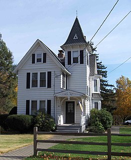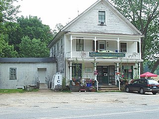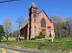
North Branford is a town in New Haven County, Connecticut, United States. The population was 13,544 at the 2020 census. The town is primarily known for agriculture and for other points of interest including Lake Gaillard and Northford Ice Pavilion. Wallingford, Durham, and North Haven border it to the north- East Haven to the west, Guilford to the east, and Branford to the south.

Branford Center is a neighborhood and census-designated place (CDP) in the town of Branford, Connecticut, United States. The CDP encompasses the traditional town center area and the area known as Branford Point. The population of the CDP was 5,819 at the 2010 census.

Connecticut Route 80 is a 25.9 mile highway that runs through south-central Connecticut. The west end is at CT 17 in Quinnipiac Meadows neighborhood of New Haven, and the east end is at CT 154 in Deep River. Route 80 runs within 5 miles of many town squares- including Downtown New Haven.

The Worthington Ridge Historic District encompasses the historic town center of Berlin, Connecticut. It runs mostly along Worthington Ridge Road from the intersection of Mill Street to Sunset Lane. This section of road was historically part of the Boston Post Road laid out in 1673, and is now lined by a diversity of residential architecture and several of the town's civic buildings. In 1974, the Berlin Historic District was formed in order to preserve the integrity of the architecture of the village. The district was listed on the National Register of Historic Places in 1989.

The Branford Point Historic District is a historic district in Branford, Connecticut. It was listed on the National Register of Historic Places in 1988. It includes a significant portion of the Branford Point neighborhood, generally considered to be the area along the west side of the Branford Harbor to the Amtrak railroad tracks. It is bounded on the west by the Short Beach neighborhood, on the north by Branford Center, and on the east by the Branford River. Harbor Street, Maple Avenue, and Stannard Avenue are the main thoroughfares of the neighborhood. In the 2000 Census, Branford Point was included by the U.S. Census Bureau in the Branford Center census-designated place.

The South Britain Historic District encompasses the core of the unincorporated village of South Britain in Southbury, Connecticut, United States. The village arose in the 18th century as an industrial center serving the surrounding agricultural community, powered by the Pomperaug River, and rivalled the town center of Southbury in importance. It was listed on the National Register of Historic Places in 1987.

The Milton Center Historic District encompasses the historic 19th-century village center of Milton in the northwestern part of the town of Litchfield, Connecticut. Basically linear, it stretches from Milton Cemetery in the west to the junction of Milton and Shearshop Roads in the east, including houses, churches, schools, and the remains of industrial sites. The district was listed on the National Register of Historic Places in 1986.

Marion is a neighborhood in the town of Southington in Hartford County, Connecticut, United States. It is generally the area in the vicinity of the intersection of Route 322 and Marion Avenue just north of the Cheshire town line.

The Greenwich Avenue Historic District is a historic district representing the commercial and civic historical development of the downtown area of the town of Greenwich, Connecticut. The district was listed on the National Register of Historic Places on August 31, 1989. Included in the district is the Greenwich Municipal Center Historic District, which was listed on the National Register the year before for the classical revival style municipal buildings in the core of Downtown. Most of the commercial buildings in the district fall into three broad styles, reflecting the period in which they were built: Italianate, Georgian Revival, and Commercial style. The district is linear and runs north–south along the entire length of Greenwich Avenue, the main thoroughfare of Downtown Greenwich, between U.S. Route 1 and the New Haven Line railroad tracks.

The New Preston Hill Historic District encompasses a small rural 19th-century village center in the New Preston area of the town of Washington, in Litchfield County, Connecticut. Settled in the late 18th century, it is distinctive for its examples of stone architecture, include a rare Federal period stone church. The district, located at the junction of New Preston Road with Gunn Hill and Findlay Roads, was listed on the National Register of Historic Places in 1985.

The Mansfield Center Historic District encompasses the historic early village center of Mansfield, Connecticut. First settled about 1692, it is one of the oldest settlements in Tolland County, and retains a strong sense of 18th century colonial layout. It extends along Storrs Street extending from Chaffeeville Road in the north to Centre Street in the south, and was listed on the National Register of Historic Places in 1972.

The Grafton Village Historic District encompasses the historic village center of the town of Grafton, Vermont. The village was developed in the early-to-mid 19th century, and has retained the character of that period better than many small communities in the state. The district was listed on the National Register of Historic Places in 2010.

The Houghtonville Historic District encompasses a cluster of residential properties that are all that remain of one of the early industrial areas of Grafton, Vermont. Located west of Grafton Village on Houghtonville Road, it includes ten well-preserved 19th-century houses, some located on properties where early mills once stood. The district was listed on the National Register of Historic Places in 2015.

The Cheshire Historic District encompasses the historic town center of Cheshire, Connecticut. Centered on the junction of Main Street and Academy Road, the district's architecture is reflective of the town's development over two centuries, and includes many of its civic buildings. It was listed on the National Register of Historic Places in 1986.

The Fourth District School is a historic district school building on Old Post Road in North Branford, Connecticut. Built about 1800, it is a rare surviving example of a late 18th-century schoolhouse in Connecticut. It was moved to its present location from a more rural setting in 1928. It was listed on the National Register of Historic Places in 1985. It is now owned and maintained by the Totoket Historical Society as a museum property.

The Howd-Linsley House is a historic house at 1795 Middletown Avenue in the Northford area of North Branford, Connecticut. Of uncertain 18th-century construction, it is a candidate as the oldest surviving building in the town, and a good example of period residential architecture. It was listed on the National Register of Historic Places in 1986.

The Maltby-Stevens Factory Site is a historic archaeological industrial site in North Branford, Connecticut. Located on the banks of the Farm River, the factory was a major local employer in the second half of the 19th century, producing buttons and dried coconut, among a diversity of products. The site, now foundations and water power infrastructure remnants, was listed on the National Register of Historic Places in 2000.

The Middlebury Center Historic District encompasses the historic civic and religious center of Middlebury, Connecticut. Centered at the junction of North and South Streets with Whittemore Road, the district includes churches, schools and municipal buildings, many from the late 19th or early 20th centuries, as well as a diversity of residential architecture. The district includes all the residences along the entire length of North Street, which leads up to the town green. The district was listed on the National Register of Historic Places in 1985.

The North Branford Center Historic District encompasses the historic town center of North Branford, Connecticut. Centered at the junction of North Street and Foxon Road, it has been the center of the town's civic and religious life since the early 18th century. The district includes the town hall, library, Congregational Church, and residential architecture dating to the early days. The district was listed on the National Register of Historic Places in 1999.

The Pines Bridge Historic District encompasses a historic industrial and commercial village in North Haven, Connecticut. Located just west of the town green and centered around the Broadway bridge over the Quinnipiac River, the village developed first as a commercial hub around a 17th-century bridge at the site, and then as a small industrial village in the 19th century. Now mainly residential, it was listed on the National Register of Historic Places in 1988.


