
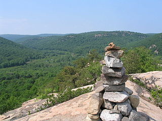
The Adirondack Mountains are a massif of mountains in Northeastern New York which form a circular dome approximately 160 miles (260 km) wide and covering about 5,000 square miles (13,000 km2). The region contains more than 100 peaks, including Mount Marcy, which is the highest point in New York at 5,344 feet (1,629 m). The Adirondack High Peaks, a traditional list of 46 peaks over 4,000 feet (1,200 m), are popular hiking destinations. There are over 200 named lakes with the number of smaller lakes, ponds, and other bodies of water reaching over 3,000. Among the named lakes around the mountains are Lake George, Lake Placid, and Lake Tear of the Clouds. The region has over 1,200 miles (1,900 km) of river.

Canadarago Lake is a 1,917-acre (7.76 km2) lake located in Otsego County, New York and is the source of Oaks Creek. The Village of Richfield Springs is located at the lake's northern end. It is the second largest lake in Otsego County, lying to the west of and parallel to the larger Otsego Lake. The lake's name is also spelled "Candajarago Lake" or "Caniadaraga Lake".
The Finger Lakes Trail consists of a network of trails in New York. The trail system is administered by the Finger Lakes Trail Conference (FLTC), a non-profit 501(c)(3) organization composed primarily of volunteers.
Sterling Forest State Park is a 22,180-acre (89.8 km2) state park located in the Ramapo Mountains in Orange County, New York. Established in 1998, it is among the larger additions to the New York state park system in the last 50 years.
Popolopen is the name of several related landmarks mainly within the Hudson Highlands of Orange County, New York. These include a peak, Popolopen Torne—or simply "The Torne", and a short and steep-sided nearby valley officially called Hell Hole, but often Popolopen Gorge. Popolopen Creek runs through this valley. The Popolopen Bridge spans its mouth at the Hudson River and is crossed by Route 9W. Popolopen Lake feeds the headwaters of its namesake creek. Despite local usage, the United States Board on Geographical Names recognizes only the lake, creek and bridge as bearing the name "Popolopen."

The New York State Department of Environmental Conservation is a department of New York state government. The department guides and regulates the conservation, improvement, and protection of New York's natural resources; manages Forest Preserve lands in the Adirondack and Catskill parks, state forest lands, and wildlife management areas; regulates sport fishing, hunting and trapping; and enforces the state's environmental laws and regulations. Its regulations are compiled in Title 6 of the New York Codes, Rules and Regulations. It was founded in 1970, replacing the Conservation Department, and is headed by Basil Seggos.

Eighteen Mile Creek is a tributary of Lake Erie located in southern Erie County, New York, United States. The creek is the second largest tributary of Lake Erie in New York State.

Alder Lake is a body of water that is located in Hardenburgh, Ulster County in the lower Hudson Valley region of New York. It is located in the Balsam Lake State Forest Preserve, which is a part of the Catskill Forest Preserve. The lake was man made by the Coykendall family in the 1900s. It is most often used for recreational uses and family day trips.
Lake Moraine is a mesotrophic lake located 2.5 miles (4.0 km) northeast of Hamilton, New York. The lake is 261 acres (1.06 km2), consisting of two basins which are separated by a causeway and interconnected by a culvert. The northern basin is 79 acres (0.32 km2) and is relatively shallow with a maximum depth of 12 feet (3.7 m) and average depth of 3.7 feet (1.1 m). The larger southern basin is 172 acres (0.70 km2) and has a maximum depth of 45 feet (14 m) and an average depth of 17.7 feet (5.4 m). Payne Brook is the lake's outflow that flows into the Chenango River.
East Caroga Lake is located in the Town of Caroga by Caroga Lake, New York. The lake provides excellent warm water fishing and rainbow trout fishing. The lake is connected to West Caroga Lake by a small channel. Origin of the name, "Caroga" is derived from the once nearby Indian Village known as "Caroga".
West Caroga Lake is located in the Town of Caroga by Caroga Lake, New York. The lake is known for excellent warm water fishing, but it also offers the only location to fish for splake in the county. The lake is connected to East Caroga Lake by a small channel. Origin of the name, "Caroga" is derived from the once nearby Indian Village known as "Caroga".

Canada Lake is located in the Town of Caroga in Fulton County in the U.S. state of New York. Unlike the nearby Caroga lakes, Canada Lake is very deep which provides colder water for species such as trout to survive. There is an annual draw down on the lake by way of a control structure on the outlet of Stewart Landing. The impoundment of this water has created a lake complex of Lily Lake, Canada Lake, West Lake and Green Lake.
Taylor Pond is a lake located in Clinton County, New York in the Adirondack Park. It is located within, and is the namesake of, the Taylor Pond Wild Forest. The lake has public access via a DEC campground, which includes a beach ramp boat launch. Taylor Pond is surrounded by public land, with no camps located on the lake.

Kane Mountain is a mountain in the Adirondack Mountains region of New York. It is located north of the Hamlet of Canada Lake. The Kane Mountain Fire Observation Station is located on top of the mountain. Sheeley Mountain is located south-southwest, Canada Lake is located south, Camelhump is located east and Pine Lake is located north of Kane Mountain.
Ambler State Forest is a forested region in Chenango County, New York, United States. It is part of the Between Rivers Unit Management Plant. The forest consists of native hardwoods and species of softwoods. It covers a land area of 629 acres.
Blue Lake, also called Sterling Forest Lake, is located in Sterling Forest State Park, New York. As of 2018, the Blue Lake Reservoir System, operated by SUEZ North America, supplies drinking water from Blue Lake to about 1,200 people.

The Opalescent River is a river in Essex County, New York. It is both a tributary of and the longest source of the Hudson River. Part of the river is designated by New York State as a Wild River in the Wild, Scenic, and Recreational Rivers system.
Pharaoh Mountain is a mountain in the Adirondack Mountains region of New York. It is located south of Paradox in Essex County and is contained within the Pharaoh Lake Wilderness Area. The mountain is the highest in the wilderness area, and is located upon the northwest shore of Pharaoh Lake. In April 1910, a fire observation station was established on the mountain but no tower was needed due to lack of tree cover on the mountain. In 1918, a 35-foot-tall Aermotor LS40 tower was built on the mountain. The tower ceased fire watching operations in 1987 and was removed in 1992.

The Saddles State Forest is a state forest in New York State. The area was purchased by The Nature Conservancy and was sold to the state in 2013. The two peaks that reach 1,600 feet are purportedly the reasoning behind the naming of the forest. The forest contains over 2,250 feet of undeveloped Lake Champlain shoreline. The area is open for recreation year round. A steep unmaintained gravel road from New York State Route 22 provides access to a parking area. There are no marked DEC trails, although unmaintained logging trails and unofficial hiking paths can be found throughout the forest.
Bucktooth State Forest is in Cattaraugus County in western New York. It covers 2,248 acres (910 ha) of land in the towns of Little Valley, Napoli and Salamanca. The North Country National Scenic Trail passes through Bucktooth State Forest. Hiking, hunting, fishing, snowshoeing, and cross-country skiing are among activities available in the park. Wildlife includes white-tailed deer, skunk, red fox, mink, coyote, ruffed grouse, and turkey. A draft management plan has been created for the area.

