
Joshua Michael Peck is an American actor, voice actor, comedian, and YouTube personality. He is best known for playing Josh Nichols alongside Drake Bell's character in the Nickelodeon sitcom Drake & Josh from 2004 to 2007, and in its two television films in 2006 and 2008. He began his career as a child actor in the late 1990s and early 2000s, and became known to young audiences after his role on The Amanda Show from 2000 to 2002. He has since acted in films such as Mean Creek (2004), Drillbit Taylor (2008), The Wackness (2008), ATM (2012), Red Dawn (2012), Battle of the Year (2013), Danny Collins (2015), and Take the 10 (2017). He has voiced Eddie in the Ice Age franchise since Ice Age: The Meltdown (2006), and voiced Casey Jones in the Nickelodeon animated series Teenage Mutant Ninja Turtles (2012–17). He also starred with John Stamos in the Fox comedy series Grandfathered (2015–16).

The Rio Hondo is a tributary of the Los Angeles River in Los Angeles County, California, approximately 16.4 miles (26.4 km) long. As a named river, it begins in Irwindale and flows southwest to its confluence in South Gate, passing through several cities. Above Irwindale its main stem is known as Santa Anita Creek, which extends another 10 miles (16 km) northwards into the San Gabriel Mountains where the source, or headwaters, of the river are found.

Franklin Creek State Natural Area is an Illinois state park on 664 acres (269 ha) in Lee County, Illinois, United States. Franklin Creek State Natural Area was dedicated in 1982, making it the 24th nature preserve in Illinois.
Eagle Creek State Park is an Illinois state park on 11,100 acres (4,492 ha)Lake Shelbyville, and is approx 34,000 acres in Shelby County, Illinois, United States.

Mallory Township is a township in Clayton County, Iowa, USA. As of the 2010 census, its population was 395, down from 411 ten years earlier.
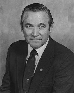
Dallas Lynn Peck was an American geologist and vulcanologist. Peck was a native of Cheney, Washington. He received his bachelor's (1951) and master's (1953) degrees in geology from the California Institute of Technology. He received a doctorate in geology from Harvard University in 1960.

Coyote Creek is a principal tributary of the San Gabriel River in northwest Orange County, southeast Los Angeles County, and southwest Riverside County, California. It drains a land area of roughly 41.3 square miles (107 km2) covering five major cities, including Brea, Buena Park, Fullerton, La Habra, and La Palma. Some major tributaries of the creek in the highly urbanized watershed include Brea Creek, Fullerton Creek, and Carbon Creek. The mostly flat creek basin is separated by a series of low mountains, and is bounded by several small mountain ranges, including the Chino Hills, Puente Hills and West Coyote Hills.
The Canajoharie Creek flows into the Mohawk River in the village of Canajoharie, New York. The name "Canajoharie" is said to be a Mohawk language term meaning "the pot that washes itself," referring to the "Canajoharie Boiling Pot," a circular gorge in the Canajoharie Creek, just south of the village of Canajoharie, New York.
The Nowadaga Creek basin drains portions of the towns of Danube, Stark, and Little Falls, as well as a small portion of the town of Warren, in southern Herkimer County before converging with the Mohawk River in Indian Castle, New York. The drainage basin is approximately 49 percent forested. The creek has an average slope of 1.7 percent over its entire stream length of 10.0 miles. On a 1790 land patent map it is spelled "Inchanando Creek".
Moyer Creek starts at Wheelock Pond near Jerusalem Hill, New York. Past Gulph, New York Moyer Creek follows a deep ravine, the Frankfort Gorge, south towards Frankfort, New York before converging with the Mohawk River in Frankfort, New York. The headwaters of Moyer Creek rise within a half mile of the source of the Unadilla River which is the most northerly headwater source of the Susquehanna and the closest to the Mohawk River.
The Cobleskill Creek starts at the mouth of the Schenevus Creek in Richmondville, New York. It flows through Cobleskill, New York before converging with the Schoharie Creek in Central Bridge, New York.

The Schenevus Creek is a river located in southern Otsego County, New York. The creek flows through Worcester and Schenevus before converging with the Susquehanna River in Colliersville, New York.
Charlotte Creek is a river located in Delaware County, New York. Charlotte Creek borders the southern border of Otsego County, New York for a few miles near the mouth. The creek converges with the Susquehanna River by Emmons, New York.
Panther Mountain is a mountain located in Central New York of New York near Fly Creek, New York and Schuyler Lake, New York. The east side of Panther Mountain drains into Fly Creek and the west side drains into Oaks Creek and Canadarago Lake.
Gifford Hill is a small mountain chain in the Central New York Region of New York. It is located northeast of Oneonta, New York. It is made of three main peaks the highest being 1928 feet. Gifford Hill is named for the Gifford Family who moved to the area in 1803 and settled along the Oneonta Creek on what is now called Gifford Hill.