Columbia County, New York

Last updated

Columbia County
First Columbia County courthouse, Claverack, NY.jpg
First Columbia County Courthouse in Claverack
Flag of Columbia County, New York.svg
Columbia County ny seal.png
Map of New York highlighting Columbia County.svg
Location within the U.S. state of New York
New York in United States.svg
New York's location within the U.S.
Coordinates: 42°15′N73°38′W / 42.25°N 73.63°W / 42.25; -73.63
CountryFlag of the United States.svg United States
StateFlag of New York.svg  New York
FoundedApril 4, 1786;237 years ago (1786-04-04) [nb 1]
Named for Christopher Columbus
Seat Hudson
Largest city Hudson
Area
  Total648 sq mi (1,680 km2)
  Land635 sq mi (1,640 km2)
  Water14 sq mi (40 km2)  2.1%
Population
 (2020)
  Total61,570 [1]
  Density97/sq mi (37/km2)
Time zone UTC−5 (Eastern)
  Summer (DST) UTC−4 (EDT)
Congressional district 19th
Website www.columbiacountyny.com
William Henry Ludlow House, built in 1786, Hudson, NY William Henry Ludlow house, Claverack, Columbia County, NY, USA.jpg
William Henry Ludlow House, built in 1786, Hudson, NY

Columbia County is a county located in the U.S. state of New York. As of the 2020 census, the population was 61,570. [2] The county seat is Hudson. [3] The name comes from the Latin feminine form of the name of Christopher Columbus, which was at the time of the formation of the county a popular proposal for the name of the United States.

Contents

Columbia County comprises the Hudson, NY Micropolitan Statistical Area, which is also included in the Albany-Schenectady, NY Combined Statistical Area. It is on the east side of the Hudson River and is considered to be part of the Upper Hudson Valley.

History

At the arrival of European colonists the area was occupied by the indigenous Mohican Indians. To the west of the river were the Mohawk and other four tribes of the Iroquois Confederacy, extending past what is now the border of New York state. The first known European exploration of Columbia County was in 1609, when Henry Hudson, an English explorer sailing for the Dutch, ventured up the Hudson River. An accident to his craft forced him to stop at what is now known as Columbia County, and search for food and supplies. [4] In 1612, the Dutch established trading posts and minor settlements, constructing New Amsterdam (today's New York City) and Fort Orange (Albany). Fort Orange became a center of the fur trade with the Mohawk people. Traders began to stop at midway points along the Hudson River, on their travels between New Amsterdam and Fort Orange. Small settlements arose along the river to supply the traders' ships. [4]

In 1649, Dutch colonists purchased land near Claverack and again in 1667. [5] As more Dutch arrived, the region slowly developed. In 1664, the English took over New Netherland and renamed it the Province of New York; they also renamed Fort Orange as Albany. [5]

In the late 17th century, Robert Livingston, a Scots immigrant by way of Rotterdam, built on his connections as Indian agent in the colony and purchased two large portions of land from the Native Americans. He gained much larger grants from the provincial government, for a total of 160,240 acres. He was made lord of Livingston Manor by the Crown, with all its perquisites, and started to develop the property with tenant farmers. In 1710, he sold 6,000 acres of his property to Queen Anne of Great Britain for use as work camps and resettlement of Palatine German refugees. The Crown had supported their passage to New York, and they were to pay off the costs as indentured labor. [6] Some 1200 Palatine Germans were brought to Livingston Manor (now known as Germantown). New York's Governor Hunter had also helped with these arrangements: the workers were to manufacture naval stores (e.g., pitch, resin, and turpentine) from the pine trees in the Catskill Mountains.

They were promised land for resettlement after completing their terms of indenture. [5] They were refugees from years of religious fighting along the border with France, as well as crop failures from a severe winter. [6] Work camps were established on both sides of the Hudson River. The Germans quickly established Protestant churches at the heart of their community, which recorded their weddings, births and deaths, among the first vital records kept in the colony. [6]

1879 map of the Vermont Central Railway 1879 CV map only.jpg
1879 map of the Vermont Central Railway

After many years, some of the colonists were granted land in the frontier of the central Mohawk Valley west of present-day Little Falls in the 100 lots of the Burnetsfield Patent; in the Schoharie Valley, and other areas, such as Palatine Bridge along the Mohawk River west of Schenectady. They were buffer communities between the British settlements and the Iroquois and French (the latter located mostly in Canada.)

Columbia County was formed in 1786 after the American Revolutionary War from portions of Albany County, [nb 1] once a vast area until new communities were developed and jurisdictions were organized. In 1799, the southern boundary of Columbia County was moved southward to include that portion of Livingston Manor located in Dutchess County.

In the nineteenth century, the Vermont Central Railway was constructed to the area. It provided transportation north towards Rutland and Burlington, Vermont, and south towards the major junction town of Chatham, New York, for travel to points west, south and east.

A large number of LGBT artists and writers settled in Columbia County in the late 20th century, including Ellsworth Kelly, who moved to the county in 1970, followed by James Ivory and Ismail Merchant (1975) and the poet John Ashbery (1978). [7]

Government and politics

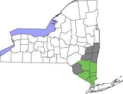
United States presidential election results for Columbia County, New York [8]
Year Republican Democratic Third party
No.%No.%No.%
2020 14,46440.62%20,38657.25%7602.13%
2016 13,75644.51%15,28449.46%1,8626.03%
2012 12,22541.97%16,22155.69%6832.34%
2008 13,33742.43%17,55655.85%5401.72%
2004 14,45746.48%15,92951.21%7172.31%
2000 13,15345.83%13,48947.00%2,0567.16%
1996 10,32437.67%12,91047.11%4,16915.21%
1992 11,56839.81%11,36839.12%6,12021.06%
1988 15,11156.12%11,58543.03%2280.85%
1984 18,81467.46%8,96032.13%1170.42%
1980 13,94653.08%9,50036.16%2,82810.76%
1976 15,87159.72%10,51439.56%1890.71%
1972 17,99570.27%7,55829.51%570.22%
1968 13,85760.03%7,76233.62%1,4666.35%
1964 9,02338.30%14,51661.62%190.08%
1960 15,89364.44%8,74735.46%240.10%
1956 19,00479.17%4,99920.83%00.00%
1952 17,53974.16%6,07525.69%350.15%
1948 13,75865.89%6,52731.26%5952.85%
1944 13,05565.02%6,96934.71%540.27%
1940 13,52761.04%8,59138.76%440.20%
1936 13,03460.14%8,37538.64%2641.22%
1932 11,66755.74%9,08343.39%1810.86%
1928 14,00067.92%6,40331.06%2091.01%
1924 10,77463.70%5,46632.32%6743.98%
1920 9,28462.63%5,20335.10%3362.27%
1916 5,31451.35%4,93847.71%970.94%
1912 3,74138.01%4,59946.73%1,50115.25%
1908 5,72651.54%5,09745.88%2862.57%
1904 5,99652.38%5,24545.82%2061.80%
1900 6,47855.61%4,95342.52%2171.86%
1896 6,65458.46%4,37338.42%3553.12%
1892 5,38445.60%5,86849.70%5554.70%
1888 6,44750.46%6,03747.25%2922.29%
1884 6,42451.45%5,85446.88%2091.67%

Voters in Columbia County since the mid-19th century have mostly elected Republicans to office. But from 1996 to 2007, new voter registrations by Democrats have outpaced those by Republicans by a margin of 4 to 1. [9] Democrats have been able to win the county in every presidential election since 1996, with Joe Biden's 57% of the vote in 2020 being the highest for a Democrat in the county since 1964.

Voter registration as of April 1, 2016 [10]
PartyActive votersInactive votersTotal votersPercentage
Democratic 13,0371,24114,27833.05%
Republican 11,77472412,49828.93%
Unaffiliated10,7241,00711,73127.16%
Other [nb 2] 4,2254674,69210.86%
Total39,7603,43943,199100%

Geography

According to the U.S. Census Bureau, the county has a total area of 648 square miles (1,680 km2), of which 635 square miles (1,640 km2) is land and 14 square miles (36 km2) (2.1%) is water. [11]

Columbia County is in the southeast south-to-central part of New York State, southeast of Albany and immediately west of the Massachusetts border. The western border is the Hudson River.

The landscapes of the county were among the scenes depicting by the Hudson River School, a mid-19th century art movement. [7]

The terrain is gentle, rolling hills, rising sharply into the Taconic and Berkshire Mountains along the state line. To the west lie the Hudson River and the Catskill Mountains.

The Catskill Mountains from Olana in southern Columbia County Catskills across the Hudson.jpg
The Catskill Mountains from Olana in southern Columbia County

The highest point is on the Massachusetts state line, near the summit of Alander Mountain, at approximately 2,110 feet (640 m) above sea level, in the town of Copake. The lowest point is at or near sea level, along the Hudson.

Columbia County is accessible by two limited-access highways. The Taconic State Parkway, which is not accessible to trucks or commercial traffic, runs through the center of the county from south to north, ending at an interchange with Interstate 90 and connecting the county with points south. Columbia County is the last New York county located along eastbound Interstate 90 (and the first county along westbound I-90), which passes through the towns of Canaan and Chatham as the Berkshire Connector portion of the New York Thruway. I-90 has two exits within the county; for the southbound Taconic State Parkway in Chatham, and for NYS Route 22 in Canaan. Depending on precise location within the county, road travel distance to New York City ranges between 96 and 145 miles (154 and 233 km).

Several other major routes cross Columbia County including north–south U.S. Route 9, east–west NYS Route 23, north–south NYS Route 22 and a short portion of east–west U.S. Route 20 in the county's northeastern corner.

Rivers and streams

The Roeliff Jansen Kill near Rhinebeck-Hudson Road in Livingston, New York. Roeliff Jansen Kill, Livingston, New York.jpg
The Roeliff Jansen Kill near Rhinebeck-Hudson Road in Livingston, New York.

The Hudson River forms the western border of the county. Other notable creeks include; the Ancram Creek, Claverack Creek, Copake Creek, Kinderhook Creek, Roeliff-Jansen Kill, and Valatie Kill. The Rossman Falls and Stuyvesant Falls lie on the Kinderhook Creek. Notable lakes and ponds include Copake Lake, Kinderhook Reservoir, Queechy Lake, and Lake Taghkanic.

A farm on Columbia County Route 3 in Ancram, New York. Herondale Farm sign, Ancram, New York.jpg
A farm on Columbia County Route 3 in Ancram, New York.

Farms

Columbia County is home to many local farms supplying the area with fresh meat, eggs, herbs, and produce, including Holmquest, Ronnybrook, Fix Brothers Fruit Farm, Eger Brothers, Hover Farms, Marsh Meadow Farm, Schober Farm, Millerhurst, Ooms Farm, Churchtown Dairy, Pigasso, Common Hands Farm, Darlin' Doe, Letterbox Farm Collective, Blue Star Farm, Green Mead Farm, Little Ghent Farm, and Ironwood Farm. [12] Other farms include the large, well-known Hawthorne Valley Farm which includes a farm store and training programs, the biodynamic Roxbury Farm, and FarmOn! at Empire Farm, also a teaching farm.

Adjacent counties

National protected area

Demographics

Historical population
CensusPop.Note
1790 27,496
1800 35,32228.5%
1810 32,390−8.3%
1820 38,33018.3%
1830 39,9074.1%
1840 43,2528.4%
1850 43,073−0.4%
1860 47,1729.5%
1870 47,044−0.3%
1880 47,9281.9%
1890 46,172−3.7%
1900 43,211−6.4%
1910 43,6581.0%
1920 38,930−10.8%
1930 41,6176.9%
1940 41,464−0.4%
1950 43,1824.1%
1960 47,3229.6%
1970 51,5198.9%
1980 59,48715.5%
1990 62,9825.9%
2000 63,0940.2%
2010 63,0960.0%
2020 61,570−2.4%
U.S. Decennial Census [13]
1790-1960 [14] 1900-1990 [15]
1990-2000 [16] 2010-2020 [2]

2020 census

Columbia County Racial Composition [17]
RaceNum.Perc.
White (NH)50,79582.5%
Black or African American (NH)2,4213.93%
Native American (NH)700.11%
Asian (NH)1,4232.31%
Pacific Islander (NH)160.02%
Other/Mixed (NH)3,3035.4%
Hispanic or Latino 3,5425.8%

2000 census

As of the census [18] of 2000, there were 63,094 people, 24,796 households, and 16,588 families residing in the county. The population density was 99 inhabitants per square mile (38/km2). There were 30,207 housing units at an average density of 48 units per square mile (19/km2). The racial makeup of the county was 92.09% White, 4.52% Black or African American, 0.21% Native American, 0.80% Asian, 0.03% Pacific Islander, 0.90% from other races, and 1.45% from two or more races. 2.53% of the population were Hispanic or Latino of any race. 17.2% were of German, 14.7% Italian, 14.5% Irish, 9.0% English, 6.3% Polish and 6.1% American ancestry according to Census 2000. 94.0% spoke English and 2.1% Spanish as their first language.

There were 24,796 households, out of which 29.90% had children under the age of 18 living with them, 52.20% were married couples living together, 10.30% had a female householder with no husband present, and 33.10% were non-families. 27.10% of all households were made up of individuals, and 11.50% had someone living alone who was 65 years of age or older. The average household size was 2.43 and the average family size was 2.95.

In the county, the population was spread out, with 24.10% under the age of 18, 6.40% from 18 to 24, 26.90% from 25 to 44, 26.30% from 45 to 64, and 16.40% who were 65 years of age or older. The median age was 40 years. For every 100 females there were 99.00 males. For every 100 females age 18 and over, there were 95.30 males.

The median income for a household in the county was $41,915, and the median income for a family was $49,357. Males had a median income of $34,702 versus $25,878 for females. The per capita income for the county was $22,265. About 6.40% of families and 9.00% of the population were below the poverty line, including 11.80% of those under age 18 and 6.80% of those age 65 or over.

As of the 2010 census, the racial makeup of the county was 90.6% White, 4.5% African American, 0.2% Native American and 1.6% Asian. Hispanic or Latino people of any race were 3.9% of the population. [19]

Communities

City

Towns

Villages

Census-designated places

Hamlets

Education

Transportation

Major highways

Interstate 90 runs east–west through the county. The Taconic State Parkway runs from I-90 south towards Westchester County. The main arterial north–south road, U.S. 9, runs through the larger towns towards the Hudson River.

Railroads

Amtrak passenger trains of the Empire Service corridor, as well as the Adirondack, Ethan Allen Express and Maple Leaf make stops at Hudson station. Until 1960s, the Penn Central railroad's local service between Albany, NY and Boston, made stops in Chatham. Neither the Penn Central's New England States (discontinued, 1967) nor Amtrak's Boston-bound section of the Lake Shore Limited, making the same route, have made stops in Columbia county.

Into the latter 1930s, the Rutland Railroad (in map above) operated trains between Bennington, Vermont and Chatham. [20] At Chatham Union Station there were connections to New York Central's Harlem Line to Grand Central Terminal. Penn Central (successor to the New York Central) truncated service on the Harlem Line from Chatham to Dover Plains in 1972. [21]

Airport

Columbia County Airport is located in Hudson and provides general aviation services.

Notable people

See also

Notes

  1. 1 2 "As a county Columbia was set off from Albany on April 4, 1786." [22]
  2. Included are voters affiliated with the Conservative Party, Green Party, Working Families Party, Independence Party, Women's Equality Party, Reform Party, and other small parties.

Related Research Articles

<span class="mw-page-title-main">Canaan, New York</span> Town in New York, United States

Canaan is a town in Columbia County, New York, United States. The population was 1,570 at the 2020 census, down from 1,710 at the 2010 census. The town is in the northeastern part of the county.

<span class="mw-page-title-main">Claverack, New York</span> Town in New York, United States

Claverack is a town in Columbia County, New York, United States. The population was 6,021 at the 2010 census. The town name in English was derived from the Dutch word Klaverakker, meaning "Clover Fields" or "Clover Reach". In 1705, a Dutch tenant farmer made the first discovery of a mastodon tooth here.

Claverack-Red Mills, commonly known as Claverack, is a census-designated place (CDP) in Columbia County, New York, United States. The population was 913 at the 2010 census.

<span class="mw-page-title-main">Copake, New York</span> Town in New York, United States

Copake is a town in Columbia County, New York, United States. The population was 3,346 at the 2020 US census, down from 3,615 at the 2010 census. The town derives its name from a lake, which was known to the natives as Cook-pake, or Ack-kook-peek, meaning "Snake Pond".

<span class="mw-page-title-main">Hillsdale, New York</span> Town in New York, United States

Hillsdale is a town in Columbia County, New York, near Hudson, New York and Great Barrington, Massachusetts. State routes 22 and 23 intersect near the town center, which is listed on the National Register of Historic Places. The town has several restaurants and a general store, among other businesses. Hillsdale is known for its hilly landscape and is near Bash Bish Falls, Taconic State Park, and the Catamount Ski Area. The Harlem Valley Rail Trail, a 26-mile bike path in two sections, is located not far from the intersection of routes 22 and 23.

Niverville is a semi-rural hamlet and census-designated place (CDP) in northern Columbia County, New York, United States. The hamlet of Niverville is located in the town of Kinderhook, south of Kinderhook Lake. The Niverville CDP includes the hamlet as well as all of the land surrounding Kinderhook Lake, extending east into the town of Chatham. The population of the CDP was 1,662 at the 2010 census.

<span class="mw-page-title-main">Chatham, New York</span> Town in New York, United States

Chatham is a town in Columbia County, New York, United States. The population was 4,104 at the 2020 census, down from the 2010 census.

<span class="mw-page-title-main">Germantown, New York</span> Town in New York, United States

Germantown is a town in Columbia County, New York, United States. The population was 1,936 at the 2020 census, down slightly from 1,954 in 2010. Germantown is located in the south-western part of the county along the east side of the Hudson River.

<span class="mw-page-title-main">Ghent, New York</span> Town in New York, United States

Ghent is a town in Columbia County, New York, United States, with a ZIP code of 12075. The population was 5,303 at the 2020 census, down from the 2010 census population of 5,402. Ghent is centrally located in the county and is northeast of the city of Hudson.

<span class="mw-page-title-main">Kinderhook, New York</span> Town in New York, United States

Kinderhook is a town in the northern part of Columbia County, New York, United States. The population was 8,330 at the 2020 census, making it the most populous municipality in Columbia County. The name of the town means "Children's Corner" in the language of the original Dutch settlers (Kinderhoek). The name "Kinderhook" has its root in the landing of Henry Hudson in the area around present-day Stuyvesant, where he was greeted by Native Americans with many children. With the Dutch kind meaning "child" and hoek meaning "corner", it could be that the name refers to a bend in the river where the children are. The eighth President of the United States, Martin Van Buren, was born in Kinderhook and retired to it.

<span class="mw-page-title-main">Schoharie, New York</span> Town in New York, United States

Schoharie is an incorporated town in and the county seat of Schoharie County, New York. The population was 3,299 at the 2000 census.

<span class="mw-page-title-main">Area codes 518 and 838</span> Telephone area codes for Upstate New York, U.S.

Area codes 518 and 838 are telephone area codes in the North American Numbering Plan for eastern Upstate New York in the United States. 518 is one of the 86 original North American area codes created in 1947. Area code 838 was added to the 518 numbering plan area in 2017. The two area codes serve 24 counties and 1,200 ZIP Code areas in a numbering plan area (NPA) that extends from the eastern Mohawk Valley to the Vermont border, and from the Canada–US border to south of Albany. The bulk of the population is in the Capital District, the vicinity of the cities Albany, Schenectady, and Troy. Other cities in the NPA are Glens Falls, Plattsburgh, and Saratoga Springs. It includes the Upper Hudson Valley counties, Greene and Columbia counties, and some northern parts of Dutchess County.

<span class="mw-page-title-main">New York State Route 344</span> State highway in Columbia County, New York, US

New York State Route 344 (NY 344) is a state highway located in Columbia County, New York, in the United States. The route is 1.90 miles (3.06 km) in length and serves primarily as an access road to the Bash Bish Falls state parks on both sides of the New York–Massachusetts border. The western terminus of NY 344 is at NY 22 in Copake Falls. Its eastern terminus is at the Massachusetts state line, where it continues into Bash Bish Falls State Park as Falls Road, a locally maintained highway. NY 344 was assigned c. 1932 and extended to its current length by 1953 after NY 22 was rerouted to bypass Copake Falls.

<span class="mw-page-title-main">New York State Route 82</span> State highway in New York, US

New York State Route 82 (NY 82) is a state highway in the eastern Hudson Valley of New York in the United States. It begins at an junction with NY 52 northeast of the village of Fishkill, bends eastward towards Millbrook, and then returns westward to end at a junction with U.S. Route 9, NY 9H, and NY 23 at Bell Pond, near Claverack. NY 82 meets the Taconic State Parkway twice; it is the only state highway that has more than one exit with the parkway. The road spans two counties: Dutchess and Columbia.

<span class="mw-page-title-main">New York State Route 9H</span> State highway in Columbia County, New York, US

New York State Route 9H (NY 9H) is a state highway located within Columbia County, New York, in the United States. It runs in a north–south direction for 18.70 miles (30.09 km) from an intersection with U.S. Route 9 (US 9), NY 82, and NY 23 in Bell Pond to a junction with US 9 in Valatie. Most of the route is an easterly alternate route of US 9; however, the two routes cross near Valatie, and the northernmost mile of NY 9H runs west of US 9. NY 9H was assigned in the early 1930s to the part of its modern alignment south of Valatie. It was extended to its current length around the end of the 1930s.

<span class="mw-page-title-main">New York State Route 66</span> State highway in New York, US

New York State Route 66 (NY 66) is a state highway in the Capital District of New York in the United States. The route begins at an intersection with US 9 and NY 23B in the Columbia County city of Hudson and ends at a junction with NY 2 in the Rensselaer County city of Troy. While both Hudson and Troy are located on the Hudson River, NY 66 follows a more inland routing between the two locations to serve several rural villages and hamlets, including Chatham and Sand Lake. NY 66 overlaps with U.S. Route 20 (US 20) and NY 43, two regionally important east–west highways, in Nassau and Sand Lake, respectively.

<span class="mw-page-title-main">New York State Route 203</span> State highway in New York, US

New York State Route 203 (NY 203) is a state highway in the Capital District of New York in the United States. It begins at an intersection with NY 22 in the Columbia County hamlet of Austerlitz and ends at a junction with U.S. Route 20 (US 20) in the Rensselaer County village of Nassau. NY 203 was assigned as part of the 1930 renumbering of state highways in New York. Prior to that time, the section of NY 203 east of Valatie was part of NY 22. The road runs northwest-southeast, and is signed east-west east of Valatie and north-south north of Valatie.

<span class="mw-page-title-main">New York State Route 217</span> State highway in Columbia County, New York, US

New York State Route 217 (NY 217) is a 6.78-mile (10.91 km) long state highway in Columbia County, New York, in the United States. It connects NY 23 in Claverack-Red Mills and the Taconic State Parkway in Hillsdale, providing a shortcut for drivers heading to and from the Rip Van Winkle Bridge and the Taconic State Parkway northwards of Philmont. The entirety of NY 217 is a rural road with only one lane in each direction separated by a double yellow strip.

<span class="mw-page-title-main">Kinderhook Creek</span> River in Massachusetts, United States

Kinderhook Creek is a 49.0-mile-long (78.9 km) tributary to Stockport Creek, an inlet of the Hudson River in the United States. From its source in Hancock, Massachusetts, the creek runs southwest through the Taconic Mountains into Rensselaer County, New York, and then into Columbia County. It flows through the towns of Stephentown, New Lebanon, Nassau, Chatham, Kinderhook and Stuyvesant to its mouth at Stockport Creek in the town of Stockport.

Taghkanic Creek is a 30.1-mile-long (48.4 km) tributary to Claverack Creek in Columbia County, New York, in the United States. Via Claverack Creek and Stockport Creek, it is part of the Hudson River watershed. Its source is in the town of Hillsdale, and it passes through the towns of Copake, Taghkanic, and Livingston before terminating at Claverack Creek in the town of Greenport.

References

  1. "US Census 2020 Population Dataset Tables for New York". United States Census Bureau. Retrieved January 2, 2022.
  2. 1 2 "U.S. Census Bureau QuickFacts: Columbia County, New York". United States Census Bureau. Retrieved January 3, 2022.
  3. "Find a County". National Association of Counties. Archived from the original on May 31, 2011. Retrieved June 7, 2011.
  4. 1 2 Columbia County, NY.com. "History of Columbia County, New York" . Retrieved February 11, 2008.
  5. 1 2 3 Rootsweb. "History of Columbia County" . Retrieved February 11, 2008.
  6. 1 2 3 Knittle, Walter Allen (1965). Early Eighteenth Century Palatine Emigration. Baltimore: Genealogical Publishing Co. ISBN   0-8063-0205-4.
  7. 1 2 Philip Gefter, The Place Beyond the Fire Island Pines, New York Times (October 23, 2017).
  8. Leip, David. "Dave Leip's Atlas of U.S. Presidential Elections". uselectionatlas.org. Retrieved October 22, 2018.
  9. "New York State Board of Elections Enrollment by County Page". Archived from the original on December 18, 2014. Retrieved December 20, 2014.
  10. "NYSVoter Enrollment by County, Party Affiliation and Status" (PDF). New York State Board of Elections. April 2016. Archived from the original (PDF) on July 30, 2016. Retrieved July 30, 2016.
  11. "2010 Census Gazetteer Files". United States Census Bureau. August 22, 2012. Archived from the original on May 19, 2014. Retrieved January 3, 2015.
  12. "Columbia County Home to Next Generation of Farmers". TWC News. Retrieved October 14, 2015.
  13. "U.S. Decennial Census". United States Census Bureau. Retrieved January 3, 2015.
  14. "Historical Census Browser". University of Virginia Library. Archived from the original on August 11, 2012. Retrieved January 3, 2015.
  15. "Population of Counties by Decennial Census: 1900 to 1990". United States Census Bureau. Retrieved January 3, 2015.
  16. "Census 2000 PHC-T-4. Ranking Tables for Counties: 1990 and 2000" (PDF). United States Census Bureau. Retrieved January 3, 2015.
  17. "P2 HISPANIC OR LATINO, AND NOT HISPANIC OR LATINO BY RACE – 2020: DEC Redistricting Data (PL 94-171) – Columbia County, New York".
  18. "U.S. Census website". United States Census Bureau . Retrieved January 31, 2008.
  19. American Fact Finder, U.S. Census, 2010, Columbia County, New York, https://factfinder.census.gov/faces/tableservices/jsf/pages/productview.xhtml?src=CF Archived 2013-06-11 at the Wayback Machine
  20. 'Official Guide of the Railways,' August 1936, Rutland Railway section, Table 5
  21. Faber, Harold (March 26, 1972). "Train Service to Upper Harlem Valley Terminated". The New York Times. p. 60. Retrieved July 3, 2011.
  22. Sullivan, James; Williams, Melvin E.; Conklin, Edwin P.; Fitzpatrick, Benedict, eds. (1927). "Chapter V. Columbia County.". History of New York State, 1523–1927 (PDF). Vol. 2. New York City, Chicago: Lewis Historical Publishing Co. p. 445. hdl:2027/mdp.39015019994048. Wikidata   Q114149636.

Further reading

42°15′N73°38′W / 42.25°N 73.63°W / 42.25; -73.63