Claverack is a town in Columbia County, New York, United States. The population was 6,058 at the 2020 census.[3][2] The town name in English was derived from the Dutch word Klaverakker, meaning "Clover Fields" or "Clover Reach". In 1705, a Dutch tenant farmer made the first discovery of a mastodon tooth here.[4]
The town is centrally located in Columbia County, east of the city of Hudson.
History
Claverack was originally approximately 60,000 acres (24,000ha) in area and was known as the Lower Manor of Rensselaer, part of a vast estate on both sides of the Hudson River granted in the 17th century to an early prominent Dutch family.[5]
During the American Revolution, the Town was formed in 1778 from the older District of Claverack. In 1782, some of the land was reassigned to the newly organized town of Hillsdale. Claverack was reduced again in 1785 to form the city of Hudson.
According to the United States Census Bureau, the town has a total area of 48.0 square miles (124.2km2), of which 47.6 square miles (123.2km2) is land and 0.39 square miles (1.0km2), or 0.81%, is water.[3]
Claverack Creek enters the town at the hamlet of Mellenville and runs southwest before turning north and forming the western town boundary before entering Stockport. Taghkanic Creek is a major tributary from the south and forms the western boundary of the town before entering Claverack Creek.
As of the census[12] of 2000, there were 6,401 people, 2,485 households, and 1,669 families residing in the town. The population density was 134.3 inhabitants per square mile (51.9/km2). There were 2,839 housing units at an average density of 59.6 per square mile (23.0/km2). The racial makeup of the town was 93.95% White, 3.31% African American, 0.20% Native American, 0.36% Asian, 0.06% Pacific Islander, 0.78% from other races, and 1.33% from two or more races. Hispanic or Latino of any race were 2.47% of the population.
There were 2,485 households, out of which 29.6% had children under the age of 18 living with them, 53.4% were married couples living together, 9.1% had a female householder with no husband present, and 32.8% were non-families. 26.4% of all households were made up of individuals, and 13.3% had someone living alone who was 65 years of age or older. The average household size was 2.44 and the average family size was 2.96.
In the town, the population was spread out, with 24.4% under the age of 18, 6.5% from 18 to 24, 25.3% from 25 to 44, 24.6% from 45 to 64, and 19.1% who were 65 years of age or older. The median age was 41 years. For every 100 females, there were 100.8 males. For every 100 females age 18 and over, there were 94.7 males.
The median income for a household in the town was $41,647, and the median income for a family was $50,175. Males had a median income of $32,896 versus $23,925 for females. The per capita income for the town was $19,848. About 3.8% of families and 6.7% of the population were below the poverty line, including 6.8% of those under age 18 and 7.1% of those age 65 or over.
Communities and locations in Claverack
Claverack town offices
Brick Tavern– A hamlet in the northwestern corner of the town.
Churchtown– A hamlet on the southern town line.
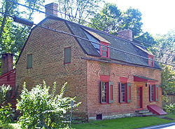
Claverack– The hamlet of Claverack is in the western part of the town.
Hollowville– A hamlet southeast of Claverack village.
Martindale– A hamlet by the eastern town boundary, by the Taconic State Parkway.
This page is based on this Wikipedia article Text is available under the CC BY-SA 4.0 license; additional terms may apply. Images, videos and audio are available under their respective licenses.