Related Research Articles
Columbia County is a county located in the U.S. state of New York. As of the 2020 census, the population was 61,570. The county seat is Hudson. The name comes from the Latin feminine form of the name of Christopher Columbus, which was at the time of the formation of the county a popular proposal for the name of the United States.
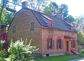
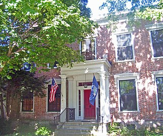
Claverack is a town in Columbia County, New York, United States. The population was 6,021 at the 2010 census. The town name is a corruption for the Dutch word “Klaverakker” for "Clover Fields" or "Clover Reach". In 1705, the first discovery of a mastodon tooth occurred here.

Copake is a town in Columbia County, New York, United States. The population was 3,346 at the 2020 US census, down from 3,615 at the 2010 census. The town derives its name from a lake, which was known to the natives as Cook-pake, or Ack-kook-peek, meaning "Snake Pond".

Taghkanic is a town in Columbia County, New York, United States. The town is in the south-central part of the county. The population was 1,231, at the 2020 US census, down from 1,310 at the 2010 census. "Taghkanic" is an older spelling of "Taconic".

Putnam Valley is a town in Putnam County, New York, United States. The population was 11,809 at the 2010 census. Its location is northeast of New York City, in the southwestern part of Putnam County. Putnam Valley calls itself the "Town of Lakes".
Berlin is a town in Rensselaer County, New York, United States. The population was 1,880 at the 2010 census. The town is named after Berlin in Germany, although natives pronounce the name differently, with the accent on the first syllable.

Grafton is a town in Rensselaer County, New York, United States. The population was 2,130 at the 2010 census. It is believed that the town received its name from Grafton, Vermont, where the first town supervisor, Nathaniel Dumbleton, was originally from. The town is an interior town near the north-central part of the county. NY Route 2 passes across the town.

Bedford Hills is a hamlet and census-designated place (CDP) in the town of Bedford, Westchester County, New York, United States. The population was 3,001 at the 2010 census. Two New York State prisons for women, Bedford Hills Correctional Facility for Women and Taconic Correctional Facility, are located in the hamlet.
Boston Corner is a hamlet of the town of Ancram in Columbia County, New York, United States and the town of Northeast in Dutchess County. The District of Boston Corner was incorporated by Massachusetts in 1838 from a tract of unincorporated land west of the town of Mount Washington, Massachusetts, and was ceded from Massachusetts to New York on January 11, 1855, because its geographical isolation from the rest of Massachusetts made maintaining law and order difficult.
Taconic State Park is located in Columbia and Dutchess County, New York abutting Massachusetts and Connecticut within the Taconic Mountains. The state park is located off New York State Route 344 south of Interstate 90 and 110 miles (180 km) north of New York City. It features camping, hiking, bicycling, hunting, cross county skiing and other recreational opportunities.


New York State Route 344 (NY 344) is a state highway located in Columbia County, New York, in the United States. The route is 1.90 miles (3.06 km) in length and serves primarily as an access road to the Bash Bish Falls state parks on both sides of the New York–Massachusetts border. The western terminus of NY 344 is at NY 22 in Copake Falls. Its eastern terminus is at the Massachusetts state line, where it continues into Bash Bish Falls State Park as Falls Road, a locally maintained highway. NY 344 was assigned c. 1932 and extended to its current length by 1953 after NY 22 was rerouted to bypass Copake Falls.

The South Taconic Trail is a 21.3 mi (34.3 km) hiking trail in the Taconic Mountains of southwest Massachusetts and adjacent New York. The trail extends from Shagroy Road in Millerton, New York, north along the ridgecrest of the southern Taconic Range and the border of New York and Massachusetts, and ends north of the Catamount Ski Area on Massachusetts Route 23 700 feet (210 m) east of the New York border in Egremont, Massachusetts. The Appalachian Trail, which traverses an adjacent ridgeline in the same mountain range, parallels the South Taconic Trail 3 mi (4.8 km) to the east. The trails are connected to one another via shorter trails.

Brace Mountain is the peak of a ridge in the southern Taconic Mountains, near the tripoint of the U.S. states of New York, Connecticut and Massachusetts. Its 2,311-foot (704 m) main summit is located in New York; it is the highest point in that state's Dutchess County.

Copake Falls is a hamlet and census-designated place (CDP) in Columbia County, New York, United States. The hamlet, once known as Copake Iron Works, is in the eastern part of the town of Copake, 1.5 miles (2.4 km) west of the Massachusetts state line. The CDP was designated after the 2010 census, so no population figure is yet available.
The Taconic Hills Central School District is a rural school district in the upstate town of Craryville, New York, United States with about 1600 students. It serves all or part of the communities of Copake, Hillsdale, Philmont, Ancram, Austerlitz, Claverack, Gallatin, Ghent, Livingston, Northeast and Taghkanic in the southeastern part of Columbia County, New York, United States. The district covers nearly 250 sq mi (650 km2).
Taconic Hills High School is a secondary school in Craryville, New York, United States operated by Taconic Hills Central School District. It serves all or part of the communities of Copake, Hillsdale, Philmont, Ancram, Austerlitz, Claverack, Gallatin, Ghent, Livingston, Northeast and Taghkanic in the southeastern part of Columbia County, New York, United States.

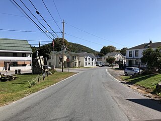
The Craryville station was a former New York Central Railroad station that served the residents of Copake, New York. It is currently located along New York State Route 23 in the hamlet of Craryville.
Copake is a hamlet and census-designated place (CDP) in Columbia County, New York, United States. The hamlet is in the south-central part of the town of Copake. The CDP was designated after the 2010 census, so no population figure is yet available.
Taconic Shores is a residential development and census-designated place (CDP) in Columbia County, New York, United States. The hamlet is near the geographic center of the town of Copake and surrounds Robinson Pond, a water body on the Roeliff Jansen Kill. The CDP was designated after the 2010 census, so no population figure is yet available.
References
- ↑ "Craryville | Town of Copake NY" . Retrieved September 15, 2022.
U.S. Geological Survey Geographic Names Information System: Craryville, New York 42°10′29″N073°34′58″W / 42.17472°N 73.58278°W
