Sand Lake, New York

Last updated

Sand Lake, New York
2015-08-20 19 36 19 "Welcome to the Town of Sand Lake" sign along eastbound New York State Route 43 (West Sand Lake Road) entering Sand Lake, New York from North Greenbush, New York.jpg
Sign at the west entrance to Sand Lake
Motto(s): 
A Place of Picnics, Porches and Progress
Rensselaer County New York incorporated and unincorporated areas Sand Lake highlighted.svg
Location in Rensselaer County and the state of New York.
Coordinates: 42°37′34″N73°34′2″W / 42.62611°N 73.56722°W / 42.62611; -73.56722
Country United States
State New York
County Rensselaer
Government
  TypeTown Board and Council
  Town SupervisorFlora Fasoldt (D)
Area
[1]
  Total36.17 sq mi (93.68 km2)
  Land35.05 sq mi (90.78 km2)
  Water1.12 sq mi (2.90 km2)
Elevation
823 ft (251 m)
Population
 (2020)
  Total8,348
Time zone UTC-5 (Eastern (EST))
  Summer (DST) UTC-4 (EDT)
ZIP code
12153
Area code 518
FIPS code 36-65013
GNIS feature ID0979455
Website Town of Sand Lake

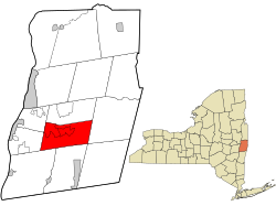
Sand Lake is a town in south-central part of Rensselaer County, New York, United States. Sand Lake is about 13 miles east of Albany, New York. As of the 2020 census, the population was 8,348. [2] Within the town are three hamlets: Averill Park, Glass Lake and the hamlet of Sand Lake. Its four lakes are a source of recreation. Many commercial enterprises of the 19th century and into the 20th century relied on power generated from the Wynants Kill Creek and Burden Lake mills. The area is known for its fertile soil for grazing and agriculture.

Contents

History

Early history

Map of Rensselaer County in 1829 showing the pre-partition Town of Sand Lake Rensselaer County 1829 Restored.jpg
Map of Rensselaer County in 1829 showing the pre-partition Town of Sand Lake

Sand Lake was first home to Native Americans. In 1629, Kiliaen van Rensselaer acquired a 700,000-acre land grant to establish a Dutch colony, encompassing what later became Sand Lake. Called the Manor of Rensselaerswyck, it was 48 miles across and 24 miles long. [3] In 1664, it became a colony of England and was called the Province of New York. It flipped back to the Dutch in 1672, and returned to the English in 1674. [3]

In the 1750s, Dutch settlers moved into what is now Sand Lake, followed by German pioneers. [4] By 1772, present day Sand Lake was in the Rensselaerwyck District of Albany County. It was held by the English until the Revolutionary War (1775–1783). [3] In 1792, when the town of Rensselaerwyck was divided into two towns, Greenbush and Stephentown. Present day Sand Lake extended into both towns. [3]

In 1805, the Union Meetinghouse was built for worship by Methodists, Baptists, and Presbyterians. It was the town's oldest public building and was a station on the Underground Railroad. [5] [lower-alpha 1]

Town of Sand Lake

The town of Sand Lake was formed from Greenbush and Berlin from an act of the legislature on March 21, 1812 and it was officially made a town on March 1, 1813. [3] [lower-alpha 2] Municipal positions were established to be responsible to its citizens, including town clerk, assessors, and more. Calvin Thompson became the first Supervisor. [3] The first postmaster, in 1815, was Daniel M. Gregory. [9] The soil, especially on the eastern lowlands, is fertile for grazing and agriculture, particularly small fruit, strawberries, and other berrys. [10]

A new church building was established for the Trinity Lutheran Church in 1816. The Zion Evangelical Lutheran Church opened in 1816 at the West Sand Lake site. There were a number of changes in the churches and its membership around the 1830s. [5] [lower-alpha 3] The present town borders were established on March 2, 1848 when the town of Sand Lake was divided into towns, Sand Lake and Poestenkill. The town was governed by a supervisor, town clerk and four justices of the peace. Town business was conducted in homes and inns for decades. [3]

Chris Crapes Hotel, about 1910 PostcardSandLakeNYChrisCrapesHotelCirca1910.jpg
Chris Crapes Hotel, about 1910
Street scene, about 1910 PostcardSandLakeNYStreetSceneCirca1910.jpg
Street scene, about 1910

There were a number of public and private schools established between 1825 and the early 20th century. [11] [lower-alpha 4] A one-room schoolhouse operated in Sand Lake from 1895 until 1929. [5]

In 1866, the Wynantskill Improvement Association created three Burden Lakes from Wynantskill Creek. The lake water turned the Burden water wheel that powered commercial enterprises, like mills, of the Industrial Revolution. [5] [12]

The Troy and New England Railway provided electric trolley service into Sand Lake from 1895 to 1925. The nine-mile route ran from Albia (of Troy) east to Averill Park. [13] The town's economy grew with tourism and people who became residents during the summer. [4]

Municipal Home Rule Law was enacted in 1964 by the State Legislature, which gave towns greater powers. In 1968, Rensselaer County revised its form of government, replacing the Board of Supervisors with a County Executive and a County Legislature. [3] In 1972, a town hall was established in the former Presbyterian Church. [3]

The Albert R. Fox House was listed on the National Register of Historic Places in 2001. [14]

Hamlets

Intersection of NY 43, NY 66 and CR 42 in the hamlet of Sand Lake 2014-08-28 13 23 29 Intersection of West Sand Lake Road (New York State Route 43), Miller Hill Road (New York State Route 66) and Taborton Road (Rensselaer County Route 42) in Sand Lake, New York.JPG
Intersection of NY 43, NY 66 and CR 42 in the hamlet of Sand Lake

Averill Park, Sand Lake, and West Sand Lake are three hamlets within the greater town of Sand Lake. [4]

Averill Park

Averill Park is a hamlet near the center of the town. The Averill post office was established in 1880, with Frank Pettit as first postmaster; the name was changed to Averill Park in 1882. [15] Faith Mills (1829-1966) is one of the textile factories that were established, starting in the early 19th century, along what is now Burden Lake Road. It was powered with water from the Wynantskill. [5] It is located east of West Sand Lake and has a number of retail businesses, two churches, and the Averill Park High School. The main street has businesses from the mid-19th century. [4]

Sand Lake

Sand Lake is the smallest hamlet of Sand Lake. There are several retail business, the Sand Lake Center for the Arts, a post office, town hall, a tavern, cemetery, and an elementary school. [4] Historic and stately houses are found in Sand Lake, with houses further away from one another than the other two hamlets. [4]

West Sand Lake

West Sand Lake is a hamlet in the northwestern corner of the town. In 1793, Bernhard Uhlein, a soldier of the American Revolutionary War, settled here and established a 325-acre farm. He received the land from a land grant from Patroon VanRensselaer. The settlement was first known as Ulinesville. [5] The post office for was established in 1834, with Frost Myers as postmaster. [16]

The community became West Sand Lake in 1838. [5] It is the largest of the three hamlets, with the most residents. There are houses dating back to the early 1800s in the western part of the hamlet. It has a number of retail businesses, schools, banks, two churches and a post office. [4]

Other areas

Sand Lake also has populated places named Maple Grove, [17] Sliter's Corner, [18] and Taborton. [19]

Glass Lake

View of Glass Lake, c. 1855, by Joseph Hidley View of Glass Lake, c. 1855, by Joseph Hidley.png
View of Glass Lake, c. 1855, by Joseph Hidley

The Glass Lake area grew up around the Rensselaer Glass Factory that Jeremiah Van Rensselaer founded in 1804. It had homes for 34 workers, a store, school, doctor's office, and more residential and commercial buildings. It is located at Glass Lake, which is the headwaters of the Wynants Kill Creek. A historical marker is located at Routes 43 and 66 at Glass Lake Road. [5]

South Sand Lake

The South Sand Lake post office was established there in 1854, with William Stevens as first postmaster. [9]

Geography

While the surface of the town is undulating in the west, it is quite mountainous in the east, a part of the Rensselaer Plateau. [20] Oak and Perigo hills are about 900 feet above sea level. [10] According to the United States Census Bureau, the town has a total area of 36.2 square miles (94 km2), [21] of which 35.2 square miles (91 km2) [22] is land and 0.9 square miles (2.3 km2) (2.63%) is water.[ verification needed ]

Lakes

Within Sand Lake, there are four lakes: Burden Lake, Crooked Lake, Crystal Lake, and Glass Lake. [23] The lakes, stocked with many kinds of fresh water fish, draws tourists to the area. [10] Glass Lake is between Crooked and Crystal Lakes. At 123 acres, it is located in Averill Park and Nassau. [10] [24] Burden Lake is located in the southern part of the town of Sand Lake and is partially in the town of Nassau, it is a total of 369 acres. [10] [25] Crystal Lake, formerly called Sand Lake, is the largest lake in the Averill Park hamlet in the town of Sand Lake. It is 66 acres in size. [10] [26] Crooked Lake is located in the southern part of the town of Sand Lake, south of Glass Lake. It is 113 acres. [10] [27] Wynants Kill is a stream that flows from Crooked Lake, through Glass and Burden Lakes, and drains into both Richard Pond and the Hudson River. [10]

Location

Demographics

Historical population
CensusPop.Note
1820 3,302
1830 3,67111.2%
1840 4,30317.2%
1850 2,558−40.6%
1860 2,502−2.2%
1870 2,6335.2%
1880 2,550−3.2%
1890 2,5550.2%
1900 2,299−10.0%
1910 2,128−7.4%
1920 1,916−10.0%
1930 2,0225.5%
1940 2,48823.0%
1950 3,25430.8%
1960 4,62942.3%
1970 5,84326.2%
1980 7,02220.2%
1990 7,6428.8%
2000 7,9874.5%
2010 8,5306.8%
2020 8,348−2.1%
U.S. Decennial Census [28] [2]

As of the 2020 census, the population was 8,348. [2] [29] In 2010 there were 8,530 people, 3,009 households, and 2,229 families residing in the town. The population density was 226.9 inhabitants per square mile (87.6/km2). There were 3,277 housing units at an average density of 93.1 per square mile (35.9/km2). The racial makeup of the town was 96.4% Non Hispanic White, 0.4% African American, 0.11% Native American, 0.50% Asian and 1.1% from two or more races. Hispanic or Latino origin were 1.5% of the population. Ancestries: German (25.2%), Irish (22.6%), English (14.6%), Italian (13.8%), French (8.9%), Polish (6.1%).

There were 3,009 households, out of which 37.1% had children under the age of 18 living with them, 58.6% were married couples living together, 11.8% had a female householder with no husband present, and 25.9% were non-families. 20.6% of all households were made up of individuals, and 7.9% had someone living alone who was 65 years of age or older. The average household size was 2.65 and the average family size was 3.08.

In the town, the population was spread out, with 26.6% under the age of 18, 6.1% from 18 to 24, 28.6% from 25 to 44, 28.1% from 45 to 64, and 10.6% who were 65 years of age or older. The median age was 39 years. For every 100 females, there were 95.7 males. For every 100 females age 18 and over, there were 93.7 males.

The median income for a household in the town was $77,372, and the median income for a family was $97,009. Males had a median income of $67,132 versus $48,321 for females. The per capita income for the town was $36,103. The Median household income for White households is $75,474 compared to $2,157,374 for Asian households and $223,858 for African American households. About 6.7% of families and 7.7% of the population were below the poverty line, including 6.3% of those under age 18 and 10.3% of those age 65 or over.

Notable people

Notes

  1. In 1776, a log building was constructed at Rensselaerwyck, about one mile southwest of West Sand Lake, that served as a school, Lutheran church, and residence for a pastor. [5]
  2. In 1843, a part of Greenbush was returned, [6] [7] and in 1848 the northern half was set off as a separate town under the name of Poestenkill. [8]
  3. The meetinghouse of 1805 was split into separate Methodist, Presbyterian and Baptists churches. The Zion Evangelical Lutheran Church was renamed the First Evangelical Lutheran Church in 1838 when a dispute among parishioners about temperance and abolition resulted in a division of the church. Some of the parishioners became members of the Second Evangelical Lutheran Church, which was an Underground Railroad station prior to the Civil War. [5]
  4. There were a number of public and private schools established between 1825 and into the early 20th century: Gregory's school (1825), Sliter's Corners (now in the hamlet of Sand Lake) school (1854), Sand Lake Academy, and a school at the Second Lutheran Church (1854). Between the 1860s and 1889 the Scram's Institute boarding school for boys (1852), Brookside Institute (1860s), Sand Lake Female Seminary (1880s), a private Day school was operated by Fannie Howard (1899), and Nellie Clark operated a private school (year not stated). [11]

Related Research Articles

<span class="mw-page-title-main">Rensselaer County, New York</span> County in New York, United States

Rensselaer County is a county in the U.S. state of New York. As of the 2020 census, the population was 161,130. Its county seat is Troy. The county is named in honor of the family of Kiliaen van Rensselaer, the original Dutch owner of the land in the area.

<span class="mw-page-title-main">Averill Park, New York</span> CDP in New York, United States

Averill Park is a census-designated place within the town of Sand Lake in Rensselaer County, New York, United States. The population was 2,098 at the 2020 census.

<span class="mw-page-title-main">Berlin, New York</span> Town in New York, United States

Berlin is a town in Rensselaer County, New York, United States. The population was 1,808 at the 2020 census. The town is named after Berlin in Germany, although natives pronounce the name differently, with the accent on the first syllable.

<span class="mw-page-title-main">Brunswick, New York</span> Town in New York, United States

Brunswick is a town in Rensselaer County, New York, United States. The municipality was originally settled in the early 18th century. During its history, it had been part of Albany County, Rensselaerswyck, and Troy, before its incorporation in 1807. It is bordered on the west by the city of Troy; on the north by Schaghticoke and Pittstown; on the east by Grafton; and on the south by Poestenkill and North Greenbush. The population was 12,581 at the 2020 census. The source of the town's name is not certain, though some claim it comes from the source of its first inhabitants from the province of Brunswick-Lüneburg in Germany.

<span class="mw-page-title-main">Grafton, New York</span> Town in New York, United States

Grafton is a town in Rensselaer County, New York, United States. The population was 2,051 at the 2020 census. It is believed that the town received its name from Grafton, Vermont, where the first town supervisor, Nathaniel Dumbleton, was originally from. The town is an interior town near the north-central part of the county. NY Route 2 passes across the town.

<span class="mw-page-title-main">North Greenbush, New York</span> Town in New York, United States

North Greenbush is a town in Rensselaer County, New York, United States. North Greenbush is located in the western part of the county. The population was 13,292 at the 2020 census.

<span class="mw-page-title-main">Pittstown, New York</span> Town in New York, United States

Pittstown is a town in Rensselaer County, New York, United States. The population was 5,735 at the 2010 census. It is in the northern part of the county.

<span class="mw-page-title-main">Rensselaer, New York</span> City in Rensselaer County, New York, US

Rensselaer is a city in Rensselaer County, New York, United States, and is located on the east side of the Hudson River, directly opposite of Albany. As of the 2020 census, the city population was 9,210. Rensselaer is on the western border of Rensselaer County. The area now known as the City of Rensselaer was settled by the Dutch in the 17th century, who called it t'Greyn Bos, which became Greenbush in English. The city has a rich industrial history stretching back to the 19th century, when it became a major railroad hub; in 2020, Albany-Rensselaer was the ninth busiest Amtrak station in the country and the second busiest in New York State. Rensselaer was one of the earliest locations of the dye industry in the United States, and was the first American location for the production of aspirin.

<span class="mw-page-title-main">Schodack, New York</span> Town in New York, United States

Schodack is a town in Rensselaer County, New York, United States. The population was 12,965 at the 2020 census. The town name is derived from the Mahican word, Escotak. The town is in the southwestern part of the county. Schodack is southeast of Albany, New York.

<span class="mw-page-title-main">Wynantskill, New York</span> CDP in New York, United States

Wynantskill is a census-designated place (CDP) in Rensselaer County, New York, United States. The population was 3,276 at the 2010 census. Wynantskill is located at the northern town line and the northeastern corner of the town of North Greenbush. The community is a suburb of Troy. state route 66 is the main route through the community. Wynantskill has a major grocery store, several banks and restaurants, a craft beverage store, convenience stores, a post office, and a bowling alley, with almost all houses located on side streets off Main Ave. Other major roads are Whiteview Road, a primarily residential road that leads to US 4; and West Sand Lake Road.

<span class="mw-page-title-main">East Greenbush, New York</span> Town in New York, United States

East Greenbush is a town in Rensselaer County, New York, United States. It is a suburb of Albany. The population was 16,748 at the 2020 census. The word Greenbush is derived from the Dutch het groen bosch, referring to the pine woods that originally covered the land. The first settlement of the land now known as East Greenbush was made by tenants under patroon Kiliaen van Rensselaer circa 1630. The town was established in 1855 as Clinton, and was renamed in 1858. It is mostly suburban along its major highways and rural in the southwestern and northeastern corners.

<span class="mw-page-title-main">Nassau, New York</span> Town in Rensselaer County, New York, US

Nassau is a town in Rensselaer County, New York, United States. The population was 4,545, down from 4,789 at the 2010 census.

<span class="mw-page-title-main">Poestenkill, New York</span> Town in Rensselaer County, New York

Poestenkill is a town in Rensselaer County, New York, United States. The population was 4,322 at the 2020 census. The town is southeast of Troy and is centrally located in the county.

<span class="mw-page-title-main">New York State Route 43</span> State highway in Rensselaer County, New York, US

New York State Route 43 (NY 43) is a state highway in Rensselaer County, New York, in the United States. It extends for 24.00 miles (38.62 km) from Interstate 90 (I-90) exit 8 in North Greenbush to the Massachusetts state line, where it continues into Williamstown as Massachusetts Route 43. Most of NY 43 is a two-lane highway that passes through a mixture of rural and residential areas; however, its westernmost 2 miles (3.2 km) between I-90 and U.S. Route 4 (US 4) is a four-lane divided highway. NY 43 has an overlap with NY 66 in Sand Lake and intersects NY 22 in Stephentown.

<span class="mw-page-title-main">New York State Route 66</span> State highway in New York, US

New York State Route 66 (NY 66) is a state highway in the Capital District of New York in the United States. The route begins at an intersection with US 9 and NY 23B in the Columbia County city of Hudson and ends at a junction with NY 2 in the Rensselaer County city of Troy. While both Hudson and Troy are located on the Hudson River, NY 66 follows a more inland routing between the two locations to serve several rural villages and hamlets, including Chatham and Sand Lake. NY 66 overlaps with U.S. Route 20 (US 20) and NY 43, two regionally important east–west highways, in Nassau and Sand Lake, respectively.

<span class="mw-page-title-main">New York State Route 351</span> State highway in Rensselaer County, New York, US

New York State Route 351 (NY 351) is a north–south state highway in central Rensselaer County, New York, in the United States. It extends for 8.16 miles (13.13 km) from an intersection with NY 43 in the Sand Lake hamlet of West Sand Lake to a junction with NY 2 in the Brunswick hamlet of Cropseyville. The portion of NY 351 north of the hamlet of Poestenkill was originally designated as New York State Route 153 in the 1930s. This designation was removed in the 1940s, and the West Sand Lake–Cropseyville roadway became County Route 77 (CR 77) sometime afterward. On April 1, 1980, all of CR 77 was transferred to the state of New York, at which time it was redesignated as NY 351 by the New York State Department of Transportation (NYSDOT).

Averill Park Central School District (APCSD) is a suburban and rural fringe public school district located east of the city of Rensselaer in south central Rensselaer County, New York. The district has five operating school buildings: three elementary schools, one Middle school, and one high school. The district is a member of the Rensselaer-Columbia-Greene Boards of Cooperative Educational Services (BOCES), known as Questar III.

<span class="mw-page-title-main">Craver Farmstead</span> Historic house in New York, United States

The Craver Farmstead was established circa 1790 consisting of 225 acres with a farmhouse and a barn. Today, the Craver Farmstead is both architecturally and historically significant. The farmhouse was built prior to 1790 and stands as one of the oldest and best preserved examples of Federal-style architecture in upstate New York. The Federal style evolved as the dominant classicizing architecture in North America between 1780 and 1830 as the new republic of the United States sought to define itself as independent in literature, art, and architecture just as it was politically.

<span class="mw-page-title-main">Snyder's Lake, New York</span> Hamlet in New York, United States

Snyder's Lake is a hamlet of North Greenbush in Rensselaer County, New York, United States.

References

  1. "2016 U.S. Gazetteer Files". United States Census Bureau. Retrieved July 5, 2017.
  2. 1 2 3 2020 United States Census, 2020 Census Report, Sand Lake town, Rensselaer County, New York https://www.census.gov/search-results.html?searchType=web&cssp=SERP&q=Sand%20Lake%20town,%20Rensselaer%20County,%20New%20York
  3. 1 2 3 4 5 6 7 8 9 "History of the Town of Sand Lake". www.townofsandlake.us. Retrieved April 14, 2021.
  4. 1 2 3 4 5 6 7 "About the Town of Sand Lake". www.townofsandlake.us. Retrieved April 14, 2021.
  5. 1 2 3 4 5 6 7 8 9 10 "SLHS: Historical Markers in the Town of Sand Lake". sandlakehistory.org. Retrieved April 13, 2021.
  6. Laws of the State of New York 1843: Wetherwax property removed from Sand Lake to Greenbush, page 84, accessed Nov 2019.
  7. The revised statutes of the state of New York: ... to the close of the session of the Legislature of 1858, ..., Banks & Brothers, 1859, page 199, accessed Nov 2019
  8. Laws of the State of New York 1848: Partition of the Town of Sand Lake, page 76, accessed Nov 2019
  9. 1 2 Kay, John L., Smith, Chester M., Jr., New York Postal History: The Post Offices and First Postmasters from 1775 to 1980, (1982) State College, PA, American Philatelic Society, ISBN   0-933580-05-3, p 266.
  10. 1 2 3 4 5 6 7 8 Anderson, George Baker (1897). Landmarks of Rensselaer County, New York. D. Mason. p. 510.
  11. 1 2 "SLHS: Town of Sand Lake (NY) Schools Prior to 1929". sandlakehistory.org. Retrieved April 14, 2021.
  12. "Sand Lake -- Mill Town?". sandlakehistory.org. Retrieved April 14, 2021.
  13. "Trolley subject of new book". The Times Record. July 10, 1976. p. 7. Retrieved April 14, 2021.
  14. "National Register Information System". National Register of Historic Places . National Park Service. March 13, 2009.
  15. Kay, John L., Smith, Chester M., Jr., New York Postal History: The Post Offices and First Postmasters from 1775 to 1980, (1982) State College, PA, American Philatelic Society, ISBN   0-933580-05-3, p 263.
  16. Kay, John L., Smith, Chester M., Jr., New York Postal History: The Post Offices and First Postmasters from 1775 to 1980, (1982) State College, PA, American Philatelic Society, ISBN   0-933580-05-3, p 267.
  17. "GNIS Detail - Maple Grove". geonames.usgs.gov. Retrieved April 14, 2021.
  18. "GNIS Detail - Sliters". geonames.usgs.gov. Retrieved April 14, 2021.
  19. "GNIS Detail - Taborton". geonames.usgs.gov. Retrieved April 14, 2021.
  20. "Rensselaer Plateau Association - Maps". Archived from the original on December 24, 2013. Retrieved August 26, 2013.
  21. "Sand Lake, NY - Geographic Facts & Maps - MapSof.net". www.mapsof.net. Retrieved April 27, 2021.
  22. "U.S. Census Bureau QuickFacts: Sand Lake town, Rensselaer County, New York". www.census.gov. Retrieved April 27, 2021.
  23. "Contour Maps for Selected Lakes in Rensselaer County - NYS Dept. of Environmental Conservation". www.dec.ny.gov. Retrieved April 14, 2021.
  24. "GNIS Detail - Glass Lake". geonames.usgs.gov. Retrieved April 14, 2021.
  25. "GNIS Detail - Burden Lake". geonames.usgs.gov. Retrieved April 14, 2021.
  26. "GNIS Detail - Crystal Lake". geonames.usgs.gov. Retrieved April 14, 2021.
  27. "GNIS Detail - Crooked Lake". geonames.usgs.gov. Retrieved April 14, 2021.
  28. "Census of Population and Housing". Census.gov. Retrieved June 4, 2015.
  29. "U.S. Census website". United States Census Bureau . Retrieved January 31, 2008.

Further reading