Castleton-on-Hudson | |
---|---|
Village | |
Coordinates: 42°31′57″N73°45′1″W / 42.53250°N 73.75028°W | |
Country | United States |
State | New York |
County | Rensselaer |
Government | |
• Mayor | Michael S. Slik |
Area | |
• Total | 0.71 sq mi (1.85 km2) |
• Land | 0.71 sq mi (1.85 km2) |
• Water | 0.00 sq mi (0.00 km2) |
Elevation | 151 ft (46 m) |
Population (2020) | |
• Total | 1,477 |
• Density | 2,068.63/sq mi (799.11/km2) |
Time zone | UTC-5 (Eastern (EST)) |
• Summer (DST) | UTC-4 (EDT) |
ZIP code | 12033 |
Area code | 518 |
FIPS code | 36-12870 |
GNIS feature ID | 0969967 |
Website | www.castleton-on-hudson.org |
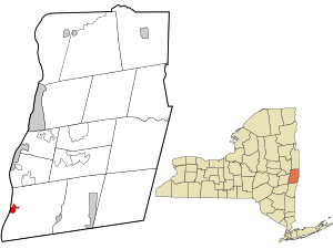
Castleton-on-Hudson is a village located in the southwestern part of the town of Schodack in Rensselaer County, New York, United States. The population was 1,473 at the 2010 census. [2] The village is southeast of Albany.
As of 2019, Castleton-On-Hudson was recognized as a Tree City USA from the Arbor Day Foundation. It's first Chairman of the Board was local resident Mike Martin. [3]
Castleton gets its name from the exploration of the North (Hudson) River by Henry Hudson. While traveling up the river, he came upon a Mahican Indian village noted for a large structure located on a rise above the river. This structure was a storehouse for foodstuffs, but was of such size that it was thought to be a "castle". Another theory for the derivation of the name "Castleton" comes from Rutherford Hayner's Troy and Rensselaer County New York: A History (1925). Hayner states "Although the exact location of this landing of Hudson's has been more or less conjectural, the weight of opinion places it at or near the present site of the village of Castleton, for on Castle Hill, back of the village, stood the dwelling of the chief of the Mohicans." [4]
The area of Castleton was settled in 1792. When the small village was incorporated into Rensselaer County on April 13, 1827, there were about 100 people living in the area, mostly along the banks of the river. Between 1890 and 1920, the village had a booming economy, with small industry, a hotel, and a small port to gain access to river traffic. However, a large flood destroyed much of the business district in 1936, and the industry took the opportunity to relocate. These days the town is a very residential suburb, with some light agriculture.
The name of the village was changed from Castleton to Castleton-on-Hudson in 1927.
The Gazetteer of the State of New York of 1860 reports that Castleton was formerly known as Morriches Hastie. (JH French, 1860)
The District School No. 3 and Joachim Staats House and Gerrit Staats Ruin are listed on the National Register of Historic Places. [5]
According to the United States Census Bureau, the village has a total area of 0.8 square miles (2.1 km2), all land.
The village is on the east bank of the Hudson River.
Census | Pop. | Note | %± |
---|---|---|---|
1870 | 580 | — | |
1880 | 912 | 57.2% | |
1890 | 1,127 | 23.6% | |
1900 | 1,214 | 7.7% | |
1910 | 1,396 | 15.0% | |
1920 | 1,595 | 14.3% | |
1930 | 1,506 | −5.6% | |
1940 | 1,515 | 0.6% | |
1950 | 1,751 | 15.6% | |
1960 | 1,752 | 0.1% | |
1970 | 1,730 | −1.3% | |
1980 | 1,627 | −6.0% | |
1990 | 1,491 | −8.4% | |
2000 | 1,619 | 8.6% | |
2010 | 1,473 | −9.0% | |
2020 | 1,477 | 0.3% | |
U.S. Decennial Census [6] |
As of the census [2] of 2000, there were 1,619 people, 615 households, and 399 families residing in the village. The population density was 2,025.5 inhabitants per square mile (782.0/km2). There were 654 housing units at an average density of 818.2 units per square mile (315.9 units/km2). The racial makeup of the village was 96.79% White, 1.36% African American, 0.25% Asian, 0.93% from other races, and 0.68% from two or more races. Hispanic or Latino of any race were 1.79% of the population.
There were 615 households, out of which 35.4% had children under the age of 18 living with them, 45.0% were married couples living together, 15.9% had a female householder with no husband present, and 35.1% were non-families. 29.6% of all households were made up of individuals, and 15.0% had someone living alone who was 65 years of age or older. The average household size was 2.46 and the average family size was 3.06.
In the village, the population was spread out, with 27.1% under the age of 18, 6.4% from 18 to 24, 28.3% from 25 to 44, 19.1% from 45 to 64, and 19.0% who were 65 years of age or older. The median age was 38 years. For every 100 females, there were 83.1 males. For every 100 females age 18 and over, there were 73.0 males.
The median income for a household in the village was $44,141, and the median income for a family was $51,957. Males had a median income of $36,019 versus $26,976 for females. The per capita income for the village was $18,660. About 2.5% of families and 8.7% of the population were below the poverty line, including 9.3% of those under age 18 and 10.8% of those age 65 or over.
Rensselaer Countyren-sə-LEER is a county in the U.S. state of New York. As of the 2020 census, the population was 161,130. Its county seat is Troy. The county is named in honor of the family of Kiliaen van Rensselaer, the original Dutch owner of the land in the area. The county is part of the Capital District region of the state.
Berlin is a town in Rensselaer County, New York, United States. The population was 1,808 at the 2020 census. The town is named after Berlin in Germany, although natives pronounce the name differently, with the accent on the first syllable.
East Nassau is a village in Rensselaer County, New York, United States. The population was 587 at the 2010 census.
Grafton is a town in Rensselaer County, New York, United States. The population was 2,051 at the 2020 census. It is believed that the town received its name from Grafton, Vermont, where the first town supervisor, Nathaniel Dumbleton, was originally from. The town is an interior town near the north-central part of the county. NY Route 2 passes across the town.
Hoosick is a town in Rensselaer County, New York, United States. The population was 6,711 at the 2020 census. It was named from the Hoosic River.
North Greenbush is a town in Rensselaer County, New York, United States. North Greenbush is located in the western part of the county. The population was 13,292 at the 2020 census.
Petersburgh is a town located in the northeast section of Rensselaer County, New York, United States. The population was 1,372 at the 2020 census. The town was named after an early settler named Peter Simmons.
Pittstown is a town in Rensselaer County, New York, United States. The population was 5,540 at the 2020 census. It is in the northern part of the county.
Rensselaer is a city in Rensselaer County, New York, United States, and is located on the east side of the Hudson River, opposite Albany and on the western border of Rensselaer County. As of the 2020 census, the city population was 9,210.
Sand Lake is a town in south-central part of Rensselaer County, New York, United States. Sand Lake is about 13 miles east of Albany, New York. As of the 2020 census, the population was 8,348. Within the town are four hamlets: West Sand Lake, Averill Park, Glass Lake and the hamlet of Sand Lake. Its four lakes are a source of recreation. Many commercial enterprises of the 19th century and into the 20th century relied on power generated from the Wynants Kill Creek and Burden Lake mills. The area is known for its fertile soil for grazing and agriculture.
Schodack is a town in Rensselaer County, New York, United States. The population was 12,965 at the 2020 census. The town name is derived from the Mahican word, Escotak. The town is in the southwestern part of the county. Schodack is southeast of Albany, New York.
Stephentown is a town in Rensselaer County, New York, United States. The population was 2,791 at the 2020 census. The town, which was originally Jericho Hallow in the Massachusetts Bay Colony, was renamed for Stephen Van Rensselaer. The town is located in the southeastern corner of the county, and has a sign proclaiming it to be the only Stephentown on Earth.
Valley Falls is a village in Rensselaer County, New York, United States. The population was 466 at the 2010 census. The village lies on the boundary of the towns of Pittstown and Schaghticoke, but is mostly in the northwestern part of Pittstown.
Green Island is a coterminous town-village in Albany County, New York, United States, some 8 miles (13 km) north of Albany. Green Island is one of only five such town-village amalgamations in New York. The population was 2,934 at the 2020 census, and the ZIP code is 12183. While the town of Green Island was once an island, it was connected to the mainland on the west side of the Hudson River in the 1960s.
Nassau is a village located in the Town of Nassau in Rensselaer County, New York, United States. The population was 1,133 at the 2010 census.
Nassau is a town in Rensselaer County, New York, United States. The population was 4,545 in 2020, down from 4,789 at the 2010 census.
Poestenkill is a town in Rensselaer County, New York, United States. The population was 4,322 at the 2020 census. The town is southeast of Troy and is centrally located in the county.
Schaghticoke is a village in Rensselaer County, New York, United States. The population was 592 at the 2010 census.
SchaghticokeSKAT-ih-kohk is a town in Rensselaer County, New York, United States. The population was 7,445 at the 2020 census. It was named for the Schaghticoke, a Native American tribe formed in the seventeenth century from an amalgamation of remnant peoples of eastern New York and New England. The tribe has one of the oldest reservations in the United States, located in what is now Litchfield County, Connecticut. It has been recognized by the state of Connecticut but has not yet achieved federal recognition.
Waterford is a village in Saratoga County, New York, United States. The population was 2,038 at the 2020 census. The name derives from the ford between the mainland and Peebles Island.