The Erie Canal in New York is part of the east–west, cross-state route of the New York State Canal System. It originally ran 363 miles (584 km) from the Hudson River in Albany to Lake Erie in Buffalo. It was built to create a navigable water route from New York City and the Atlantic Ocean to the Great Lakes. It was completed in 1825 and was the second longest canal in the world, and it greatly enhanced the development and economy of the cities of New York, including Albany, Syracuse, Rochester, Buffalo, and New York City, as well as the United States. This was in part due to the new ease of transport of salt and other goods, and industries that developed around those.

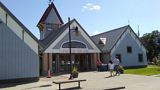
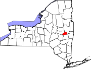
Clifton Park is a suburban town in Saratoga County, New York, United States. According to the United States Census Bureau, the 2010 population was 36,705. The name is derived from an early land patent. The town is in the south part of the county and is located approximately 12 miles (19 km) north of Albany, 7 miles (11 km) northeast of Schenectady, and 10 miles (16 km) south of Saratoga Springs.

Niskayuna is a town in Schenectady County, New York, United States. The population was 21,781 at the 2010 census. The town is located in the southeast part of the county, east of the city of Schenectady, and is the easternmost town in the county.

The Mohawk River is a 149-mile-long (240 km) river in the U.S. state of New York. It is the largest tributary of the Hudson River. The Mohawk flows into the Hudson in Cohoes, New York, a few miles north of the city of Albany. The river is named for the Mohawk Nation of the Iroquois Confederacy. It is a major waterway in north-central New York. The largest tributary, the Schoharie Creek, accounts for over one quarter (26.83%) of the Mohawk River's watershed. Another main tributary is the West Canada Creek, which makes up for 16.33% of the Mohawk's watershed.

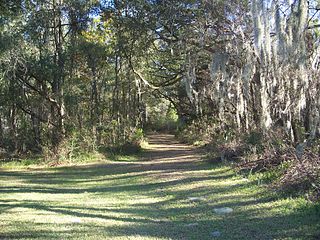
The Cross Florida Barge Canal, now officially the Marjorie Harris Carr Cross Florida Greenway is a protected green belt corridor, more than one mile (1.6 km) wide in places. It is named for the leader of opposition to the Cross Florida Barge Canal, Marjorie Harris Carr, and was originally a U.S. Army Corps of Engineers canal project to connect the Gulf of Mexico and the Atlantic Ocean across Florida for barge traffic. Two sections were built but the project was ultimately cancelled, due to local opposition related to environmental concerns, including protecting the state's water supply and conservation of the Ocklawaha River Valley ecosystem, but also due to national opposition for the costs being perceived as "government waste" with "limited national value."

The New York State Canal System is a successor to the Erie Canal and other canals within New York. Currently, the 525-mile (845 km) system is composed of the Erie Canal, the Oswego Canal, the Cayuga–Seneca Canal, and the Champlain Canal. In 2014 the system was listed as a national historic district on the National Register of Historic Places in its entirety, and in 2016 it was designated a National Historic Landmark.

The Thames Path is a National Trail following the River Thames from its source near Kemble in Gloucestershire to the Thames Barrier at Charlton, south east London. It is about 184 miles (296 km) long. A path was first proposed in 1948 but it only opened in 1996.

Rexford is a hamlet in Saratoga County, New York, located on the north bank of the Mohawk River. Rexford is in the Town of Clifton Park, near the southwest town line. Its boundaries, like those of neighboring Alplaus, are unofficial and necessarily vague. To the south, it is bounded by the Mohawk River and Grooms Road and to the west, Alplaus and the Schenectady County line. Route 146 and Vischer's Ferry Road, are probably a reasonable delineations of its northern and eastern boundaries. The ZIP Code is 12148.

Dunsbach Ferry is a hamlet of the town of Colonie, in Albany County, New York. The hamlet sits to the east of, and below, the Thaddeus Kosciusko Bridge, where Interstate 87 (I-87) crosses the Mohawk River. There are numerous private and public docks and landings between the Twin Bridges and the Colonie Town Park. Dunsbach Ferry was once an important river crossing and a stop on the Schenectady and Troy Railroad (T&S), later a branch of the New York Central Railroad. The ZIP code is 12047 (Cohoes).

Verdoy, formerly known as Watervliet Center, is a hamlet of the town of Colonie in Albany County, New York. Much of Verdoy is in the Airport Noise Overlay District due to its immediate proximity to Albany International Airport's main north/south runway, which was recently extended by 1,300 feet to the north, moving it even closer to Verdoy. The former Troy & Schenectady Branch of the New York Central Railroad runs along Verdoy's northern border with the Mohawk River; it is now part of the Mohawk Hudson Hike/Bike Trail.

Crescent Bridge is a 1,229-foot (375 m) bridge over the Mohawk River and the Erie Canal. It is in Crescent, New York, a hamlet in the town of Halfmoon in southern Saratoga County on the northern side of the Mohawk River. The Crescent Bridge carries U.S Route 9 over the Mohawk River between the towns of Colonie in Albany County and Halfmoon.

The Port of New York and New Jersey is the port district of the New York-Newark metropolitan area, encompassing the region within approximately a 25-mile (40 km) radius of the Statue of Liberty National Monument. It includes the system of navigable waterways in the New York–New Jersey Harbor Estuary, which runs along 650 miles (1,050 km) of shoreline in the vicinity of New York City and northeastern New Jersey, as well as the region's airports and supporting rail and roadway distribution networks. Considered one of the largest natural harbors in the world, the port has become the second busiest port by tonnage in the United States as of 2019, and the busiest on the East Coast.
New York State Route 103 (NY 103) is a state highway in Schenectady County, New York, in the United States. It runs for just 0.50 miles (0.80 km) from an intersection with NY 5S in the hamlet of Rotterdam Junction to NY 5 in the town of Glenville. In between, the route crosses the Mohawk River at Erie Canal at Lock 9. When it was assigned in the early 1930s, it was the only crossing of the Mohawk River between Pattersonville and downtown Schenectady. It later became the only bridge between Amsterdam and Schenectady. Its regional importance declined following the completion of NY 890 near Schenectady in 1998. In late 2011, NY 103 was closed for three months to repair parts of the road damaged by Hurricane Irene and Tropical Storm Lee.

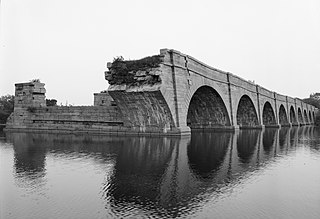
Schoharie Crossing State Historic Site, also known as Erie Canal National Historic Landmark, is a historic district that includes the ruins of the Erie Canal aqueduct over Schoharie Creek, and a 3.5-mile (5.6 km) long part of the Erie Canal, in the towns of Glen and Florida within Montgomery County, New York. It was the first part of the old canal to be designated a National Historic Landmark, prior to the designation of the entire New York State Barge Canal as a NHL in 2017.

Vischer Ferry is a hamlet in the town of Clifton Park in Saratoga County, New York, United States, along the Mohawk River.
Van Schaick Island is an island in the city of Cohoes, New York. Van Schaick is a part of the delta of the Mohawk River at its mouth with the Hudson River. The island has been referred to by numerous names including Quehemesicos, Long, Anthony's, Isle of Cohoes, and Cohoes Island. The island was home to US Revolutionary War fortifications in the 18th century, and to an important shipyard in the 20th century. The shipyard and the extreme northern end of the island is part of the Peebles Island State Park, and the only vehicular entrance to the state park is on the island.

The Woodlawn Preserve is a patch of the Albany Pine Bush in the Woodlawn neighborhood of the city of Schenectady, New York. It is the only remaining example of this rare ecosystem in that area, a combination of swamp, wetlands, water bodies, and dune vegetation, and one of the most biologically diverse parcels in Schenectady County.

The Vischer Ferry Nature and Historic Preserve is a 740-acre (3.0 km2) site along the Mohawk River in the Town of Clifton Park, New York, near the hamlet of Vischer Ferry. It is owned by the New York State Canal Corporation, but Clifton Park maintains its extensive trail system under a special lease arrangement. The preserve also is known as Vischer Ferry Bird Conservation Area.

Mohawk River State Park is a 105-acre (0.42 km2) undeveloped state park in the town of Niskayuna in Schenectady County, New York. The park is located adjacent to the Mohawk River.
Lisha Kill flows through Lisha Kill, New York before emptying into the Mohawk River in Niskayuna, New York. The stream is also referred to as Lisha's Kill and received its name from a local legend about a Native American woman who is buried along its banks.


