Schenectady County is a county in the U.S. state of New York. As of the 2020 census, the population was 158,061. The county seat is Schenectady. The name is from a Mohawk language word meaning "on the other side of the pine lands," a term that originally applied to Albany.
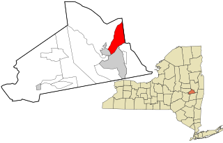
Clifton Park is a suburban town in Saratoga County, New York, United States. According to the United States Census Bureau, the 2010 population was 36,705. The name is derived from an early land patent. The town is in the southern part of Saratoga County, approximately 12 miles (19 km) north of Albany, 7 miles (11 km) northeast of Schenectady, and 10 miles (16 km) south of Saratoga Springs.
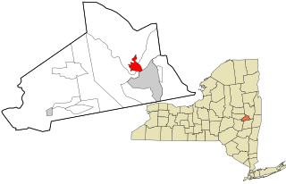
East Glenville is a hamlet in Schenectady County, New York, United States. The population was 6,616 at the 2010 census. The CDP includes the adjacent hamlet of Alplaus.

Glenville is a town in Schenectady County, New York, United States. It was incorporated in 1820 from Schenectady. As of the 2010 census, the town population was 29,480.
Scotia is a village in Schenectady County, New York, United States, incorporated in 1904. The population was 7,729 at the 2010 census. Scotia is part of the town of Glenville, and is connected with the city of Schenectady by the Western Gateway Bridge over the Mohawk River.

Colonie is a town in Albany County, New York, United States. It is the most-populous suburb of Albany, and is the third-largest town in area in Albany County, occupying approximately 11% of the county. Several hamlets exist within the town. As of the 2010 census, the town had a total population of 81,641.

Amsterdam is a town in Montgomery County, New York, United States. The population was 5,566 at the 2010 census. The town is named after Amsterdam, the capital of the Netherlands.

Niskayuna is a town in Schenectady County, New York, United States. The population was 23,278 at the 2020 census. The town is located in the southeast part of the county, east of the city of Schenectady, and is the easternmost town in the county. The current Town Supervisor is Jaime Puccioni.

The Mohawk River is a 149-mile-long (240 km) river in the U.S. state of New York. It is the largest tributary of the Hudson River. The Mohawk flows into the Hudson in Cohoes, New York, a few miles north of the city of Albany. The river is named for the Mohawk Nation of the Iroquois Confederacy. It is a major waterway in north-central New York. The largest tributary, the Schoharie Creek, accounts for over one quarter (26.83%) of the Mohawk River's watershed. Another main tributary is the West Canada Creek, which makes up for 16.33% of the Mohawk's watershed.

Area codes 518 and 838 are telephone area codes serving the northeasternmost part of Upstate New York in the United States. 518 was established as one of the original area codes during 1947. Area code 838 was added as an overlay during 2017. The two area codes cover 24 counties and 1,200 ZIP Codes. There are 493 landline exchanges and 100 wireless exchanges served by 47 carriers. The numbering plan area (NPA) it covers in New York State extends from the eastern Mohawk Valley to the Vermont border, and from the Canada–US border to south of Albany. The bulk of this NPA population is in the Capital District. Other cities in the NPA are Glens Falls, Plattsburgh, and Saratoga Springs.
Rexford is a hamlet in Saratoga County, New York, United States, located on the north bank of the Mohawk River. Rexford is in the Town of Clifton Park, near the southwestern town line. Its boundaries, like those of neighboring Alplaus, are unofficial and necessarily ambiguous. To the south, it is bounded by the Mohawk River and Grooms Road and to the west, Alplaus and the Schenectady County line. Route 146 and Vischer's Ferry Road, are probably a reasonable delineations of its northern and eastern boundaries. The ZIP Code is 12148.
Latham is a hamlet in Albany County, New York, United States. It is located along U.S. Route 9 in the town of Colonie, a dense suburb north of Albany. As of the 2010 census, the population was 20,736. Latham was a census-designated place in the 1970, 1980, and 1990 US Censuses, but ceased to be in the 2000 Census, then became a CDP again in 2020.

Bridge 8, known locally as the Rexford Bridge, is a two-lane bridge crossing the Mohawk River northeast of the city of Schenectady in New York, United States. It carries New York State Route 146 (NY 146) from Schenectady County to Rexford, a hamlet in the Saratoga County town of Clifton Park. The bridge was designed by the New York State Department of Public Works and opened in 1965. It has a total length of 727 feet (222 m) and a main span of 266 feet (81 m).
Dunsbach Ferry is a hamlet of the town of Colonie, in Albany County, New York, United States. The hamlet sits to the east of, and below, the Thaddeus Kosciusko Bridge, where Interstate 87 (I-87) crosses the Mohawk River. There are numerous private and public docks and landings between the Twin Bridges and the Colonie Town Park. Dunsbach Ferry was once an important river crossing and a stop on the Schenectady and Troy Railroad (T&S), later a branch of the New York Central Railroad. The ZIP code is 12047 (Cohoes).
Verdoy, formerly known as Watervliet Center, is a hamlet of the town of Colonie in Albany County, New York, United States. Much of Verdoy is in the Airport Noise Overlay District due to its immediate proximity to Albany International Airport's main north/south runway, which was recently extended by 1,300 feet to the north, moving it even closer to Verdoy. The former Troy & Schenectady Branch of the New York Central Railroad runs along Verdoy's northern border with the Mohawk River; it is now part of the Mohawk Hudson Hike/Bike Trail.
New York State Route 103 (NY 103) is a state highway in Schenectady County, New York, in the United States. It runs for just 0.50 miles (0.80 km) from an intersection with NY 5S in the hamlet of Rotterdam Junction to NY 5 in the town of Glenville. In between, the route crosses the Mohawk River at Erie Canal at Lock 9. When it was assigned in the early 1930s, it was the only crossing of the Mohawk River between Pattersonville and downtown Schenectady. It later became the only bridge between Amsterdam and Schenectady. Its regional importance declined following the completion of NY 890 near Schenectady in 1998. In late 2011, NY 103 was closed for three months to repair parts of the road damaged by Hurricane Irene and Tropical Storm Lee.
The Niskayuna Central School District is a public school district located in Niskayuna, New York. It has a total enrollment of 4,312 students in grades K–12 in 8 schools. The district superintendent was Susan Kay Salvaggio until 2014. After that, Dr. Cosimo Tangorra became the superintendent and is the current superintendent. Then Until Salvaggio was superintendent Kevin. S. Baughman held the prestigious note of being the second-highest school administrator in the State of NY, making over $200,000, nearly double the salary of the Governor. The district primarily serves the Town of Niskayuna, but also covers a small section of the Town of Colonie, the Alplaus area of the Town of Glenville and the Rexford area of the Town of Clifton Park, both north of the Mohawk River.
Mohawk Valley Airport IS CLOSED. It is now a cornfield. was a privately owned, public-use airport located three nautical miles northwest of Scotia, a village in the Town of Glenville in Schenectady County, New York, United States.
South Hartwick is a hamlet in Otsego County, New York, United States. The community is located along Otsego County Route 11 which runs parallel with NY 205, 13 miles (21 km) north of Oneonta. South Hartwick is served by ZIP code 13348.

Aqueduct is a hamlet in the Town of Niskayuna, Schenectady County, New York, United States. Its center is at the south end of the bridge of New York State Route 146 over the Mohawk River, that connects Schenectady County to the south and Saratoga County to the north. It was formerly a transportation hub. Alexander's Bridge across the Mohawk antedated the Aqueduct. A new Route 146 steel highway bridge, with board pavement, parallel to the Aqueduct was built in the early 20th century. A Schenectady trolley line ended there, the line also serving Luna Park, just over the river in Rexford. There was, in Aqueduct, a staffed station of the Troy & Schenectady Railroad, which operated from 1841 to 1932.