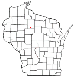
Ogema, Wisconsin

Last updated
Ogema, Wisconsin
Ogema Town Hall.JPG
Ogema Town Hall, July 2014.
WIMap-doton-Ogema.png
Location of Ogema, Wisconsin
Coordinates: 45°26′50″N90°20′52″W / 45.44722°N 90.34778°W / 45.44722; -90.34778
Country Flag of the United States.svg  United States
State Flag of Wisconsin.svg  Wisconsin
County Price
Area
  Total81.4 sq mi (210.8 km2)
  Land81.3 sq mi (210.6 km2)
  Water0.1 sq mi (0.2 km2)
Elevation
[1]
1,480 ft (451 m)
Population
 (2000)
  Total882
  Density10.8/sq mi (4.2/km2)
Time zone UTC-6 (Central (CST))
  Summer (DST) UTC-5 (CDT)
Area code(s) 715 & 534
FIPS code 55-59525 [2]
GNIS feature ID1583855 [1]

Ogema is a town in Price County, Wisconsin, United States. The population was 882 at the 2000 census. The unincorporated community of Ogema is located in the town.

Contents

Geography

According to the United States Census Bureau, the town has a total area of 81.4 square miles (210.8 km2), of which, 81.3 square miles (210.6 km2) of it is land and 0.1 square miles (0.2 km2) of it (0.09%) is water.

Timms Hill, the highest geographic point in the state of Wisconsin (1,951.5 feet) is located just outside Ogema.

Demographics

As of the census [2] of 2000, there were 882 people, 349 households, and 255 families residing in the town. The population density was 10.8 people per square mile (4.2/km2). There were 417 housing units at an average density of 5.1 per square mile (2.0/km2). The racial makeup of the town was 99.21% White, 0.34% Native American, and 0.45% from two or more races.

There were 349 households, out of which 32.7% had children under the age of 18 living with them, 59.9% were married couples living together, 8.3% had a female householder with no husband present, and 26.9% were non-families. 21.8% of all households were made up of individuals, and 12.6% had someone living alone who was 65 years of age or older. The average household size was 2.53 and the average family size was 2.95.

In the town, the population was spread out, with 26.8% under the age of 18, 8.2% from 18 to 24, 24.9% from 25 to 44, 23.1% from 45 to 64, and 17.0% who were 65 years of age or older. The median age was 39 years. For every 100 females, there were 99.5 males. For every 100 females age 18 and over, there were 100.0 males.

The median income for a household in the town was $29,545, and the median income for a family was $31,625. Males had a median income of $30,125 versus $20,469 for females. The per capita income for the town was $13,664. About 12.6% of families and 14.6% of the population were below the poverty line, including 21.8% of those under age 18 and 12.4% of those age 65 or over.

Notable people

Related Research Articles

<span class="mw-page-title-main">Mount Ayr, Indiana</span> Town in Indiana, United States

Mount Ayr is a town in Jackson Township, Newton County, in the U.S. state of Indiana. The population was 122 at the 2010 census.

Ogema Township is a township in Pine County, Minnesota, United States. The population was 298 at the 2000 census.

<span class="mw-page-title-main">Pine Hollow, Oregon</span> Unincorporated community in the state of Oregon, United States

Pine Hollow is a census-designated place (CDP) and unincorporated community in Wasco County, Oregon, United States. It surrounds Pine Hollow Reservoir. The CDP population was 424 at the 2000 census.

<span class="mw-page-title-main">Salix, Pennsylvania</span> Census-designated place in Pennsylvania, United States

Salix is an unincorporated community and census-designated place (CDP) in Cambria County, Pennsylvania, United States. The population was 1,149 at the 2010 census. In previous censuses it was listed as Salix-Beauty Line Park.

<span class="mw-page-title-main">Capon Bridge, West Virginia</span> Town in West Virginia, United States

Capon Bridge is a town in eastern Hampshire County, West Virginia, United States, along the Northwestern Turnpike, approximately 20 miles (32 km) west of Winchester, Virginia. The population was 418 at the 2020 census. Originally known as "Glencoe", Capon Bridge was incorporated in 1902 by the Hampshire County Circuit Court. It is named because of the construction of the bridge over the Cacapon River at that place, the name of the river being derived from the Shawnee Cape-cape-de-hon, meaning "river of medicine water".

<span class="mw-page-title-main">Pilsen, Wisconsin</span> Town in Wisconsin, United States

Pilsen is a town in Bayfield County, Wisconsin, United States. The population was 210 at the 2010 census. The unincorporated community of Moquah is located in the town.

<span class="mw-page-title-main">Morgan, Wisconsin</span> Town in Wisconsin, United States

Morgan is a town in Oconto County, Wisconsin, United States. The population was 882 at the 2000 census. The unincorporated communities of Morgan and Sampson are located in the town.

<span class="mw-page-title-main">Stiles, Wisconsin</span> Town in Wisconsin, United States

Stiles is a town in Oconto County, Wisconsin, United States. The population was 1,465 at the 2000 census. The unincorporated communities of Stiles and Stiles Junction are located in the town. Situated within ancestral Menominee territory that was ceded to the United States in the 1836 Treaty of the Cedars, its Menominee name is Pæhkuahkiw which means "pointed hillock".

<span class="mw-page-title-main">Eau Galle, St. Croix County, Wisconsin</span> Town in Wisconsin, United States

Eau Galle is a town in St. Croix County, Wisconsin, United States. The population was 882 at the 2000 census. The unincorporated community of Wildwood is located in the town. The unincorporated community of Viking is also partially located in the town.

<span class="mw-page-title-main">Cloverland, Vilas County, Wisconsin</span> Town in Wisconsin, United States

Cloverland is a town in Vilas County, Wisconsin, United States. The population was 919 at the 2000 census.

<span class="mw-page-title-main">Dousman, Wisconsin</span> Village in Wisconsin, United States

Dousman is a village in Waukesha County, Wisconsin, United States. The population was 2,419 at the 2020 census.

<span class="mw-page-title-main">Sussex, Wisconsin</span> Village in Wisconsin, United States

Sussex is a village in Waukesha County, Wisconsin, United States, about 19 miles (31 km) northwest of Milwaukee and 9 miles (14 km) north of Waukesha. The village is 7.24 square miles (19 km2) at an elevation of 930 feet. The population was 11,487 at the 2020 census. It is part of the Milwaukee metropolitan area.

<span class="mw-page-title-main">Clayton, Winnebago County, Wisconsin</span> Town in Wisconsin, United States

Clayton is a town in Winnebago County, Wisconsin, United States. The population was 3,951 at the 2010 census. The unincorporated communities of Larsen, Medina Junction, and Mikesville are located within the town.

<span class="mw-page-title-main">Marathon (village), New York</span> Village in New York, United States

Marathon is a village within the town of Marathon in Cortland County, New York, United States. The population of the village was 919 at the 2010 census, out of 1,967 in the entire town.

Tomahawk is a town in Lincoln County, Wisconsin, United States. The population was 416 at the 2010 census. The city of Tomahawk is located to the northeast of the town and is not contiguous with it. The unincorporated community of Spirit Falls is located in the town.

<span class="mw-page-title-main">Montello (town), Wisconsin</span> Town in Wisconsin, United States

Montello is a town in Marquette County, Wisconsin, United States. The population was 1,043 at the 2000 census. The City of Montello and the unincorporated community of Glen Oak are located within the town.

The Town of Clayton is located in Polk County, Wisconsin, United States. The population was 571 at the 2000 census. The Village of Clayton and the unincorporated communities of Joel and Richardson are located in the town.

Prentice is a town in Price County, Wisconsin, United States. The population was 479 at the 2000 census. The village of Prentice and the unincorporated community of Pennington are located within the town.

<span class="mw-page-title-main">Medford, Wisconsin</span> City in Wisconsin, United States

Medford is a city in Taylor County, in north-central Wisconsin, United States. The population was 4,349 at the 2020 census. The city is located mostly within the boundaries of the Town of Medford. It is the county seat of Taylor County.

Scandinavia is a town in Waupaca County, Wisconsin, United States. The population was 1,075 at the 2000 census. The Village of Scandinavia is located within the town.

References

  1. 1 2 "US Board on Geographic Names". United States Geological Survey. 2007-10-25. Retrieved 2008-01-31.
  2. 1 2 "U.S. Census website". United States Census Bureau . Retrieved 2008-01-31.
  3. 'Wisconsin Blue Book 1915,' Biographical Sketch of August Heden, pg. 530
  4. 'Wisconsin Blue Book 1948, Biographical Sketch of Ernest A. Heden, pg. 32
  5. Wisconsin Blue Book 1929
  6. "Tombstone Pizza co-founder Joseph Simek dies". Green Bay Press Gazette . 2013-02-21. Retrieved 2013-03-17.

Coordinates: 45°26′37″N90°17′54″W / 45.44361°N 90.29833°W / 45.44361; -90.29833