Fifield is a town in Price County, Wisconsin, United States. The population was 948 at the 2020 census. The unincorporated community of Fifield is in town, as is the ghost town of Coolidge.
As logging boomed and the population grew, a town hall was built in 1882, but it burned in the fire of 1893, along with Fifield's business district of 60 buildings.[citation needed] The next spring, the town rebuilt the hall with the same dimensions, headed by carpenter Theodore Ristin.[citation needed]
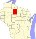
Geography
According to the United States Census Bureau[citation needed], the town has an area of 156.5 square miles (405.3km2), of which 149.4 square miles (386.9km2) is land and 7.1 square miles (18.4km2) (4.53%) is water.
Demographics
As of the census[4] of 2020, there was 948 people and 503 households residing in the town. The population density was 6.3 people per square mile (2.4/km2). There were 1,058 housing units, at an average density of 7.06 per square mile (2.73/km2). From the total of 1 058 housing units, 81% were single units, 19% were mobile homes, and 1% was a multi-unit.
The population of 948 consists of: 14% under the age of 18, followed by 49% from ages 20 to 64, and 37% of people were 65 and older. The median age is 57.3 years. The population was recorded as 48% female, and 52% male.
Educational alignment showed that 95.1% of people finished high school grad or higher, while 19.5% had a Bachelor's degree or higher.
Out of 503 households, 58% were married couples living together, 11% had a female householder, 3% had a male householder, and 28% were non-families. On average, the household size was 1.9 people.
The median income for a household in the town was $58,523. The per capita income for the town was $37,464. About 10% of the population were below the poverty line, including 34% of those under age 18, and 3% of those age 65 or over.
This page is based on this Wikipedia article Text is available under the CC BY-SA 4.0 license; additional terms may apply. Images, videos and audio are available under their respective licenses.