Flambeau, Wisconsin | |
---|---|
Coordinates: 45°46′33″N90°33′59″W / 45.77583°N 90.56639°W | |
Country | United States |
State | Wisconsin |
County | Price |
Area | |
• Total | 98.4 sq mi (254.8 km2) |
• Land | 95.8 sq mi (248.1 km2) |
• Water | 2.6 sq mi (6.7 km2) |
Elevation | 1,457 ft (444 m) |
Population (2000) | |
• Total | 535 |
• Density | 5.6/sq mi (2.2/km2) |
Time zone | UTC-6 (Central (CST)) |
• Summer (DST) | UTC-5 (CDT) |
Area code(s) | 715 & 534 |
FIPS code | 55-26050 [2] |
GNIS feature ID | 1583205 [1] |
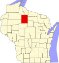
Flambeau is a town in Price County, Wisconsin, United States. The population was 535 at the 2000 census. The unincorporated community of Lugerville is located in the town.
According to the United States Census Bureau, the town has a total area of 98.4 square miles (254.8 km2), of which, 95.8 square miles (248.1 km2) is land and 2.6 square miles (6.7 km2) (2.64%) is water.
As of the census [2] of 2000, there were 535 people, 207 households, and 146 families residing in the town. The population density was 5.6 people per square mile (2.2/km2). There were 460 housing units at an average density of 4.8 per square mile (1.9/km2). The racial makeup of the town was 98.32% White, 0.19% Asian, 0.37% from other races, and 1.12% from two or more races. Hispanic or Latino people of any race were 1.68% of the population.
There were 207 households, out of which 33.3% had children under the age of 18 living with them, 61.4% were married couples living together, 6.3% had a female householder with no husband present, and 29.0% were non-families. 26.6% of all households were made up of individuals, and 12.1% had someone living alone who was 65 years of age or older. The average household size was 2.58 and the average family size was 3.14.
In the town, the population was spread out, with 28.0% under the age of 18, 5.6% from 18 to 24, 26.4% from 25 to 44, 27.9% from 45 to 64, and 12.1% who were 65 years of age or older. The median age was 40 years. For every 100 females, there were 109.0 males. For every 100 females age 18 and over, there were 102.6 males.
The median income for a household in the town was $41,250, and the median income for a family was $45,469. Males had a median income of $35,000 versus $20,313 for females. The per capita income for the town was $15,196. About 6.0% of families and 11.6% of the population were below the poverty line, including 8.2% of those under age 18 and 25.0% of those age 65 or over.
Indianola is a village in Carroll Township, Vermilion County, Illinois, United States. It is part of the Danville, Illinois Metropolitan Statistical Area. The population was 207 at the 2000 census.
Burlington is a town in Burlington Township, Carroll County, Indiana, United States. The population was 603 at the 2010 census. It is part of the Lafayette, Indiana Metropolitan Statistical Area. State Road 22 connects it to Kokomo.
Silver Lake is a town in Lake Township, Kosciusko County, in the U.S. state of Indiana. The population was 915 at the 2010 census.
Spurgeon is a town in Monroe Township, Pike County, in the U.S. state of Indiana. The population was 207 at the 2010 census. It is part of the Jasper Micropolitan Statistical Area.
Hazleton is a city in Buchanan County, Iowa, United States. The population was 713 at the time of the 2020 census.
Waite is a town in Washington County, Maine, United States. The town was named after Benjamin Waite, a lumberman and businessman from Calais, Maine. The population was 66 at the 2020 census.
Secretary is a town in Dorchester County, Maryland, United States. The population was 535 at the 2010 census.
Chokio is a city in Stevens County, Minnesota, United States. The population was 404 at the 2020 census.
Clinton is a village in southwestern Summit County, Ohio, United States. The population was 1,197 at the 2020 Census. It is part of the Akron metropolitan area.
Haines is a city in Baker County, Oregon, United States. The population was 416 at the 2010 census.
Northfork is a town in McDowell County, West Virginia, United States, located on U.S. Route 52 between Welch and Bluefield.
Springvale is a town in Columbia County, Wisconsin, United States. The population was 550 at the 2000 census.
The Town of Germantown is in Juneau County, Wisconsin, in the United States. At the 2000 census, the town population was 1,174.
Paris is a town in Kenosha County, Wisconsin, United States. The population was 1,397 at the 2020 census. The unincorporated communities of Chapin and Paris are located within the town.
Rockland is a town in Manitowoc County, Wisconsin, United States. The population was 896 at the 2000 census. The unincorporated community of Collins is located in the town. The unincorporated community of Wells is also partially located in the town.
Holton is a town in Marathon County, Wisconsin, United States. It is part of the Wausau, Wisconsin Metropolitan Statistical Area. The population was 873 at the 2010 census.
How is a town in Oconto County, Wisconsin, United States. The population was 563 at the 2000 census. The unincorporated community of Hayes is located in the town. The town is named for Calvin F. How, Jr., an insurance and banking executive.
Herman is a town in Shawano County, Wisconsin, United States. The population was 741 at the 2000 census. The unincorporated community of Lyndhurst is located in the town. The unincorporated community of Leopolis is also located partially within the town.
Bergen is a town in Vernon County, Wisconsin, United States. The population was 1,365 at the 2020 census. The unincorporated community of Pleasant Valley is located in the town.
Bass Lake is a town in Washburn County, Wisconsin, United States. The population was 535 at the 2000 census.