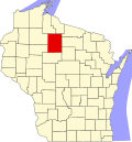
Kennedy, Wisconsin

Last updated

Kennedy, Wisconsin
USA Wisconsin location map.svg
Red pog.svg
Kennedy, Wisconsin
Usa edcp location map.svg
Red pog.svg
Kennedy, Wisconsin
Coordinates: 45°54′37″N90°39′27″W / 45.91028°N 90.65750°W / 45.91028; -90.65750
Country Flag of the United States.svg  United States
State Flag of Wisconsin.svg  Wisconsin
County Price
Elevation
449 m (1,473 ft)
Time zone UTC-6 (Central (CST))
  Summer (DST) UTC-5 (CDT)
Area code(s) 715 & 534
GNIS feature ID1579574 [1]
Downtown Kennedy faced the Omaha Railroad tracks, in the foreground of this photo. Businesses included, from left to right, are Jack Welsh's saloon and restaurant, Oscar Joyce's Saloon, Bricco's General Store, post office and Branshaw's hotel. Kennedy, Wisconsin.jpeg
Downtown Kennedy faced the Omaha Railroad tracks, in the foreground of this photo. Businesses included, from left to right, are Jack Welsh's saloon and restaurant, Oscar Joyce's Saloon, Bricco's General Store, post office and Branshaw's hotel.

Kennedy is an unincorporated community located in the town of Lake, Price County, Wisconsin, United States. [1] [2] Once a busy sawmill community during the logging boom, Kennedy is now a ghost town.

History

The village of Kennedy was platted in 1908, in an area near the Price-Sawyer County border, adjacent to the Omaha Railway tracks. It may have been named after Pat Kennedy, a Fifield pioneer who kept a tavern in the new village. [3]

The land where Kennedy was located was originally owned by Cornell University, who had been given the property through a university land grant. Cornell sold the property to the Sage Land Company, which owned much property in nearby Park Falls. The Sage Company later sold the land to Williard Walther of the Dells Lumber and Pulp Company, for $600. [3] The Dells Lumber and Puld Company was involved in paper making and was based in Eau Claire. The company built a headquarters and office west of Kennedy. Spur lines were built from Kennedy to seven logging camps to the north, near the Ashland County border. In 1908, Willard Walther developed the plat for the new community. [3]

The village grew as the logging operations drew more workers, and the cut-over land was settled. A log schoolhouse was the first building built, located on the west side of the settlement. Taverns, a boarding house, general store, and a train station also soon appeared. A frame schoolhouse and post office were built in 1911. In time, Kennedy had some basic businesses, including a hotel. [3]

Kennedy was the terminus of the Omaha Railway Line for two years, and settlers boarded the train there to reach Rice Lake. In 1916, a road was built that stretched east to Kaiser, another sawmill town. About twenty-five families lived in Kennedy during the 1920s, and thirty students attended the school. [3]

In the mid-1920s, the Dells Company moved its headquarters 2.5 miles farther away from Kennedy, to a community named Delco. Delco was located in a clearing in the woods. A post office was established there for the mill workers, loggers and trainmen who ate and slept at the boarding house there. Delco had an office, a warehouse, a blacksmith shop, and a horse barn. It existed only to handle wood, and the post office was only open between 1927 and 1929. [3]

The Dells Company continued logging until 1933. Virtually all other logging activities in Kennedy came to a halt in 1935. [3]

Edith Bricco, Laura Perry, and Edith Rozell followed Stanley Berg as postmasters until 1938, when the post office was discontinued. The school was closed in 1939 and the village of Kennedy was all but abandoned. All but four of the buildings in the village were taken down, burned, or decayed until they collapsed. The railroad tracks were removed in 1964. [3]

Notes

  1. 1 2 "Kennedy, Wisconsin". Geographic Names Information System . United States Geological Survey, United States Department of the Interior.
  2. Kennedy Topo Map in Price County WI
  3. 1 2 3 4 5 6 7 8 100 Years on the Flambeau. 1989. pp. 56–57. ISBN   0-938627-08-2.

Related Research Articles

<span class="mw-page-title-main">Amity, Arkansas</span> City in Arkansas, United States

Amity is a city in Clark County, Arkansas, United States. The population was 723 at the 2010 census. The city began on the Caddo River in the mid-19th century when William F. Browning and others, including A.B. Clingman, at various times moved to the area.

<span class="mw-page-title-main">Elizabethtown-Kitley</span> Township in Ontario, Canada

Elizabethtown-Kitley is a township in eastern Ontario, Canada, in the United Counties of Leeds and Grenville. Its southern border lies along the St. Lawrence River and it extends north into many rural hamlets and villages. The township was created on January 1, 2001, by the amalgamation of the former Township of Elizabethtown and Township of Kitley.

<span class="mw-page-title-main">Edwardsburgh/Cardinal</span> Township in Ontario, Canada

Edwardsburgh/Cardinal is a township in the United Counties of Leeds and Grenville of eastern Ontario, Canada. Edwardsburgh township was first surveyed in 1783, and incorporated in 1850. The township was part of the historical Grenville County before it merged with Leeds County to form the United Counties in the 19th century.

Pequaming is an unincorporated community in L'Anse Township of Baraga County in the U.S. state of Michigan. It is located on a narrow point of land that juts into Keweenaw Bay. Although still partially inhabited, Pequaming is one of the largest ghost towns in the Upper Peninsula of Michigan.

<span class="mw-page-title-main">Bridal Veil, Oregon</span> Unincorporated community in the state of Oregon, United States

Bridal Veil is a virtual ghost town located in Multnomah County, Oregon, United States. It was established in the 1880s during a logging boom by a logging company as it harvested timber on nearby Larch Mountain to be a company mill town around a sawmill. It had a close relationship with the logging town of Palmer for the first 50 years of its history. As of November 2011, all that remains of the town is a post office and a cemetery. The site is located near the west end of the Columbia River Gorge.

<span class="mw-page-title-main">Winn, Michigan</span> Census-designated place & unincorporated community in Michigan, United States

Winn is an unincorporated community and census-designated place (CDP) in Isabella County in the U.S. state of Michigan. The CDP had a population of 166 at the 2020 census. The community is located within Fremont Township.

Lytleville is an unincorporated community in McLean County, Illinois, United States, located south of Bloomington-Normal, and is approximately 3½ miles northeast of Heyworth in Randolph Township. The community was laid out by John Baldwin in 1836, around his sawmill. Baldwin named the town after a friend, Robert T. Lytle, a Democrat who was a U.S. Congressman from Ohio from 1833 to 1835.

Edgerton is an unincorporated community in Jackson Township, Allen County, in the U.S. state of Indiana.

Swiss is an unincorporated community in western Nicholas County, West Virginia, United States. Its elevation is 735 ft (224 m).

<span class="mw-page-title-main">Buffalo City, North Carolina</span> Town in North Carolina, US

Buffalo City was a logging and moonshine town in East Lake Township, Dare County, North Carolina, United States. It was on the mainland, 19 miles (31 km) west of Manteo near present-day Manns Harbor. The marshy land where Buffalo City once stood, near U.S. 64, is now part of the Alligator River National Wildlife Refuge. The town's history lasted approximately 80 years from the 1870s to 1950s, but at one time Buffalo City's population of 3,000 in the early 20th century made it the largest community in Dare County. A hotel, post office, schoolhouse, general store, 100 miles (160 km) of railroad track and rows of homes once stood on the now-abandoned area. Today, the only remnants of the ghost town include a road sign, rusted rails and building debris now overgrown with weeds.

<span class="mw-page-title-main">Nagrom, Washington</span> Ghost town in Washington (state)

Nagrom is a ghost town in King County, Washington, United States.

<span class="mw-page-title-main">Crannell, California</span> Unincorporated community in California, United States

Crannell is a former settlement in Humboldt County, California. It is located 4.5 miles (7.2 km) southeast of Trinidad, at an elevation of 203 feet (62 m).

<span class="mw-page-title-main">Hermansville, Michigan</span> Census-designated place in Michigan, United States

Hermansville is an unincorporated community and census-designated place (CDP) in Meyer Township of Menominee County in the U.S. state of Michigan. As of the 2020 census, it had a population of 509. The community formed around the defunct Wisconsin Land & Lumber Company as a company town. The company's former headquarters is open as the IXL Historical Museum. US Highway 2 (US 2) passes through the north edge of the community.

<span class="mw-page-title-main">Hannibal, Wisconsin</span> Unincorporated community in Wisconsin, United States

Hannibal is an unincorporated community located in Taylor County, Wisconsin, United States. Hannibal is located on Wisconsin Highway 73 and County Highway M north of Gilman, in the town of Cleveland. Today Hannibal is quiet, but once it was a bustling little economic hub at the junction of two logging railroads.

<span class="mw-page-title-main">Kaiser, Wisconsin</span> Ghost town in Wisconsin, United States

Kaiser is a ghost town in Price County, Wisconsin, United States. Kaiser was located in the town of Lake along the current route of the Tuscobia State Trail, 5 miles (8.0 km) west-southwest of Park Falls. The town was marked on USGS maps as late as 1941.

<span class="mw-page-title-main">Morse (community), Wisconsin</span> Unincorporated community in Wisconsin, United States

Morse is an unincorporated community located in the town of Gordon, Ashland County, Wisconsin, United States. Morse is located along the Bad River 7.5 miles (12.1 km) south-southeast of Mellen.

<span class="mw-page-title-main">Donald, Wisconsin</span> Unincorporated community in Wisconsin, United States

Donald is an unincorporated community located in the town of Pershing, Taylor County, Wisconsin, United States, where the Canadian National Railway crosses County Highway M.

Shanagolden is an unincorporated community located in the town of Shanagolden, Ashland County, Wisconsin, United States. Shanagolden is located on the East Fork Chippewa River 10 miles (16 km) northwest of Butternut.

Black Rock is an unincorporated community and former logging camp in Polk County, Oregon, United States. It is located about three miles west of Falls City, in the Central Oregon Coast Range on the Little Luckiamute River.

<span class="mw-page-title-main">La Madera, Rio Arriba County, New Mexico</span> Census-designated place in New Mexico, United States

La Madera is a census-designated place in Rio Arriba County, New Mexico, United States. Its population was 154 as of the 2010 census. La Madera has a post office with ZIP Code 87539.