
Sullivan County is a county in the U.S. state of New York. As of the 2020 census, the population was 78,624. The county seat is Monticello. The county's name honors Major General John Sullivan, who was labeled at the time as a hero in the American Revolutionary War in part due to his successful campaign against the Iroquois. The county is part of the Hudson Valley region of the state.

Pyramid Peak is a fourteen-thousand-foot mountain in the U.S. state of Colorado. It is the 47th highest mountain peak in Colorado, and 78th highest peak in the United States. It is located in the Elk Mountains in southeastern Pitkin County, approximately 12 miles (19 km) southwest of Aspen. The summit somewhat resembles a ragged square pyramid and is visible from the Roaring Fork River valley north of Aspen along the canyon of Maroon Creek.

Gray Peak is a mountain located in the town of Keene in Essex County, New York. It is the seventh-highest of the Adirondack High Peaks, with an elevation of 4,840 feet (1,480 m), and is located in close proximity to Mount Marcy, the highest peak in New York. Gray Peak is southwest of Mount Marcy and southeast of Mount Colden. The first recorded ascent of the peak was made on September 16, 1872, by surveyor Verplanck Colvin and guide Bill Nye. It was named for Asa Gray by Colvin. Although the mountain is only 0.6 miles (0.97 km) from the summit of Marcy and lacked prominence desired by the Marshall brothers for inclusion in the High Peaks, it was added to the list to preserve the name.
Baker Mountain is a wild, trail-less mountain located in Beaver Cove, Piscataquis County, Maine. It is flanked to the northwest by Lily Bay Mountain. Elephant Mountain is about 2 miles (3 km) to the southwest, and White Cap Mountain is about 5 miles (8 km) to the east.
Mount Sequoyah is a mountain in the Great Smoky Mountains, located in the Southeastern United States. It has an elevation of 6,003 feet above sea level. While the Appalachian Trail crosses its summit, Sequoyah is an 11.5-mile (18.5 km) hike from the nearest parking lot, making it one of the most remote places in the Great Smoky Mountains National Park.

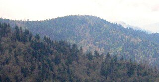
Blackhead is a mountain located in Greene County, New York.

Vly Mountain is a mountain located in the town of Halcott, New York, United States in Greene County. The mountain is part of the Catskill Mountains. Vly Mountain is flanked to the northwest by Bearpen Mountain, to the east by Vinegar Hill, to the northeast by Kipp Hill, and to the southeast by Beech Ridge.
West Kill Mountain, or Westkill Mountain, is located in Greene County, New York. The mountain is named after the West Kill stream which flows along its northern side, and is part of the Devil's Path range of the Catskill Mountains. To the east, West Kill Mountain faces Southwest Hunter Mountain across 800-foot-deep (240 m) Diamond Notch; to the west, West Kill faces North Dome across Mink Hollow.

Indian Head Mountain is a 3,573 ft (1,089 m) mountain located in the southeast corner of Greene County, New York. The mountain, named for the appearance of its profile, is part of the Devil's Path range of the Catskill Mountains. To the northwest, Indian Head is separated from Twin Mountain by Jimmy Dolan Notch; to the southeast, Indian Head is flanked by Plattekill Mountain.

Plateau Mountain is located in the town of Hunter in Greene County, New York, United States. It is part of the Devil's Path range of the Catskill Mountains. Plateau has a two-mile-long (3.2 km) summit ridge above 3,500 feet (1,100 m). The highest point, at least 3,840 feet (1,170 m), is at the southeast end, facing Sugarloaf Mountain to the east across Mink Hollow Notch. It is the 12th-highest peak in the range Devils Tombstone is located west of Plateau Mountain. The northwest end faces Hunter Mountain to the west across 1,400-foot deep (430 m) Stony Clove Notch.
Big Indian Mountain is a mountain located in Ulster County, New York. The mountain is part of the Catskill Mountains. It is flanked to the northwest by Eagle Mountain, to the southeast by Fir Mountain, and to the southwest by Doubletop Mountain.
Doubletop Mountain is a mountain located in Ulster County, New York. The mountain is part of the Catskill Mountains. Doubletop Mountain is flanked to the northwest by Graham Mountain, to the east by Big Indian Mountain, and to the southwest by the Beaver Kill Range.

Eagle Mountain is a mountain located in Ulster County, New York. The mountain is part of the Catskill Mountains. Eagle Mountain is flanked to the north by Haynes Mountain, to the southwest by Doubletop Mountain and Graham Mountain, and to the southeast by Big Indian Mountain.
Lone Mountain is a mountain located in Ulster County, New York. The mountain is part of the Catskill Mountains. Lone Mountain is flanked to the southwest by Table Mountain, and to the east by Rocky Mountain.

Balsam Cap is a mountain located in Ulster County, New York. The mountain is part of the Catskill Mountains. Balsam Cap is flanked to the north by Friday Mountain, and to the southwest by Rocky Mountain.

Cornell Mountain is a mountain located in Ulster County, New York. The mountain is part of the Burroughs Range of the Catskill Mountains. Cornell Mountain is flanked to the northeast by Wittenberg Mountain, to the southwest by Friday Mountain, and to the west by 4,180-foot (1,270 m) Slide Mountain — the highest peak in the Catskills.

The Painted Rock Mountains are a short 15-mile (24 km) long mountain range of the north-central Sonoran Desert southwest of Phoenix, Arizona and in southwest Maricopa County. The Gila River flows through the central-north end of the range.
Frost Hill is a mountain in the Finger Lakes Region of New York. It is located west of Bristol Springs in Ontario County. At an elevation of 2,284 feet (696 m), the mountain is the highest point in Ontario County. It is about 1.25 miles (2.01 km) southwest of the 2,150-foot (660 m) Worden Hill, where Bristol Mountain Ski Resort is.

Huntersfield Mountain is a mountain located in the Catskill Mountains of New York north-northwest of Ashland. Ashland Pinnacle is located east, and Tower Mountain is located south-southeast of Huntersfield Mountain. It is the highest point in Schoharie County and it is ranked 9 of 62 on the list of New York County High Points.
Rattle Hill is a mountain in Sullivan County, New York. It is located north-northwest of Grooville. Beech Mountain is located east-northeast, Burnt Hill is located west-southwest and Gray Hill is located south-southwest of Rattle Hill.

