Orangetown, New York

Last updated

Orangetown
Nyack NY Panorama.JPG
View of the Hudson River
Orangetown, NY Seal.png
Rockland County New York incorporated and unincorporated areas Orangetown highlighted.svg
Location in Rockland County and the state of New York.
USA New York location map.svg
Red pog.svg
Orangetown
Location within the state of New York
Coordinates: 41°3′31″N73°57′42″W / 41.05861°N 73.96167°W / 41.05861; -73.96167
Country United States
State New York
County Rockland
Settled1680
EstablishedMarch 7, 1788
Government
  SupervisorTeresa M. Kenny (R)
Area
[1]
  Total31.33 sq mi (81.15 km2)
  Land24.06 sq mi (62.32 km2)
  Water7.27 sq mi (18.83 km2)
Elevation
95 ft (29 m)
Population
 (2020)
  Total48,655
Time zone UTC−5 (Eastern (EST))
  Summer (DST) UTC−4 (EDT)
FIPS code 36-55211
GNIS feature ID0979316
Website www.orangetown.com

Orangetown is a town in Rockland County, New York, United States, located in the southeastern part of the county. It is northwest of New York City, north of New Jersey, east of the town of Ramapo, south of the town of Clarkstown, and west of the Hudson River. The population was 48,655 at the 2020 census. [2]

Contents

History

Michael Salyer Stone House Michael Salyer Stone House, Orangetown, NY.jpg
Michael Salyer Stone House

Orangetown was first settled around 1680. The first settlers were Dutch men who purchased a tract of land from the Tappan Indians in 1686; their patent of the same year called the place Orange, but it was also known as Orangetown and Tappan (after the first village). [3] When the state's first twelve counties were established in 1683, the territory that would become Orangetown lay within Orange County. It became part of Rockland County when that county was created in 1798.[ citation needed ]

Historical material from the Gazetteer of New York, 1860 & 1861: [4]

ORANGETOWN—was formed March 7, 1788, and was named from Orange co., of which it then formed a part. It lies upon the Hudson, in the S. angle of the co. Its surface is broken by abrupt and rocky hills in the E. ; but in the center and W. it spreads out into a rolling or moderately hilly region. The Nyack Hills, extending along the river, are 300 to 500 feet high, with steep, rocky declivities upon the E., but more gradual slopes upon the W. Their summits are rocky and covered with a light growth of forest trees. Snake Hill, in the N.E. corner, upon the line of Clarks- town, is one of the principal peaks. The principal stream is Hackensack River, flowing S. through the W. part. Pascack Creek flows through the extreme W. angle, and Spar Kil is a tributary of the Hudson. Near the N. line are several bog or peat meadows, generally well drained and under cultivation. The red sandstone which crops out on the E. declivities of the hills, within a few rods of the river, between Piermont and Nyack, is extensively quarried and exported for building stone. The soil is a reddish, sandy loam intermixed with clay. Fruit growing and furnishing milk for the New York market have become leading pursuits. Nyack, (p.v.,) upon the Hudson, in the N.E. corner of the town, contains 5 churches, 5 shoe manufactories, a steam tub and pail factory, the Rockland Female Institute, and a private academy. Pop. 1,458. Piermont, (p.v.,) upon the Hudson, in the S. part, was incorp. May 21, 1850. It is the E. terminus of the Piermont Branch of the N. Y. & Erie R. R.,—the one over which the freight is carried. Nearly the whole business of the place is connected with the R.R. establishment. A pier 1 mi. long has been built into the river, where the freight is transferred to and from the cars and barges in the river. Upon each end of the pier are extensive offices for the transaction of the busi- ness of the road. At this place the R.R. co. also have a large iron foundery and extensive repair shops. Pop. 2,204. Tappantown, (p.v.,) near the N. J. line, contains 2 churches and 30 dwellings. This place was the scene of the trial of Andre, and for a time in 1780 was the head- quarters of Gen. Washington. Rockland, (Palisades p.o.,) upon the Hudson, in the S. part of the town, contains 3 churches and 40 dwellings. Orange Mills, Middletown, and Blauveltville, (p. o.,) a station on the N. Y. & E. R. R., are hamlets. The first settlement is supposed to have been made by the Dutch, as early as 1680. The first church (Ref. Prot. D.) was formed Oct. 24, 1694; and the first preacher was Rev. Guilllam Bartholf. The first church edifice was erected in 1716. There are 16 churches in town.

The Orangetown Resolutions, a protest of the imposition of duties and the closing of the port of Boston by the British Parliament, were passed in Tappan on July 4, 1774, a precursor of the American Revolution.

Geography

According to the United States Census Bureau, the town has a total area of 31.4 square miles (81 km2), of which 24.2 square miles (63 km2) is land and 7.2 square miles (19 km2), or 22.92%, is water.

The eastern border is defined by the Hudson River, and the southern border is New Jersey. The town is bordered to the north by the town of Clarkstown and to the northwest by the town of Ramapo. [5] [ citation needed ]

Demographics

Historical population
CensusPop.Note
1790 1,175
1820 2,257
1830 1,947−13.7%
1840 2,77142.3%
1850 4,76972.1%
1860 7,06048.0%
1870 6,810−3.5%
1880 8,07718.6%
1890 10,34328.1%
1900 10,4561.1%
1910 14,37037.4%
1920 14,284−0.6%
1930 18,02926.2%
1940 26,66247.9%
1950 34,55429.6%
1960 43,17224.9%
1970 53,53324.0%
1980 48,612−9.2%
1990 46,742−3.8%
2000 47,7112.1%
2010 49,2123.1%
2020 48,655−1.1%
U.S. Decennial Census [6] 2020 [7]

As of the census [8] of 2000, there were 47,711 people, 17,330 households, and 11,940 families residing in the town. The population density was 1,973.1 inhabitants per square mile (761.8/km2). There were 17,827 housing units at an average density of 737.3 per square mile (284.7/km2). The racial makeup of the town was 83.97% White, 5.88% African American, 0.11% Native American, 6.42% Asian, 0.02% Pacific Islander, 1.66% from other races, and 1.93% from two or more races. Hispanic or Latino of any race were 6.02% of the population.

There were 17,330 households, out of which 30.3% had children under the age of 18 living with them, 57.1% were married couples living together, 8.8% had a female householder with no husband present, and 31.1% were non-families. 25.8% of all households were made up of individuals, and 11.0% had someone living alone who was 65 years of age or older. The average household size was 2.62 and the average family size was 3.18.

In the town, the population was spread out, with 22.5% under the age of 18, 8.1% from 18 to 24, 28.9% from 25 to 44, 24.9% from 45 to 64, and 15.6% who were 65 years of age or older. The median age was 39 years. For every 100 females, there were 92.6 males. For every 100 females age 18 and over, there were 89.7 males.

The median income for a household in the town was $70,477, and the median income for a family was $87,341 (these figures had risen to $91,497 and $111,742 respectively as of a 2007 estimate. Males had a median income of $53,596 versus $39,886 for females. The per capita income for the town was $33,170. About 2.4% of families and 4.8% of the population were below the poverty line, including 4.2% of those under age 18 and 8.0% of those age 65 or over.

As of the 2020 Census, there were 48,655 people residing in the Town of Orangetown. [9]

Education

Education in the city is provided by the South Orangetown Central School District.

Elected representation

Orangetown has a Town Supervisor, presently Teresa Kenny (R). Orangetown is represented by the council-form of government, with four councilmen elected alternating years for four year terms. Presently the Orangetown Town Council consists of Gerald "Jerry" Bottari (D), Paul Valentine (R), Thomas F. Diviny (R), and Brian Donohue (R). Orangetown is part of New York’s 17th Congressional District represented in the United States House of Representatives by Mike Lawler. [10] In state government, it is represented by Senator Bill Weber and Assemblyman John McGowan.

Communities and locations

Lake Tappan Lake Tappan.jpg
Lake Tappan
Tallman Mountain Tallman Mountain jeh.JPG
Tallman Mountain

Incorporated villages

Unincorporated hamlets

Other notable locations

Former Unincorporated hamlets

Transportation

Pearl River station in Pearl River gives commuter rail service from Spring Valley south to Hoboken Terminal, on New Jersey Transit's Pascack Valley Line.

The New York Thruway carries I-87 through the town. The highway continues to the east, on the Tappan Zee Bridge, over the Hudson River, to Westchester County.

Notable people

Related Research Articles

<span class="mw-page-title-main">Rockland County, New York</span> County in New York, United States

Rockland County is the second-southernmost county on the west side of the Hudson River in the U.S. state of New York, after Richmond County. It is part of the New York metropolitan area. As of the 2020 U.S. census, the county's population is 338,329, making it the state's third-most densely populated county outside New York City after Nassau and neighboring Westchester Counties. The county seat and largest city is New City. Rockland County is accessible via the New York State Thruway, which crosses the Hudson to Westchester at the Tappan Zee Bridge ten exits up from the NYC border, as well as the Palisades Parkway five exits up from the George Washington Bridge. The county's name derives from "rocky land", as the area has been aptly described, largely due to the Hudson River Palisades.

<span class="mw-page-title-main">Blauvelt, New York</span> Census-designated place in New York, United States

Blauvelt is a hamlet, about 20 miles northwest of New York City. It was a census-designated place, formerly known as Greenbush and then Blauveltville, in the town of Orangetown, Rockland County, New York, United States. It is located north of Tappan, east of Nauraushaun and Pearl River, south of Central Nyack, and west of Orangeburg. As of the 2010 census, the CDP had a population of 5,689.

<span class="mw-page-title-main">Clarkstown, New York</span> Town in New York, United States

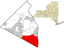
Clarkstown is a town in Rockland County, New York, United States. The town is on the eastern border of the county, located north of the town of Orangetown, east of the town of Ramapo, south of the town of Haverstraw, and west of the Hudson River. As of the 2020 census, the town had a total population of 86,855. The hamlet of New City, the county seat of Rockland County, is also the seat of town government and of the Clarkstown Police Department, the county sheriff's office, and the county correctional facility. New City makes up about 41.47% of the town's population.

<span class="mw-page-title-main">Grand View-on-Hudson, New York</span> Village in New York, United States

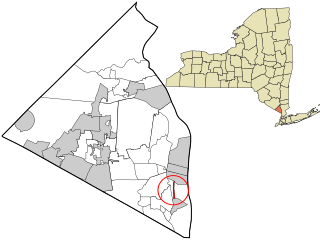
Grand View-on-Hudson is a village incorporated in 1918 in the town of Orangetown in Rockland County, New York, United States. It is located north of Piermont, east of Orangeburg, south of South Nyack, and west of the Hudson River. The population was 285 at the 2010 census. The name is derived from the scenic view from its location.

<span class="mw-page-title-main">Nanuet, New York</span> Census-designated place in New York, United States

Nanuet is a hamlet and census-designated place in the town of Clarkstown, Rockland County, New York, United States. The third largest hamlet in Clarkstown, it is located north of Pearl River, south of New City, east of Spring Valley, and west of West Nyack. It is located midway between Manhattan and Bear Mountain, 19 miles (31 km) north and south of each respectively; and 2 miles (3 km) north of the New Jersey border. It has one of three Rockland County stations on New Jersey Transit's Pascack Valley Line. The population of Nanuet was 17,882 at the 2010 census.

<span class="mw-page-title-main">Nyack, New York</span> Village in New York, United States

Nyack is a village located primarily in the town of Orangetown in Rockland County, New York, United States. Incorporated in 1872, it retains a very small western section in Clarkstown. The village had a population of 7,265 as of the 2020 census. It is a suburb of New York City lying approximately 15 miles (24 km) north of the Manhattan boundary near the west bank of the Hudson River, situated north of South Nyack, east of Central Nyack, south of Upper Nyack, and southeast of Valley Cottage.

<span class="mw-page-title-main">Orangeburg, New York</span> Census-designated place in New York, United States

Orangeburg is a hamlet and census-designated place, in the town of Orangetown, Rockland County, New York, United States. It is located north of Tappan, south of Blauvelt, east of Pearl River and west of Piermont. The population was 4,568 at the 2010 census.

<span class="mw-page-title-main">Pearl River, New York</span> Census-designated place in New York, United States

Pearl River is a hamlet and census-designated place in the town of Orangetown, Rockland County, New York, United States. It is east of Chestnut Ridge, south of Nanuet, west of Blauvelt, New York, and north of Montvale and Old Tappan, New Jersey. The population was 15,876 at the 2010 census.

<span class="mw-page-title-main">Piermont, New York</span> Village in New York, United States

Piermont is a village incorporated in 1847 in Rockland County, New York, United States. Piermont is in the town of Orangetown, located north of the hamlet of Palisades, east of Sparkill, and south of Grand View-on-Hudson, on the west bank of the Hudson River. The population was 2,517 at the 2020 census. Woody Allen set The Purple Rose of Cairo, a fictional film within The Purple Rose of Cairo (1984) in Piermont.

<span class="mw-page-title-main">South Nyack, New York</span> Hamlet in New York, United States

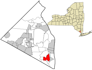
South Nyack is a hamlet and census-designated place in the town of Orangetown in Rockland County, New York, United States. It is located north of Grand View-on-Hudson, northeast of Orangeburg, east of Blauvelt State Park, south of Nyack and west of the Hudson River. The hamlet is the western terminus of the Tappan Zee Bridge. Its population was 3,510 at the 2010 census. The hamlet was formerly incorporated as a village from 1878 until 2022.

<span class="mw-page-title-main">Tappan, New York</span> Census-designated place in New York, United States

Tappan is a hamlet and census-designated place in the town of Orangetown, Rockland County, New York. It is located northwest of Alpine, New Jersey, north of Northvale, New Jersey and Rockleigh, New Jersey, northeast of Old Tappan, New Jersey, east/southeast of Nauraushaun and Pearl River, south of Orangeburg, southwest of Sparkill, and west of Palisades; Tappan shares a border with each. The population was 6,673, according to the 2020 census.

<span class="mw-page-title-main">Blauvelt State Park</span> State park in Rockland County, New York

Blauvelt State Park is a 644-acre (2.61 km2) undeveloped state park located in the Town of Orangetown in Rockland County, New York, near the Hudson River Palisades. The park's land occupies the site of the former Camp Bluefields, a rifle range used to train members of the New York National Guard prior to World War I. The park is located south of Nyack.

<span class="mw-page-title-main">Palisades, New York</span> Hamlet in New York, United States

Palisades, formerly known as Sneden's Landing, is a hamlet in the Town of Orangetown in Rockland County, New York. It is located north of Rockleigh and Alpine, New Jersey; east of Tappan; south of Sparkill; and west of the Hudson River.

<span class="mw-page-title-main">Area codes 845 and 329</span> Telephone area code in New York state

Area codes 845 and 329 are telephone area codes in the North American Numbering Plan (NANP) for the U.S. state of New York. The numbering plan area comprises the mid- and lower Hudson Valley, specifically Orange, Putnam, Rockland, and Ulster counties, and parts of Columbia, Delaware, Dutchess, Greene, and Sullivan counties.

<span class="mw-page-title-main">Sparkill, New York</span> Census-designated place in New York, United States

Sparkill, formerly known as Tappan Sloat, is a suburban hamlet and census-designated place in the Town of Orangetown, Rockland County, New York, United States located north of Palisades; east of Tappan; south of Piermont and west of the Hudson River. As of the 2010 census, the CDP had a population of 1,565. The hamlet is home to St. Thomas Aquinas College and the Dominican Sisters of Sparkill.

<span class="mw-page-title-main">New York State Route 340</span> State highway in Rockland County, New York, US

New York State Route 340 (NY 340) is a 3.10-mile (4.99 km) state highway in southeastern Rockland County, New York, in the United States. Though it is signed as an east–west route, it actually follows a north–south alignment. The southern terminus of the route is at the New Jersey state line in Palisades, where it becomes County Route 501 (CR 501). The northern terminus is at an intersection with NY 303 in Orangeburg; however, according to the New York State Department of Transportation (NYSDOT), the route continued for another 0.07 miles (0.11 km) to the northwest of NY 303 until by 2017. NY 340 was assigned to part of its modern routing in the early 1930s and extended to its current length in the early 1940s.

<span class="mw-page-title-main">New York State Route 303</span> State highway in Rockland County, New York, US

New York State Route 303 (NY 303) is a north–south state highway in eastern Rockland County, New York, in the United States. It begins at the New Jersey state line in the hamlet of Tappan and runs generally northward for 10.92 miles (17.57 km) to an intersection with U.S. Route 9W (US 9W) in Clarkstown. The route has connections to the Palisades Interstate Parkway and the New York State Thruway, the latter carrying Interstate 87 (I-87) and I-287. NY 303 was assigned as part of the 1930 renumbering of state highways in New York, and only minor realignments have occurred since that time.

The recorded history of Rockland County, New York begins on February 23, 1798, when the county was split off from Orange County, New York and formed as its own administrative division of the state of New York. It is located 6 miles (9.7 km) north-northwest of New York City, and is part of the New York Metropolitan Area. The county seat is the hamlet of New City. The name comes from rocky land, an early description of the area given by settlers. Rockland is New York's southernmost county west of the Hudson River. It is suburban in nature, with a considerable amount of scenic designated parkland. Rockland County does not border any of the New York City boroughs, but is only 9.5 miles (15.3 km) north of Manhattan at the counties' two respective closest points
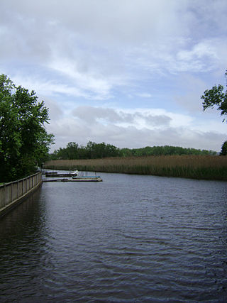
<span class="mw-page-title-main">Sparkill Creek</span> River in New Jersey, United States

Sparkill Creek, is a tributary of the Hudson River in Rockland County, New York and Bergen County, New Jersey in the United States. It flows through the Sparkill Gap in the Hudson Palisades, which was created by a fault line which provided the only sea-level break in the Palisades.

<span class="mw-page-title-main">Joseph B. Clarke Rail Trail</span>

The Joseph B. Clarke Rail Trail is a paved 3.8 mile north-south rail trail in the town of Orangetown, Rockland County, New York. It begins at the Blauvelt Free Library on Western Highway in the hamlet of Blauvelt, and ends at the intersection of Oak Tree Road in the hamlet of Tappan. The trail intersects the Old Erie Path at Depot Square in Sparkill.

References

  1. "2016 U.S. Gazetteer Files". United States Census Bureau. Retrieved July 5, 2017.
  2. U.S. Census Bureau, 2020 Report, Orangetown, Rockland County, New York QuickFacts https://www.census.gov/quickfacts/orangetowntownrocklandcountynewyork
  3. "A. W. VanKeuren, "Town of Orangetown," in Arthur S. Tompkins, Historical Record to the Close of the Nineteenth Century of Rockland County, New York, pp. 345-414". Nyack, NY: Van Deusen & Joyce, 1902. Retrieved June 24, 2012.
  4. http://gedcomindex.com/Reference/New_York/new_york570.html [Gazetteer of New York, 1860 & 1861]
  5. "Orangetown Museum". Orangetown Museum. Retrieved February 20, 2018.
  6. "Census of Population and Housing". Census.gov. Retrieved June 4, 2015.
  7. U.S. Census Bureau, 2020 Report, Orangetown, Rockland County, New York QuickFacts https://www.census.gov/quickfacts/orangetowntownrocklandcountynewyork
  8. "U.S. Census website". United States Census Bureau . Retrieved January 31, 2008.
  9. New York; Orangetown town, Rockland County, New York
  10. "About New York's 17th District | Representative Nita Lowey". Archived from the original on September 5, 2015. Retrieved September 19, 2015.
  11. Westfair Online
  12. "George Worth Bio, Stats, and Results | Olympics at Sports-Reference.com". www.sports-reference.com. Archived from the original on April 17, 2020. Retrieved January 13, 2022.