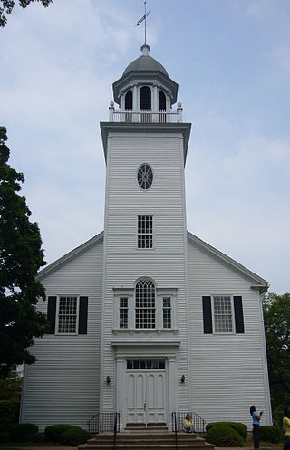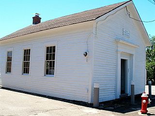
Litchfield Historic District, in Litchfield, Connecticut, is a National Historic Landmark District designated in 1968 as a notable and well-preserved example of a typical late 18th century New England village. As a National Historic Landmark, it is listed on the National Register of Historic Places (NRHP). It is the core area of a larger NRHP-listed historic district that includes the entire borough of Litchfield and was designated a state historic district in 1959.

Court Square is the central plaza and historic district in Springfield, Massachusetts. It is located in the heart of Springfield's urban Metro Center neighborhood. Court Square is the City of Springfield's only topographical constant since its founding in 1636.

The Longmeadow Historic District is a historic district encompassing the village green of Longmeadow, Massachusetts and properties in its immediate vicinity. The district acquired local protection in 1973 and was added to the National Register of Historic Places in 1982.

The Newbury Historic District encompasses the historic town center of Newbury, Massachusetts. Centered on the town's upper green, the area has a history of more than 350 years, and includes buildings dating to the 17th century. It extends from the green northward on High Street to the town line with Newburyport. It was listed on the National Register of Historic Places in 1976.

Johnsville is an unincorporated community in Frederick County, Maryland, United States. It is located approximately halfway between Libertytown and Union Bridge along Maryland Route 75. The Kitterman-Buckey Farm was listed on the National Register of Historic Places in 2005.

The Milton Centre Historic District encompasses the traditional civic heart of Milton, Massachusetts. The district is located on Canton Avenue between Readsdale Road and Thacher and Highland Streets, and includes municipal buildings, churches, and residences, most built in the 18th or 19th century. The district was listed on the National Register of Historic Places in 1988.

Norwichtown is a historic neighborhood in the city of Norwich, Connecticut, United States. It is generally the area immediately north of the Yantic River between I-395 and Route 169.

The Union Green is the town green of the New England town of Union, Connecticut. The Green is a small town-owned wedge at the north end of a triangle park area formed by Town Hall Road, Buckley Highway and Kinney Hollow Road. The Green, Union Grove, and properties to the north along Route 190 are listed on the National Register of Historic Places as the Union Green Historic District. The historic district contains 16 buildings, 3 sites, and 2 objects over an area of 300 acres (1.2 km2).

Bolton Green Historic District is a historic district that includes the town green, Bolton Green, of the town of Bolton, Connecticut. The green and the surrounding buildings were listed on the National Register of Historic Places in 2001. The district encompasses 9 buildings, 1 site, 4 structures, and 2 objects that contribute to the historical significance of the area. The district extends east about 500 yards (460 m) from the green along Bolton Center Road. The oldest existing buildings around the Green are the former tavern and the Bolton General Store. The most prominent building around the Green is the Bolton Congregational Church, a Greek Revival structure built in 1818 with a truncated box-spire. Other structures around the green are a house facing the green on the east side built in the 1840s, and a new ranch house that was built on the former site of an 1870s house that was destroyed by fire. Other properties in the district includes the Brick Tavern, the site of Bolton's first post office, the town hall, the Tuthill residence, and the Bolton Heritage Farm.

The Orange Center Historic District encompasses the historic town center of Orange, Connecticut. Centered on the town green at the junction of Meetinghouse Lane and Orange Center Road, it has retained its character as a 19th-century agrarian town center despite significant 20th-century suburbanization around it. Originally established as a local historic district in 1978, it listed on the National Register of Historic Places in 1989.

Wolcott Green Historic District a historic district in the New England town of Wolcott, Connecticut. The district encompasses the town green and the surrounding buildings. The green is located in the town center of Wolcott along Center Road. It has a triangular shape and is surrounded by several houses, a church and the town hall. The other streets bounding the green are Bound Line Road and Kenea Avenue.

West Haven Green is the town green of the New England town of West Haven, Connecticut. The green is bordered by Church Street on the south, Savin Avenue on the west, Main Street on the north and Campbell Avenue on the east. The green and surrounding buildings are part of the West Haven Green Historic District.

Prospect Green Historic District is a historic district in the New England town of Prospect, Connecticut. The district is centered on the Prospect Green, the town green. The green is located on the highest settled point in New Haven County. The green is bounded by Route 68 and Center and Church Streets.

The Woodbridge Green Historic District is a historic district encompassing the historic town center of Woodbridge, Connecticut. It is located in the block bounded on the south by Center Road, on the east by Newton Road, and on the north and west by Meetinghouse Lane. The center is a good example of early 20th-century town planning, with good examples of Colonial and Classical Revival architecture. The district was added to the National Register of Historic Places in 2003.

The Bellamy-Ferriday House and Garden is a historic house museum at 9 Main Street North in Bethlehem, Connecticut. The main house was built between about 1754 and 1767 by the Rev. Joseph Bellamy, a prominent Congregationalist minister who played an influential role in the First Great Awakening. The property, the National Register of Historic Places in 1982. The house and surrounding gardens are owned and operated by Connecticut Landmarks; admission is charged. Another 81 acres of forest and fields adjacent to the museum property are maintained as Bellamy Preserve, the town of Bethlehem's "Central Park," by the Bethlehem Land Trust.

The Goffstown Main Street Historic District is a historic district encompassing the historic 19th-century center of Goffstown, New Hampshire. Most of the district's 23 buildings lie on Main Street, in a 0.5-mile (0.80 km) running north from the Piscataquog River to North Mast Street. The district also includes properties on Depot Street and Church Street, west of Main Street. It was listed on the National Register of Historic Places in 2007.
Liberty Green Historic District is a local historic district in the town of Clinton, Connecticut, and Liberty Green is a triangular town green within it. The district was created in 1979 following a lengthy study, report and enabling ordinance

Ellington Center Historic District is an 80-acre (32 ha) historic district in the town of Ellington, Connecticut that was listed on the National Register of Historic Places in 1990.

The Winsted Green Historic District encompassing the historic town green of Winsted, Connecticut, and a collection of historic buildings that face it. It extends northward from the junction of United States Route 44 and Connecticut Route 8 to Holabird Avenue, and features a diversity of architecture from the early 19th to 20th centuries, reflecting the city's growth. The district was listed on the National Register of Historic Places in 1977, and slightly enlarged in 1982.

The Watertown Center Historic District encompasses the historic village center of Watertown, Connecticut. It exhibits architectural and historic changes from the early 1700s into the 20th century. It is roughly bounded by Main, Warren, North, Woodbury, Woodruff, and Academy Hill Roads, and was listed on the National Register of Historic Places in 2001.


