| Merrick Brook | |
|---|---|
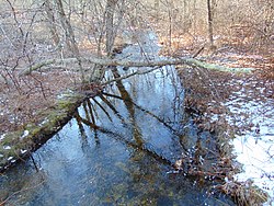 Merrick Brook in the winter | |
 | |
| Location | |
| County | United States |
| State | Connecticut |
| Towns | Chaplin, Hampton, Scotland |
| Physical characteristics | |
| Source | |
| • location | Unnamed Pond, Chaplin, Connecticut |
| • coordinates | 41°47′00″N72°06′37″W / 41.7833°N 72.1104°W |
| Mouth | |
• location | Shetucket River, Scotland, Connecticut |
• coordinates | 41°39′38″N72°06′37″W / 41.6606°N 72.1104°W |
| Length | 12 mi (19 km) |
| Width | |
| • minimum | 5.6 feet (1.7 m) |
| • average | 39.1 feet (11.9 m) |
| • maximum | 117.8 feet (35.9 m) |
| Basin features | |
| Population | 3,000 |
| Tributaries | |
| • left | Beaver Brook, Clover Brook |
| Waterbodies | Large Unnamed Ponds |
| Bridges | |
Merrick Brook is a stream that runs through the towns of Scotland, Hampton, and Chaplin, Connecticut. It begins at an unnamed pond in eastern Chaplin and flows down into the Shetucket River at the very southern part of Scotland. It flows through Clarks Corner, Hampton, and the center of Scotland. It offers many wild trout for fishing. [1] [2] [3]