The River Cole is a 25 miles (40 km) river in the English Midlands. It rises on the lower slopes of Forhill, one of the south-western ramparts of the Birmingham Plateau, at Hob Hill, near Wythall; and flows largely north-east across the plateau to enter the River Blythe below Coleshill, near Ladywalk, shortly before the Blythe meets the Tame. This then joins the Trent, whose waters reach the North Sea via the Humber Estuary. Its source is very near the main watershed of Midland England : tributaries are few and very short except in the lower reaches, so the Cole is only a small stream.

The Hogsmill River in Surrey, England, is one of the tributaries of the River Thames. It rises in Ewell and flows into the Thames at Kingston upon Thames on the reach above Kingston road bridge. The river is 6 miles (9.9 km) in length and has a catchment area of 73 km². The river flows through low-lying land, most of it sports grounds and green space, with the exception of Kingston town centre.

The Upper Ammonoosuc River is a tributary of the Connecticut River that flows through Coös County in northern part of the northeastern U.S. state of New Hampshire. Despite its name, the river is not an upstream portion of the Ammonoosuc River, but instead a separate tributary of the Connecticut River flowing from 20 to 60 miles to the north of the Ammonoosuc.
Ipswich River is a small river in northeastern Massachusetts, United States. It held significant importance in early colonial migrations inland from the ocean port of Ipswich. The river provided safe harborage at offshore Plum Island Sound to early Massachusetts subsistence farmers, who were also fishermen. A part of the river forms town boundaries and divides Essex County, Massachusetts on the coast from the more inland Middlesex County. It is 35 miles (56 km) long, and its watershed is approximately 155 square miles (401 km2), with an estimated population in the area of 160,000 people.

Moxie Falls is a waterfall in Somerset County, Maine. At a vertical drop of over 90 feet (30 m) into a pool about 17 feet (5 m) deep, Moxie Falls is one of the highest falls in New England. The falls are part of Moxie Stream which flows from Moxie Pond into the Kennebec River approximately 1 kilometer (0.62 mi) downstream the falls. Moxie Stream drains Moxie Pond approximately 5 miles (8.0 km) upstream of the falls.

The Carrabassett River, a tributary of the Kennebec River, is located in Franklin County and Somerset County, Maine, in the United States. It rises near Sugarloaf Mountain, east of Rangeley Lake, and runs for 33.8 miles (54.4 km), flowing southeast past Kingfield and joining the Kennebec River in the town of Anson.

The Millers River is a 52.1-mile-long (83.8 km) river in northern Massachusetts, originating in Ashburnham and joining the Connecticut River just downstream from Millers Falls, Massachusetts. The river was formerly known as Paquag or Baquag, a Nipmuc word meaning "clear water". Sections of the river are used for whitewater kayaking, and a section upriver is popular with flatwater racers.

The Ten Mile River is a river within the U.S. states of Massachusetts and Rhode Island. It flows approximately 22 miles (35 km) and drains a watershed of 54 square miles (140 km2).

The Wood River is a river in the U.S. states of Connecticut and Rhode Island. It flows approximately 25 miles (40 km) and is a major tributary of the Pawcatuck River. There are 8 dams along the river's length.

The Batten Kill, Battenkill, or Battenkill River is a 59.4-mile-long (95.6 km) river rising in Vermont that flows into New York and is a tributary of the Hudson River. As "kill" means a creek, the name "Battenkill River" is pleonastic.
The Passumpsic River is a 22.7-mile-long (36.5 km) tributary of the Connecticut River, in Vermont. Though primarily a Caledonia County river, it is the only river to flow through all three counties of the Northeast Kingdom.

Spencer State Forest is a Massachusetts state forest and recreation reserve located in the town of Spencer, managed by the Massachusetts Department of Conservation and Recreation. The 92 mile (148 km) Midstate Trail passes through the state forest. The Commonwealth of Massachusetts also conducts logging in some parts of the property.

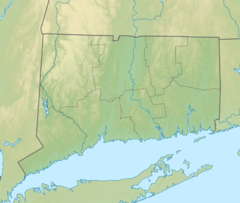
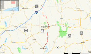
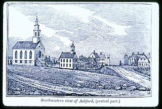
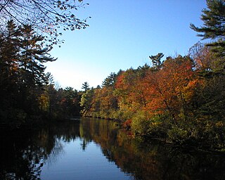
Lake Chaffee is a small, shallow, man-made lake located approximately 2 miles (3.2 km) northwest of the hamlet of Westford in the town of Ashford in Windham County, northeastern Connecticut. The lake has an area of 54 acres and a maximum depth of 11 feet. Its average surface elevation is 856 feet above sea level.

The Sheldrake River is a freshwater stream located in Southern Westchester County, New York. The river forms in White Plains and flows six miles (9.7 km) south until it joins the Mamaroneck River. Approximately 1.58 miles (2.54 km) of the Sheldrake River flow through Scarsdale, 2.13 miles (3.43 km) through New Rochelle and two miles (3.2 km) through the Town of Mamaroneck.

Trout Brook is a tributary of South Branch Tunkhannock Creek in Lackawanna County and Wyoming County, in Pennsylvania, in the United States. It is approximately 5.0 miles (8.0 km) long and flows through West Abington Township in Lackawanna County and Clinton Township in Wyoming County. The stream has no named tributaries, but it does have ten unnamed tributaries. There are also a number of wetlands in the watershed of the stream. The stream is classified as a Coldwater Fishery. Its watershed occupies portions of three municipalities in Wyoming County and five in Lackawanna County.
The Belgrade Lakes are a chain of lakes around Belgrade, Maine. The flow sequence is from East Pond to North Pond to Great Pond to Long Pond to Messalonskee Lake and thence via Messalonskee Stream to the Kennebec River at Waterville. The lakes have long been an important resort area for fishing, boating, and swimming; and shoreline development includes residences for individuals employed in the cities of Waterville and Augusta.
South Brook is a tributary of Mehoopany Creek in Luzerne County and Wyoming County, in Pennsylvania, in the United States. It is approximately 6.0 miles (9.7 km) long and flows through Ross Township and Lake Township, Luzerne County, Pennsylvania in Luzerne County and Forkston Township in Wyoming County. The watershed of the stream has an area of 10.1 square miles (26 km2). Wild trout are present in the stream and it has one named tributary, which is known as Opossum Brook.
Opossum Brook is a tributary of South Brook in Luzerne County and Wyoming County, in Pennsylvania, in the United States. It is approximately 4.0 miles (6.4 km) long and flows through Ross Township in Luzerne County and Forkston Township in Wyoming County. The watershed of the stream has an area of 5.13 square miles (13.3 km2). The stream is classified as a High-Quality Coldwater Fishery and has wild trout. The stream has a number of wetlands in its watershed and in some areas is good for birdwatching.

The River Sem is a natural waterway that flows through the ceremonial county of Wiltshire in England. It flows approximately 4 1⁄4 miles (7 km) from its source near East Knoyle to join the River Nadder near Wardour.