Related Research Articles

New London County is in the southeastern corner of Connecticut and comprises the Norwich-New London, Connecticut Metropolitan Statistical Area, which is also included in the Hartford-East Hartford, Connecticut Combined Statistical Area. There is no county government and no county seat, as is the case with all eight of Connecticut's counties; towns are responsible for all local government activities, including fire and rescue, snow removal, and schools.

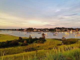
Mystic is a village and census-designated place (CDP) in Groton and Stonington, Connecticut, United States.

North Stonington is a town in New London County, Connecticut which was split off from Stonington in 1724. The population was 5,149 at the 2020 census.
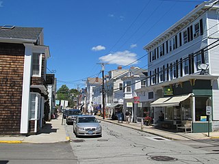
Pawcatuck is a village and census-designated place (CDP) in the town of Stonington which is located in New London County, Connecticut. The population was 5,624 at the 2010 census. It is located across the Pawcatuck River from Downtown Westerly, Rhode Island. The Mechanic Street Historic District of Pawcatuck is listed on the National Register of Historic Places and includes sites of shipbuilding, mills, and worker housing in a 147-acre (0.59 km2) area.
Westerly is a town on the southwestern shoreline of Washington County, Rhode Island, first settled by English colonists in 1661 and incorporated as a municipality in 1669. It is a beachfront community on the south shore of the state with a population of 23,359 as of the 2020 census.
The town of Stonington is located in New London County, Connecticut in the state's southeastern corner. It includes the borough of Stonington, the villages of Pawcatuck, Lords Point, and Wequetequock, and the eastern halves of the villages of Mystic and Old Mystic. The population of the town was 18,335 at the 2020 census.

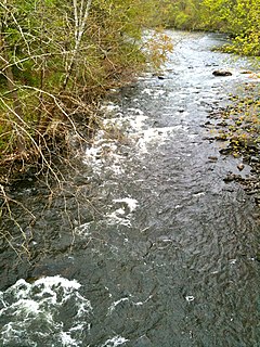
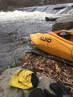
The Pawcatuck River is a river in the US states of Rhode Island and Connecticut flowing approximately 34 miles (55 km). There are eight dams along the river's length. USS Pawcatuck was named after the river.
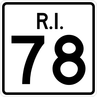
Route 78, also known as the Westerly Bypass, is a two-lane arterial boulevard and expressway between Pawcatuck, Connecticut to Westerly, Rhode Island. The route is about 4.6 miles (7.4 km) long and begins at Connecticut Route 2 in Stonington, crossing into Rhode Island at the Pawcatuck River, where it continues as an expressway to U.S. Route 1 in Westerly. The route was constructed in 1979, after a sixteen-year delay. The designation was to become part of the Orient Point–Watch Hill Bridge, but this plan was later dropped. The route was given the memorial name of Veterans Way in 2004.
The Beaver River is a river in the U.S. state of Rhode Island. It flows approximately 11.0 miles (17.7 km). There are three dams along the river's length. The river is also famous locally for its trout fishing in the spring.

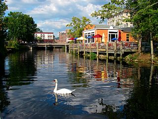
The Mystic River is a 3.4-mile-long (5.5 km) estuary in the southeast corner of the U.S. state of Connecticut. Its main tributary is Whitford Brook. It empties into Fishers Island Sound, dividing the village of Mystic, Connecticut between the towns of Groton and Stonington. Much of the river is tidal. The Mystic River was the location of three large shipbuilding firms during the 19th-century, and it is now the home of the Mystic Seaport maritime museum. The name Mystic is derived from the Pequot term "missi-tuk", describing a large river whose waters are driven into waves by tides or wind, according to the Mystic River Historical Society.
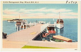
Little Narragansett Bay is an inlet of the Atlantic Ocean and an estuary of the Pawcatuck River on the Rhode Island–Connecticut state line. It is sheltered by a curving peninsula, known as Napatree Point.
The Naugatuck River is a 40.2-mile-long (64.7 km) river in the U.S. state of Connecticut. Its waters carve out the Naugatuck River Valley in the western reaches of the state, flowing generally due south and eventually emptying into the Housatonic River at Derby, Connecticut and thence 11 miles (18 km) to Long Island Sound. The Plume and Atwood Dam in Thomaston, completed in 1960 following the Great Flood of 1955, creates a reservoir on the river and is the last barrier to salmon and trout migrating up from the sea.
The Wood River is a river in the U.S. states of Connecticut and Rhode Island. It flows approximately 25 miles (40 km) and is a major tributary of the Pawcatuck River. There are 8 dams along the river's length.
The Moosup River is a river in the U.S. states of Rhode Island and Connecticut. It flows approximately 23.7 miles (38.1 km). The river is named after the Native American sachem Maussup.
The Green Fall River is a river in the U.S. states of Connecticut and Rhode Island. It flows approximately 13 km (8 mi).
The Ashaway River is a river in the U.S. states of Rhode Island and Connecticut. It flows approximately 4 km (2 mi). There are three dams along the river's length.
Sandy Point Island is a 35-acre (14 ha) island in Little Narragansett Bay, lying mostly in Westerly, Rhode Island and partly in Stonington, Connecticut. Once an extension of Napatree Point, Sandy Point is now a one-mile-long (1.6 km) island that serves as an important nature preserve and recreation site. Sandy Point is the westernmost piece of land in the state of Rhode Island.

The Norwich and Westerly Railway was an interurban trolley system that operated in Southeastern Connecticut during the early part of the 20th century. It operated a 21-mile line through rural territory in Norwich, Preston, Ledyard, North Stonington, and Pawcatuck, Connecticut to Westerly, Rhode Island between 1906 and 1922. For most of its length, the route paralleled what is now Connecticut Route 2.

The Pequabuck River is a river, approximately 19 miles (30.6 km) in length, which rises in Litchfield County, Connecticut, and courses through neighboring Hartford County before emptying into the Farmington River in Farmington. The river has played a crucial role in the development of Plainville, Connecticut, in particular. The river's lower drainage basin consists of industrial and urban areas, and effluents from these areas pollute the river's waters. The Pequabuck drove a water wheel that provided 8 horsepower to the Upper Lock Shop in Plymouth, Connecticut, a facility which would eventually become the Lewis Lock Company in 1851 and, finally, the once-renowned Eagle Lock Company. The river banks were historically the site of one of United States' first malleable iron-producing units, known as Malleable Iron Works.
Harman Garrett was a Niantic sachem and then governor of the Eastern Pequots slightly east of the Pawcatuck River in what is now Westerly, Rhode Island. His chosen English name was very similar to that of Herman Garrett, a prominent colonial gunsmith from Massachusetts in the 1650s.
References
- ↑ "Explore Designated Rivers". Rivers.gov. Retrieved January 8, 2022.
- ↑ Circular. The Survey. 1965. p. 1920. Retrieved 2 April 2013.
- ↑ John Henry Frederick Feth (1965). Selected references on saline ground-water resources of the United States. U.S. Geological Survey. p. 1963. Retrieved 2 April 2013.
- ↑ Estimated water use and availability in the Pawcatuck Basin, southern Rhode Island and southeastern Connecticut, 1995-99. DIANE Publishing. p. 16. ISBN 978-1-4289-8392-2 . Retrieved 2 April 2013.
- ↑ Geological Survey Professional Paper. U.S. Government Printing Office. 1973. p. 82. Retrieved 2 April 2013.
- ↑ Native American Place Names of Connecticut. Applewood Books. 1 March 2001. p. 44. ISBN 978-1-55709-540-4 . Retrieved 2 April 2013.
- ↑ William Bright (2004). Native American placenames of the United States. University of Oklahoma Press. p. 435. ISBN 978-0-8061-3598-4 . Retrieved 2 April 2013.
- ↑ Isaacs, Anna (2013-03-30). "At last, North Stonington bridges the gap". The Day. Connecticut. Retrieved 1 April 2013.