List of rivers of Massachusetts

Last updated

List of rivers of Massachusetts (U.S. state).

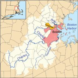
All Massachusetts rivers flow to the Atlantic Ocean. The list is arranged by drainage basin from north to south, with respective tributaries indented under each larger stream's name, arranged travelling upstream along the larger stream.

Contents

By drainage

Gulf of Maine north of Cape Ann

Merrimack River watershed Merrimackrivermap.png
Merrimack River watershed

Massachusetts Bay

Boston Harbor watershed Charlesrivermap.png
Boston Harbor watershed

Cape Cod Bay

Map showing Cape Cod Bay and other major waters off Massachusetts Cape Cod Bay map.png
Map showing Cape Cod Bay and other major waters off Massachusetts

Nantucket Sound

Martha's Vineyard

Buzzards Bay

Narragansett Bay

Taunton River watershed Taunton River Watershed.gif
Taunton River watershed
Blackstone River watershed Blackstonevalleymap.png
Blackstone River watershed

Long Island Sound

Connecticut River watershed Connecticut River Map.png
Connecticut River watershed
Housatonic River watershed Housatonicrivermap.png
Housatonic River watershed
Hoosic River watershed Hoosicrivermap.png
Hoosic River watershed

New York Harbor

Alphabetically

See also

Related Research Articles

Green River may refer to:

<span class="mw-page-title-main">Berkshires</span> Region in western Massachusetts and northern Connecticut

The Berkshires are a highland region located in western Massachusetts and northwestern Connecticut in the United States. Generally, "Berkshires" may refer to the range of hills in Massachusetts that lie between the Housatonic and Connecticut Rivers. Highlands of northwest Connecticut may be seen as part of the Berkshires and sometimes called the Northwest Hills or Litchfield Hills. The segment of the Taconic Mountains in Massachusetts is often considered a part of the Berkshires, although they are geologically separate and are a comparatively narrow range along New York's eastern border.

<span class="mw-page-title-main">Walloomsac River</span> River in the U.S. states of Vermont and New York

The Walloomsac River from the Native American name, Wal-loom-sac is a 16.8-mile-long (27.0 km) tributary of the Hoosic River in the northeastern United States. It rises in southwestern Vermont, in the Green Mountains east of the town of Bennington in Woodford Hollow at the confluence of Bolles Brook and City Stream where it is labeled Walloomsac Brook on maps but is locally known as "The Roaring Branch". The river then flows west toward Bennington and passes the downtown area to the north. For many years this section was intermittent due to the water having been diverted to power mills in town. This divergence gave the name Walloomsac to a portion of the river flowing through town on the present course of South Stream. The combined Walloomsac / South Stream joins the Roaring Branch northwest of town. From here the river flows westward as the Walloomsac River and joins the Hoosic River below Hoosick Falls, New York.

<span class="mw-page-title-main">Western Massachusetts</span> Region of Massachusetts, United States

Western Massachusetts, known colloquially as "western Mass," is a region in Massachusetts, one of the six U.S. states that make up the New England region of the United States. Western Massachusetts has diverse topography; 22 colleges and universities including UMass in Amherst, MA, with approximately 100,000 students; and such institutions as Tanglewood, the Springfield Armory, and Jacob's Pillow.

<span class="mw-page-title-main">Farmington River</span> River in the United States of America

The Farmington River is a river, 46.7 miles (75.2 km) in length along its main stem, located in northwest Connecticut with major tributaries extending into southwest Massachusetts. The longest route of the river, from the origin of its West Branch, is 80.4 miles (129.4 km) long, making it the Connecticut River's longest tributary by 2.3 miles (3.7 km) over the major river directly to its north, the Westfield River. The Farmington River's watershed covers 609 square miles (1,580 km2). Historically, the river played an important role in small-scale manufacturing in towns along its course, but it is now mainly used for recreation and drinking water.

<span class="mw-page-title-main">Geography of Massachusetts</span>

Massachusetts is the 7th smallest state in the United States with an area of 10,555 square miles (27,340 km2). It is bordered to the north by New Hampshire and Vermont, to the west by New York, to the south by Connecticut and Rhode Island, and to the east by the Atlantic Ocean and Gulf of Maine. Massachusetts is the most populous New England state.

<span class="mw-page-title-main">Massachusetts Route 8</span> State highway in Berkshire County, Massachusetts

Route 8 is the portion of the 148 mile multistate New England Route 8 within the state of Massachusetts. The highway runs 66.643 miles (107.252 km) from the Connecticut state line in Sandisfield, where the highway continues as Connecticut Route 8, north to the Vermont state line in Clarksburg, where the highway continues as Vermont Route 8 and VT 100. Route 8 serves several towns in eastern and northern Berkshire County. The highway is the main highway between the cities of Pittsfield and North Adams, where the route intersects Route 9 and Route 2, respectively. Route 8 also intersects U.S. Route 20 in Becket.

<span class="mw-page-title-main">Naugatuck River</span> River in Connecticut, United States

The Naugatuck River is a 40.2-mile-long (64.7 km) river in the U.S. state of Connecticut. Its waters carve out the Naugatuck River Valley in the western reaches of the state, flowing generally due south and eventually emptying into the Housatonic River at Derby, Connecticut and thence 11 miles (18 km) to Long Island Sound. The Plume and Atwood Dam in Thomaston, completed in 1960 following the Great Flood of 1955, creates a reservoir on the river and is the last barrier to salmon and trout migrating up from the sea.

<span class="mw-page-title-main">Quinapoxet River</span> River

The Quinapoxet River is part of the Nashua River watershed in northern Massachusetts in the United States. It is part of the Massachusetts Water Resources Authority water system supplying drinking water to the greater Boston area.

<span class="mw-page-title-main">Stillwater River (Nashua River tributary)</span> River in the United States

The Stillwater River is part of the Nashua River watershed. This river is part of the Massachusetts Water Resources Authority system that supplies drinking water to the greater Boston area.

<span class="mw-page-title-main">Westfield River</span> River in Massachusetts, United States

The Westfield River is a major tributary of the Connecticut River located in the Berkshires and Pioneer Valley regions of western Massachusetts. With four major tributary branches that converge west of the city of Westfield, it flows 78.1 miles (125.7 km) before its confluence with the Connecticut River at Agawam, across from the city of Springfield's Metro Center district. Known for its whitewater rapids and scenery, the Westfield River provides over 50 miles (80 km) of whitewater canoeing and kayaking, in addition to one of the largest roadless wilderness areas remaining in the Commonwealth.

<span class="mw-page-title-main">Brodie Mountain</span> Mountain in United States of America

Brodie Mountain, 2,621 feet (799 m), is a prominent 5.5-mile (8.9 km) long ridgeline in the Taconic Mountains of western Massachusetts, known for the former Brodie Mountain ski area, which closed in 2002. The ridge has eight well defined summits, three of which have names: Sheep's Heaven Mountain, 2,530 feet (770 m), the ridge's southern prominatory; Beoadic Mountain, the ridge high point, just north of Sheep's Heaven; and East Mountain, 2,613 feet (796 m) located at the top of the former ski area at the center of the ridge. A northern summit, 2,170 feet (660 m), is shown as "Brodie Mountain" on maps that predate the Brodie Mountain ski area.

Crum Hill, 2,841 feet (866 m), located in northwest Massachusetts, United States, in the towns of Monroe and Florida, is the highest point in Franklin County. The mountain, part of the Hoosac Range, is crossed by a trail system maintained by a local snowmobile club, the Florida Mountaineers. They maintain a trail map on their website.

References

Commons-logo.svg Media related to Rivers of Massachusetts at Wikimedia Commons