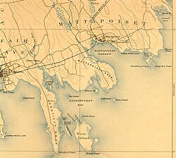
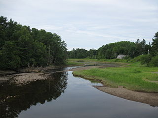
Mudflats or mud flats, also known as tidal flats or, in Ireland, slob or slobs, are coastal wetlands that form in intertidal areas where sediments have been deposited by tides or rivers. A global analysis published in 2019 suggested that tidal flat ecosystems are as extensive globally as mangroves, covering at least 127,921 km2 (49,391 sq mi) of the Earth's surface. They are found in sheltered areas such as bays, bayous, lagoons, and estuaries; they are also seen in freshwater lakes and salty lakes alike, wherein many rivers and creeks end. Mudflats may be viewed geologically as exposed layers of bay mud, resulting from deposition of estuarine silts, clays and aquatic animal detritus. Most of the sediment within a mudflat is within the intertidal zone, and thus the flat is submerged and exposed approximately twice daily.

The East Bay River in Florida is a 15-mile-long (24 km) river located in Santa Rosa and Okaloosa counties. It flows from east to west, forming near Hurlburt Field, and empties into the eastern portion of East Bay (Florida) near the towns Holley and Navarre. The river forms part of the southern boundary of Eglin Air Force Base.

The Eastern Bay is a tributary of the Chesapeake Bay located between Queen Anne's County, Maryland and Talbot County, Maryland on the Eastern Shore. Its main tributaries include the Miles River and the Wye River. It is located south of the Chester River and north of the Choptank River and is connected to the Chester River via Kent Narrows.

The Crystal River National Wildlife Refuge is part of the United States National Wildlife Refuge (NWR) System, located in Kings Bay, in the town of Crystal River, and consists of 20 islands and several small parcels of land. The 80-acre (32 ha) refuge was established in 1983, to protect the West Indian manatee.
Pokegama Bay is a small bay in northwestern Douglas County, Wisconsin, United States, which the St Louis River flows. It makes up part of the border between Minnesota and Wisconsin. Pokegama River, named after the bay, flows into this bay.

The Passagassawakeag River is a 16-mile-long (26 km) river in Waldo County, Maine in the United States. From the outlet of Lake Passagassawakeag in Brooks, it runs south and east to its estuary in Belfast, Maine. The river empties into Belfast Bay, an inlet of Penobscot Bay, where it passes under US Route 1.

Vly Mountain is a mountain located in the town of Halcott, New York, United States in Greene County. The mountain is part of the Catskill Mountains. Vly Mountain is flanked to the northwest by Bearpen Mountain, to the east by Vinegar Hill, to the northeast by Kipp Hill, and to the southeast by Beech Ridge.

Eagle Mountain is a mountain located in Ulster County, New York. The mountain is part of the Catskill Mountains. Eagle Mountain is flanked to the north by Haynes Mountain, to the southwest by Doubletop Mountain and Graham Mountain, and to the southeast by Big Indian Mountain.
Fir Mountain is a mountain located in Ulster County, New York. The mountain is part of the Catskill Mountains. Fir Mountain is flanked to the northwest by Big Indian Mountain, and to the southeast by Spruce Mountain.

Table Mountain is located in Ulster County, New York. The mountain is part of the Catskill Mountains. Table Mountain is flanked to the south by Peekamoose Mountain, and to the northeast by Lone Mountain.
Lone Mountain is a mountain located in Ulster County, New York. The mountain is part of the Catskill Mountains. Lone Mountain is flanked to the southwest by Table Mountain, and to the east by Rocky Mountain.

Balsam Cap is a mountain located in Ulster County, New York. The mountain is part of the Catskill Mountains. Balsam Cap is flanked to the north by Friday Mountain, and to the southwest by Rocky Mountain.
Friday Mountain is a mountain located in Ulster County, New York. The mountain is part of the Catskill Mountains. Friday Mountain is flanked to the north by Cornell Mountain, and to the south by Balsam Cap.

Cornell Mountain is a mountain located in Ulster County, New York. The mountain is part of the Burroughs Range of the Catskill Mountains. Cornell Mountain is flanked to the northeast by Wittenberg Mountain, to the southwest by Friday Mountain, and to the west by 4,180-foot (1,270 m) Slide Mountain — the highest peak in the Catskills.
The Pennamaquan River is a short, 8.1-mile (13 km) river in the U.S. state of Maine, draining from medium-sized, low-elevation Pennamaquan Lake into Cobscook Bay.
The Goose River is a river in Waldo County, Maine. From the outflow of Swan Lake in Swanville, the river runs 9.3 miles (15.0 km) south to the city of Belfast and its mouth at Belfast Bay, an arm of Penobscot Bay.
The Indian River is a river in Washington County, Maine. From its source in Columbia Falls, the river runs about 12.7 miles (20.4 km) south to its estuary at the village of Indian River in the town of Addison. The tidal portion of the Indian River extends another 3.6 miles (5.8 km) south through the township of Jonesport, and then west to Wohoa Bay, an arm of Western Bay on the Atlantic Ocean. The term "Indian River" is also used to loosely refer to the entire combined townships of Addison and Jonesport through which the river passes.
The Johns River is an extension of Johns Bay in Lincoln County, Maine. From Johns Island, it runs 2.5 miles (4 km) north, then splits into its Eastern Branch and North Branch, which run about a mile further north. It forms part of the border between Bristol and South Bristol.
The Orange River is a short river in Whiting, Maine.