Bass River (Massachusetts)

Last updated

Bass River
Bass River, MA.jpg
Looking up Bass River
Location
CountryUnited States
State Massachusetts
Physical characteristics
Source Mill Pond
  locationNW of South Yarmouth
  coordinates 41°42′19″N70°11′40″W / 41.7053°N 70.1944°W / 41.7053; -70.1944
Mouth Nantucket Sound
  location
S of South Yarmouth
  coordinates
41°38′46″N70°11′48″W / 41.6461°N 70.1968°W / 41.6461; -70.1968
  elevation
0 ft (0 m)
Windmill Beach in South Yarmouth Judah Baker Windmill, Bass River Cape Cod, MA.jpg
Windmill Beach in South Yarmouth
Dennis on the bank of Bass River Bass River Massachusetts.jpg
Dennis on the bank of Bass River

Bass River is an estuary and village in South Yarmouth, Massachusetts, United States. [1] [2] The estuary separates the towns of Yarmouth and Dennis at the central, southern sections of the towns. At its widest and most southerly point, it opens to and meets Nantucket Sound. Its brackish, northwestern end flows into Follins Pond, from there winding further north as a brook, to Mill Pond then an underground stream that nearly bisects Cape Cod.

The mouth of the river is between Smugglers Beach on the Yarmouth side and West Dennis Beach on the Dennis side. West Dennis beach has become a popular site for kite boarding in the past few years. In the same way, Kalmus Beach in Hyannis has become popular for windsurfing. Once inside the river, there is a large land mass covered with sea grass, in the middle of which is a large bay. The island is called 'Marsh Island' by the locals.

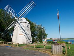
Marsh Island separates Bass River into two parts. The right side of the river, which is referred to as the 'Old Field Channel', goes towards West Dennis and the Fingers development. The left side is the main channel of the river, passing Windmill Beach, Bass River Yacht Club, Ship Shops Marina and the prestigious Bass River Marina and Yacht Club. After the marina, the river goes under the Route 28 bridge and winds five more miles deep into the cape. Bass River was once considered a viable location for a canal traversing Cape Cod, and is the largest river the Mid-Cape Highway spans.

Bass River is home to a friendly rivalry between West Dennis Yacht Club and the Bass River Yacht Club. These clubs also compete against Hyannis Yacht Club, Wianno Yacht Club, and others in the Southern Massachusetts Sailing Association team racing circuit. The Yarmouth shores are home to Bass River Golf Course, which is owned and operated by the town of Yarmouth.

There is another Bass River in the city of Beverly.

Related Research Articles

<span class="mw-page-title-main">Harwich, Massachusetts</span> Town in Massachusetts, United States

Harwich is a New England town on Cape Cod, in Barnstable County in the state of Massachusetts in the United States. At the 2020 census it had a population of 13,440. Harwich experiences a seasonal increase to roughly 37,000. The town is a popular vacation spot, located near the Cape Cod National Seashore. Harwich's beaches are on the Nantucket Sound side of Cape Cod. Harwich has three active harbors. Saquatucket, Wychmere and Allen Harbors are all in Harwich Port. The town of Harwich includes the villages of Pleasant Lake, West Harwich, East Harwich, Harwich Port, Harwich Center, North Harwich and South Harwich.

<span class="mw-page-title-main">Cape Cod</span> Cape in the northeastern United States

Cape Cod is a hook-shaped peninsula extending into the Atlantic Ocean from the southeastern corner of Massachusetts, in the northeastern United States. Its historic, maritime character and ample beaches attract heavy tourism during the summer months. The name Cape Cod, coined in 1602 by Bartholomew Gosnold, is the ninth oldest English place-name in the U.S.

<span class="mw-page-title-main">Wellfleet, Massachusetts</span> Town in Massachusetts, United States

Wellfleet is a town in Barnstable County, Massachusetts, United States, and is located halfway between the "tip" and "elbow" of Cape Cod. The town had a population of 3,566 at the 2020 census, which swells nearly sixfold during the summer. A total of 70% of the town's land area is under protection, and nearly half of it is part of the Cape Cod National Seashore. Wellfleet is famous for its oysters, which are celebrated in the annual October Wellfleet OysterFest.

<span class="mw-page-title-main">Barnstable County, Massachusetts</span> County in Massachusetts, United States

Barnstable County is a county located in the U.S. state of Massachusetts. At the 2020 census, the population was 228,996. Its county seat is Barnstable. The county consists of Cape Cod and associated islands.

<span class="mw-page-title-main">Eastham, Massachusetts</span> Town in Massachusetts, United States

Eastham is a town in Barnstable County, Massachusetts, United States, Barnstable County being coextensive with Cape Cod. The population was 5,752 at the 2020 census.

<span class="mw-page-title-main">Woods Hole, Massachusetts</span> Census-designated place in Massachusetts, United States

Woods Hole is a census-designated place in the town of Falmouth in Barnstable County, Massachusetts, United States. It lies at the extreme southwest corner of Cape Cod, near Martha's Vineyard and the Elizabeth Islands. The population was 781 at the 2010 census.

<span class="mw-page-title-main">Yarmouth, Massachusetts</span> Town in Massachusetts, United States

Yarmouth is a town in Barnstable County, Massachusetts, United States, on Cape Cod. The population was 25,023 at the 2020 census.

<span class="mw-page-title-main">Brewster, Massachusetts</span> Town in Massachusetts, United States

Brewster is a town in Barnstable County, Massachusetts, United States, Barnstable County being coextensive with Cape Cod. The population of Brewster was 10,318 at the 2020 census.

<span class="mw-page-title-main">Chatham, Massachusetts</span> Town in Massachusetts, United States

Chatham is a town in Barnstable County, Massachusetts, United States. Chatham is located at the southeast tip of Cape Cod and has historically been a fishing community. First settled by the English in 1664, the township was originally called Monomoit based on the indigenous population's term for the region. Chatham was incorporated as a town on June 11, 1712, and has become a summer resort area. The population was 6,594 at the 2020 census, and can swell to 25,000 during the summer months. There are four villages that comprise the town, those being Chatham (CDP), South Chatham, North Chatham, and West Chatham. Chatham is home to the Monomoy National Wildlife Refuge, and the decommissioned Monomoy Point Light both located on Monomoy Island. A popular attraction is the Chatham Light, which is an operational lighthouse that is operated by the United States Coast Guard.

<span class="mw-page-title-main">Falmouth, Massachusetts</span> Town in Massachusetts, United States

Falmouth is a town in Barnstable County, Massachusetts, United States. The population was 32,517 at the 2020 census, making Falmouth the second-largest municipality on Cape Cod after Barnstable. The terminal for the Steamship Authority ferries to Martha's Vineyard is located in the village of Woods Hole in Falmouth. Woods Hole also contains several scientific organizations such as the Woods Hole Oceanographic Institution (WHOI), the Marine Biological Laboratory (MBL), the Woodwell Climate Research Center, NOAA's Woods Hole Science Aquarium, and the scientific institutions' various museums.

<span class="mw-page-title-main">Dennis, Massachusetts</span> Town in Massachusetts, United States

Dennis is a town in Barnstable County, Massachusetts, United States, located near the center of Cape Cod. The population was 14,674 at the 2020 census.

<span class="mw-page-title-main">Hyannis, Massachusetts</span> Village in Massachusetts, United States

Hyannis is the largest of the seven villages in the town of Barnstable, Massachusetts, in the United States. It is the commercial and transportation hub of Cape Cod and was designated an urban area at the 1990 census. Because of this, many refer to Hyannis as the "Capital of the Cape". It contains a majority of the Barnstable Town offices and two important shopping districts: the historic downtown Main Street and the Route 132 Commercial District, including Cape Cod Mall and Independence Park, headquarters of Cape Cod Potato Chips. Cape Cod Hospital in Hyannis is the largest on Cape Cod.

<span class="mw-page-title-main">Cotuit, Massachusetts</span> Village in Massachusetts, United States

Cotuit is one of the villages of the Town of Barnstable on Cape Cod in Barnstable County, Massachusetts, United States. Located on a peninsula on the south side of Barnstable about midway between Falmouth and Hyannis, Cotuit is bounded by the Santuit River to the west on the Mashpee town line, the villages of Marstons Mills to the north and Osterville to the east, and Nantucket Sound to the south. Cotuit is primarily residential with several small beaches including Ropes Beach, Riley's Beach, The Loop Beach and Oregon Beach.

<span class="mw-page-title-main">Osterville, Massachusetts</span> Village in Massachusetts, United States

Osterville is one of seven villages within the town of Barnstable, Massachusetts, United States. The village of Osterville is located on the south side of Barnstable on Nantucket Sound. Osterville is a residential community that includes marshes, bays, ponds, a small lake, beaches, and a small business district. Notably, the village is home to the Crosby Yacht Yard; the Crosbys are America's oldest active wooden boat-building family.

<span class="mw-page-title-main">Shrewsbury River</span> Estuary in New Jersey

The Shrewsbury River is a short stream and navigable estuary. The stream is approximately 8 mi (13 km) long and is located in Central New Jersey.

<span class="mw-page-title-main">Cape Cod Rail Trail</span>

The Cape Cod Rail Trail (CCRT) is a 25.5-mile (41.0 km) paved rail trail located on Cape Cod in Massachusetts. The trail route passes through the towns of Yarmouth, Dennis, Harwich, Brewster, Orleans, Eastham, and Wellfleet. It connects to the 6-plus mile (10 km) Old Colony Rail Trail leading to Chatham, the 2 mile Yarmouth multi-use trail, and 8 miles (13 km) of trails within Nickerson State Park. Short side trips on roads lead to national seashore beaches including Coast Guard Beach at the end of the Nauset Bike Trail in Cape Cod National Seashore. The trail is part of the Claire Saltonstall Bikeway.

<span class="mw-page-title-main">Marstons Mills, Massachusetts</span> Village in Massachusetts, United States

Marstons Mills is a village in the town of Barnstable, Massachusetts, United States. It is primarily residential, located on Massachusetts Route 28, and rural in nature. Main roads also include Massachusetts Route 149, Race Lane, River Road, Osterville-West Barnstable Road, and Santuit-Newtown Road.

<span class="mw-page-title-main">Barnstable, Massachusetts</span> Town in Massachusetts, United States

Barnstable is a town in the U.S. state of Massachusetts and the county seat of Barnstable County. Barnstable is the largest community, both in land area and population, on Cape Cod, and is one of thirteen Massachusetts municipalities that have been granted city forms of government by the Commonwealth of Massachusetts but wish to retain "the town of" in their official names. At the 2020 census it had a population of 48,916. The town contains several villages within its boundaries. Its largest village, Hyannis, is the central business district of the county and home to Barnstable Municipal Airport, the airline hub of Cape Cod and the islands of Martha's Vineyard and Nantucket. Additionally, Barnstable is a 2007 winner of the All-America City Award.

<span class="mw-page-title-main">East Harbor</span> Former harbor and current lake in North Truro, Massachusetts

East Harbor is a tidal estuary in Truro, Massachusetts that was originally a harbor until it was cut off from Cape Cod Bay to form a salt marsh lagoon, later renamed Pilgrim Lake. It is now within the Cape Cod National Seashore.

References

  1. "Bass River". Geographic Names Information System . United States Geological Survey, United States Department of the Interior . Retrieved August 18, 2018.
  2. "Bass River". Geographic Names Information System . United States Geological Survey, United States Department of the Interior . Retrieved August 18, 2018.