Related Research Articles

Cape Cod is a peninsula extending into the Atlantic Ocean from the southeastern corner of Massachusetts, in the northeastern United States. Its historic, maritime character and ample beaches attract heavy tourism during the summer months. The name Cape Cod, coined in 1602 by Bartholomew Gosnold, is the ninth oldest English place-name in the U.S.
The Cape Cod National Seashore (CCNS) encompasses 43,607 acres on Cape Cod, in Massachusetts. CCNS was created on August 7, 1961, by President John F. Kennedy, when he signed a bill enacting the legislation he first co-sponsored as a Senator a few years prior. It includes ponds, woods and beachfront of the Atlantic coastal pine barrens ecoregion. The CCNS includes nearly 40 miles (64 km) of seashore along the Atlantic-facing eastern shore of Cape Cod, in the towns of Provincetown, Truro, Wellfleet, Eastham, Orleans and Chatham. It is administered by the National Park Service.

Wellfleet is a town in Barnstable County, Massachusetts, United States, and is located halfway between the "tip" and "elbow" of Cape Cod. The town had a population of 3,566 at the 2020 census, which swells nearly sixfold during the summer. A total of 70% of the town's land area is under protection, and nearly half of it is part of the Cape Cod National Seashore. Wellfleet is famous for its oysters, which are celebrated in the annual October Wellfleet OysterFest.

The Cape Cod Canal is an artificial waterway in Massachusetts connecting Cape Cod Bay in the north to Buzzards Bay in the south, and is part of the Atlantic Intracoastal Waterway. The approximately 7.4-mile-long (11.9 km) canal traverses the neck of land joining Cape Cod to the state's mainland. It mostly follows tidal rivers widened to 480 feet (150 m) and deepened to 32 feet (9.8 m) at mean low water, shaving up to 135 miles (217 km) off the journey around the cape for its approximately 14,000 annual users.

Barnstable County is a county in the U.S. state of Massachusetts. At the 2020 census, the population was 228,996. The county seat is Barnstable. The county consists of Cape Cod and associated islands.
Eastham is a town in Barnstable County, Massachusetts, United States, Barnstable County being coextensive with Cape Cod. The population was 5,752 at the 2020 census.
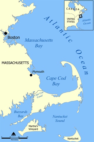
Massachusetts Bay is a bay on the Gulf of Maine that forms part of the central coastline of the Commonwealth of Massachusetts.

Orleans is a town in Barnstable County, Massachusetts, United States, situated along Cape Cod. The population was 6,307 at the 2020 census.

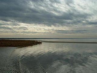
Provincetown Harbor is a large natural harbor located in the town of Provincetown, Massachusetts. The harbor is mostly 30 to 90 feet deep and stretches roughly 1 mile (1.6 km) from northwest to southeast and 2 miles (3.2 km) from northeast to southwest – one large, deep basin with no dredged channel necessary for boats to enter and exit.
Graveyard of the Atlantic is a nickname for the treacherous waters and area of numerous shipwrecks off the Outer Banks of North Carolina, United States, which are due to the coast's shifting sands and inlets. To a lesser degree, this nickname has also been applied to Sable Island off of Nova Scotia, Canada, as well as the waters off Cape Cod, Massachusetts, United States.
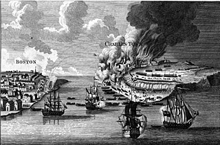
Timeline of the War of 1812 is a chronology of the War of 1812, including a list of battles.
HMS Somerset was a 70-gun third-rate ship of the line of the Royal Navy, built at Chatham Dockyard to the draught specified by the 1745 Establishment, and launched on 18 July 1748. She was the third vessel of the Royal Navy to bear the name. Somerset was involved in several notable battles of the Seven Years' War and the American Revolutionary War. She was wrecked in a storm in 1778 when she ran aground off of Provincetown, on Cape Cod, Massachusetts.

Billingsgate Island, also sometimes known as Bellingsgate Island, was an island off Cape Cod in Massachusetts in the United States. Originally settled as a fishing and whaling community as part of the town of Eastham, Massachusetts, Billingsgate Island was for a long time the site of a lighthouse used as a navigational aid in Cape Cod Bay. Local historians sometimes call it the Atlantis of Cape Cod.

The Cape Cod Rail Trail (CCRT) is a 25.5-mile (41.0 km) paved rail trail located on Cape Cod in Massachusetts. The trail route passes through the towns of Yarmouth, Dennis, Harwich, Brewster, Orleans, Eastham, and Wellfleet. It connects to the 6-plus mile (10 km) Old Colony Rail Trail leading to Chatham, the 2 mile Yarmouth multi-use trail, and 8 miles (13 km) of trails within Nickerson State Park. Short side trips on roads lead to national seashore beaches including Coast Guard Beach at the end of the Nauset Bike Trail in Cape Cod National Seashore. The trail is part of the Claire Saltonstall Bikeway.

SS James Longstreet was a Liberty ship built in the United States during World War II. Named after the Confederate general James Longstreet, she entered service in 1942, but was wrecked in a storm on 26 October 1943 and was subsequently used as a target hulk by the United States Navy.

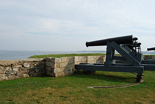
Camp Wellfleet is a former United States military training camp. It occupies about 1,738 acres (7.03 km2) of land located along the Atlantic Ocean in the town of Wellfleet, Massachusetts, on Cape Cod. The 548th Antiaircraft Artillery Battalion used the Camp for a firing range from 1954 to 1956. The majority of the site is owned and maintained by the National Park Service, as the administrator of the Cape Cod National Seashore. The Town of Wellfleet owns a portion of the site. It was officially opened on March 19, 1943.
Fort Phoenix is a former American Revolutionary War-era fort located at the entrance to the Fairhaven-New Bedford harbor, south of U.S. 6 in Fort Phoenix Park in Fairhaven, Massachusetts. The fort was originally built in 1775 without a name, and added to the National Register of Historic Places in 1972. Just off the fort, in Buzzards Bay, was the first naval engagement of the American Revolution, the Battle of Fairhaven on 14 May 1775.
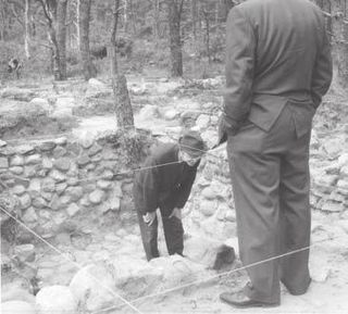
The Samuel Smith Tavern Site is a historic archeological site in Wellfleet, Massachusetts, United States. It encompasses the remains of a late 17th-century tavern operated by Samuel Smith, owner of Great Island, which shelters Wellfleet Harbor. The tavern site is located within the Cape Cod National Seashore, and is accessible via the Great Island Trail. The site was excavated in 1969–70, recovering thousands of artifacts, including clay pipes, drinking artifacts, a harpoon, and a chopping block fashioned from whale vertebrae.
Jeremiah's Gutter, also called Jeremy’s Dream was a canal located on the border of Orleans and Eastham, Massachusetts, the first canal to cut across the peninsula of Cape Cod. It connected Cape Cod Bay in the west to the Atlantic Ocean in the east. It was active for over 100 years, although it gradually fell out of use and was replaced by the Cape Cod Canal.

Nauset Public Schools, or the Nauset Regional School District, is a school district headquartered in Orleans, Massachusetts. In addition to Orleans its attendance area includes Brewster, Eastham, and Wellfleet.
References
- ↑ Mark Fiegel (12 October 2012). "FINDINGS: A breakthrough on Rock Harbor - News - Wicked Local - Boston, MA". wickedlocal.com. Retrieved 23 March 2014.
- ↑ "Rock Harbor Cape Cod Review | Fodor's". Fodors.com. 2013-12-23. Retrieved 2014-03-20.
- ↑ "Rock Harbor dredging has some dreading cost". CapeCodOnline.com. 2013-12-27. Archived from the original on 2014-03-20. Retrieved 2014-03-20.
- ↑ "THE BATTLE OF ROCK HARBOR by William Quinn" (PDF). Retrieved 2014-03-20.
The Historical Marker Database, Commemorating the Battle of Rock Harbor, retrieved April 22, 2022
Swift, Charles Francis, Cape Cod, the Right Arm of Massachusetts, An Historical Narrative, Registered Publishing Company, p. 249, Retrieved April 21, 2022
Snow, Bonnie (Feb 7, 2014) Cape Cod Times, A history of military attacks on Cape Cod, Retrieved April 22, 2022
Clark, Admont and Murdoch, Richard, Orleans Historical Society, The Battle of Orleans, 1814, Retrieved April 24, 2022