Related Research Articles

Boston Harbor is a natural harbor and estuary of Massachusetts Bay, located adjacent to Boston Massachusetts. It is home to the Port of Boston, a major shipping facility in the Northeastern United States.

Green Island, also known as North Brewster Island, is a rocky outer island in the Boston Harbor Islands National Recreation Area, to the north of Calf Island and Hypocrite Channel. The island has a permanent size of 2.5 acres (10,000 m2), plus an intertidal zone of a further 15 acres (61,000 m2), and is exposed from the east and northeast with little soil or plant life. The island is named after Joseph Green, a well-known merchant, who owned the island during Colonial times.
South Channel or Broad Sound South Entrance Channel is one of three shipping channels in the United States connecting Boston Harbor to Massachusetts Bay near Boston, Massachusetts. Starting at the eastern end of the President’s Roads anchorage, the channel passes north of Lovell's Island and Ram’s Head Flats, then northwest of Aldridge Ledge and the Devils Back. It is dredged to a 30-foot depth.
Devils Back in Massachusetts, USA, is a very small and barren rock in Massachusetts Bay located within the city limits of Boston. The rock is northeast of Aldridge Ledge, southwest of Commissioners Ledge, northwest of Half Tide Rocks, west of Green Island, and just east of the South Channel.
Shag Rocks are barren rocks situated 8 nautical miles offshore of Custom House Tower in downtown Boston, in the Boston Harbor Islands National Recreation Area and within the city limits of Boston. The rocks are northeast of Little Brewster Island and east of Great Brewster Island and have been the site of several shipwrecks. Boston Light on Little Brewster Island warns mariners to steer clear of the rocks. Public access is impractical.

Bakers Island is a small, residential island in Massachusetts Bay, in Salem, Massachusetts. It is located southeast of Great Misery Island & Little Misery Island, northeast of North Gooseberry Island and South Gooseberry Island, and far northeast of Children's Island. It is the outermost island on the main shipping channel into Salem Harbor. Bakers Island Light, located on the island's northern side, is used for navigation.

Spectacle Island is a 114-acre (46 ha) island in Boston Harbor, 4 miles (6.4 km) offshore of downtown Boston, Massachusetts. It is part of the city of Boston. The island has a varied history, and today is a public park with a marina, visitor center, cafe, lifeguarded swimming beach, and five miles of walking trails, forming part of the Boston Harbor Islands National Recreation Area. It is served all year by ferries from Boston, and on weekends and summer weekdays by a shuttle boat to and from nearby islands.

Peddocks Island is one of the largest islands in Boston Harbor. Since 1996 it has formed part of the Boston Harbor Islands National Recreation Area. Managed by the Department of Conservation and Recreation, the island is home to the now-defunct Fort Andrews, active in harbor defense from 1904 to the end of World War II, on its eastern end, and a group of privately owned cottages on its western end. Campsites are also on the eastern end. Ferry service between Peddocks Island and Georges Island is provided on a seasonal basis.
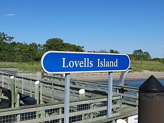
Lovells Island, or Lovell's Island, is a 62-acre (250,000 m2) island in the Boston Harbor Islands National Recreation Area, in Massachusetts. The island is across The Narrows from Georges Island and some 7 miles (11 km) offshore of downtown Boston. It is named after Captain William Lovell, who was an early settler of nearby Dorchester. The island is known as the site of several shipwrecks, including the 74-gun French warship Magnifique in 1782.

Little Brewster Island is a rocky outer island in the Boston Harbor Islands National Recreation Area. It is best known as the location of Boston Light, one of only five remaining Coast Guard-staffed lighthouses in the United States, and an important navigation aid for traffic to and from the Port of Boston. The island is situated some 9 miles (14 km) offshore of downtown Boston and has a permanent size of 3 acres (12,000 m2), plus an intertidal zone of a further 4 acres (16,000 m2).

Moon Island is an island in Quincy Bay, in the middle of Boston Harbor, Massachusetts. It is the location of the Boston Fire Department Training Academy, and Boston Police Department shooting range. All of the land on the island is owned by the City of Boston but the island is under the jurisdiction of Quincy, Massachusetts. It is also part of the Boston Harbor Islands National Recreation Area.

Bumpkin Island, also known as Round Island, Bomkin Island, Bumkin Island, or Ward's Island, is an island in the Hingham Bay area of the Boston Harbor. Bumpkin Island is part of Boston Harbor Islands National and State Park. The island has an area of 30 acres (120,000 m2), plus an intertidal zone of a further 31 acres (130,000 m2). It is composed of a central drumlin with an elevation of 70 feet (21 m) above sea level, surrounded by a rock-strewn shoreline. A sand spit, exposed at low tide, connects the eastern end of the island to Sunset Point in Hull.
Calf Island, also known as Apthorps Island, is an island situated some 9 miles (14 km) offshore of downtown Boston in Boston Harbor Islands National and State Park. The island has a permanent size of 18 acres (73,000 m2), plus an intertidal zone of a further 16 acres (65,000 m2).
Middle Brewster Island is a rugged outer island in the Boston Harbor Islands National Recreation Area, located 9 miles (14 km) offshore from downtown Boston. The island has a permanent size of 13 acres (53,000 m2), reaches a height of 52 feet (16 m) above sea level, and is bounded by sharp cliffs and sunken crags. It has only sparse vegetation and serves primarily as a nesting site for gulls and cormorants. The birds are aggressive during their nesting season and access by humans is discouraged during this period. Access is difficult due to the lack of beaches and inlets, and is only accessible by private boat.
Little Calf Island is a small rocky island in the Boston Harbor Islands National Recreation Area, some 9 miles (14 km) offshore from downtown Boston, Massachusetts. The island has no vegetation and no history of human occupation. It is used for nesting by gulls and cormorants which can be aggressive during their nesting season. Access by humans is by private boat only, and is discouraged.

Spinnaker Island is an island in the Hingham Bay area of Boston Harbor in Massachusetts, USA. The island is part of the town of Hull, to which it is connected by a bridge, and is one of the few harbor islands that neither forms part of the Boston Harbor Islands National Recreation Area nor is considered within the municipal limits of the city of Boston.

The Misery Islands are an 87-acre (350,000 m2) nature reserve established in 1935 in Salem Sound close to the Salem Harbor in Salem, Massachusetts. It is managed by the Trustees of Reservations. The islands are a part of the city of Salem, although they are much closer to the mainland of the city of Beverly, in whose aquatic territory they lie.

Fort Andrews was created in 1897 as part of the Coast Defenses of Boston, Massachusetts. Construction began in 1898 and the fort was substantially complete by 1904. The fort was named after Major General George Leonard Andrews, an engineer and Civil War commander, who assisted in the construction of nearby Fort Warren in Boston Harbor. It occupies the entire northeast end of Peddocks Island in Boston Harbor, and was originally called the Peddocks Island Military Reservation. Once an active Coast Artillery post, it was manned by hundreds of soldiers and bristled with mortars and guns that controlled the southern approaches to Boston and Quincy Bay. The fort also served as a prisoner-of-war camp for Italian prisoners during World War II, who were employed as laborers following the Italian surrender to the Allies in 1943. Today, the fort is abandoned, and is managed by the Massachusetts Department of Conservation and Recreation, as part of the Boston Harbor Islands National Recreation Area.
Broad Sound is a bay on the Massachusetts coast north of Boston. It lies on the west of Massachusetts Bay, between Nahant and Deer Island; Lynn harbor is at its north end. The main channel of Boston Harbor empties into the sound.
References
- ↑ "Hypocrite Channel". edits.nationalmap.gov. Geographic Names Information System. Retrieved 24 August 2024.
42°20′51.71″N70°53′40.26″W / 42.3476972°N 70.8945167°W
| | This article about a location in Boston is a stub. You can help Wikipedia by expanding it. |